Search Entire Article - Hold CTRL + F
Article 3
Overlays and Zoning Districts
In order to ensure that
all development in unincorporated PBC is consistent with the Plan, it is
necessary to establish a series of districts and overlays to ensure that each
use is compatible with surrounding uses, served by adequate public facilities,
and sensitive to natural resources. Standard, PDD, and TDD Zoning Districts,
and Overlays, where applicable, have been adopted to be in compliance with the
Plan. Each district and overlay has its own purpose and permitted uses, Conditional
Uses, Special Uses, and other regulations that control the use of land. All
development within each district shall be consistent with the purposes stated
in this Article. [Ord. 2011-016]
In order to carry out
and implement the Plan, the following Overlays, Standard Zoning Districts,
Planned Development Districts (PDDs), and Traditional Development Districts
(TDDs) are hereby established. [Ord. 2011-016]
AGEO, Agricultural Enclave Overlay [Ord. 2011-016]
AZO, Airport Zoning Overlay
BRPO, Bioscience Research Protection Overlay [Ord. 2016-042]
COZ, Conditional Overlay Zone
GAO, Glades Area Overlay
IOZ, Indiantown Road Overlay
IRO, Infill Redevelopment Overlay [Ord. 2011-016]
LCSO, Lion Country Safari Overlay [Ord. 2016-042]
LOSTO, Lake Okeechobee Scenic Trail Overlay
NBOZ, Northlake Boulevard Overlay Zone
NEO, Native Ecosystem Overlay
PBIAO, Palm Beach International Airport Overlay
RTO, Research and Technology Overlay
SCGCFO, Sugar Cane Growers Cooperative of Florida Protection
Area Overlay [Ord. 2004-040]
SR 80 Non-Residential Overlay
TAPO, Turnpike Aquifer Protection Overlay
URAO, Urban Redevelopment Area Overlay [Ord. 2011-016]
WCRAO, Westgate Community Redevelopment Area Overlay
WCRO, Western Communities Residential Overlay [Ord. 2017-011]
AGR, Agricultural
Reserve
AP, Agricultural
Production
AR, Agricultural
Residential
CC, Community
Commercial
CG, General Commercial
CHO, Commercial High
Office
CLO, Commercial Low
Office
CN, Neighborhood
Commercial
CRE, Commercial
Recreation
IG, General Industrial
IL, Light Industrial
IPF, Institutional and
Public Facilities
IR, Infill
Redevelopment Overlay [Ord. 2011-016]
PC, Preservation/Conservation
PO, Public Ownership
RE, Residential Estate
RM, Multifamily
Residential
RS, Single Family
Residential
RT, Residential
Transitional
UC, Urban Center
[Ord.
2011-016]
UI, Urban Infill
[Ord.
2011-016]
MHPD, Mobile Home
Planned Development [Ord. 2017-025]
MUPD, Multiple Use
Planned Development [Ord. 2021-023]
PIPD, Planned
Industrial Park Development
PUD, Planned Unit
Development
RVPD, Recreational
Vehicle Planned Development
TMD, Traditional
Marketplace Development
TND, Traditional
Neighborhood Development
TTD, Traditional Town
Development
The location and
boundaries of the districts established in this Article shall be set forth on
the Official Zoning Map which is hereby incorporated by reference. A copy of
the Official Zoning Map shall be located for inspection at all times by the
general public during regular business hours in the office of PZB.
If amendments are made
to the boundaries of the Official Zoning Map, the Zoning Director shall update
the Official Zoning Map within 30 days after the amendment.
In the event that the
Official Zoning Map becomes damaged, destroyed, lost, or difficult to interpret
due to changes and additions, the BCC shall adopt a new Official Zoning Map
that shall supersede the prior Official Zoning Map.
The new Official Zoning
Map may correct drafting and clerical errors or omissions in the prior Official
Zoning Map, but no such corrections shall have the effect of amending the
original Official Zoning Map, or subsequent amendments thereto, without a duly
noticed public hearing pursuant to the procedures and standards of this Code.
In order to promote
ease of use and the consistent application of this Code, the Official Zoning
Map may be updated administratively to delineate the Planned Development
District that corresponds to certain prior approvals specified in
Art. 3.A.3.B.2, Special Exceptions or
Conditional Use Approvals for Previously Approved Planned Developments
. Updating the Official Zoning Map by
delineating the current zoning category or terminology on a particular property
is not a rezoning and does not change the land development regulations that are
applicable to a particular property. [Ord. 2012-003]
Pursuant to
F.S. § 163.3194
and Objective 2.2, Future Land Use
Provisions – General, of the PBC Comprehensive Plan’s Future Land Use Element,
all Zoning actions must be consistent with the Comprehensive Plan. A parcel’s
zoning district must be consistent with the parcel’s future land use
designation. The following Tables establish the future land use designation and
zoning consistency in the Comprehensive Plan Future Land Use Element.
[Ord.
2023-009]
1. Table 1.6-a,
Glades Tier Residential Future Land Use/Zoning Consistency, under Policy 1.6-d;
[Ord.
2023-009]
2. Table 2.2-f.1,
Non-Residential Future Land Use – Zoning Consistency, under Policy 2.2-f; and,
[Ord.
2023-009]
3. Table
2.2.1-j.1, Residential Future Land Use – Zoning Consistency, under Policy
2.2.1-j.
[Ord. 2023-009]
Any application for a Development Order to any of the prior
approvals listed herein shall comply with the applicable requirements of the
corresponding district, except for any information permitted to be carried
forward from a prior approval. Unless otherwise indicated by the Comprehensive
Plan FLU/Zoning Consistency Tables, the following former zoning districts shall
correspond to the current zoning districts as identified below. [Ord. 2023-009] [Ord. 2023-021]
a. The Special
Agriculture (SA) Zoning District shall correspond to the AP Zoning District in
the Glades Tier, AGR Zoning District in the AGR Tier, and AR Zoning District in
the Rural Tier. [Ord. 2023-021]
b. The Specialized
Commercial High (CSH) and Specialized Commercial (CS) Zoning Districts shall
correspond the CHO Zoning District.
[Ord.
2023-021]
a. Large Scale
Community or Regional Shopping Centers, Planned Commercial Developments (PCDs),
Planned Neighborhood Commercial Developments (PNCDs), Planned General
Commercial Developments (PGCDs), Mixed Use Planned Developments (MXPDs), and
Planned Office Business Parks (POBPs) shall correspond to the MUPD Zoning
District. [Ord. 2023-021]
b. Planned Industrial
Developments (PIDs) shall correspond to the IL or IG Zoning District. [Ord. 2023-021]
c. Planned
Developments consisting of PUDs, PIPDs, MHPDs, and RVPDs shall correspond to
the same PDDs. [Ord. 2023-021]
In addition to the provisions set forth above, the following
applies to specific zoning districts and circumstances. [Ord. 2023-009]
1. An existing
Legal Lot of Record may be developed with a SFD with accessory uses, provided
the existing zoning is identified in Table 2.2-f.1, Non-Residential Future Land
Use – Zoning Consistency, under Policy 2.2-f; and Table 2.2.1-j.1, Residential
Future Land Use – Zoning Consistency, under Policy 2.2.1-j. [Ord. 2011-016] [Ord. 2021-023]
[Ord.
2023-009]
2. Existing institutional
or civic uses in the RE, RT, RS, or RM Zoning Districts with an INST FLU
designation shall not be considered non-conforming. [Ord. 2011-016] [Ord. 2021-023] [Ord. 2023-009]
3. The CG Zoning
District is consistent with the CL FLU designation on sites located within the
U/S Tier which have existing CG zoning with a CL FLU designation prior to the
adoption of Ordinance No. 2020-011 on July 6, 2020. Any lot greater than one
acre in size shall utilize the CC Zoning District approval process; any lot one
acre or less shall utilize the CN Zoning District approval process.
[Ord.
2021-023]
4. A rezoning
shall not be required for any Palm Beach County Natural Area with a CON FLU
designation provided that any subdivision or development is consistent with all
development standards and use regulations for the PC Zoning District.
[Ord.
2011-016] [Ord. 2021-023]
5. A rezoning
shall not be required for the installation or replacement of a SFWMD telemetry
tower in accordance with
Art.
5.B.1.A.13.c, Exceptions for SFWMD Telemetry Towers in the Glades Tier
.
[Ord.
2014-025]
(This page intentionally left blank)
(This page intentionally left blank)
The boundaries of each
overlay shall be depicted on the Official Zoning Map.
The provisions of each
overlay shall apply to all proposed development and expansion of existing uses
within the overlay unless otherwise noted below.
The provisions of an
overlay are intended to supplement the other regulations in this Code.
If a conflict exists
between provisions of an overlay and other Articles in this Code, the
provisions of the overlay shall prevail except where superseded by State or Federal
laws.
The purpose and intent
of the Airport zoning regulations is to promote the maximum safety of aircraft
using publicly-owned airports, the safety of residents and property in areas
surrounding the airports, and the full utility of the airports, including
non-airport related uses. These regulations apply to properties around
publicly-owned airports in PBC; and uses located on the Airport Master Plans
required by Plan Objective TE 1.7.
[Ord. 2006-036]
For those properties
around publicly-owned airports, the provisions of the Airport zoning
regulations create zones, based on the approach and departure pattern of
aircraft, and regulate the height of structures and the use of land within
these zones. The Airport zoning regulations for properties around publicly-owned
airports are contained in
Art. 16, Airport Regulations
. [Ord. 2006-036]
The provisions of this
Section shall apply to airport-related and non-airport related uses within the
boundaries of the Airport Master Plans for those parcels with a U/T FLU
designation and in the PO Zoning District for the four County-operated airports
identified as follows: PBIA, PBC Glades Airport, PBC Park Airport (a.k.a.
Lantana Airport), and North PBC General Aviation Airport. Development of these
airports shall be in accordance with the Airport Master Plans as required by Plan
Objective TE 1.7, Future Airport Expansion. [Ord. 2006-036] [Ord. 2022-002]
a. Use Regulations
1) Airport-Related
Uses
Airport-related uses
are directly related to general airport operations and maintenance including,
but not limited to, maintenance facilities, cargo distribution terminals, car
rental operations, warehouses, hotels, airport administrative offices, and
communication facilities, as well as uses found within the terminals,
including, but not limited to, restaurants, general retail sales, and personal
services. [Ord. 2006-036]
2) Non-Airport
Related Uses
Non-airport related
uses are not related to the operation and maintenance of the airport, and can
coexist in close physical proximity to airports and their related facilities. Non-airport
related uses are additional uses that are encouraged by the Federal Aviation
Administration (FAA) to generate income to help offset the costs of operating
the airport and are compatible with surrounding development. These uses may
include, but are not limited to, commercial, public, and civic, recreation,
agricultural, utilities and excavation, and industrial uses, but more
specifically including, but not limited to, professional, business, and medical
offices, retail centers, restaurants, and hotels. [Ord. 2006-036]
3) Prohibited Uses
Prohibited uses include
Adult Entertainment and billboards. [Ord. 2006-036] [Ord. 2009-040]
4) Specific Use
Regulations
The following uses are
permitted in the AZO on airport properties: [Ord. 2006-036]
|
Table 3.B.2.B – Airport Use
Regulations
|
|
Use Type
|
|
|
|
|
|
|
|
|
Caretaker Quarters
|
D
|
D
|
CG or
IG
|
|
All
|
|
|
|
Auction, Indoor
|
|
D
|
CG
|
2
|
All
|
|
Auction, Outdoor
|
|
A
|
CG
|
2
|
All
|
|
Car Wash
|
|
D
|
CG or
IL
|
4
|
All
|
|
Catering Service
|
P
|
D
|
CG or
IL
|
5
|
All
|
|
Cocktail Lounge
|
P
|
A
|
CG
|
6
|
All
|
|
Convenience Store
|
|
D
|
CG
|
7
|
All
|
|
Dispatching Service
|
P
|
D
|
CG
|
8
|
All
|
|
Dog Day Care
|
P
|
D
|
CG
|
9
|
All
|
|
Financial Institution
|
P
|
P
|
CG
|
10
|
All
|
|
Financial Institution with Drive-Through
Facilities
|
P
|
D
|
CG
|
11
|
All
|
|
Financial Institution Freestanding ATM
|
P
|
D
|
CG
|
12
|
All
|
|
Gas and Fuel Sales, Retail
|
|
A
|
CG
|
15
|
All
|
|
Hotel or Motel
|
P
|
D
|
CG
|
17
|
All
|
|
Kennel, Type 2 (Commercial)
|
P
|
D
|
CG or
IG
|
18
|
All
|
|
Kennel, Type 3 (Commercial Enclosed)
|
P
|
D
|
CG or
IG
|
19
|
All
|
|
Landscape Service
|
|
D
|
CG or
IL
|
20
|
All
|
|
Laundry Service
|
|
D
|
CG or
IL
|
21
|
All
|
|
Medical or Dental Office
|
P
|
D
|
CG
|
23
|
All
|
|
Office, Business or Professional
|
P
|
D
|
CG
|
25
|
All
|
|
Parking, Commercial
|
P
|
D
|
CG or
IL
|
26
|
All
|
|
Pawnshop
|
|
A
|
CG
|
27
|
All
|
|
Personal Services
|
P
|
D
|
CG
|
28
|
All
|
|
Repair and Maintenance, Heavy
|
P
|
A
|
CG or
IG
|
29
|
All
|
|
Repair and Maintenance, Light
|
P
|
D
|
CG or
IG
|
30
|
All
|
|
Repair Services, Limited
|
P
|
D
|
CG or
IG
|
31
|
All
|
|
Restaurant, Type 1
|
P
|
A
|
CG
|
32
|
All
|
|
Restaurant, Type 2
|
P
|
D
|
CG
|
33
|
All
|
|
Retail Sales
|
P
|
D
|
CG
|
35
|
All
|
|
Retail Sales, Mobile
|
|
S
|
CG or
IG
|
3
|
All
|
|
Retail Sales, Temporary
|
|
S
|
CG or
IG
|
10
|
All
|
|
Self-Service Storage, Limited Access
|
|
D
|
CG or
IG
|
36
|
All
|
|
Self-Service Storage, Multi-Access
|
|
D
|
CG or
IG
|
36
|
All
|
|
Single Room Occupancy (SRO)
|
P
|
A
|
CG
|
37
|
All
|
|
Vehicle or Equipment Sales and Rental,
Heavy
|
|
A
|
CG or
IL
|
39
|
All
|
|
Vehicle Sales and Rental, Light
|
P
|
B
|
CG or
IL
|
40
|
All
|
|
Veterinary Clinic
|
P
|
D
|
CG or
IL
|
41
|
All
|
|
Vocational Institution
|
P
|
D
|
CG or
IG
|
42
|
All
|
|
[Ord. 2006-036] [Ord. 2008-003] [Ord.
2010-009] [Ord. 2010-022] [Ord. 2011-016] [Ord. 2017-007] [Ord. 2018-018]
[Ord. 2019-005] [Ord. 2022-002] [Ord. 2023-012]
|
|
Table 3.B.2.B – Airport Use Regulations, Cont’d.
|
|
Use Type
|
|
|
|
|
|
|
|
|
Assembly
Institutional Nonprofit
|
D
|
D
|
CG
|
2
|
All
|
|
Assembly Membership
Nonprofit
|
D
|
D
|
CG or
IL
|
3
|
All
|
|
Place of Worship
|
|
D
|
CG
|
12
|
All
|
|
Government Services
|
P
|
P
|
CG or
IL
|
9
|
All
|
|
Hospital
|
|
A
|
CG
|
11
|
All
|
|
Prison, Jail, or
Correctional Facility
|
P
|
A
|
CG or
IL
|
13
|
All
|
|
|
|
Arena or Stadium or
Amphitheater
|
P
|
A
|
CG
|
1
|
1
|
|
Entertainment, Indoor
|
P
|
D
|
CG or
IL
|
3
|
All
|
|
Entertainment,
Outdoor
|
P
|
D
|
CG or
PO
|
4
|
All
|
|
Fitness Center
|
P
|
D
|
CG or
IL
|
5
|
All
|
|
Golf Course
|
|
D
|
CG or
IL
|
6
|
All
|
|
Park, Neighborhood
|
|
P
|
CG or
IG
|
7
|
All
|
|
Park, Passive
|
P
|
P
|
CG or
IL
|
8
|
All
|
|
Park, Public
|
|
P
|
CG or
IG
|
9
|
All
|
|
|
|
Agriculture, Bona
Fide
|
|
P
|
IL
|
1
|
2
|
|
Agriculture, Light
Manufacturing
|
|
P
|
IL
|
2
|
2
|
|
Agriculture, Packing
Plant
|
|
P
|
IL
|
3
|
2
|
|
Agriculture, Research
and Development
|
|
P
|
IL
|
5
|
2
|
|
Agriculture, Sales
and Service
|
|
P
|
IL
|
6
|
2
|
|
Agriculture, Storage
|
|
P
|
IL
|
7
|
2
|
|
Community Vegetable
Garden
|
|
P
|
CG or
IL
|
10
|
2
|
|
Nursery, Retail
|
|
D
|
CG
|
13
|
All
|
|
Shade House
|
|
P
|
IL
|
17
|
2
|
|
|
|
Air Curtain
Incinerator
|
|
D
|
CG or
IG
|
|
All
|
|
Chipping and Mulching
|
|
D
|
IG
|
1
|
All
|
|
Commercial
Communication Towers
|
P
|
D
|
CG or
IG
|
|
All
|
|
Composting Facility
|
|
D
|
IG
|
2
|
All
|
|
Excavation, Type 2
|
P
|
P
|
CG or
IG
|
4
|
All
|
|
Minor Utility
|
P
|
D
|
CG or
IG
|
7
|
All
|
|
|
|
Airport
|
P
|
|
PO
|
1
|
All
|
|
Heliport or Vertiport
|
P
|
A
|
CG or
IL
|
2
|
All
|
|
Transportation
Facility
|
B
|
B
|
CG or
IG
|
5
|
All
|
|
[Ord. 2006-036] [Ord.
2008-003] [Ord. 2010-022] [Ord. 2012-007] [Ord. 2013-001] [Ord. 2017-007]
[Ord. 2022-002]
|
|
Table 3.B.2.B – Airport Use Regulations, Cont’d.
|
|
Use Type
|
|
|
|
|
|
|
|
|
Communication Cell Sites on Wheels (COWs)
Tower, Mobile
|
P
|
P
|
CG or
IG
|
1
|
All
|
|
Recycling Drop-Off Bin
|
D
|
D
|
CG or
IG
|
7
|
All
|
|
Special Event
|
P
|
D (3)
|
CG or
IL
|
8
|
All
|
|
|
|
Asphalt or Concrete Plant
|
P
|
D
|
IG
|
|
All
|
|
Contractor Storage Yard
|
|
D
|
IG
|
1
|
All
|
|
Data and Information Processing
|
P
|
D
|
CG or
IG
|
2
|
All
|
|
Distribution Facility
|
B
|
B
|
CG or
IG
|
3
|
All
|
|
Machine or Welding Shop
|
P
|
D
|
IL
|
7
|
All
|
|
Multi-Media Production
|
|
D
|
CG or
IG
|
10
|
All
|
|
Gas and Fuel, Wholesale
|
P
|
D
|
IG
|
5
|
All
|
|
Research and Development
|
|
D
|
IG
|
13
|
All
|
|
Manufacturing and Processing
|
P
|
D
|
IG
|
8
|
All
|
|
Medical or Dental Laboratory
|
|
D
|
CG or
IL
|
9
|
All
|
|
Recycling Center
|
D
|
D
|
CG or
IG
|
11
|
All
|
|
Recycling Plant
|
P
|
D
|
IG
|
12
|
All
|
|
Warehouse
|
P
|
D
|
IG
|
17
|
All
|
|
Wholesaling, General
|
P
|
D
|
IG
|
18
|
All
|
|
[Ord. 2006-036] [Ord.
2010-022] [Ord. 2017-007] [Ord. 2018-002] [Ord. 2022-002]
|
|
Key:
|
|
P
|
Permitted
by Right
|
|
D
|
Permitted
subject to approval by the DRO
|
|
B
|
Permitted
only if approved by the Zoning Commission (ZC)
|
|
A
|
Permitted
only if approved by the Board of County Commissioners (BCC)
|
|
Use Applicable to
Specific Airport:
|
|
1
|
PBIA
|
|
2
|
PBC
Glades Airport
|
|
3
|
PBC
Park Airport (a.k.a. Lantana Airport)
|
|
4
|
North
PBC General Aviation Airport
|
|
All
|
PBIA,
PBC Glades Airport, PBC Park Airport (a.k.a. Lantana Airport), and North PBC
General Aviation Airport
|
|
Notes:
|
|
1.
|
For
purposes of determining the applicable property development regulations (PDRs)
for non-airport related uses, the corresponding zoning district’s PDR
identified in
Table 3.D.1.A, Property Development
Regulations
shall apply
to lot dimension, density, FAR, building coverage, and setbacks.
[Ord.
2018-002]
|
|
2.
|
Reference
Art. 4, Use
Regulations
for
additional Supplementary Use Standards which includes exceptions,
restrictions, or prohibitions. [Ord. 2017-007] [Ord. 2018-018]
|
|
3.
|
Temporary
Use through the ZAR process. [Ord. 2018-002]
|
|
|
|
|
|
|
|
5) Development
Review Procedures
The approval process
for airport-related and non-airport related uses shall be in accordance with
the above
Table 3.B.2.B, Airport Use Regulations
and
Art. 2, Application Processes and Procedures
. It is not necessary for the parcels to be rezoned.
[Ord. 2006-036]
a) Development
Requirements
Only airport-related
uses owned, operated, or directly regulated by the DOA or other governmental
entity shall be eligible for PO district exemptions. Examples of these uses
include tenants leasing space in airport terminal or other related service
facilities. Leased land areas used for non-airport related development,
including vehicle rental, restaurants, hotels, and other non-airport related
uses, shall be subject to applicable ULDC requirements.
[Ord.
2006-036]
b) Development
Exceeding PDD or TDD Design Thresholds
Any such development
that meets or exceeds the maximum square footage thresholds of
Table 3.B.2.B, PDD or TDD Design Thresholds
, shall be subject to either the property
development regulations of a PDD or TDD. The DOA shall be responsible for
determining which specific PDD or TDD shall apply. It is not necessary for the
parcels to be rezoned.
[Ord. 2006-036]
c) Other
Development
All other development
shall be in accordance with the property development regulations for the
corresponding zoning districts indicated in
Table 3.B.2.B, Airport Use Regulations
. [Ord. 2006-036]
d) Other
Requirements
All proposed airport-related
and non-airport related uses must be developed in accordance with all
applicable Federal and State guidelines, regulations, and requirements, as
amended, including but not limited to all Federal Aviation Regulations (F.A.R.s),
FAA Advisory Circulars, and FAA Orders, as well as all applicable Florida
Statutes and Florida Department of Transportation guidelines.
[Ord.
2006-036]
e) Conflict with
Other Applicable Regulations
Where the provisions of
this Section are in conflict with other regulations applicable to this
district, the provisions of this Section shall prevail. Where provisions of the
AZO district are not in conflict with other applicable regulations, the most
restrictive regulations shall prevail.
[Ord. 2006-036]
A COZ district is to
modify or restrict the use and site development regulations authorized in the
underlying Standard Zoning District to prevent, minimize, or mitigate adverse
impacts upon the surrounding land uses. Conditions shall be included if the
applicable regulations are inadequate to protect the surrounding land uses. Requirements
of the COZ district are in addition to and supplement other applicable
requirements of this Code. [Ord. 2008-037]
The boundary of the COZ
is applied to the property considered for rezoning. [Ord. 2008-037]
The provisions of the
COZ shall apply to lands in unincorporated PBC pursuant to BCC approval. In
application of the COZ, the BCC shall find that the proposed rezoning is
appropriate only if the applicable regulations are modified. The BCC shall find
one or more of the following reasons for the COZ district: [Ord. 2008-037]
1. potential impact to surrounding land uses
requires mitigation;
2. compatibility will be furthered between the
requested zoning district and adjacent zones if uses and property development
regulations (PDRs) are modified; and/or,
3. intensity limits reflect available capacity
of public facilities.
Restrictions which may
be imposed in the COZ district include: limitations on uses, size, height,
bulk, mass, scale, and location of improvements; standards for landscaping,
buffering, and lighting; adequate ingress and egress; on-site or off-site
improvements; hours of operation; and, any other specific site development regulations
required or authorized by this Code.
During the Zoning
review process, the Property Owner shall either: [Ord. 2008-037]
a. apply for a COZ overlay; or [Ord. 2008-037]
b. voluntarily agree to a COZ overlay
recommended by Staff for the property being considered for rezoning. [Ord. 2008-037]
The COZ authorizes
specific development restrictions, including but not limited to, traffic
performance standards, use limitations, etc. to proactively address potential
incompatibilities with the adjacent properties. The BCC may impose Conditions
of Approval to address these restrictions. [Ord. 2008-037]
In the case when a rezoning
is requested or required to maintain consistency with the Comprehensive Plan or
any conditions to a Site Specific Plan amendment initiated by the Planning
Division, consent of the Property Owner(s) or agreement with the COZ shall not
be required. [Ord. 2008-037]
The GAO is established
to promote economic diversification in the Glades Area and facilitate
development or redevelopment opportunities emanating from the U.S. Department
of Housing and Urban Development Community Challenge Planning Grant Glades
Region Master Plan (GRMP). The GAO provides flexibility or streamlined
procedures for obtaining development approvals, critical to ensuring a timely
response to development or redevelopment opportunities that may increase job
opportunities and improve the economic vitality of the area. In addition, the
GAO may include regulations that recognize the character of the area.
[Ord.
2014-02
5
] [Ord. 2016-016]
The GAO shall apply to
all land within the Urban Service Area (USA) of the Glades Tier. All Development
Orders within the GAO shall also comply with all applicable Joint Planning Area
Agreements, pursuant to Florida Statutes. [Ord. 2014-02
5
] [Ord. 2016-016]
The boundaries of the
GAO coincide with the USA in the Glades Tier, which is delineated on
Comprehensive Plan Map LU 2.1, Service Areas, and is generally comprised of
those lands lying near or around the Cities of Belle Glade, Pahokee, and South
Bay, and the unincorporated community of Canal Point.
[Ord.
2005-002] [Ord. 2014-025]
The Urban/Suburban Tier
requirements of the ULDC shall apply. [Ord. 2014-025]
The density, intensity,
and acreage thresholds of
Table 4.A.9.A, Thresholds for Projects
Requiring DRO Approval
, and
Table 4.A.9.B, Thresholds for Projects
Requiring Board of County Commissioners Approval
, shall be multiplied by two within the GAO.
[Ord. 2016-016] [Ord. 2018-002]
a. General
Uses shown in a Use
Matrix as Permitted by Right (P), or Development Review Officer (DRO) shall
remain subject to the same approval process shown in the Use Matrix. [Ord. 2014-025]
b. Conditional Uses
Uses allowed as
Conditional Uses in a non-residential zoning district and Cottage Homes may be
approved by the DRO after compliance with
Art. 2.B.7.B.2, Standards
.
[Ord. 2016-016] [Ord. 2018-002]
[Ord. 2019-034]
c. Non-Conformities
1) Non-Conforming
Use
A non-conforming use
permitted to expand subject to DRO approval may be expanded through the ZAR
process.
[Ord. 2006-036] [Ord. 2014-025]
[Ord. 2016-016] [Ord. 2018-002]
2) Permitted Uses
and Uses Subject to DRO Approval within Non-Conforming Structures
Uses Permitted by Right
and uses subject to DRO approval may exceed the allowable percentages of
Table 1.F.1.G, Non-Conformities – Percentage
and Approval Process for Maintenance, Renovation, and Natural Disaster Damage
Repair
, provided all the
standards below are met: [Ord. 2016-016]
a) Exterior
Building and Site Elements Improvements
A minimum 25 percent of
the total maintenance, renovation, or natural disaster damage repair Improvement
Value shall be dedicated to exterior building and site elements. Of that
percentage, a minimum of ten percent shall be dedicated to façade improvements
abutting the R-O-W (frontage and side street frontages) and a minimum ten
percent shall be dedicated to landscape improvements; [Ord. 2016-016]
b) Limitation
The total maintenance,
renovation, or natural disaster damage repair improvements for the proposed
use(s) may be allowed only if the proposed improvements will not cause an
increase in building square footage or generate additional parking, unless the
additional parking requirements or design is required to bring the site into
compliance with the ULDC to the greatest extent possible; and,
[Ord.
2016-016]
c) Certification of
Improvements
The detailed Justification
Statement of compliance to the above standards and calculations of the improvements,
including the total Improvement Value for the project, shall be signed and
sealed by the architect of record for the project, and shall be reviewed and
certified by the Zoning Division Permit Review Section for compliance with this
Section prior to submittal to the Building Division. [Ord. 2016-016]
d) Exceptions for
Glades Area Housing Authorities
The following
developments shall be exempt from limits on maintenance, renovations, and
natural disaster damage repairs for conforming residential, administrative,
recreational, or maintenance uses in non-conforming structures, provided that
any addition or expansion is in compliance with the ULDC: [Ord. 2016-016]
(1) Pahokee Housing Authority, Padgett Island, and
Fremd Village developments.
[Ord.
2016-016]
(2) Belle Glade Housing Authority, Everglades, and
Osceola developments. [Ord. 2016-016]
a. Prohibited Uses in Non-Residential
Districts
Uses not otherwise permitted
in a non-residential zoning district may be approved as a Class A Conditional Use
provided the BCC makes a finding that the proposed use meets the following: [Ord. 2014-025] [Ord. 2016-016] [Ord. 2018-002]
1) Increases jobs or provides needed housing; [Ord. 2016-016]
2) Does not adversely affect adjacent land uses;
and, [Ord. 2016-016]
3) Helps to support existing or encourage additional
Glades Area economic development or the GRMP. [Ord. 2016-016]
The BCC may consider an
increase in the density and intensity allowed by the Plan within the GAO
subject to approval of a Conditional Use.
[Ord. 2014-025] [Ord. 2018-002]
[Ord. 2019-005]
Building Permits in the
GAO may be permitted between the 120-foot and 220-foot R-O-W line within the
R-O-W of State Road 700 through Canal Point, from Third Street on the north to
Triangle Park on the east, subject to approval of the County Engineer.
[Ord.
2014-025]
Planned Industrial Park
Developments (PIPDs) located in the GAO shall be subject to the following
exception provisions: [Ord. 2014-025]
a. Public Street
For the purposes of
this Section, a public street within a PIPD shall not include private streets
that comply with the following:
[Ord.
2014-024]
1) Located within or adjacent to an Industrial Pod;
and
[Ord. 2014-025]
2) Services industrial uses only.
[Ord. 2014-025]
b. Minimum Frontage
The PIPD is not
required to have minimum frontage on an Arterial or Collector Street but at a minimum
must connect to an Arterial or Collector Street through a Non-Plan Collector Roadway,
subject to approval of the Zoning Director and County Engineer.
[Ord. 2014-025]
c. Maximum Commercial Acreage – Conditional
Use Approval
The BCC may consider an
increase in the maximum commercial acreage allowed pursuant to
Table 3.E.5.C, PIPD Land Use Mix
, subject to approval of a Conditional Use;
and upon finding that the increase will serve the projected workforce and
residential population of the PIPD, and encourage internal automobile trip
capture.
[Ord. 2014-025] [Ord. 2018-002]
Industrial buildings
visible from a public street or residential zoning district may be exempt from
the Roofline, Façade, and Additional Design Elements of
Art. 5.C.1.H, Guidelines
, if the adjacent perimeter R-O-W or Incompatibility Buffer is doubled
in width and planting requirements, and upon demonstration by line of sight
that the majority of the affected area of the building will be screened by the
increased buffering. For those parcels that use this exemption, only that portion
of the building façade with the main public and employee entrances, and
extending along the façade a minimum of 100 feet in each direction from each
entrance, including around corners, unless interfering with a loading
area/space/dock/bay, are subject to the provisions of
Art. 5.C.1.H, Guidelines
. If the distance between entry treatments is less than ten percent of
the overall length of the building façade, the treatment shall be extended.
[Ord. 2014-025]
e. Parking and Loading in Industrial
Pods
1) Loading Area
Screening
Loading spaces, docks, and associated maneuvering areas not
visible from a public street are exempt from screening requirements of
Art. 6.E.4.A.3.b, Loading Area Screening
.
[Ord. 2014-025] [Ord. 2020-020]
f. Landscaping in Industrial Pods
1) Foundation
Planting
Industrial buildings
visible from a public street or residential zoning district may be exempt from
the foundation planting requirements of
Art. 7.C.3.B, Foundation Planting
if the adjacent perimeter R-O-W or Incompatibility Buffer is increased
in width by eight feet and the foundation planting requirements are relocated
to the buffer. For those parcels that use this exemption, only that portion of
the building façade with the main public and employee entrances, and extending
along the façade a minimum of 100 feet in each direction from each entrance,
including around corners, unless interfering with a loading
area/space/dock/bay, are subject to the provisions. If the distance between
foundation planting treatments is less than ten percent of the overall length
of the building façade, the treatment shall be extended. If the Architectural
Review exemption in
Art. 3.B.4.F.1.d, Architectural Review
is utilized, the additional buffer width
and planting is not required to utilize the foundation planting exemption.
[Ord. 2014-025]
2) Interior
Landscaping Exceptions
a) Interior Tree
and Shrub Requirements
(1) One tree per 4,000 square feet; and
[Ord. 2014-025]
(2) Three shrubs per 4,000 square feet.
[Ord. 2014-025]
b) Interior vehicular use areas not used for
parking of passenger vehicles are not required to provide landscape islands.
[Ord.
2014-02
5
] [Ord. 2018-002]
c) Perimeter Compatibility Buffers are not
required between parcels supporting compatible industrial uses. Where fences or
walls are installed along the perimeter, they shall be protected from vehicles
by a curb or similar barrier, and shall not encroach into the drive aisle
(excluding gates) or impede vehicular circulation. [Ord. 2014-02
5
]
An Applicant may apply
for Waivers for development standards within an Industrial Pod in accordance
with
Art. 2.C.5.G, Type 1 Waiver
. Applications for Type 1 Waivers shall be
expressly limited to the requirements listed below: [Ord. 2014-025]
|
Table 3.B.4.F – Type 1 Waivers for Industrial Pods
|
|
Article/Table
Reference and Title
|
|
|
|
Art.
3.E.1.C.2.h.2), Non-Residential Uses
[Related to PDD Performance
Standards for Parking]; or
Table 6.B.1.B,
Minimum Parking and Loading Requirements
|
The minimum or maximum number of parking spaces may be
reduced or increased by up to 25 percent, subject to DRO approval of a
parking demand study.
|
·
The parking demand study, justification, and any supporting
documentation shall be submitted in a form established by the Zoning
Director;
·
Alternative calculations shall be based on evidence of
actual parking demand for similar uses or reliable traffic engineering and
planning information; and,
·
A reduction in required parking shall require designation
of reserved space or a limitation of uses consistent with the parking demand
study.
|
|
Art.
3.E.1.C.2.h.5), Location – Non-Residential PDDs
[Related to PDD Performance
Standards for Parking]; or
Art. 6.B.2.A.1.b, Location of
Front, Side, and Rear Parking
|
Parking required to be located on the side or rear of a building
may be relocated for industrial uses.
|
·
Demonstration that proposed use(s) require limited public
or employee access due to special security requirements, or where side or
rear fa
ç
ades are primarily
utilized for bay door or other transportation logistics parking or access;
and
·
Demonstration that proposed Site Plans and building floor
plans provide building entrances within reasonable proximity to any public or
employee parking areas.
|
|
Art. 7.C.5.A, Overlap in a R-O-W and
Incompatibility Buffers
|
Landscape buffers may overlap easements by up to ten feet.
|
For one of the following scenarios:
·
Any R-O-W Buffer 30 feet in width or greater resulting from
use of
Art. 3.B.4.F.1.d, Architectural Review
; or
·
Landscape buffers 20 feet in width or greater, upon
demonstration that new technology developed after the original utility
easement was platted necessitate increased easement width.
|
|
·
Documentation from a licensed Landscape Architect
demonstrating that careful consideration in the selection of planting
materials to be used will ensure that all required landscaping is sustainable
and will not adversely impact utilities.
|
|
Table 3.B.4.F
– Type 1 Waivers for Industrial Pods, Cont’d.
|
|
Article/Table
Reference and Title
|
|
|
|
Art. 5.B.1.A.2.e, Dangerous
Materials
|
Barbed wire on the top of fences or walls may be allowed.
|
·
When the Applicant demonstrates that an increased level of
security is necessary.
·
The Applicant shall provide written justification and
support documentation to support the need for barbed wire.
|
|
Art. 5.B.1.A.3.b, Outdoor Storage – Location
|
Outdoor Storage may be allowed within required building
setbacks.
|
·
When all parcels adjacent to the Outdoor Storage are within
an Industrial Pod of the PIPD.
|
|
Art. 5.B.1.A.19, Permanent
Generators
|
Permanent generators may be allowed within required side or
rear building setbacks.
|
·
When all parcels adjacent to the generator location are
within an Industrial Pod of the PIPD.
|
|
Art. 5.B.1.A.20.a.2)a)
, Screening
Requirements
|
Screening for ground-mounted mechanical equipment is not
required.
|
·
If the equipment cannot be viewed from a R-O-W or any
commercial, civic, recreation, or residential parcels.
|
|
Table 5.E.4.E, Illumination Levels
|
Increased illumination levels in outdoor work areas of up
to 25 percent may be allowed when all adjacent parcels are within an Industrial
Pod, as follows:
|
·
Demonstration in writing and with supporting documentation
that increased illumination levels will not adversely impact other uses
within or abutting the PIPD;
·
Demonstration that the need for additional lighting is for
employee safety or site security; and,
·
Provided the illumination level complies with the Table at
the perimeter property line adjacent to a public R-O-W or to residentially
zoned property.
|
|
Table 5.E.4.E, Maximum Permitted Luminaire
Height
|
Luminaire heights may be increased by 25 percent.
|
·
When all adjacent parcels are within an Industrial Pod.
|
|
Art. 6.B.3.A.2.d,
Pedestrian Circulation
|
Canopy trees, benches, and accented walkways are not
required.
|
·
Demonstration that these amenities conflict with site
security;
·
Demonstration in writing and supporting documentation that
either manned or electronic security access is provided for employees; and,
·
That a minimum of 25 percent of the required amenities or
equivalent improvements are utilized at the public or employee entrances to
the facility or in outdoor break areas, if applicable.
|
|
Table 8.G.2.A, Freestanding Sign Standards
|
Maximum sign area for freestanding signs may be increased
by 25 percent to accommodate additional address information for multiple
tenant buildings.
|
·
With uses that generate heavy truck traffic, as documented
within the traffic study for the project.
|
|
Table 8.G.2.B, Freestanding Outparcel
Identification Signs
|
Maximum sign area for freestanding outparcel identification
signs may be increased by up to 50 percent to accommodate additional address
information for multiple tenant buildings.
|
·
With uses that generate heavy truck traffic, as documented
within the traffic study for the project.
|
|
[Ord. 2014-025] [Ord. 2019-005] [Ord. 2019-034]
|
The IOZ is intended to
implement the site development regulations of uses within the established
Indiantown Road Corridor Study Area pursuant to the interlocal agreement that
has been adopted between PBC and the Town of Jupiter. The Town has adopted the
IOZ pursuant to the recommendation of the Indiantown Road Corridor Study (IRCS)
and
F.S. ch. 163, pt. II
.
The purpose of the IOZ
is to protect residential neighborhoods, limit uses, improve the overall
aesthetics of the Indiantown Road Corridor Study Area, and establish
development incentives to accomplish the various objectives of the corridor
study.
Through the interlocal
agreement the Town and PBC shall provide for a means of intergovernmental
cooperation in implementing the IOZ standards throughout all appropriate
incorporated and unincorporated portions of the Indiantown Road corridor and in
accordance with
F.S. ch. 163, pt. IV
. The Town and PBC agree to use a joint
review process to advance the public health, safety, and general welfare and
adopt procedures for the joint administration of land development regulations.
The provisions of the
IOZ district and the Indiantown Road Corridor Study Area, incorporated by
reference, shall apply to all proposed Development Order applications within
the boundaries of the IOZ district, except for applications for Variances.
The IOZ generally is
located along incorporated portions of Indiantown Road east of I-95 and west of
the Atlantic Ocean, including certain portions of U.S. Highway One, Military
Trail, Center Street, Maplewood Drive, and Central Boulevard, and certain
unincorporated portions of the Indiantown Road corridor east of I-95.
Unincorporated portions of the Indiantown Road corridor include portions of
Section 3, Township 41, Range 42 as indicated on the Official Zoning Map.
The IOZ district
regulations are contained in the interlocal agreement.
Development approval
submitted to the PZB located within the unincorporated IOZ shall be reviewed by
the Town of Jupiter. The review process shall be provided for in the adopted interlocal
agreement.
The Town and PBC are
specifically granted authority to jointly plan for unincorporated areas adjacent
to incorporated municipalities and to adopt procedures for the joint
administration of land development regulations.
The LOSTO is to
encourage nature and heritage based tourist related uses, such as lodging,
restaurants, and trail outfitters, around the Herbert Hoover Dike to facilitate
development of the Lake Okeechobee Scenic Trail. The LOSTO is also intended to
provide flexibility in the range of uses and land development regulations
allowed in the underlying districts within its boundaries.
The LOSTO includes the
area located between the Herbert Hoover Dike and 250 feet south of U.S. Highway
27, or between the Herbert Hoover Dike and 250 feet east of Conners Highway as
depicted on the Official Zoning Map.
Uses Permitted by Right in the underlying district are Permitted
by Right in the LOSTO. In addition, the following uses shall be permitted
subject to
Art.
4.B, Use Classification
: [Ord. 2017-007]
1. Bed and
Breakfast; [Ord. 2017-007]
2. Camping Cabin; [Ord. 2017-007]
3. Catering
Service; [Ord. 2017-007]
4. Office,
Business or Professional;
[Ord.
2017-007]
Within the LOSTO, an office limited to a maximum of 1,500 square
feet of GFA and for the sole purpose of arranging nature or heritage based
activities, such as bicycle tours and bus tours to natural, agricultural, or
historic points of interest of the area, shall be allowed subject to the ZAR
process. [Ord. 2017-007] [Ord. 2018-002]
5. Restaurant,
Specialty; [Ord. 2017-007]
6. Retail Sales; [Ord. 2017-007]
Additional standards for Retail Sales shall be limited to
specialty shops selling merchandise such as hand-crafted items, nature books,
prepackaged meals, snacks, and non-alcoholic beverages for consumption off the
premises, hiking supplies such as backpacks and walking sticks, and outfitters
renting equipment for recreational use including bicycles, skates, canoes, and
kayaks and 3,000 square feet of total floor area shall be allowed subject to
the ZAR process.
[Ord. 2017-007]
[Ord. 2018-002]
7. Stable, Commercial.
[Ord. 2017-007]
A NEO is to ensure the protection of environmentally sensitive
lands in unincorporated PBC, while ensuring development options by permitting
flexibility in development regulations.
The NEO shall include
the following lands within its boundaries.
Lands as defined in
Art. 14.C, Vegetation Preservation and Protection
.
Lands identified as “A”
Quality Ecosystems in the Plan, Conservation Element, Policy 2-a and LU
Element, Policy 1-d.
Areas required to be
set aside by
Art. 14.C, Vegetation Preservation and
Protection
.
Lands that have a high
potential for water resources protection, such as aquifer recharge areas and
present and potential wellfield areas.
In the NEO district,
the use regulations shall be the same as the underlying district.
The development of
lands within the NEO shall be subject to the PDRs of the underlying district,
except that the following PDRs may be modified by the Zoning Director upon a
written request up to the maximum allowed deviations below.
On-site parking
standards may be reduced by up to a maximum of 30 percent if:
a. Environmentally Sensitive Lands
(ESL)
A development permitted
by the underlying district cannot be feasibly designed with the required on-site
parking spaces, because of the location of ESL, the 25 percent set aside on the
subject property, or water resource protection areas.
b. Alternative Plan
An alternative plan of
development is prepared for the property that provides the maximum number of on-site
parking spaces that are feasible, with a total impervious surface area design
that does not exceed 50 percent of the lot coverage requirement, while ensuring
the proposed development is not disruptive to ESL, lands set aside pursuant to
the 25 percent set-aside requirement, or the alternative plan of development
shall be consistent with the purpose and intent of the NEO district water
resource protection areas.
The calculation of
maximum density or lot coverage shall be based on gross lot area.
Setbacks and on-site
loading requirements may be modified providing the following standards are met:
a. ESL
A development permitted
by the underlying district cannot be feasibly designed with the required
setbacks and on-site loading space because of the location of ESL, the 25 percent
set aside on the subject property, or water resource protection areas; and
b. Alternative Plan
1) On-Site Loading
An alternative plan of development
is prepared for the property with a total impervious surface area not exceeding
65 percent of the maximum building coverage requirements, while ensuring that
the proposed development is not disruptive to ESL, the 25 percent set-aside
requirement, or water resource protection areas; and
2) Setbacks
An alternative plan of
development is prepared for the property that complies to the greatest extent
practicable, as determined by Staff, with the setback requirements, while
ensuring the proposed development is not disruptive to ESL, lands set aside
pursuant to the 25 percent set-aside requirement, or water resource protection
areas. The alternative plan of development shall be consistent with the purpose
and intent of the NEO district.
Height restrictions may
be modified to implement the permitted FAR or building coverage if the building
coverage does not exceed 60 percent of that otherwise allowed by the underlying
district, and the total impervious surface area does not exceed 65 percent of
the maximum building coverage requirement.
All exterior lighting
shall be shielded and directed away from native vegetation.
The purpose and intent
of the NBOZ is to encourage improvement, enhancement, renovation, and/or
redevelopment of the Northlake Boulevard corridor and to provide criteria by
which to review development/redevelopment within the Overlay Zoning District. The
criteria outlined in “Design Guidelines: Northlake Boulevard Overlay Zoning
District (NBOZ)” will serve to unify commercial development along the corridor
and provide a positive collective identity for the corridor. These regulations
were prepared under the guidance of the Northlake Boulevard Corridor Task Force
(NBCTF)—an intergovernmental task force created by interlocal agreement
composed of two representatives each from PBC, the Town of Lake Park, the
Village of North Palm Beach, and the City of Palm Beach Gardens.
[Ord.
2011-016]
The provisions of the
NBOZ, as outlined in “
Design Guidelines: Northlake Boulevard
Overlay Zoning District (NBOZ)
” prepared by Michael Redd & Associates, and dated March 11, 2002,
which are incorporated herein by reference, shall apply to all proposed Development
Order applications within the boundaries of the NBOZ, as described in
Art. 3.B.8.C, Boundaries
.
The NBOZ includes the
public R-O-W for Northlake Boulevard and all properties along Northlake
Boulevard from Military Trail to U.S. Highway One for one property depth north
and south of Northlake Boulevard, including the street intersection properties
at U.S. Highway One and at Military Trail. Unincorporated portions of the NBOZ
include portions of Section 18, Township 42, Range 43; Section 17, Township 42,
Range 43; Section 24, Township 42, Range 42; and, Section 19, Township 42,
Range 43, as indicated on the Official Zoning Map.
In the event of a
conflict between the NBOZ and other applicable regulations, the more
restrictive regulation shall prevail.
An Applicant may apply
for Type 1 Waivers for development standards contained within the NBOZ Design
Guidelines in accordance with
Art. 2.C.5.G, Type 1 Waiver
. Applications for Type 1 Waivers shall be expressly limited to Sections
listed in
Table 3.B.8.E, Type 1 Waivers for NBOZ
Design Guidelines
. Type 1
Waiver requests shall be submitted concurrently with any other DRO application
request for Public Hearing certification, where applicable. [Ord. 2016-016]
Table 3.B.8.E – Type 1 Waivers for NBOZ Design Guidelines
(1)
|
|
NBOZ Design Guideline
|
|
|
Article I. General Provisions
|
|
Sec. 1-3.A.2
|
Proposed Waiver is consistent with NBOZ Design Guidelines
Article I. Sec. 1-1.A, Purpose and intent
|
|
Article III. Architectural Elements
|
|
Sec. 3-1, General Provisions (excluding
Sec. 3-1.A, Intent)
|
1. Demonstration that the NBOZ Design Guideline requirement
will reduce required parking, or substantially restrict the operation of the
existing business or property use.
2. Proposed
Waiver is consistent with NBOZ Design Guidelines Article I. Sec. 1-1.A,
Purpose and intent, and Article III. Sec. 3-1.A, Intent.
|
|
Sec. 3-2, Design Treatments
|
|
Sec. 3-3, Building Facade / Elevation
|
|
Sec. 3-4, Building Color and Finish
|
|
Sec. 3-5, Architectural Elements
|
|
Sec. 3-6, Window / Door Treatments
|
|
Sec. 3-7, Preferred Roof Materials /
Styles
|
|
Article IV. Landscape Elements
|
|
Sec. 4-2.D.4, Relocation or Replacement
for Redevelopment
|
1. Demonstration that the NBOZ Design Guideline
requirement will reduce required parking, or substantially restrict the
operation of the existing business or property use.
2. Proposed Waiver is consistent with NBOZ
Design Guidelines Article I. Sec. 1-1.A, Purpose and intent, and Article IV. Sec.
4-1, Intent.
|
|
Sec 4-3 Nonconforming landscape areas
|
|
Sec. 4-5, New construction and substantial
revision
|
|
Sec. 4-6, Prohibited and standard invasive
plants
|
|
Sec. 4-7, Preferred landscape palette
|
|
Sec. 4-8, Minimum landscape requirements
|
|
Sec. 4-9, Miscellaneous landscape elements
|
|
Sec. 4-10, Landscape requirements for
off-street parking areas
|
|
Sec. 4-11, Minimum landscape buffer and
planting requirements
|
|
Sec. 4-12, Foundation landscaping and
plantings
|
|
Sec. 4-15, Pruning
|
|
Article V. Signage and Outdoor Displays
|
|
Sec. 5.4, Temporary signs
|
1. Demonstration that the NBOZ Design Guideline
requirement will reduce required parking, or substantially restrict the
operation of the existing business or property use.
2. Proposed Waiver is consistent with NBOZ
Design Guidelines Article I. Sec. 1-1.A, Purpose and intent, and Article V.
Sec. 5-1.A, Intent.
|
|
Sec. 5.5, Accessory signs
|
|
Sec. 5-6, Business signs
|
|
Sec. 5-8, Measurement determinations
|
|
Sec. 5-9, Design, construction, and
location standards
|
|
Article VI. Site Plan Elements
|
|
Sec. 6-1, General design
|
1. Demonstration that the NBOZ Design Guideline
requirement will reduce required parking, or substantially restrict the
operation of the existing business or property use.
2. Proposed Waiver is consistent with NBOZ
Design Guidelines Article I. Sec. 1-1.A, Purpose and intent.
|
|
Sec. 6-2, Building orientation and
placement
|
|
Sec. 6-3, Off-street parking areas
|
|
Sec. 6-4, Pedestrian amenities
|
|
Sec. 6-5, Site and street furniture
|
|
[Ord. 2016-016]
|
|
Notes:
|
|
1.
|
Deviations from the limitations or permissions granted for
Waivers shall be prohibited.
|
|
|
|
The PBIAO recognizes
that some airplane noise-affected lands surrounding the PBIA are most suitable
for campus-style industrial development, and other quality non-residential land
uses, as described in
Art. 16, Airport Regulations
. The purposes of the PBIAO district,
therefore, are as follows:
[Ord. 2004-051]
1. to protect neighborhoods surrounding the PBIA
from incompatible land development; [Ord. 2004-051]
2. to protect airport operations from
incompatible land development, and provide development regulations that will
assure safe, unobstructed access for all aircraft that enter and exit the
airport; [Ord. 2004-051]
3. to allow Property Owners to initiate conversion
to industrial use where appropriate; and, [Ord. 2004-051]
4. to allow Property Owner participation in the
land use decision-making process. [Ord. 2004-051]
Nothing herein shall
require modification of an existing use, except as provided below.
[Ord.
2004-051]
The PBIAO district
consists of those lands in unincorporated PBC bounded by Belvedere Road on the
north, Southern Boulevard on the south, PBIA on the east, and Florida’s
Turnpike on the west, except for incorporated municipal areas.
[Ord.
2004-051]
All development within
the PBIAO district shall be compatible with airport operations, as determined
by the BCC, using the standards established in the Plan and
Art. 16, Airport Regulations
.
[Ord. 2004-051]
All residential,
commercial, and industrial uses Permitted by Right in the underlying district
shall be permitted in the PBIAO district. [Ord. 2004-051]
Adult Entertainment
establishments, bulk storage of gas and oil, and outdoor retail sales (other
than greenhouses, shade houses, or nurseries) shall be prohibited in the PBIAO district.
[Ord. 2004-051] [Ord. 2009-040]
All uses allowed as Conditional
Uses in the underlying district, shall be permitted in the PBIAO district after
compliance with the Conditional Use regulations. [Ord. 2004-051]
All uses that are subject to the Administrative Approval process
in the underlying district shall be allowed in the PBIAO after compliance with
applicable Code requirements. [Ord. 2004-051] [Ord. 2018-002]
a. Existing Residential Uses
All residential uses
that existed within the PBIAO on the date that the PBIAO provisions were
adopted shall be considered conforming uses. [Ord. 2004-051] [Ord. 2017-007]
b. Existing Non-Residential Uses
Commercial uses that
existed within the PBIAO on the date that the PBIAO provisions were adopted and
that meet the provisions of this Section shall be classified as conforming
uses. Commercial uses that existed within the PBIAO on the date that the PBIAO
provisions were adopted, but do not meet the provisions of this Section, shall
be classified as non-conforming uses. [Ord. 2004-051]
All development
requests within the PBIAO shall comply with the following:
[Ord.
2004-051]
Land shall be eligible
for rezoning to the IL district or PIPD district, regardless of FLUA
designation, except in non-conversion areas described below. Industrial
development using either zoning district shall be in the form of a PIPD or
campus-like industrial development. Notwithstanding the provisions of
Art. 2.B, Public Hearing Processes
, every application for industrial rezoning within the boundaries of the
PBIAO district, shall comply with the following:
[Ord. 2004-051] [Ord.
2012-027]
a. Non-Conversion Areas
1) Areas designated as Parks and Recreation on
the FLUA shall remain as such. [Ord. 2004-051]
2) The following areas shall be limited to the
uses permitted in the residential FLU designation and the applicable residential
zoning district: [Ord. 2004-051]
a) Timber Run subdivision;
[Ord.
2004-051]
b) Lake Belvedere Estates subdivision;
[Ord.
2004-051]
c) Overbrook subdivision; and,
[Ord.
2004-051]
d) The area
defined by the following boundaries beginning at Wallis and Jog Roads. [Ord. 2004-051]
(1) Western boundary: Jog Road between Wallis Road
and Belvedere Road; [Ord. 2004-051]
(2) Northern boundary: Belvedere Road between Jog
Road and the Timber Run subdivision; [Ord. 2004-051]
(3) Eastern
boundary: The western limits of the Timber Run subdivision and the Royal Palm
Estates subdivision; [Ord. 2004-051]
(4) Southern boundary: Southern Boulevard
extending to the western side of Sunbeam Avenue; [Ord. 2004-051]
(5) Southwestern boundary: Sunbeam Avenue between
Southern Boulevard and Wallis Road. [Ord. 2004-051]
b. Rezoning Criteria
Lands may be rezoned to
the IL district, except for those areas described as non-conversion areas,
provided one of the following conditions are met: [Ord. 2004-051]
1) Lands that support existing residential
development or that have a Development Order for residential development may be
rezoned to the IL or PIPD district, if they: [Ord. 2004-051] [Ord. 2010-022]
a) are at least five acres; and
[Ord.
2004-051]
b) abut a R-O-W identified on the County’s
Thoroughfare Identification Map; or
[Ord. 2004-051]
c) are at least ten acres; and
[Ord.
2004-051]
d) do not abut a R-O-W identified on the
County’s Thoroughfare Identification Map; or
[Ord. 2004-051]
2) Lands that are currently vacant or do not
have a Development Order may be rezoned to the IL or PIPD district provided the
parcel is contiguous on no more than two sides to existing residential
development and they:
[Ord. 2004-051] [Ord.
2010-022]
a) are at least five acres; and
[Ord.
2004-051]
b) abut a R-O-W identified on the County’s
Thoroughfare Identification Map; or
[Ord. 2004-051]
c) are at least ten acres; and
[Ord.
2004-051]
d) do not abut a
R-O-W identified on the County’s Thoroughfare Identification Map, or [Ord. 2004-051]
3) Lands within the PBIAO that are bounded by
Southern Boulevard on the south, the L-4 Canal on the north, Military Trail on
the east, and the western boundary of the Royal Palm Estates subdivision on the
west, shall only be allowed to have residential uses converted to industrial uses
subject to the following: [Ord. 2004-051]
a) All new industrial uses shall be developed as
a PIPD; and
[Ord. 2004-051]
b) All new PIPDs shall be a minimum size of 25
acres; and
[Ord. 2004-051]
c) The following uses shall be prohibited:
salvage junk yards, machine or welding shops, hazardous waste facilities, solid
waste facilities, bulk storage facilities, transportation and multi-modal
facilities, large-scale repair and heavy equipment repair and service
facilities, petroleum and coal-derivations-manufacturing and storage
facilities, heliports, helipads, airstrips, hangers, and accessory facilities,
and Type 3 Excavation.
[Ord. 2004-051] [Ord. 2017-007]
4) Lands located in the transitional area on the
west side of Jog Road and continuing along and adjacent to the north and south
sides of Alexander and Bishoff Roads shall require a minimum lot size of one acre
to be rezoned. [Ord. 2004-051]
An application for
commercial zoning of land within the overlay cannot be submitted unless the
land is designated commercial on the FLUA. [Ord. 2004-051]
If vacant land within the overlay is developed as residential,
the developer shall provide notification to Property Owners within the new
residential areas, that they are located within the PBIAO, and may experience
some airport-related noise. [Ord. 2020-020]
a. The developer
shall include a disclosure statement in all Property Owners’ Association
documents, as well as, but not limited to written sales brochures, sales
contracts, Master Plans, and related Site or Subdivision Plans, notifying
prospective residents that the community is within the PBIAO. [Ord. 2020-020]
b. The disclosure
shall state that the residence is located within the Palm Beach International
Airport Overlay and will be subject to aircraft noise at varying levels,
vibrations, odors, fumes, and other impacts from the aircraft operations
conducted at the airport or within the vicinity. It shall be in a prominent
location within each document described above with a bold font no less than
nine point. [Ord. 2020-020]
c. The developer
shall provide documentation evidence of compliance with the notification
requirements on an annual basis to the Planning and Development Division of the
Department of Airports, until all units within the development have been sold
or the Property Owner turns over control to the Property Owners’ Association. [Ord. 2020-020]
Applications shall
comply with the PDRs of the underlying districts except as follows.
[Ord.
2004-051]
Setbacks and lot
dimensions for commercial and industrial development shall comply with the PDRs
in
Art. 3.D, Property Development Regulations
(PDRs)
, unless modified
herein. [Ord. 2004-051]
a. Lot Size
The minimum lot size
shall be one acre unless a Legal Lot of Record pursuant to
Art. 11.A.8.B, Legal Lots of Record
. [Ord. 2004-051] [Ord. 2008-037]
b. Setbacks
The minimum building
setbacks shall be as follows: [Ord. 2004-051]
1) No rear setbacks shall be required where an
industrial lot abuts an existing or proposed railroad R-O-W or spur.
[Ord.
2004-051]
2) Setbacks from all other property lines shall be
required according to
Table 3.B.9.F, PBIAO Setbacks
. [Ord. 2004-051]
c. Height
1) Maximum Height
for Industrial and Commercial Development
When adjacent to an
existing residential use, building height shall be limited to a maximum of 35
feet. The building height may be increased provided that two feet is added to
all setbacks for each foot of building height above 35 feet. [Ord. 2004-051]
No truck, or
tractor-trailer parking or loading shall be permitted closer than 75 feet to
the lot lines abutting a residential district (inclusive of the buffer), unless
the area is designated as display parking as permitted by
Art. 4.B, Use Classification
. [Ord. 2004-051]
3.
Lighting
In addition to the
standards of
Art. 5.E.4.E, Outdoor Lighting
, and
Art. 16, Airport Regulations
, lighting within the PBIAO shall comply with the following:
[Ord.
2004-051] [Ord. 2020-020]
a. Rooftop
lighting shall be permitted; [Ord. 2004-051]
b. Lighting
fixtures shall be limited to the minimum needed for essential lighting of the
site and building; and, [Ord. 2004-051]
c. Lighting shall
be scaled to pedestrians for sites or buildings adjacent to residential uses.
[Ord.
2004-051]
Any development within
the PBIAO district shall be developed under common ownership or Unity of Control
as provided in
Art. 5.F.1.F.3.b, PDDs
. [Ord. 2004-051]
[Ord. 2020-020] [Ord. 2021-006]
In addition to
standards in
Art. 5.B.1.A.3, Outdoor Storage and
Activities
, all activities
except storage and sales of landscape material, shall be operated within
enclosed buildings. [Ord. 2004-051]
When a structure used
for industrial or commercial uses, lying in a residential district or adjacent
to a residential district, is renovated or expanded by more than 20 percent of
GFA, in any one or more expansions or the cumulative total of previous expansions,
the PDRs of the PBIAO district shall apply. [Ord. 2004-051]
The purpose and intent
of the RTO is to protect critical industrial, manufacturing, and research and
development activities from the encroachment of incompatible land uses and
activities; provide opportunities to locate accessory, auxiliary, and
supporting industrial land uses in close proximity to existing facilities; and,
ensure the location of land uses and activities in the district that are
compatible with or complement manufacturing and high-tech operations that are
related to the continuation and expansion of PBC's manufacturing and industrial
base. The RTO is specifically included in this Code to meet provisions in the
Plan related to the United Technologies Corporation (Pratt-Whitney Overlay).
[Ord.
2005-002]
The RTO consists
generally, of those lands in unincorporated PBC lying east and north of the
Beeline Highway and the Pratt-Whitney facility, which includes all or portions
of Sections 1, 2, 3, 4, 5, 7, 8, 9, 10, 11, 12, 13, 14, 15, 16, 17, and 18,
Township 41, Range 40; Sections 5, 6, 7, 8, 9, 17, and 18, Township 41, Range
41; and, Section 13, Township 41, Range 39.
Development in the RTO
shall comply with the use regulations of the underlying district.
a. Residential (excluding Caretaker Quarters);
b. Hotels or Motels;
c. Medical or Dental Offices; and,
d. Hospitals. [Ord. 2017-007]
Uses not listed above,
which generally would not be allowed within the RTO may be permitted as
accessory uses to a permitted principal use.
All development within
the RTO shall be subject to the property development regulations of the
underlying district. However, development proposed in the NEO shall be subject
to the development regulations of the NEO district.
All development within
the RTO shall comply with the rules and regulations of all governmental
agencies having appropriate jurisdiction, and with all applicable requirements
of this Code.
The purpose and intent
of the SCGCFO is to maintain the integrity of Bona Fide Agriculture operations
related to the cultivation and processing of sugar cane, by prohibiting the
encroachment of incompatible land uses or activities. It will also provide
opportunities for the inclusion of related accessory and supporting uses and/or
activities in close proximity to the existing mill.
[Ord. 2004-040]
The SCGCFO includes all
of Sections 21 and 28, the East half of Sections 20 and 29, Township 43, Range
37, excluding completely the West half of Sections 20 and 29.
[Ord.
2004-040]
The following uses may be permitted in the SCGCFO, subject to
Art.
4, Use
Regulations
, and the following: [Ord. 2004-040] [Ord. 2017-007]
Uses Permitted by
Right: (1)
|
DRO Uses: (1)
|
|
Agriculture, Bona Fide
|
Agriculture, Packing Plant
|
|
Agriculture, Light Manufacturing
|
Agriculture, Sales and Service
|
|
Agriculture, Research and Development
|
Chipping and Mulching
|
|
Agriculture, Storage
|
Commercial Communication Tower
|
|
Agriculture, Transshipment
|
Composting Facility
|
|
Livestock Raising (≤ 5 animals per ac.)
|
Government Services
|
|
Machine or Welding Shop
|
Heavy Industry
|
|
Nursery, Wholesale
|
Minor Utility
|
|
Park, Passive
|
Park, Public
|
|
Shade House, Accessory (≤ 2,000 sq. ft.)
|
Potting Soil Manufacturing
|
|
Warehouse
|
Recycling Drop-Off Bin [Ord. 2013-001]
|
|
|
Shade House (> 2,000 sq. ft.)
|
|
|
Vocational Institution
|
|
|
Water or Wastewater Treatment Plant
|
|
Class A Conditional
Uses:
|
ZAR:
|
|
Electric Power Plant
|
Produce Stand, Temporary
|
|
Livestock Raising (> 5 animals per ac.)
|
Caretaker Quarters
|
|
Sugar Mill or Refinery
|
|
|
[Ord. 2013-001] [Ord.
2017-007] [Ord. 2018-002] [Ord. 2018-018]
|
|
Notes:
|
|
1.
|
Reference
Art. 4, Use Regulations
for
additional Supplementary Use Standards, which includes exceptions,
restrictions, or prohibitions. [Ord. 2018-018]
|
|
|
|
All development within
the SCGCFO shall be subject to the PDRs for the Light Industrial (IL) Zoning District,
pursuant to
Table 3.D.1.A, Property Development
Regulations
.
To maintain the
character of the Rural Tier, and to implement the Goals and Objectives in the
Plan, the ZC and BCC may impose Conditions of Approval on non-residential uses
in the Rural Tier along SR 80 as follows.
Conditions may exceed
Code requirements by up to 500 percent based on the size, depth, and width of
the site, compatibility with surrounding land uses, and impact of the proposed
use on the surrounding area. Conditions may include, but are not limited to:
additional setbacks, landscaping, buffering, and screening; a requirement to
provide equestrian trails; and, more restrictive signage, lighting, access, and
hours of operation.
If a condition requires
a landscape buffer which is twice as large as a required buffer, dry
retention/detention areas may overlap the buffer provided up to 50 percent of
the width. Wet retention/detention areas, water management tracts, and
easements may overlap up to 25 percent of the additional width provided.
The purpose and intent
TAPO district is to: (1) protect and safeguard the public health, safety, and
welfare by enhancing the functions of natural groundwater recharge areas; (2)
minimize any potential adverse impacts on the surficial aquifer system, known
locally as the “Turnpike” aquifer by limiting or restricting certain
incompatible uses and developments; and, (3) prevent the continuing loss of
prime public water supply sites by requiring certain developments and uses to
identify and/or dedicate public water supply sites.
1. The provisions of the TAPO shall apply to all
new development, new uses, or expansions of existing uses within its
boundaries.
2. All new development, new uses, or expansion
of existing uses located within the TAPO shall be designed and constructed to
protect and preserve the identified groundwater resources of the area. For the
purposes of this Section, all improvements shall be designed and constructed in
accordance with the public supply water well site location criteria contained
within this Section.
All development and
uses which existed within the revised TAPO boundaries, as described in
Art. 3.B.13.D, Boundaries
around Water or Wastewater Treatment Plant
(WTP) 3 on June 16, 1992, and around WTP 8 on the effective date of this Code
shall be exempt from the requirements of this Section. [Ord. 2017-007]
The TAPO boundaries
shall generally be described as two areas around Water or Wastewater Treatments
Plants (WTP) 3 and 8. [Ord. 2017-007]
1. The TAPO around WTP-3 includes portions of
the area north of Woolbright Road, south of Boynton Beach Boulevard, east of
Hagen Ranch Road, and west of Jog Road.
2. The TAPO around WTP-8 includes portions of
the water plant property; the area north of Belvedere Road, west of Jog Road,
and south of the Turnpike; and, the area north of Southern Boulevard, south of
Belvedere Road, east of the Turnpike, and west of Drexel Road.
The specific boundaries are depicted on maps and legal
descriptions incorporated herein and made a part of this Code. See
Appendix
1, Legal Description Water or Wastewater Treatment Plant No. 3
, and
Appendix
2, Legal Description Water or Wastewater Treatment Plant No. 8
.
[Ord.
2017-007]
The requirements of
this Section, unless superseded by
Art. 14.B, Wellfield Protection
, of this Code or applicable State or Federal
law, shall apply to all new development, new uses, or expansion of existing
uses within the TAPO.
1. All new development, new uses, or expansion
of existing uses within the TAPO which occur following the effective date of
this Section shall comply, at a minimum, with the Zone 3 requirements of
Art. 14.B, Wellfield Protection
, of this Code for the storage, handling, use, or production of Regulated
Substances.
2. All new development, new uses, or expansion
of existing uses within the TAPO shall comply with the public supply water well
location criteria as provided herein.
3. All requests for development approval for new
uses or expansion of existing uses within the TAPO submitted after the
effective date of this Section shall comply with the provisions of this
Section.
Development approvals
for new development, new uses, or expansion of existing uses within the TAPO
submitted after the effective date of this Section shall identify public supply
water well sites. Dedication of public supply water well sites shall be
required when there is rough proportionality between the required dedication
and the needs of the community because of the development. The amount of well
sites to be identified or identified and dedicated shall be based upon the
total size of the proposed project as provided below:
1. Developments consisting of at least 25 acres,
but less than 100 acres, shall be required to identify or identify and dedicate
one public supply water well site;
2. Developments consisting of at least 100
acres, but less than 200 acres, shall be required to identify or identify and
dedicate two public supply water well sites; and,
3. Developments consisting of more than 200
acres shall be required to identify or identify and dedicate one public supply
water well site for each 100 acres or part thereof.
1. Public supply water well sites shall be
located to be compatible with the groundwater resources of the area. To ensure
compatibility, public supply water well sites shall be designed to achieve the
following:
a. maximize natural groundwater recharge;
b. minimize potential drawdown impacts to
surrounding natural resources, environmental resources, and artificial surface
water management systems; and,
c. minimize adverse impacts to surrounding non-residential
land uses as outlined in
Art. 14.B, Wellfield Protection
, of this Code.
2. The following criteria shall be used in
locating public supply water well sites in all new development, new uses, or
expanded uses located within the TAPO:
a. Public supply water well sites shall be
located along the perimeter of the affected property in a manner acceptable to
the PBCWUD;
b. Public supply water well sites shall be
located, in a manner acceptable to the PBCWUD, to facilitate connection to any
existing or proposed raw water line located along the R-O-W of Jog Road or
Hagen Ranch Road;
c. Public supply water well sites, to the extent
possible and in a manner acceptable to the PBCWUD, shall be evenly spaced, with
a minimum separation distance of 500 feet between such sites;
d. Public supply water well sites shall be
located in accordance with setbacks required by the FDEP and by
Art. 15.B, PBC Environmental Control Rule II
– Drinking Water Supply Systems
;
e. Public supply water well sites shall be
located within new or expanded land uses in a manner acceptable to the PBCWUD
to minimize drawdown impacts to natural water bodies, surface water management
systems with planted littoral shelves, and wetlands;
f. Public supply water well sites to be
dedicated, unless other dimensions are approved by the PBCWUD, shall be a
minimum size of 60 feet by 40 feet; and,
g. Public supply water well sites, to the
maximum extent possible, shall be located on properties acquired, dedicated, or
reserved for public or common purposes such as parks, open space, or easements.
For the purposes of
this Code, well sites dedicated to the PBCWUD shall be included in any
calculation to determine required open space.
1. A permanent access easement from each
dedicated public supply water well site to the closest public R-O-W shall be
provided in a manner acceptable to the PBCWUD for such purposes as maintenance
of equipment and installation of water pipes.
2. If a public R-O-W does not exist adjacent to
a public supply water well site, a permanent access easement shall be provided
in a manner acceptable to the PBCWUD.
A temporary
construction access easement shall be provided from each dedicated public
supply water well site to the closest public R-O-W or other R-O-W acceptable to
the PBCWUD.
Each dedication of a
public supply water well site shall include a hold harmless agreement to
relieve PBC from liability for impacts to on-site irrigation wells, aesthetic
lakes, and surface water management systems. The agreement shall be in a form
acceptable to the County Attorney's Office.
1. Upon approval of each future well site or
sites by the PBCWUD, a conditional letter of acceptance will be issued. Prior
to application for Building Permits, each public supply water well site shall
be identified or identified and dedicated as provided below:
a. If a new development, a new use, or an
expanded use does not require recording of a plat then each public supply water
well site to be dedicated shall be conveyed within 90 days following Final Site
Plan certification by the DRO. The conveyance shall be in a form approved by
the County Attorney's Office.
b. If a new development, a new use, or expanded
use requires recording a plat, the location and recordation information of each
public supply water well site shall be shown on such plat.
c. If a new development, a new use, or expanded
use does not require a recorded plat or Final DRO Site Plan or subdivision
certification, then each public supply water well site to be dedicated shall be
conveyed prior to issuance of the first required Development Permit, including
a vegetation removal permit other than a prohibited species removal permit,
excavation permit, or Building Permit. However, the PBCWUD may stipulate an
alternate time when the public supply water well site dedication shall occur.
The conveyance shall be in a form approved by the County Attorney's Office.
2. The location of each well site to be
dedicated shall be approved by the PBCWUD.
The PBCWUD may require,
as part of a developer's agreement to provide water or sewer service to a new
or expanded land use, dedication of public supply water well sites consistent
with the provisions of this Section.
The Westgate/Belvedere
Homes Community Redevelopment Agency (WCRA) was created pursuant to
F.S. ch. 163 pt. III, Community
Redevelopment
, to remove
blighted conditions, enhance the PBC's tax base, improve living conditions, and
preserve areas of low and moderate cost housing in the Westgate/Belvedere Homes
area of unincorporated PBC.
The use of community redevelopment
powers enables the BCC and the WCRA to make public improvements that encourage
and enhance investment while providing neighborhood stability, prevent
continuation of inefficient and incompatible land use patterns, and assist
revitalization and rehabilitation of older commercial and residential areas in
the Westgate/Belvedere Homes area. The WCRAO is established with the purpose
and intent of encouraging development and redevelopment of the
Westgate/Belvedere Homes area through regulatory incentives; arresting
deterioration of property values; preserving and protecting existing, viable
affordable housing; providing opportunity for the future development of
affordable housing; implementing the 2004 Westgate/Belvedere Homes Community
Redevelopment Plan (WCRA Plan); providing for mixed-use development; and,
providing for increased residential densities and commercial intensities,
without amendment to the Plan.
The WCRA Plan proposes
to use smart growth and form-based code principles that incorporates urban
design and mixed-use development to achieve infill, residential, and commercial
redevelopment. Mixed-use development is required to implement the goals of the
WCRA Plan to allow for a pedestrian-friendly environment, the vertical
integration of uses, and higher intensity and density. The BCC finds that the
secondary effects of Adult Entertainment establishments, as set out in the
various studies, affidavits, and other materials cited in
Art. 4.B.2.C.1.i, Findings of Fact
, are incompatible with the stated purpose
and intent of the WCRAO. Therefore, the BCC determines that Adult Entertainment
establishments shall be prohibited within the WCRAO.
[Ord. 2006-004] [Ord.
2009-040]
Non-conforming uses,
structures, and lots shall be allowed to continue subject to the provisions of
Art. 1.F, Non-Conformities
and the following: [Ord. 2006-004] [Ord. 2010-022]
The addition of parking
to a non-conforming structure that does not meet the location requirements of
this Section, shall be permitted subject to a Type 2 Waiver approval.
[Ord.
2006-004] [Ord. 2018-002]
b. Permitted Uses, Uses Subject to
DRO Approval within Non-Conforming Structures, and Non-Conforming Single Family
Dwellings
The WCRA Plan
encourages rehabilitation of existing commercial and residential properties to prevent
and eliminate slums and urban blight, to promote physical and economic
revitalization of the neighborhoods and commercial areas, and to improve the
visual appearance of existing structures and the overall experience of the
area. Uses Permitted by Right, uses subject to DRO approval, and non-conforming
Single Family dwellings therefore may exceed the allowable percentages of
Table 1.F.1.G, Non-Conformities – Percentage
and Approval Process for Maintenance, Renovation, and Natural Disaster Damage
Repair
, provided all the
standards below are met:
[Ord. 2010-022]
[Ord. 2020-001]
1) Exterior
Building and Site Elements Improvements
A minimum 25 percent of
the total maintenance, renovation, or natural disaster damage repair Improvement
Value shall be dedicated to, façade improvements abutting the R-O-W per
Art. 1, General Provisions
, landscaping, pedestrian amenities, and other site elements as
determined by the Westgate CRA Executive Director to address specific site
constraints that include, but are not limited to, lot size, lot configuration,
and/or adjacent redevelopment efforts;
[Ord.
2010-022] [Ord. 2020-001]
2) Limitation
The total maintenance,
renovation, or natural disaster damage repair improvements for the proposed
use(s) may be allowed only if the proposed improvements will not cause an
increase in building square footage or generate additional parking unless the
additional parking requirements or design is required to bring the site into
compliance with the ULDC to the greatest extent possible; and, [Ord. 2010-022]
3) Certification of
Improvements
The detailed Justification
Statement of compliance to the above standards and calculations of the improvements,
including the total Improvement Value for the project, shall be signed and
sealed by the architect of record for the project, and shall be reviewed and
certified by the Westgate CRA for compliance with this Section prior to
submittal to the Building Division.
[Ord.
2010-022]
All properties in the
PO district or any publicly-owned properties developed to serve a public use
shall be exempt from the requirements of this Section. [Ord. 2006-004]
The WCRAO consists of
those lands within unincorporated PBC bounded by Okeechobee Boulevard on the
north, Belvedere Road on the south, Florida Mango Road on the east, and
Military Trail on the west. See
Figure 3.B.14.C, Map of WCRAO Boundaries and
Sub-areas
.
[Ord.
2006-004]
To implement the WCRAO
Plan, sub-areas are hereby established to identify additional use regulations,
PDRs, and supplemental standards that may differentiate from related
requirements of the ULDC. Unless expressly stated herein, development shall
comply with the requirements of a site’s zoning district and FLU designation. Sub-area
boundaries are based on the WCRAO Plan and the need for special protective
measures, additional design standards, and redevelopment incentives within
specific geographic areas. See
Figure 3.B.14.C, Map of WCRAO Boundaries and
Sub-areas
, for the location
of each sub-area. [Ord. 2006-004]
a. NR, Neighborhood Residential
Intended to maintain and
encourage the redevelopment of existing Single Family residential dwellings.
[Ord.
2006-004]
b. NRM, Neighborhood Residential –
Medium Density
Intended to encourage
mixed-use development based on CL neighborhood-based uses and Single Family, Townhouse,
and Multifamily dwelling units. [Ord. 2006-004]
c. NG, Neighborhood General
Intended to encourage
mixed-use development, including more intense commercial uses, and Townhouse
and Multifamily dwelling units. [Ord. 2006-004]
d. NC, Neighborhood Commercial
Intended to be the key
focal point of the redevelopment area, with provisions to encourage and
incentivize mixed-use development. [Ord. 2006-004] [Ord. 2018-002]
e. UG, Urban General
Additional
redevelopment area allowing for mixed-use development with more intense
commercial and residential uses, including multi-story towers where feasible.
[Ord.
2006-004]
f. UH, Urban Highway
Existing commercially developed
corridors with little or no changes proposed to current Zoning PDRs or use
regulations. [Ord. 2006-004]
g. UI, Urban Industrial
Existing commercial and
industrial areas that will be encouraged to be redeveloped by the recent
adoption of FLU amendments allowing CH or IND development. [Ord. 2006-004]
Redevelopment projects
or the expansion of an existing project in the UH and UG Sub-areas that include
parcels in the NG, NC, or NRM Sub-areas that are shaded in
Figure 3.B.14.C, Map of WCRAO Boundaries and
Sub-areas
, may elect to
develop in accordance with the requirements of the majority sub-area.
[Ord.
2006-004]
Applicants must obtain
and provide evidence of recommendation from the WCRA with the submittal of
applications pursuant to the following:
[Ord. 2006-004]
[Ord. 2021-006]
a. Types of Applications
1) Non-Conforming
Lots
The development of Single Family or duplex residential
structures on a non-conforming lot.
[Ord.
2007-013] [Ord. 2021-006]
2) Public Hearing
Processes
Applications outlined under
Art. 2.B, Public Hearing Processes
, for the following: Official
Zoning Map Amendments, Conditional Uses, Development Order Amendments,
Development Order Abandonments, Plan amendments, density bonuses, Type 2 Variances,
and Type 2 Waivers.
[Ord. 2006-004]
[Ord. 2007-013] [Ord. 2018-002] [Ord. 2021-006]
3) DRO Approval
Applications outlined under
Art. 2.C, Administrative
Processes
, for the following: Full DRO approval, Development Order
Abandonments, Type 1 Variances and Waivers, and Zoning Agency Review (ZAR)
limited to a new use(s) and modifications to the square footage of an approved
use. [Ord. 2006-004] [Ord. 2021-006]
b. Application Requirements
The form and
application requirements for a WCRA recommendation shall be submitted as
specified by the WCRA; however, in no case shall supporting documents required
by the WCRA exceed the requirements of the Development Review Procedures listed
above. [Ord. 2006-004]
WCRA staff shall
determine whether or not the application is sufficient or insufficient within
ten working days. Any amendment to an application shall require the timeframe
for response to restart. [Ord. 2006-004]
1) Sufficiency and Recommendation
If the application is
determined to be sufficient, a recommendation shall be mailed to the Applicant
within 30 days of application submittal. If a recommendation is not made within
this timeframe, the application shall be considered to have received a
recommendation for approval, and the WCRA shall provide a letter indicating
such. [Ord. 2006-004]
2) Insufficiency
If an application is
determined to be insufficient, WCRA staff shall provide a written notice
specifying the deficiencies to the Applicant, to be mailed within ten days of
receipt of the application. No further action shall be taken until the Applicant
remedies the deficiencies. If the deficiencies are not remedied within 20 days
of the date of the written notice, the application shall be considered to have
a recommendation for denial. If amended and determined to be sufficient, the
application shall be processed in accordance with
Art. 3.B.14.D.1.b.1), Sufficiency and
Recommendation
.
[Ord.
2006-004]
In addition to the
requirements of
Art. 2, Application Processes and Procedures
, the following shall apply:
[Ord.
2006-004]
a. Official Zoning Map Amendments
All Official Zoning Map
Amendment requests shall comply with the following standards:
[Ord.
2006-004]
1) Industrial
Districts
Any request to rezone
lots located in the flight path of the PBIA to an industrial district shall not
require a Plan amendment, in accordance with Policy 1.2-3-d of the Plan.
[Ord.
2006-004]
2) Commercial
Districts
Any request to rezone
lots to a commercial district or PDD that were not designated commercial on the
FLUA as of the Plan’s August 31, 1989 adoption shall not require a FLUA
amendment, in accordance with Policy 1.2.3-c of the Plan, subject to the
following: [Ord. 2006-004]
a) Purpose
The rezoning advances
the purpose and intent of the WCRA Plan, and does not have an adverse impact on
surrounding uses.
[Ord. 2006-004]
b) 20 Percent
Limitation
The rezoning must not
cause the total amount of acreage in the WCRAO shown as commercial on the FLUA
as of the August 31, 1989 adoption of the Plan to be increased by more than 20
percent.
[Ord. 2006-004]
c) WCRA Approval
The Applicant receives
a recommendation for approval from the WCRA in accordance with
Art. 3.B.14.D.1, WCRA Recommendation
. [Ord. 2006-004]
b. Class A Conditional Uses on Lots
Two Acres or Less
A DOA or new
application for a Class A Conditional Use, with a gross land area of two acres
or less, may be approved as a Class B Conditional Use. [Ord. 2006-004]
In the WCRAO, mixed use
means the combination of residential and one or more non-residential uses that
are functionally integrated. Mixed use may be required or permitted in
commercial districts that have a commercial with underlying residential FLU
designation, as indicated in
Table 3.B.14.E, WCRAO Minimum/Maximum
Residential and Non-Residential Uses
. [Ord. 2006-004] [Ord. 2021-023]
|
Table 3.B.14.E – WCRAO Minimum/Maximum Residential and Non-Residential
Uses
|
|
Sub-areas
|
|
|
|
|
|
|
|
|
Mixed Use (2)
|
Prohibited
|
Permitted (1)(3)
|
Permitted (1)(3)
|
Permitted (3)
|
Permitted
|
Permitted
|
Prohibited
|
|
Min. Residential Use
|
N/A
|
50%
|
50%
|
0%
|
0%
|
0%
|
N/A
|
|
Max. Residential Use
|
N/A
|
100%
|
100%
|
100%
|
100%
|
100%
|
N/A
|
|
Min. Non-Residential Use
|
N/A
|
0%
|
0%
|
0%
|
0%
|
0%
|
N/A
|
|
Max. Non-Residential Use
|
N/A
|
50%
|
50%
|
100%
|
100%
|
100%
|
N/A
|
|
[Ord. 2006-004] [Ord.
2011-001] [Ord. 2015-031] [Ord. 2018-002] [Ord. 2020-001] [Ord. 2021-023]
|
|
Notes:
|
|
1.
|
Non-residential uses on parcels that have a commercial FLU
with underlying residential designation, approved as part of Plan Amendment
Round 2005-01,
Ordinance No. 2005-032
, shall be permitted in in
the NRM and NG Sub-areas. Non-residential uses shall only be permitted if all
permitted residential density is utilized, but in no case shall it be less
than one unit. Density shall be calculated meeting the requirements of
FLUE
Table 2.2.1-g.1, and other related Policies of the
Plan.
[Ord. 2006-004] [Ord. 2015-031] [Ord. 2018-002] [Ord. 2019-005] [Ord.
2020-001]
|
|
2.
|
Minimum and maximum percentages for residential and non-residential
uses are calculated by dividing the total GFA for either use (residential OR
non-residential) type by the total GFA (residential AND non-residential).
Projects that vertically integrate a minimum of 20 percent of the site’s
approved (includes allowed density and any density bonus units) residential
density with commercial uses may be allowed to utilize up to 100 percent of
both the site’s commercial intensity and residential density.
[Ord.
2006-004] [Ord. 2020-001]
|
|
3.
|
Residential-only developments are permitted within the NC,
NRM, and NG Sub-areas. [Ord. 2015-031] [Ord. 2018-002] [Ord. 2020-001]
|
|
|
|
|
|
|
|
|
|
a. Use Regulations
In addition to the
requirements of
Art. 4.B, Use Classification
, the following uses shall be prohibited or
permitted in the WCRAO Sub-areas.
The Zoning Director may apply the provisions of
Art. 4.B, Use Classification
for the underlying zoning district, subject
to a mutual agreement and approval by the WCRA Board.
[Ord. 2006-004] [Ord.
2022-018]
|
Table 3.B.14.E – WCRAO Sub-area Use Regulations
|
|
Sub-areas
|
|
|
|
|
|
|
|
|
|
|
|
Cottage Home – Single Unit on a Single Lot
|
X
|
P
|
X
|
X
|
X
|
X
|
X
|
4.B.1.C.2
|
|
Cottage Homes – Multiple Units on a Single
Lot or Site
|
X
|
P
|
P
|
X
|
X
|
X
|
X
|
4.B.1.C.2
|
|
Family Community Residence
|
P
|
P
|
X
|
X
|
X
|
X
|
X
|
4.B.1.C.3
|
|
Multifamily (MF)
|
X
|
P (5)
|
P (5)
|
P (5)
|
P (5)
|
P (5)
|
X
|
4.B.1.C.5
|
|
Recovery Community
|
X
|
P (5)
|
P (5)
|
P (5)
|
P (5)
|
P (5)
|
X
|
4.B.1.C.6
|
|
Single Family
|
P
|
P
|
X
|
X
|
X
|
X
|
X
|
4.B.1.C.7
|
|
South Westgate Estates Single Family Alternative
|
X
|
P
|
X
|
X
|
X
|
X
|
X
|
4.B.1.C.7
|
|
Townhouse
|
X
|
P (5)
|
P (5)
|
P (5)
|
P (5)
|
P (5)
|
X
|
4.B.1.C.8
|
|
Transitional Community Residence
|
-
|
P (5)
|
P (5)
|
P (5)
|
P (5)
|
P (5)
|
X
|
4.B.1.C.9
|
|
Zero Lot Line (ZLL)
|
X
|
X
|
X
|
X
|
X
|
X
|
X
|
4.B.1.C.10
|
|
|
|
Adult Entertainment (3)
|
X
|
X
|
X
|
X
|
X
|
X
|
X
|
4.B.2.C.1
|
|
Car Wash
|
X
|
X
|
X
|
X
|
- (7)
|
-
|
-
|
4.B.2.C.4
|
|
Convenience Store
|
X
|
X
|
X
|
X
|
X
|
-
|
-
|
4.B.2.C.7
|
|
Gas and Fuel Sales, Retail
|
X
|
X
|
X
|
X
|
X
|
-
|
-
|
4.B.2.C.15
|
|
Landscape Service
|
X
|
X
|
X
|
X
|
X
|
X
|
-
|
4.B.2.C.20
|
|
Employment Agencies (6)
|
X
|
X
|
X
|
X
|
X
|
-
|
-
|
4.B.2.C.24
|
|
Parking, Commercial (8)
|
X
|
X
|
X
|
X
|
X
|
X
|
X
|
4.B.2.C.25
|
|
Repair and Maintenance, Heavy
|
X
|
X
|
X
|
X
|
-
|
-
|
-
|
4.B.2.C.28
|
|
Repair and Maintenance, Light
|
X
|
X
|
X
|
X
|
-
|
-
|
-
|
4.B.2.C.29
|
|
Self-Service Storage, Limited Access
|
X
|
X
|
X
|
X
|
-
|
-
|
-
|
4.B.2.C.35
|
|
Self-Service Storage, Multi-Access
|
X
|
X
|
X
|
X
|
X
|
X
|
-
|
4.B.2.C.35
|
|
Vehicle or Equipment Sales and Rental,
Heavy
|
X
|
X
|
X
|
X
|
-
|
-
|
-
|
4.B.2.C.38
|
|
Vehicle Sales and Rental, Light
|
X
|
X
|
X
|
X
|
-
|
-
|
-
|
4.B.2.C.39
|
|
Work/Live Space
|
X
|
(4)
|
(4)
|
(4)
|
(4)
|
(4)
|
X
|
4.B.2.C.42
|
|
|
|
Contractor Storage Yard
|
-
|
-
|
-
|
-
|
-
|
-
|
A
|
4.B.5.C.1
|
|
Distribution Facility
|
X
|
X
|
X
|
X
|
X
|
A
|
D
|
4.B.5.C.3
|
|
Manufacturing and Processing
|
X
|
X
|
X
|
X
|
X
|
A
|
D
|
4.B.5.C.8
|
|
Warehouse
|
X
|
X
|
X
|
X
|
X
|
A
|
D
|
4.B.5.C.17
|
|
Office Warehouse
|
X
|
X
|
X
|
X
|
A (1)
|
A (1)
|
-
|
4.B.5.C.17
|
|
Wholesaling
|
X
|
X
|
X
|
X
|
X
|
A
|
D
|
4.B.5.C.18
|
|
[Ord. 2006-004] [Ord. 2007-013] [Ord.
2009-040] [Ord. 2010-022] [Ord. 2011-016] [Ord. 2012-007] [Ord. 2017-002]
[Ord. 2017-007] [Ord. 2018-002] [Ord. 2018-018] [Ord. 2020-001] [Ord.
2021-006] [Ord. 2021-022] [Ord. 2021-023] [Ord. 2023-012]
|
|
Key:
|
|
X
|
Prohibited in sub-area
|
|
-
|
Subject to use regulations of zoning district
|
|
P
|
Permitted by Right in sub-area
[Ord. 2007-013] [Ord.
2009-040] [Ord. 2020-001]
|
|
D
|
Permitted by DRO approval [Ord. 2021-006]
|
|
A
|
Class A Conditional Use [Ord. 2017-007]
|
|
Notes:
|
|
1.
|
Limited to lots with a CH FLU designation and corresponding
zoning district. [Ord. 2006-004] [Ord. 2018-002]
|
|
2.
|
A number in the Supplementary Use Standards # column refers
to
Art. 4.B, Use Classification
, which are applicable to
the use. [Ord. 2006-004] [Ord. 2020-001]
|
|
3.
|
Adult Entertainment shall also be prohibited as an
accessory use to other principal uses within the sub-areas.
[Ord.
2007-013]
|
|
4.
|
Limited to lots with a CH or CL FLU designation and
corresponding zoning district. Work/Live Space shall be Permitted by Right in
all sub-areas except the NR and UI. [Ord. 2007-013] [Ord. 2020-001]
|
|
5.
|
Multifamily, Townhouse, Transitional Community Residence,
and Recovery Community units may be Permitted by Right in non-residential
districts where mixed use is permitted in accordance with
Table 3.B.14.E. WCRAO Minimum/Maximum
Residential and Non-Residential Uses
. Transitional Community Residences and Recovery
Communities shall follow the approval processes of the underlying zoning
district. Within the NC, UG, and UH Sub-areas, residential-only Multifamily,
Townhouse, and Recovery Community developments with five dwelling units or
more shall be permitted; residential-only developments with under five units
shall not be permitted.
[Ord. 2017-002] [Ord. 2020-001] [Ord. 2021-022]
[Ord. 2021-023]
|
|
6.
|
Employment Agencies as contained in
Art. 4, Use Regulations
under Office, Business or Professional.
[Ord.
2017-007]
|
|
7.
|
Limited to lots which front Okeechobee Boulevard and
consistent with
Art. 11.E.2.A.4.b, Non-Residential Lots
. [Ord. 2021-006]
|
|
8.
|
Commercial Parking use on surface lots is prohibited in all
sub-areas. Commercial Parking use in structured parking garages is permitted
in the UG, UH, and UI Sub-areas subject to Class A Conditional Use approval.
[Ord.
2021-006] [Ord. 2023-012]
|
|
|
|
|
|
|
|
|
|
|
b. Table for Allowable Uses by Floor
Where permitted by the
existing zoning district, uses shall be further regulated by floor, as
indicated in
Table 3.B.14.E, WCRAO Sub-area Uses
Permitted by Floor
.
[Ord.
2006-004] [Ord. 2020-001]
|
Table 3.B.14.E – WCRAO Sub-area Uses Permitted by Floor
(1)
|
|
Sub-areas
|
|
|
|
|
|
|
|
|
1st Floor
|
R,Cv, Rc
|
All
|
All
|
R, C, O, CV, Rc
|
All
|
All
|
C, I, O
|
|
2nd Floor
|
R,Cv, Rc
|
R,Cv,Rc,O
|
R,Cv,Rc,O
|
All
|
All
|
All
|
All
|
|
3rd Floor
|
R
|
R
|
R
|
R,O
|
All
|
All
|
All
|
|
4th Floor
|
N/A
|
N/A
|
R
|
R,O
|
All
|
All
|
All
|
|
5th Floor and Above
|
N/A
|
N/A
|
N/A
|
R
|
All
|
All
|
All
|
|
[Ord. 2006-004] [Ord.
2018-002]
|
|
Key:
|
|
All
|
Residential, civic, recreation, office, commercial, and industrial
|
R
|
Residential
|
|
C
|
Commercial, other than office
|
CV
|
Civic
|
|
I
|
Industrial
|
Rc
|
Recreation
|
|
N/A
|
Not Applicable
|
O
|
Office
|
|
Notes:
|
|
1.
|
Use allowed by floor only where
permitted by existing zoning district, and the mixed-use provisions of
Table 3.B.14.E, WCRAO Minimum/Maximum Residential and Non-Residential
Uses
. [Ord. 2006-004]
|
|
|
|
|
|
|
|
|
|
|
|
In order to implement
the form-based code outlined in the WCRA Plan, additional PDRs are established
for the seven sub-areas. Development in the WCRAO shall be in compliance with
all Standard Zoning District, PDD, or TDD PDRs, unless specified otherwise in
Table 3.B.14.F, WCRAO Non-Residential and Mixed-Use
Sub-area PDRs
. Residential-only
development in the WCRAO shall comply with
Table 3.B.14.F, WCRAO Residential PDRs
for the applicable residential use type. Accessory
uses and structures shall be in accordance with
Art. 5.B.1, Accessory Uses and Structures
, unless stated otherwise.
[Ord. 2006-004] [Ord. 2008-003] [Ord. 2017-007] [Ord. 2019-005] [Ord. 2020-001]
[Ord. 2021-023]
A building in the NRM,
NG, and NC Sub-areas may be built along the interior side property line with a
zero setback, subject to the following: [Ord. 2006-004] [Ord. 2015-031]
1) No windows, doors, or other openings are
permitted. No portion of the building, including roof eaves, gutters, and
soffits may encroach onto adjacent property. [Ord. 2006-004] [Ord. 2015-031]
2) No form of opening, attachment, or any item
or method of construction requiring maintenance other than cleaning and
painting when visible, shall be permitted. [Ord. 2006-004]
3) A maintenance easement is granted allowing
for a minimum of two feet for access to any portion of a structure left exposed
and requiring limited maintenance. [Ord. 2006-004] [Ord. 2015-031]
4) Height shall be limited to a maximum of 36
feet for properties in the NRM and NG Sub-areas abutting existing Single Family
uses. [Ord. 2006-004] [Ord. 2010-022] [Ord. 2015-031] [Ord. 2020-001]
|
Table 3.B.14.F – WCRAO Non-Residential and
Mixed-Use Sub-area PDRs
|
|
Sub-areas
|
|
|
|
|
|
|
|
|
|
|
Min. Frontage/Lot Width
|
-
|
-
|
75’ (4)
|
75’ (4)
|
100’
|
100’ (5)
|
-
|
|
Min. Lot Depth
|
-
|
-
|
100’
|
100’
|
100’
|
100’
|
-
|
|
Max. Building
Coverage
|
N/A
|
40%
|
40%
|
40% (3)
|
40% (3)
|
40% (3)
|
45% (3)
|
|
|
|
Front or Side Street
(10)
|
N/A
|
Build-to-Line – 15’
|
Build-to-Line – 15’
|
Build-to-Line – 10’
|
Build-to-Line –
10-25’
|
10’ min.
|
Build-to-Line – 10-25’
|
|
Min. Side
|
10’ (6)
|
10’ (6)
|
10’ (6)
|
15’
|
15’
|
15’
|
|
Min. Rear
|
25’
|
25’
|
25’
|
25’
|
25’
|
25’
|
|
|
|
Min. Frontage (10)
|
N/A
|
60%
|
60%
|
80%
|
60%
|
-
|
60%
|
|
|
|
Build-to-Line Exception
|
N/A
|
Max. 50% of Building Frontage,
min. width of 20’, and max. depth of 25’
|
-
|
-
|
|
|
|
Max. Stories
|
N/A
|
3
|
4
|
6
|
20
|
10
|
15
|
|
Max. Height (8)
|
36’
|
48’
|
72’
|
240’
|
120’
|
180’
|
|
|
|
Max. Building Length (7)(9)
|
N/A
|
300’
|
300’
|
300’
|
300’
|
-
|
-
|
|
[Ord.2006-004] [Ord. 2010-022]
[Ord. 2015-031] [Ord. 2017-002] [Ord. 2017-007] [Ord. 2017-025] [Ord.
2019-005] [Ord. 2020-001] [Ord. 2021-006] [Ord. 2021-023]
|
|
Key:
|
|
-
|
PDRs not specified in this Table shall be subject to the
PDRs of the lot’s zoning district
|
|
Notes:
|
|
1.
|
PDRs for Single Family dwellings
in the NR Sub-area shall be in accordance with
Table 3.B.14.F,
WCRAO Residential PDRs
.
[Ord. 2020-001] [Ord.
2021-023]
|
|
2.
|
Minimum lot size per
Table 3.D.1.A,
Property Development Regulations
shall not apply.
[Ord.
2021-006]
|
|
3.
|
Building coverage may be increased to 60 percent if all parking
is provided curbside or in a parking structure.
[Ord. 2006-004] [Ord.
2020-001]
[Ord. 2021-006]
|
|
4.
|
May be reduced to 50 feet if rear or cross access is
provided. If cross access is provided, evidence of reciprocal agreement to
allow vehicular cross access between the subject and adjacent property must
be obtained prior to Final DRO approval or issuance of a Building Permit,
whichever occurs first.
[Ord. 2021-006]
|
|
5.
|
May be reduced to 75 feet for lots fronting Okeechobee
Boulevard with vehicular access limited only to the rear or via cross access
from the adjacent property.
[Ord. 2021-006]
|
|
6.
|
Side setbacks may be reduced to zero in accordance with
Art.
3.B.14.F.1.a, NRM, NG, and NC Side Setback Reduction
. [Ord. 2006-004]
|
|
7.
|
Mid-block separation a minimum of 20 feet in width is
required at the first floor level for building length in exceeding 200 feet,
and must be 50 feet or more from either end of the building.
[Ord.
2006-004]
|
|
8.
|
Minor increases in the maximum height allowed by this Table
may be permitted subject to all of the standards of
Art. 5.C.1.E.4
,a-c and as exempted by
Art. 3.D.1.E.4, Height Exceptions
, and as defined by
Art. 1, General Provisions
. Buildings over 35 feet shall not be subject to the
requirements of
Art. 3.D.1.E.2, Multifamily,
Non-Residential Districts, and PDDs
. [Ord. 2010-022] [Ord. 2021-023]
|
|
9.
|
Buildings shall be articulated so that the longest side
faces the front build-to-line. Where a parcel is located at the intersection
of two or more streets, at least one building shall be placed at a corner in
accordance with
Art. 3.B.14.F.2.b.2), R-O-W/Easement
Exception
,
and comply with the build-to-line for both streets. [Ord. 2015-031]
|
|
10.
|
Minimum frontage shall only apply to the front build-to-line,
and may be reduced in accordance with
Art. 3.B.14.F.2.b.1)a), Minimum Building
Frontage Exception
. [Ord. 2015-031] [Ord. 2017-025]
|
|
|
|
|
|
|
|
|
|
|
|
|
Table 3.B.14.F – WCRAO Residential PDRs
|
|
Residential Use Type
(8)
|
|
|
|
|
|
|
|
|
|
|
Min. Frontage/Lot Width
|
50’
|
25’
|
25’
|
75’
|
16’
|
75’
|
100’
|
|
Min. Lot Depth
|
90’
|
90’
|
70’
|
100’
|
50’
|
100’
|
100’
|
|
Max. Building
Coverage
|
50%
|
45% (10)
|
50%
|
80%
|
80%
|
40% (2)
|
40% (2)
|
|
|
|
Front/Build-to-Line
|
25’ min.
|
20’ min.
|
20’ min.
|
10’ min.
|
Build-to-Line – 10-25’
|
Build-to-Line – 10-25’
|
Build-to-Line – 10-25’
|
|
Min. Side (3)
|
5’
|
3’
|
3’
|
5’
|
5’ – End unit;
0’ – Interior unit
|
5’
|
10’
|
|
Min. Side Street
|
7.5’
|
7.5’
|
7.5’
|
7.5’
|
10’ – End unit
|
10’
|
10’
|
|
Min. Rear
|
10’
|
10’
|
10’
|
15’
|
7.5’
|
10’
|
25’
|
|
|
|
Max. Stories
|
2
|
2
|
2
|
2
|
3
|
3
|
2 min. (6)
|
|
Max. Height (4)
|
N/A
|
N/A
|
N/A
|
N/A
|
36’
|
36’
|
(5)
|
|
Accessory Structures
|
Max. 2
stories
|
|
|
|
Min. Building
Frontage
|
N/A
|
N/A
|
N/A
|
N/A
|
60% (7)
|
60% (7)
|
60% (7)
|
|
[Ord. 2020-001] [Ord.
2021-022] [Ord. 2021-023]
|
|
Notes:
|
|
1.
|
Unless provided for herein,
Townhouse developments shall comply with
Table. 3.D.2.A,
Townhouse Property Development Regulations
.
[Ord.
2020-001]
|
|
2.
|
Building coverage may be increased to 60 percent if all parking
is provided curbside or in a parking structure.
[Ord.
2020-001]
|
|
3.
|
Side setbacks may be reduced to zero in accordance with
Art. 3.B.14.F.1.a,
NRM, NG, and NC Side Setback Reduction
. [Ord. 2020-001]
|
|
4.
|
Minor increases in maximum height may be permitted subject
to all of the standards of
Art. 5.C.1.E.4
,a-c and as exempted by
Art. 3.D.1.E.4, Height Exceptions
, and as defined by
Art. 1, General Provisions
. [Ord. 2020-001]
|
|
5.
|
Maximum height of Multifamily projects of five units or
more shall be in accordance with Maximum Stories and Height by Sub-area in
Table 3.B.14.F, WCRAO Non-Residential and Mixed-Use
Development Sub-area PDRs
. [Ord. 2020-001]
|
|
6.
|
Multifamily developments with five units or more shall be
required to be a minimum of two stories in the NC, UG, and UH Sub-areas.
[Ord.
2020-001]
|
|
7.
|
Minimum building frontage of 80 percent is required for all
Townhouse and all Multifamily developments in the NC Sub-area.
[Ord.
2020-001]
|
|
8.
|
Community Residences and Recovery Communities are subject
to the same sub-area PDRs as the specific housing type they are located
within. [Ord. 2021-022]
|
|
9.
|
Per
Art. 4.B.1.C.2, Cottage Home
, the maximum size for
Cottage Homes is limited to 1,000 square feet per dwelling unit.
[Ord.
2021-023]
|
|
10.
|
Maximum building coverage may be allowed to increase by up
to ten percent to accommodate solid roof porches and/or patios. Attached
garages shall not exceed 15 percent of the maximum building coverage.
[Ord.
2021-023]
|
|
|
|
|
|
|
|
|
|
The first three floors
of all main structures, excluding parking garages, shall be constructed at the
build-to-line, unless specified otherwise. Maximum encroachments for balconies,
and entryways shall comply with
Table 3.B.14.G, WCRAO Supplementary
Standards by Sub-area
.
[Ord. 2006-004] [Ord. 2011-001] [Ord.
2017-025]
1) General
Exceptions
The following exceptions to the build-to-line shall be Permitted
by Right:
[Ord. 2017-025]
a) An additional
ten or 12-foot setback is permitted where a gallery is used in lieu of an
arcade. [Ord. 2017-025]
b) Up to 25
percent of the building frontage or footprint that is required to be on the
build-to-line may be either set back or projected beyond the build-to-line to
accommodate requirements for balconies, stoops, porches, or other architectural
features designed to enhance the pedestrian streetscape environment, provided
that ground floor improvements do not conflict with the placement of street
trees. [Ord. 2017-025]
c) Recesses and
projections of the building façade up to a maximum of three feet.
[Ord. 2017-025]
d) Plazas and
squares are optional. References to such shall not be misconstrued as a
requirement, except that dimensions for plazas and squares shall be met when applied
as an exception to build-to-line in accordance with
Art. 3.B.14.F.2.a,
Build-to-Line
. [Ord. 2017-002] [Ord. 2017-025]
2) R-O-W/Easement Exception
The build-to-line may be adjusted by the DRO where a Site Plan
is required, or at Building Permit review for projects Permitted by Right, to
accommodate requirements such as increased R-O-W Buffers due to location of
existing utility easements, or required safe sight distance or corner clips.
[Ord.
2017-025] [Ord. 2018-002]
b. Minimum Building Frontage
1) The minimum building frontage shall be in
accordance with the requirements of
Table 3.B.14.F, WCRAO Non-Residential and
Mixed-Use Sub-area PDRs
or
Table 3.B.14.F, WCRAO Residential PDRs
. The portion of the structure required to
meet the building frontage shall be located on the build-to-line unless
otherwise stated. [Ord. 2006-004] [Ord.
2010-022] [Ord. 2011-001] [Ord.
2015-031] [Ord. 2017-025] [Ord. 2020-001] [Ord. 2021-023]
a) Minimum Building Frontage Exception
This provision is established for lots that only have frontage
on one street, or where side or rear access to required parking is
unobtainable, or where a narrow lot with side or rear access cannot meet
minimum building frontage and setback requirements. The minimum building
frontage may be reduced, provided that the reduction shall be the minimum
necessary to accommodate required side setbacks, perimeter buffers, foundation
planting areas, and a maximum of one vehicular access point for required
parking, as well as any pedestrian sidewalk up to five feet in width.
[Ord. 2017-025]
|
Figure 3.B.14.F – Typical Example of Minimum Building
Frontage Exception
|
|
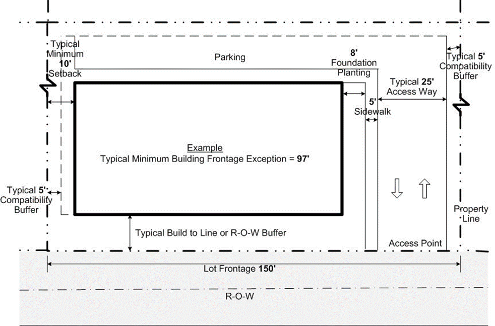
|
|
Typical example of how Minimum Building Frontage
Exception is calculated:
·
Lot frontage = 150’
·
Neighborhood Commercial (NC) Sub-area requires
a minimum 80% Building Frontage per
Table 3.B.14.F, WCRAO Non-Residential and
Mixed-Use Sub-area PDRs
·
150’
x 80% = Minimum Building Frontage of 120’ required
·
If no
side or rear access, Minimum Building Frontage may be reduced to accommodate
the following ULDC requirements: 10’ Side Setback (includes typical 5’
Compatibility Buffer); 8’ side Foundation Planting area; 5’ sidewalk; 25’
Access Way; and, typical 5’ Compatibility Buffer.
·
Reduction
is taken from Lot Frontage: 150’ - (10
’ + 8’ + 5’ + 25’ + 5’) =
Minimum Building Frontage of 97’
|
|
[Ord. 2017-025]
|
2) For parcels with multiple street frontages,
the WCRA Executive Director shall determine the hierarchy of street frontages
after consultation with the PBC Zoning Division and Engineering and Public
Works Department. In establishing the hierarchy of frontages, the WCRA
Executive Director will consider the proposed building design, orientation, and
programming, and other site elements, including but not limited to: CPTED
practices, landscaping, and streetscape to support a pedestrian-friendly
environment. [Ord. 2015-031]
The 40-foot-wide visual
buffer requirement of
Art. 3.D.1.D.1, Base Building Line
, shall not apply to those lots abutting
Westgate Avenue between Congress Avenue and Military Trail. The base building
line for said lots shall be the existing R-O-W line of Westgate Avenue.
[Ord.
2006-004] [Ord. 2021-006]
In addition to the
requirements of
Art. 5, Supplementary Standards
, and
Table 3.B.14.G, WCRAO Supplementary
Standards by Sub-area
, the
following shall apply:
[Ord. 2006-004]
|
Table 3.B.14.G – WCRAO Supplementary Standards by Sub-area
|
|
Sub-areas
|
|
|
|
|
|
|
|
|
|
|
Single Family Dwelling Unit
|
1,000 sq. ft.
|
1,000 sq. ft.
|
-
|
-
|
-
|
-
|
-
|
|
Accessory Quarters
|
300 sq. ft.
|
300 sq. ft.
|
300 sq. ft.
|
-
|
-
|
-
|
-
|
|
|
|
Prohibited Materials (6)
|
Chain link, wire mesh, barbed wire, wood
basket weave, or corrugated metal panels
|
|
|
|
Arcades and Galleries (1)
|
-
|
-
|
-
|
Required – Westgate Avenue (10)
|
-
|
-
|
-
|
|
Min. Building Depth
|
-
|
20’
|
20’
|
20’
|
30’
|
-
|
30’
|
|
Min. 1st Floor Height
|
-
|
-
|
-
|
12’
|
-
|
-
|
-
|
|
Min. Number of Floors
|
-
|
-
|
-
|
2 (2)
|
-
|
-
|
-
|
|
|
|
Min. Glazing of Frontage (3)
|
-
|
(3)
|
(3)
|
(3)
|
-
|
-
|
-
|
|
|
|
Front Setback Max. Encroachment (7)
|
8’
|
6’
|
6’
|
-
|
-
|
-
|
-
|
|
Min./Max. Porch Depth (4)
|
6’/10’
|
-
|
-
|
-
|
|
Min./Max. Porch Length (4)
|
8’/50% of building façade
|
-
|
-
|
-
|
|
Min./Max. Balcony Depth (4)
|
3’/3’
|
-
|
|
Min./Max. Balcony Length (4)
|
6’/50% total of building façade
|
-
|
|
|
|
Location of Surface Parking (9)
|
-
|
Rear
|
Rear
|
Rear
|
-
|
-
|
-
|
|
Driveways (5)(9)
|
-
|
Rear
|
Rear
|
Rear
|
-
|
-
|
-
|
|
|
|
Detached
|
Back of rear façade of primary structures
|
-
|
-
|
-
|
-
|
|
|
|
See
Art. 3.B.14.J,
WCRAO Landscape Modifications
allowing for reduction in Perimeter and
foundation planting requirements.
|
|
Min. Pervious Surface
|
-
|
20%
|
20%
|
20%
|
-
|
-
|
-
|
|
[Ord. 2006-004] [Ord.
2009-040] [Ord. 2015-031] [Ord. 2017-002] [Ord. 2017-007] [Ord. 2018-002]
[Ord. 2020-001] [Ord. 2021-023]
|
|
Key:
|
|
-
|
Subject to the supplementary standards of the lot’s zoning
district
|
|
Notes:
|
|
1.
|
See
Art.
3.B.14.G.3.d,
Arcades and Galleries
,
Figure
3.B.14.G, WCRAO Arcade and Gallery Standards
. [Ord. 2006-004]
|
|
2.
|
Required
second floor shall meet minimum frontage and depth requirements.
[Ord.
2006-004]
|
|
3.
|
See
Art. 3.B.14.G.3.c, Fenestration Details – Windows and Doors
.
Residential-only
development in the NG and NRM Sub-areas shall be exempt from
Art.
3.b.14.G.3.c, Fenestration Details – Windows and Doors
. [Ord. 2006-004] [Ord. 2020-001] [Ord. 2021-023]
|
|
4.
|
Excludes
stoops.
[Ord. 2006-004]
|
|
5.
|
Access from the front or side may be permitted
for lots with no rear street frontage. [Ord. 2006-004]
|
|
6.
|
Chain link fences
may be installed for the following: [Ord. 2009-040]
|
|
a.
|
Single Family residential
use provided a continuous native hedge is planted along the exterior side of
the fence and adequate room for maintenance is provided along the property
lines adjacent to public R-O-W. The hedge shall be maintained at the same
height as the chain link fence. Black or green vinyl-coated chain link fence
may be installed along remaining perimeter property lines not adjacent to a
public R-O-W; [Ord. 2009-040]
|
|
b.
|
Non-residential
uses within the UI Sub-area if the chain link fence is black or green vinyl
coated; or,
|
|
c.
|
When a landscape
barrier is required pursuant to
Art.
4.B.2.C.16.c, Accessory Uses – Green Market
.
[Ord. 2019-005]
|
|
7.
|
The maximum
encroachment for porches, balconies, and entryways located in NC Sub-area
shall only apply to permitted residential or hotel uses. These ground floor
improvements shall not conflict with the placement of street trees.
[Ord.
2011-001]
|
|
8.
|
Single Family
dwellings and Cottage Homes (Single Unit on a Single Lot) are not required to
provide porches, balconies, and entryways, but may elect to utilize setback
exceptions provided encroachment complies with other applicable maximum
dimensions. [Ord. 2015-031] [Ord. 2020-001]
|
|
9.
|
Shall not apply
to residential uses, except Multifamily developments with five units or more.
[Ord. 2015-031] [Ord. 2020-001]
|
|
10.
|
Lots with 100
feet or less of frontage and residential development may be exempt.
[Ord.
2017-002] [Ord. 2020-001] [Ord. 2021-023]
|
|
|
|
|
|
|
|
|
|
|
a. Accessory Structures
1) Except as
otherwise stated within
Art. 3.B.14,
WCRAO, Westgate Community Redevelopment Area Overlay
, accessory structures
shall meet the setbacks of the underlying zoning district and Supplementary
Regulations as stated within Art. 5.B.1.A.1, General.
[Ord.
2019-005]
2) Accessory
structures shall be architecturally compatible with the principal building,
with exception to accessory structures such as small sheds associated with Single
Family residences (excluding garages), when less than 150 square feet in size
and ten feet in height, and completely screened from all public rights-of-way. [Ord. 2006-004] [Ord. 2009-040]
3) Accessory
structures permitted pursuant to Art. 4.B.6.C.10.c,
Community Vegetable Garden and
Art.
4.B.2.C.16.c, Accessory Uses – Green Market
shall comply with the PDRs of
the zoning district in which the parcel is located and Supplementary Standards
in
Art. 5, Supplementary
Standards
, and shall not be subject to
Table
3.B.14.F, WCRAO Non-Residential and Mixed-Use Sub-area PDRs
, Build-to-Line/Setbacks
and Minimum Building Frontage requirements. [Ord. 2019-005] [Ord. 2020-001]
b. Accessory Quarters and Garages
Accessory Quarters and
garages shall meet the requirements of
Table 3.B.14.G, WCRAO Supplementary
Standards by Sub-area
and
Figure 3.F.3.D, TND Garages
. [Ord. 2006-004] [Ord. 2017-007]
c. Prohibited Uses in Front Yards
In the NR, NRM, NG
Sub-areas, the following uses are prohibited in front yards or building façades:
[Ord. 2006-004]
1) Parking on unpaved surfaces.
[Ord.
2006-004]
2) Clotheslines and other clothes-drying
apparatus. [Ord. 2006-004]
3) Electrical meters. [Ord. 2006-004]
4) Air-conditioning equipment, including window
units on the building façade. [Ord. 2006-004]
5) Antennas and satellite dishes.
[Ord.
2006-004]
Interior fences and
walls in the NRM, NG, and NC Sub-areas shall be decorative in nature, and shall
not obstruct views of pedestrian access ways, courtyards, or parking entrances.
Lots developed for Single Family residential use may be exempted from this
requirement. [Ord. 2006-004] [Ord. 2010-022]
a. Mixed-Use Development and NC
Sub-area
Fences and walls shall
be prohibited in the front or side street setbacks for mixed-use development or
any project in the NC Sub-area. [Ord. 2006-004]
b. NRM and NG Sub-areas
Fencing for residential
uses in front yard setbacks may be increased to six feet in height if limited
to decorative wrought iron or other similar materials that do not obstruct
vision. [Ord. 2006-004]
a. Porches and Balconies
Notwithstanding the
requirements of
Art. 5.C.1.H.2.b, Balconies and Patios
, a minimum of 20 percent of all Townhouses
or the total number of Multifamily dwelling units on each floor shall have
individual balconies or porches. A minimum of one balcony or porch shall be
required for any project with less than five units. [Ord. 2006-004]
b. Building Entrance Orientation
All uses in the NRM,
NG, NC, and UG Sub-areas shall have a principal entrance on the first floor
oriented towards the street used as the primary frontage for the building. Cottage
Homes (Multiple Units on a Single Lot) may also be oriented to a common
entryway or open space courtyard which is oriented towards the street used as
the primary frontage. [Ord. 2006-004] [Ord. 2010-022] [Ord. 2020-001]
All mirrored or
reflective glass, sliding glass doors, and glass blocks shall be prohibited. Where
required, glazing shall have a minimum 70 percent transparency. A minimum of
six square feet of glazing per linear foot of façade shall be provided at a
pedestrian scale, on the first floor frontage or side street frontage. For the
purpose of applying minimum fenestration required, the first floor shall be
considered the area located up to a maximum of 12 feet above finished grade. Window
or door frames and mullions shall be allowed to be included in the calculation.
[Ord. 2006-004] [Ord. 2010-022] [Ord. 2015-031]
Arcade or gallery
dimensions shall be in accordance with
Figure 3.B.14.G, WCRAO Arcade and Gallery
Standards
. Where arcades
and galleries are required, galleries shall not exceed 50 percent of the total
building frontage. [Ord. 2006-004] [Ord. 2010-022]
e. Drive-Throughs and Gas Station
Canopies
In the NRM, NG, and NC
Sub-areas, a drive-through, gas station canopy, or fueling area shall be
located to the rear of all buildings. [Ord. 2006-004]
f. Mezzanines
Mezzanines shall be
counted as a floor, but cannot be used to meet the NC Sub-area two-story
requirement. [Ord. 2006-004]
A non-conforming lot
that is a Legal Lot of Record, has a minimum of 25 feet of frontage, and is
located in the NRM, NG, or NC Sub-areas, may be combined with an adjacent lot
meeting the same standards, or a conforming lot, provided it serves to reduce
the non-conformity and creates a new lot with a minimum of 50 feet of frontage.
The subdivision may be approved in accordance with
Art. 11.A.8.D, Plat Waiver with Certified
Boundary Survey
.
[Ord.
2008-003]
The provisions of
Art. 5.G.1, Workforce
Housing Program (WHP)
apply when WCRAO Density Bonus Program units are not
utilized. The following provisions apply when additional density is utilized
through the WCRAO Density Bonus Program. [Ord. 2021-006]
In accordance with
WCRAO Plan Policy 1.2.3-b, an additional 1,300 residential units, that may be
utilized for rental and for-sale projects, are available in the WCRAO pursuant
to the following: [Ord. 2006-004] [Ord. 2021-006]
|
Table
3.B.14.H – WCRAO Density Bonus Pool Limits
|
|
Sub-areas
|
|
|
|
|
|
|
|
|
Max. WCRAO Density Bonus per ac.
|
N/A
|
20
|
30
|
50
|
150
|
150
|
N/A
|
|
[Ord. 2006-004] [Ord. 2021-006]
|
a. WCRA Recommendation
In accordance with Plan
FLUE Sub-Objective 1.2.3 and Policy 1.2.3-b, any proposed project that includes
a request from the Density Bonus Pool must obtain a recommendation of approval
from the WCRA in accordance with the standards of
Art. 3.B.14.D, Development Review Procedures
consistent with the provisions below:
[Ord. 2006-004] [Ord. 2007-013] [Ord.
2011-011] [Ord. 2021-006]
1) Facilitates the
development of diverse, quality housing stock that addresses a mix of income
levels pursuant to WCRA Community Redevelopment Plan Housing Policy Goal 3.1
and Objective 3.2;
[Ord. 2021-006]
2) Meets the
requirements of
Table
3.B.14.E, WCRAO Minimum/Maximum Residential and Non-Residential Uses
,
Table 3.B.14.E,
WCRAO Sub-area Use Regulations
,
Table
3.B.14.F, WCRAO Non-Residential and Mixed-Use Sub-area PDRs
, and
Table 3.B.14.F,
WCRAO Residential PDRs
, as applicable;
[Ord. 2021-006] [Ord. 2021-023]
3) Provides a
minimum of five percent of the project residential square footage as outdoor
space for resident use, which may include but not be limited to: individual
unit porches, patios, and/or balconies; usable open space for on-site common
outdoor amenities such as grilling areas and tot lots; or, neighborhood
amenities such as pedestrian streetscapes with furnishings, landscaping, or
hardscape elements; and,
[Ord. 2021-006]
4) For projects
with ten or more units, provides a minimum of 20 percent of the total units in
the project as on-site affordable and workforce housing units such that:
[Ord.
2021-006]
a) A minimum of
ten percent, with no more than 40 percent of the total project units qualify at
or below the Workforce Housing Program Low-Income Category; and a minimum of
ten percent of the total project units qualify as
Workforce
Housing Moderate 1 Income Category,
as defined in
Art. 5.G.1.A.3.b,
Income Categories
; [Ord. 2021-006]
b) These units
meet
Art.
5.G.1.A.3.h, Design Standards
; and,
[Ord. 2021-006]
c) These units
meet the provisions of
Art. 5.G.1.D, Delivery
of WHP Units
and
Art.
5.G.1.E, Enforcement
.
[Ord.
2021-006]
b. Approval Process
The review process for
a WCRAO Density Bonus Pool approval is based on the density bonus requested in
accordance with
Table 3.B.14.H, WCRAO Density Bonus Pool
Approval
. Notice of all
proposed projects shall be forwarded to the County Administrator or designee by
the Division responsible for reviewing the application.
[Ord. 2006-004]
[Ord. 2007-013] [Ord. 2010-022]
[Ord.
2021-006]
|
Table 3.B.14.H – WCRAO Density Bonus Pool Approval
|
|
Approval Process
Required (1)
|
|
|
Permitted by Right
(2)
|
0.1-4
|
|
DRO Approval
|
4.01-22
|
|
BCC Approval
|
≥ 22.01
|
|
[Ord. 2006-004] [Ord.
2007-013] [Ord. 2021-006]
|
|
Notes:
|
|
1.
|
The transfer of density to a PDD or TDD requires approval
as a Class A Conditional Use. [Ord. 2006-004] [Ord. 2018-002]
|
|
2.
|
Up to one unit may be Permitted by Right for projects less
than one acre in size. [Ord. 2006-004]
|
|
3.
|
Additional units may be acquired through the County’s TDR Program.
[Ord. 2021-006]
|
|
|
|
1) The Applicant
may request to modify or reduce the landscape requirements pursuant to
Art. 7, Landscaping
subject to a Type 1 Waiver process. The
request shall be consistent with the Plan and a WCRA recommendation for
approval. [Ord. 2006-004] [Ord. 2021-006]
2) The Applicant
may request to utilize WHP incentives available under the Full Incentive Option
pursuant to
Art.
5.G.1.B.2.f, Incentives Available under Full Incentive Option
. The request
shall be consistent with the Plan and receive a WCRA recommendation for
approval. [Ord. 2021-006]
a. General
1) For properties located east of the LWDD L-2B
Canal and west of Suwanee Drive within the NRM, NG, and NC Sub-areas, parking
shall be accessed from the rear of the lot from a street or alleyway, when
available. [Ord. 2006-004] [Ord. 2011-001]
2) Reserved parking, including spaces reserved
for valet parking, shall be prohibited except for parking provided above the
minimum required, or for individual garages for residential units.
[Ord.
2006-004]
b. Parking Exemption in the NC Sub-area
Projects on lots less
than 10,000 square feet in size shall be exempt from on-site parking
requirements if fronting on a street with on-street parking. [Ord. 2006-004]
c. Allowable Reductions in Required
On-Site Parking
The required amount of
on-site parking may be reduced in accordance with any of the following
provisions. These provisions may be applied cumulatively. [Ord. 2006-004]
1) UG, UH, NRM, NG,
and NC Deviations
Deviations in the
required parking specified in
Table 6.B.1.B, Minimum Parking and Loading
Requirements
shall be
permitted for mixed-use or residential projects in the UG, UH, NRM, NG, or NC
Sub-areas as specified in
Table 3.B.14.I, WCRAO Mixed-Use and
Residential Parking Deviations
. [Ord. 2006-004] [Ord. 2007-013]
2) Curbside Parking
On-street parking
available along the frontage, side, or rear lot lines that directly abuts the
subject lot may be applied toward the parking requirements of the uses on the
lot. Applicable spaces shall be calculated by taking the total linear distance
of parking spaces and abutting the site’s lot lines and dividing by the average
length of spaces. [Ord. 2006-004] [Ord. 2007-013]
|
Table 3.B.14.I – WCRAO Mixed-Use and Residential Parking Deviations
|
|
Use
|
|
|
Multifamily Residential
|
1 Bedroom
|
1 per unit plus required guest parking
|
|
2 Bedroom
|
1.5 per unit plus required guest parking
|
|
≥ 3 Bedrooms
|
2 spaces per unit plus required guest
parking (2)
|
|
Hotel or Motel (other
areas calculated separately)
|
1.25 per room
|
|
Office, Business or
Professional and Medical or Dental
|
2.5 per 1,000 sq. ft.
|
|
Commercial Uses
|
2.5 per 1,000 sq. ft.
|
|
Commercial, General
Retail Sales
|
3 per 1,000 sq. ft.
|
|
Restaurant, Cocktail
Lounge
|
1 per 4 seats
|
|
[Ord. 2006-004] [Ord. 2007-013] [Ord.
2017-002]
|
|
Notes:
|
|
1.
|
Unless stated otherwise in this Section, parking and
loading shall be in accordance with
Table 6.B.1.B, Minimum Parking and Loading
Requirements
.
[Ord. 2006-004] [Ord. 2007-013]
|
|
2.
|
A parking ratio of 1.5 spaces per unit plus required guest
parking shall also be permitted for any unit required to be deed restricted
for very-low and low-income households. [Ord. 2007-013]
|
|
|
|
|
3) Connections to
Adjacent Parking
Parking areas connecting
to adjoining or future adjoining lots shall be granted a five percent reduction
in the amount of required parking. This five percent reduction shall be
deducted from the final calculated parking requirement, after all other
eligible reductions are taken into consideration. [Ord. 2006-004]
To further development
of WCRAO smaller parcels in the NRM, NG, NC, UG, or UI Sub-areas that promote
the form-based code principles of the WCRA Plan, the WCRA Executive Director may
authorize the use of access aisles or other similar location on a site with
structures less than 25,000 square feet in size, to also be used as loading
areas, subject to the following: [Ord. 2007-013]
a. Application
An application shall be
submitted to the WCRA in a form established by the Executive Director of the
WCRA. The application shall include a loading demand study that addresses the
minimum standards of this Section. [Ord. 2007-013]
b. Standards
The following standards
shall apply to any shared location for a required loading zone:
[Ord.
2007-013]
1) Demonstrate that site constraints or the
benefits of an alternate loading zone is needed to allow for the development,
including efforts to maximize potential FAR or density; [Ord. 2007-013]
2) Identify the size and types of uses that will
be using the alternate loading zone, to include turnover rates and peak loading
hours; [Ord. 2007-013]
3) Demonstrate that the proposed alternate
loading zone will not adversely impact required vehicle stacking at entrances,
block building entrances, emergency vehicle access, or parked vehicles;
[Ord.
2007-013]
4) Identify the dimensions and types of vehicles
that will use the alternate loading zone; [Ord. 2007-013]
5) Incorporate other available data, including
but not limited to: traffic engineering or other Planning studies demonstrating
the feasibility of the request; [Ord. 2007-013]
6) The use of the site may be limited to the
size and types of uses indicated in the approved loading zone study;
[Ord.
2007-013]
7) The site design shall provide sufficient
maneuvering area and turning radii for proposed delivery vehicles; and,
[Ord.
2007-013]
8) If located in an access aisle, a minimum ten-foot-wide
by-pass shall be maintained along the entire length of the designed alternative
loading area. [Ord. 2007-013]
c. Approval Letter and Documentation
The WCRA Executive
Director shall recommend approval or denial of the application within the
timeframes established under
Art. 3.B.14.D.1.b, Timeframe for Response
. The WCRA Executive Director shall issue a
letter to the Applicant indicating their recommendation. [Ord. 2007-013]
The County Engineer may
approve alternatives to PBC Standard design sections for Local Street
construction, where streets are maintained by PBC, in order to accommodate
construction or reconstruction of paving and drainage improvements to an
existing public Local Street, or segment thereof. The eligible R-O-Ws shall
have a width of less than 50 feet. The alternative design(s) shall provide for
paved travel-way widths, structural sections, drainage, pedestrian access, dead-end
turnarounds, and safe sight corners as prescribed by PBC Standards for Local Streets,
or as deemed equivalent by the County Engineer. All required treatment and
discharge control of stormwater runoff to the street drainage system shall be
provided by secondary stormwater management facilities located outside the
street R-O-W, permitted and constructed in accordance with applicable
regulations of all agencies having jurisdiction over the receiving waters at
the point of legal positive outfall. [Ord. 2006-004]
b. Access to Residential Subdivision
Lots
In lieu of minimum legal access requirements pursuant to
Art. 11.E.1.A.1, Access and Circulation
Systems
, a Local Street
improved pursuant to
Art. 3.B.14.I.3.a, Construction in Existing
R-O-Ws
, and having
continuous paved access to at least one public street on the perimeter of the
WCRAO, shall be deemed by the County Engineer to meet the requirement of Local
Street access for residential lots created by subdivision of abutting property.
Nothing herein shall prohibit the owner of abutting property from making
application for and receiving appropriate approval of a Final Subdivision Plan
or waiver of platting prior to completion of the above-noted improvements;
provided, however, that the applicable plat or affidavit of waiver shall not be
approved for recordation until construction has commenced for said
improvements. [Ord. 2006-004]
c. Alleys
Removal of existing
alleys is prohibited, unless approved by the WCRA. [Ord. 2006-004]
d. Driveways
In the NRM, NG, NC, and
UG Sub-areas, a maximum of one driveway is permitted for lots less than 100
feet wide, or for one driveway for each 100 linear feet of frontage (or rear
property line for double frontage where applicable). [Ord. 2006-004]
a. Build-to-Line
Required foundation
planting along any façade with a required build-to-line may be deleted. [Ord. 2010-022]
The following modifications
shall be permitted subject to DRO approval of an ALP: [Ord. 2010-022] [Ord. 2018-002]
1) The width of side foundation planting areas
may be reduced from eight to five feet in width for buildings with a ten-foot
side setback if the overall volume of reduced planting area is relocated on
site or the required landscaping within the foundation planting area, at
installation, be increased in height by 25 percent. [Ord. 2010-022]
2) Side foundation planting may be eliminated
for buildings using a zero side setback.
[Ord.
2010-022]
3) Side foundation planting may be relocated on
site or the equivalent required landscaping within the site, be increased in
height by 25 percent if the Applicant can demonstrate that proposed building
heights will adversely limit sunlight and viability of planting area. [Ord. 2010-022]
A required R-O-W or Incompatibility
Buffer width may be reduced by up to 50 percent in the NRM, NG, NC, UG, and UI
Sub-areas for commercial or mixed-use projects, provided that a minimum five-foot-wide
planting area is provided with no encroachments, and that all other Code
requirements are met, unless indicated otherwise. A side interior perimeter
buffer shall not be required when a zero side setback is used.
[Ord.
2010-022] [Ord. 2018-002]
Shrubs and hedges shall
not be required for any R-O-W Buffer along the Westgate Avenue corridor from
Congress Avenue to the L-10 Canal, provided that required trees are planted 20
feet on center. This provision may also be used along the frontage of any mixed-use
project in the NRM, NC, NG, and UG Sub-areas. [Ord. 2010-022]
a.
Clustering
In the WCRAO, clustering is not permitted in conjunction with
the R-O-W Buffer in the NRM, NG, and NC Sub-areas.
[Ord. 2006-004] [Ord.
2018-002]
Side interior perimeter
buffers are not required where adjacent to a surface parking lot that shares a
common border with and is interconnected to an adjacent surface parking lot,
subject to DRO approval. [Ord. 2010-022]
For subdivision of land
where all of the land proposed to be subdivided, is included within an active
Surface Water Management Permit issued by the SFWMD, where all water quality
and water quantity requirements of the SFWMD have been met under said permit,
the requirements for control of discharge pursuant to
Art. 11.E.4.F, Secondary Stormwater System
Design and Performance
,
shall be deemed in compliance.
[Ord.
2006-004]
The purpose and intent
of the Infill Redevelopment Overlay (IRO), is as follows: [Ord. 2010-005]
1. Establish optional development regulations to
facilitate revitalization of commercially designated lands in the
Urban/Suburban Tier, by incrementally retrofitting commercial corridors and
isolated land uses with sustainable development that creates a sense of place,
improves streetscapes, and successfully integrates into the surrounding
community; [Ord. 2010-005]
2. Offer property development incentives that
will encourage developers, property, or business owners to utilize the IRO
(e.g., reduced setbacks and parking ratios, increased FAR, and flexible
landscaping regulations to maximize the efficient use of property); [Ord. 2010-005]
3. Implement the Goals, Objectives, and Policies
of the Comprehensive Plan that mandate sustainable, walkable urban/suburban
redevelopment; [Ord. 2010-005]
4. Utilize Smart Growth and Form-Based Coding
principles to establish standards that create a predictable built form that
improves the streetscape and establishes an enhanced pedestrian realm; [Ord. 2010-005]
5. Advocate walking, cycling, and mass transit
as viable alternatives to automobile use;
[Ord.
2010-005]
6. Promote interconnectivity between uses; [Ord. 2010-005]
7. Promote sustainability by integrating the
social, economic, and ecological needs of the community with overall Regional,
State, and National policy advocating management of resources for future
generations; [Ord. 2010-005]
8. Mitigate adverse impacts of commercial
development to surrounding residential uses and the community as a whole; [Ord. 2010-005]
9. Promote non-residential and residential mixed
use; [Ord. 2010-005]
10. Respect market realities, industry trends, and
property rights; [Ord. 2010-005]
11. Address multi-disciplinary regulatory and
development review processes; and,
[Ord.
2010-005]
12. Establish expedited review process. [Ord. 2010-005]
The provisions of the
IRO are optional, with the stipulation that when selected all new development
will be in compliance with this Section, excepting any permitted Type 1
Waivers. An Applicant may elect to use the IRO regulations for parcels that
meet the following criteria: [Ord. 2010-005] [Ord. 2012-027]
Parcels shall be located
in the U/S Tier, defined as that area being located within the USA, as depicted
on Map LU 2.1, Service Areas, of the Plan. [Ord. 2010-005]
Where applicable, the
IRO may be used in conjunction with the following overlays: GAO, LOSTO, NEO,
PBIAO, TAPO, WCRAO-UH Sub-area, and URA where a parcel does not have a URA
Urban Center (UC) or Urban Infill (UI) FLU designation. Where there is a
conflict between the provisions of the IRO and any of the above overlays, the
specific provisions of the other overlay shall prevail. [Ord. 2010-005]
Eligible parcels shall
have one or any combination of the following: CL-O, CL, CH-O, or CH FLU designation.
[Ord. 2010-005]
Use of the IRO shall
require rezoning to the IR district, unless allowed otherwise herein. Any IRO
project that requires Public Hearing approval, excluding a Development Order
Abandonment (ABN), shall submit a concurrent application to rezone the subject
property to the IR district. [Ord. 2010-005]
a. IR Rezoning Alternative
To assist in expediting
IRO projects that do not require any Public Hearing approvals, a rezoning shall
not be required subject to the following:
[Ord.
2010-005]
1) Eligible
Districts
Parcels shall have a
CN, CLO, CC, CHO, CG, or MUPD Zoning District, or combination thereof. MUPD may
also include applicable prior approvals identified in
Art. 3.E.3.A.2, Applicability
[Ord.
2010-005]
2) Intensity Limits
Application of IRO
standards shall be made based upon the lesser of either the actual FLU
designation for the site, or the zoning district equivalent as identified in
the Table below: [Ord. 2010-005]
|
Table
3.B.15.B – Zoning/FLU Equivalent
|
|
Zoning District(s) of
Subject Site
|
|
|
|
|
|
|
|
CLO
|
✓
|
|
|
|
|
CHO
|
|
✓
|
|
|
|
CN
|
|
|
✓
|
|
|
CC
|
|
|
✓
|
|
|
CG
|
|
|
|
✓
|
|
MUPD
|
(1)
|
(1)
|
(1)
|
(1)
|
|
[Ord. 2010-005]
|
|
Notes:
|
|
1.
|
Not applicable, apply FLU designation(s) for subject site.
|
|
Examples:
|
|
|
|
|
|
|
|
CN
|
(CL)
|
CH
|
=
|
CL
|
|
CLO
|
(CL-O)
|
CH-O
|
=
|
CL-O
|
|
CG
|
(CH)
|
CL
|
=
|
CL
|
|
MUPD
|
(N/A)
|
CL
|
=
|
CL
|
|
|
|
|
|
|
If a conflict exists,
the provisions of this Section shall apply to the extent of the conflict,
unless stated otherwise herein. [Ord. 2010-005]
Density and intensity
shall be in accordance with the FLU designation and related zoning PDRs for the
subject site as described herein. [Ord. 2010-005]
Uses permitted, PDRs,
density, and intensity shall be determined by the land use designation on the
affected area. Density may be transferred from one portion of the site to
another. [Ord. 2010-005]
The allowable density
shall be in accordance with FLUE Table 2.2.1-g.1 and other related Policies of
the Plan and related Policies, and
Art. 5.G, Density Bonus Programs
. [Ord. 2010-005] [Ord. 2019-005]
The maximum allowable
FAR for an IRO project with a CL or CH FLU designation may be increased up to
1.0 in accordance with
Table 3.B.15.C, IRO FAR Increase
. The maximum permissible increase is
limited to those subject sites having sufficient land area to allow for
establishment of the Core Transect Zone, so as to encourage the assembly of
smaller parcels. [Ord. 2010-005]
|
Table 3.B.15.C – IRO FAR Increase
|
|
Transect Zone
|
|
|
|
|
|
|
|
General
|
0.25 (1)
|
0.35 (1)
|
0.50
|
0.75
|
|
Core
|
0.35 (1)
|
0.50
|
0.75
|
1.0
|
|
[Ord. 2010-005]
|
|
Notes:
|
|
1.
|
May be increased up to 0.50 for accessory retail projects,
in accordance with the Plan.
|
|
2.
|
Applicable when a project achieves sufficient points to be
classified as Green Architecture pursuant to
Art. 5.C, Design Standards
.
|
|
|
|
|
|
|
A mixed-use project
that vertically integrates at least 20 percent of allowed residential units
with non-residential uses shall be allowed to utilize up to 100 percent of both
a site’s residential density and commercial intensity. [Ord. 2010-005]
All applications for an
IR rezoning or an IRO project shall require a PAC pursuant to procedures in
Art. 2.A.5.A, Pre-Application Conference
(PAC)
. [Ord. 2010-005]
Required plans shall
comply with
Art. 2.A.6.B, Plan Requirements
, and the Zoning Technical Manual.
[Ord.
2010-005]
a. Preliminary Master Plan
The BCC shall approve a
Preliminary Master Plan for a rezoning to the IR district. [Ord. 2010-005]
1) Effect of BCC
Approval
BCC approval of a Preliminary
Master Plan, or any other plans submitted voluntarily by the Applicant, shall
be binding upon the Property Owners subject to the Development Order, their
successors, or assignees, and shall constitute the development regulations for
the land. [Ord. 2010-005]
2) Additional
Requirements
The Preliminary Master
Plan shall also include the following, as applicable: [Ord. 2010-005]
a) Intensity or density, including any mix of
uses and vertical integration for any project proposing to use
Art. 3.B.15.C.4,
Mixed-Use Projects
;
[Ord.
2010-005]
b) Transect zones assigned to all land;
[Ord.
2010-005]
c) Vehicular and pedestrian circulation,
including location of access points and interconnectivity to adjacent parcels;
perimeter streets; and, the internal street network, including alleys;
[Ord.
2010-005]
d) General building location, including any
tenants 65,000 square feet or larger and pedestrian streetscape realm for all
perimeter street frontages; [Ord. 2010-005]
e) Location of any Conditional Uses;
[Ord.
2010-005] [Ord. 2018-002]
f) General location of parking, loading, and
service areas; and, [Ord. 2010-005]
g) General location of required usable open
space. [Ord. 2010-005]
|
Figure
3.B.15.D – Typical Example of IRO Preliminary Master Plan
|
|
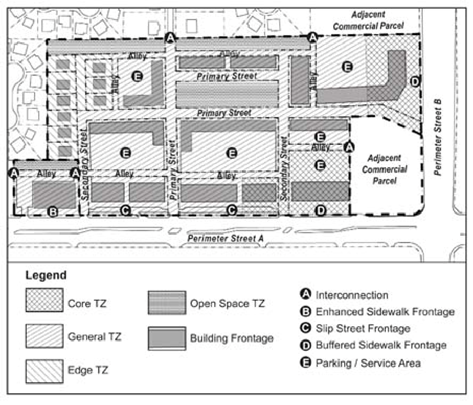
|
|
[Ord. 2010-005]
|
b. Other Plans
1) Regulating Plan
The DRO shall approve a
Regulating Plan.
[Ord. 2010-005] [Ord.
2016-042]
2) Master Sign Plan
Shall not be required
for BCC approval if no freestanding signs are proposed, excluding directional
signage. [Ord. 2010-005]
3) Architectural
Elevations
Shall be in accordance
with
Art. 5.C, Design Standards
.
[Ord.
2010-005]
c. Final Plans
Shall include the
additional requirements listed above under the Preliminary Master Plan, as
applicable. [Ord. 2010-005]
1) Final Site Plan
or Subdivision Plan
The DRO shall approve a
Final Site Plan or Final Subdivision Plan(s) for all land areas located within
an IRO project. [Ord. 2010-005]
An IRO project shall be
designed in a manner that establishes an enhanced pedestrian environment by
providing a functional interface with perimeter streets and abutting uses. This
is accomplished by regulating the following: site layout; interconnectivity;
location of intensity and density; building and parking placement; building
form; and, provision of an enhanced streetscape and usable pedestrian
amenities. [Ord. 2010-005]
The IRO is primarily
intended to accommodate smaller parcels fronting commercial corridors, and
establishes perimeter frontage standards for building setbacks and streetscape
improvements based upon the size or intensity of such streets. Larger IRO
projects shall be designed to create block configurations composed of primary
and secondary streets, and alleys. Access from perimeter streets shall be
limited to primary streets where feasible, and rear alley access, with
exception to smaller parcels which may use access ways to comply with rear
alley requirements. IRO projects shall provide for the establishment of an
alley system that connects to abutting commercial parcels, providing for an
alternative slow speed vehicular access system running parallel to commercial
corridors. Additional connectivity shall be required where larger parcels
establish new intersections from internal streets and alleys.
[Ord.
2010-005]
Transect zones are
distinct categories that define and organize density and intensity ranging from
the most urban to the least urban. The IRO requires the application of one or
more of the following four transect zones to all land within an IRO project: Core,
General, Edge, and Open Space. The primary intent is to facilitate the
development of urban forms while providing for gradual transitions in building
scale and use intensity, rather than rigid distinctions. The following
describes the four TZ types: [Ord. 2010-005]
|
Table
3.B.15.E – Generalization of IRO Transect Zones
|
|
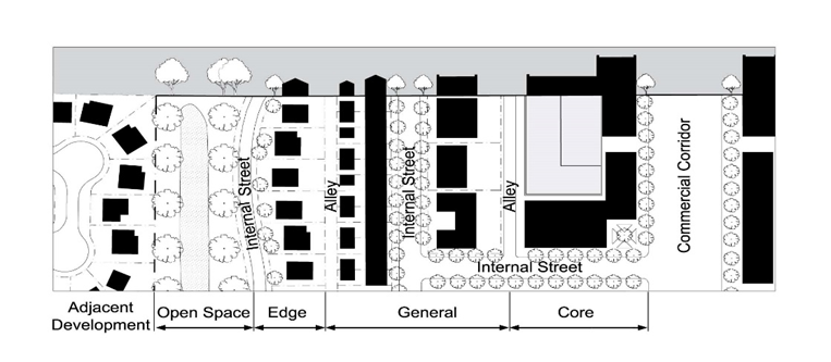
|
|
[Ord. 2010-005]
|
a. Core
The most intense TZ typically
comprised of larger interconnected commercial or mixed-use buildings that
create a continuous street wall along one or more streetscapes. Using the Core
TZ may also require the use of the General or Edge TZ if the parcel is adjacent
to residential uses or parcels with a residential FLU designation, so as to
provide a compatible transition.
[Ord.
2010-005]
b. General
A moderately intense TZ
comprised of a wide range of building types including smaller interconnected
commercial, mixed-use, and Multifamily buildings. The General TZ may be used as
a transition between the Core TZ and less intense zones or abutting uses, or
for smaller parcels with size constraints.
[Ord.
2010-005]
c. Edge
A low-intensity TZ
comprised of residential or work/live uses that are compatible with or similar
in scale to adjoining residential neighborhoods. The Edge TZ may be used to
provide an appropriate transition between the Core or General TZs and abutting residential
uses. [Ord. 2010-005]
d. Open Space
A passive TZ comprised
primarily of unbuilt, landscaped areas. Open space may be surrounded by another
TZ or used as a buffer between the General TZ and development on abutting
parcels. Typical uses include passive civic, recreation, or other public open
spaces such as plazas and squares, or drainage retention areas, environmental
preservation, or perimeter landscape buffers. [Ord. 2010-005]
All buildings shall be
located along perimeter streets first, and then may be located internally,
provided they front a primary street and are clustered with perimeter
buildings. [Ord. 2010-005]
a. Building Types
There are five general
building types permitted in the IRO: block, liner, courtyard, and Townhouse,
with additional standards for civic uses, accessory structures, and related
outdoor uses. [Ord. 2010-005]
1) Block
A type of building with
little or no substantial deviations in any façades typically used to
accommodate single-floor uses of up to 65,000 square feet per floor. [Ord. 2010-005]
2) Liner
A specialized type of
building, used to conceal parking garages, large footprint building (large-scale
development or multi-tenant) in excess of 65,000 square feet in size, and may
also include green spaces, plazas, or squares. Liner buildings may be attached
to, or have rear alley access separating the use to be concealed, and shall be
the same height as the use to be concealed. [Ord. 2010-005]
3) Courtyard
A type of building
arranged around a courtyard, such as a garden, patio, plaza, or square that is
open to the sky, and dedicated for common use. [Ord. 2010-005]
4) Civic
A type of building used
to accommodate public or private civic uses. Deviations from IRO property
development regulations may be permitted, where stated, when a public plaza,
square, or other passive open space area is incorporated into the site. [Ord. 2010-005]
5) Townhouse
A type of building
primarily intended for residential use that may also be used as a Work/Live Space
or unit. While a Townhouse building is intended to be developed using
individual lots and party walls, it may also be developed as Multifamily if
developed consistent with all Townhouse requirements. A Townhouse building
shall comply with
Art. 3.D.2.A, Townhouse
and all other related ULDC provisions,
unless expressly stated otherwise herein.
[Ord.
2010-005]
b. Accessory Structures and Outdoor
Uses
Shall be located so as
to be screened from view from streets and to minimize any adverse impacts to
adjacent residential properties.
[Ord.
2010-005]
Required parking and
loading for each tenant shall be located to the rear of buildings. Parking
shall only be permitted in front of buildings in the form of on-street parking.
Parking may be allowed on the side of buildings only if minimum frontage
requirements have been addressed. [Ord. 2010-005]
a. A pedestrian-oriented streetscape shall be
provided along all perimeter, primary, and secondary street frontages; [Ord. 2010-005]
b. Plazas, squares, and other forms of usable
open space shall be located in front of or adjacent to buildings; and, [Ord. 2010-005]
c. Additional sidewalks or pathways shall be
provided to establish a complete pedestrian network that links all uses and
parking lots to perimeter street frontages. [Ord. 2010-005]
Landscaping in an IRO
project shall be designed to enhance pedestrian areas, allow for improved visual
surveillance from building windows, and minimize impacts to adjacent
residential developments. Drainage retention areas, preserves, and other
similar low-intensity open space areas shall be located so as to provide a
transition between commercial uses and existing adjacent residential uses, or
parcels with a residential FLU designation, when possible. [Ord. 2010-005]
An IRO project shall
comply with the following: [Ord. 2010-005]
Access shall be limited
to minimize curb cuts to streets so as to improve traffic flow and reduce
adverse impacts to pedestrian walkways. Where feasible, access from rear alleys
is encouraged. [Ord. 2010-005]
a. External
No more than one access point shall be permitted for each 160
linear feet of street frontage, and shall be in the form of a street or alley,
unless exempted otherwise herein. Parcels with side
street frontages shall be required to provide rear alley access or a
larger street, unless bounded by a street along the rear property line. [Ord. 2010-005]
b. Internal
No more than one access
point or alley shall be permitted for each 160 linear feet of street frontage
to allow for access to parking and loading, drive-through facilities, or other
similar uses. [Ord. 2010-005]
c. Small Parcel Exception
Parcels with less than
160 feet of frontage shall be permitted to establish one access point along a
perimeter street; however, alley access shall be encouraged as the primary
means of vehicular access where feasible.
[Ord.
2010-005]
Blocks shall be created
by utilizing streets and alleys to provide continuous pedestrian and vehicular
circulation, interconnectivity, and accessibility in IRO projects. Any new
blocks created, whether required or voluntary, shall be in accordance with the
following: [Ord. 2010-005]
a. Applicability
Blocks are required for
projects five or more acres in size, or where the subdivision of land is
proposed, excluding lot recombination.
[Ord.
2010-005]
b. Minimum Dimensions
|
Table 3.B.15.F – Block Dimension Requirements
|
|
Block Perimeter (Total)
|
|
|
|
No Pedestrian Pass-Through; or
|
640’
|
1,600’
|
|
With Pedestrian Pass-Through
|
640’
|
2,200’
|
|
Block Length (Single Side)
|
|
|
|
No Pedestrian Pass-Through; or
|
160’
|
600’
|
|
With Pedestrian Pass-Through
|
160’
|
750’
|
|
[Ord. 2010-005]
|
c. Block Frontage
All blocks shall have
frontage on a perimeter or internal street frontage. Streets shall be used to
interconnect blocks. When using alleys to meet block requirements, they shall only
be permitted along the side or rear of a block where streets are not required. [Ord. 2010-005]
d. Subdivision
Any subdivision of land
shall comply with all lot dimensions applicable to the IR district, with
exception to Townhouse lots.
[Ord.
2010-005]
e. PDD Subdivision Alternative
An IRO project may
apply for an exemption from subdivision recordation requirements and subdivide
by fee title conveyance of individual lots in accordance with the approval
process and requirements of
Art. 11.A.6.B, Subdivision of Commercial and
Industrial Building Sites
. [Ord. 2010-005]
f. Exceptions
Where new blocks are
required, exceptions shall be permitted only where PBC DEPW requirements preclude
required vehicular access points necessary to complete the block structure. [Ord. 2010-005]
|
Figure
3.B.15.F – Typical Example of IRO Blocks, Streets, and Subdivision
|
|
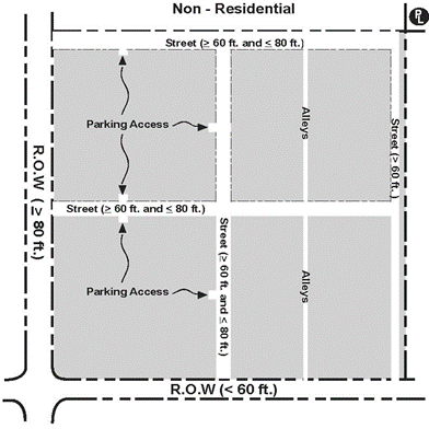
|
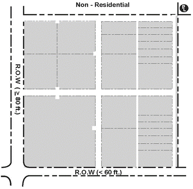
|
|
[Ord. 2010-005]
|
This Code addresses the
design of external and internal streets and establishes related standards to
ensure that pedestrian amenities and walkways, buildings, and other
improvements are properly and safely situated. Vehicular circulation and
interconnectivity shall be established using a system of streets and alleys,
unless exempted herein. Streets are used to create connections between parcels,
establish blocks, and provide frontage for buildings that are not located with
frontage on a perimeter street. Alleys provide links between adjacent parcels
along the rear of lots, behind buildings, and to link parking areas.
[Ord.
2010-005]
a. Perimeter Street Types
Building perimeter
frontages and setbacks shall be determined by the width of the ultimate street
R-O-W. All perimeter streets shall be classified as indicated in
Table 3.B.15.F, Perimeter Street Types
.
[Ord.
2010-005]
1) Exceptions
A Type 1 or Type 2
street type may be used to apply the standards of this Code if the street meets
one of the following situations:
[Ord.
2010-005]
a) Street has a limited number of travel lanes
and large medians, or on-street parking; or [Ord. 2010-005]
b) Where streets are designed with narrower
lanes and official posted speed limits are 35 miles per hour or less, a Type 2
R-O-W may be applied, or where 30 miles per hour or less, a Type 1 R-O-W may be
applied. [Ord. 2010-005]
Internal streets shall
include primary streets, secondary streets, slip streets, and alleys. For the
purposes of the IRO, internal streets may include access ways or driveways,
provided they comply with the design standards herein; however, new internal
streets or alleys designated as private or public R-O-W shall also comply with
any Engineering requirements. [Ord. 2010-005]
1) Primary Street
The design for the
street, on-street parking, and streetscape shall comply with
Figure 3.F.2.A, TDD Commercial Street
, or the TMD design exception summarized in
Art. 3.F.4.C.2.a.1), Design Exception
as illustrated in
Figure 3.F.4.C, Typical Example of TMD
Commercial Street with Angled Parking
. If required, primary streets shall serve to establish the main
pedestrian routes of a project.
[Ord.
2010-005]
2) Secondary Street
Secondary streets may
be permitted where necessary to comply with block structure requirements. Secondary
streets shall be designed to be consistent with primary streets, except that
on-street parking shall not be required, and minimum sidewalk width may be
reduced to five feet in width.
[Ord.
2010-005]
3) Slip Street
Option
The slip street option
allows for the establishment of a parallel street immediately abutting a
commercial corridor. The slip street establishes a pedestrian-oriented
streetscape along perimeter frontages that also accommodates on-street parking.
Eligible parcels shall have a minimum frontage of 400 feet along a perimeter
street, and shall be generally consistent with the standards for a primary
street, with exception to the following:
[Ord.
2010-005]
a) Vehicular traffic shall be one way, in the
direction of the closest lanes on the abutting R-O-W; [Ord. 2010-005]
b) The street shall be a minimum of 12 feet
wide, or as required by the County Engineer; [Ord. 2010-005]
c) Vehicle stacking and interaction with any
access points shall be as required by the County Engineer; and,
[Ord.
2010-005]
d) On-street parking shall only be required on
one side of the street. [Ord. 2010-005]
4) Alleys
Alley access shall not
be permitted from primary streets. Alleys shall conform to the requirements of
Art. 3.F.2.A.1.e, Alleys
.
[Ord.
2010-005]
c. Streetscape
Street trees, street
lights, sidewalk dimensions, and other pedestrian amenities shall be in
accordance with the streetscape standards defined in
Art. 3.B.15.F.8, Streetscape Standards
.
[Ord.
2010-005]
Interconnectivity to
adjacent residential parcels is encouraged, but not required. Interconnectivity
shall be required to any non-residential development or vacant parcel with a non-residential
use, FLU designation, or zoning district abutting an IRO project. In addition,
the following shall apply. [Ord. 2010-005]
a. Street Connections
Parcels required to or
proposing to establish a block structure, shall provide interconnectivity where
any new internal intersections abut adjacent parcels. [Ord. 2010-005]
b. Parallel Alley
All parcels with
frontage on a commercial corridor shall install an alley running parallel to
the corridor. The alley shall be generally located along the rear property
line, or at a point that allows interconnectivity to shallower abutting lots. Where
new blocks are not required or proposed, alleys may be incorporated as drive
aisles within parking lots. In the event the adjacent parcel is undeveloped, a
stub out shall be provided to accommodate future connections. [Ord. 2010-005]
The use of gates or
other similar barriers is prohibited. Exceptions are permitted for the
following: dumpsters, loading areas, and private garages or parking lots. [Ord. 2010-005]
d. Cross-Access Agreement
Where interconnectivity
is required, an irrevocable cross-access easement shall be provided prior to Final
DRO plan approval. [Ord. 2010-005]
Transect zone
boundaries shall follow proposed lot lines or be clearly dimensioned for
parcels developed under one entity. No land may be assigned two or more
transect zones.
Overall parcel size,
dimensions, R-O-W frontages, and other abutting parcel uses or FLU designations
dictate the type and location of allowable TZs, with the most intense being
located along commercial corridors or where adjacent to similar IRO projects, commercial,
or industrial uses, transitioning to the least intense where needed to address
the context of adjacent uses. [Ord. 2010-005]
a. General Standards
The following general
standards shall be followed when assigning TZs: [Ord. 2010-005]
1) The Core TZ should be located adjacent to
busy highways, Arterials, or Collectors;
[Ord.
2010-005]
2) Changes in TZs should generally occur at the
rear of buildings or lots, rather than along streets, with exception to the
Open Space TZ; [Ord. 2010-005]
3) The Open Space TZ may face other TZs across
streets. When the Open Space TZ is used to designate a public open space within
the proposed development, it should be surrounded by streets on one or more
sides; [Ord. 2010-005]
4) When a parcel adjoins existing or approved
development, either a similar transect zone or a zone that establishes a
compatible transition shall be assigned.
[Ord.
2010-005]
b. Minimum Standards
The following Table
establishes minimum standards for assigning each of the four TZs: [Ord. 2010-005]
|
Table
3.B.15.F – IRO TZ Standards
|
|
Parcel Standards
|
|
|
|
|
|
|
|
Min. Overall Parcel
Size
|
1 ac.
|
N/A
|
N/A
|
N/A
|
|
Max. Percentage of
Overall Parcel
|
50% (1)
|
N/A
|
N/A
|
N/A
|
|
Min. Percentage of
Overall Parcel
|
N/A
|
25%
|
N/A
|
N/A (2)
|
|
Min. Setback from
Abutting Residential
|
200’
|
10’
|
N/A
|
N/A
|
|
Required Frontage
|
|
Arterial or Collector
|
✓
|
✓ (3)
|
N/A
|
N/A
|
|
Local Commercial
Street (5)
|
✓
|
✓ (3)
|
N/A
|
N/A
|
|
Local Residential
Street (5)
|
N/A
|
N/A
|
✓
|
N/A
|
|
Permitted Side Street
or Other Frontages
|
|
Expressway
|
✓
|
✓
|
✓
|
✓
|
|
Local Commercial
Street (5)
|
✓
|
✓
|
✓
|
✓
|
|
Local Residential
Street (5)
|
N/A
|
✓
|
✓
|
✓
|
|
Residential Access
(5)
|
N/A
|
✓
|
✓ (4)
|
✓
|
|
Alleys (Internal) (5)
|
✓
|
✓
|
✓
|
✓
|
|
[Ord. 2010-005]
|
|
Notes:
|
|
✓
|
Means applicable or permitted.
[Ord. 2010-005]
|
|
1.
|
Maximum Core TZ may be increased up to 95 percent, and
minimum General TZ may be reduced commensurately, where parcel is abutting on
all sides by Arterials, Collectors, and commercial or industrial parcels up
to a depth of a minimum of 200 feet from the property line.
[Ord.
2010-005]
|
|
2.
|
See
Art. 3.B.15.F.9, Usable Open Space
, for minimum “usable open
space” requirements. [Ord. 2010-005]
|
|
3.
|
General TZ shall be exempt from Arterial or Collector
requirement when a Core TZ is used, or where an eligible parcel only fronts
on a Local Commercial Street. [Ord. 2010-005]
|
|
4.
|
General TZ frontage only permitted for parcels less than
one acre in size. [Ord. 2010-005]
|
|
5.
|
Includes any access way meeting IRO street standards.
[Ord.
2010-005]
|
|
|
|
|
|
|
The provisions of this
Section shall be applied in conjunction with any other applicable ULDC
standards or limitations for buildings, unless stated expressly herein.
[Ord.
2010-005]
a. Building Placement
Table 3.B.15.F, Block Dimension Requirements
, provides the dimensional requirements for
building placement for IRO projects. All building types excluding outdoor uses
and related structures, shall comply with the following: [Ord. 2010-005]
1) Corners
Where a parcel is
located at the intersection of two streets, at least one building shall be
placed so as to meet the build-to-lines for both streets. [Ord. 2010-005]
2) Building
Hierarchy
Building placement
shall follow an established order, with initial buildings required to meet
minimum placement and frontage requirements along the most intense perimeter
streets. Additional buildings may be located on interior main streets, but
shall be ordered so as to create a consistent streetscape. [Ord. 2010-005]
b. Building Property Development
Regulations
The primary façade of
all buildings shall front a street and shall be designed in compliance with the
following. [Ord. 2010-005]
1) Perimeter Street
Building Frontage
Building frontage is
the percentage of the total width of a lot which is required to be occupied by
the primary façade of a building.
[Ord.
2010-005]
a) The primary façade shall be parallel to a
street, and located in accordance with the build-to-line requirements of the
street type; [Ord. 2010-005]
b) Frontage requirements must be addressed for
the most intense perimeter streets first. [Ord. 2010-005]
2) Perimeter
Frontage Exceptions
Once the frontage
requirement has been addressed for the most intense perimeter street,
exceptions for other perimeter streets shall be permitted where insufficient
building intensity is proposed or for less intense side streets. Frontage
requirements may be reduced for lots with no rear or side access to required
parking as necessary to accommodate a drive aisle for ingress/egress. [Ord. 2010-005]
3) Internal
Building Frontage
Internal buildings
shall only be permitted when located fronting a primary street, unless exempted
herein. [Ord. 2010-005]
4) Setback
Measurement
Setbacks shall be in
accordance with
Table 3.B.15.F, Block Building Configuration
PDRs
, and the following: [Ord. 2010-005]
a) Perimeter
Frontage
Setbacks shall be measured
from the edge of ultimate R-O-W, or from the property line, whichever is
applicable. [Ord. 2010-005]
b) Internal
Frontage
Setbacks shall be
measured from the proposed building frontage façade to the outside edge of
curb. [Ord. 2010-005]
c) Townhouses
For the purposes of Townhouse
units, building placement setbacks shall be used to establish the location of Townhouse
lots. Additional Townhouse building setbacks may be permitted. This may also be
applied to Multifamily buildings that are constructed to Townhouse standards.
[Ord.
2010-005]
d) Side Setback
Reduction
Where permitted,
buildings permitted to use a zero side setback reduction shall comply with the
following: [Ord. 2010-005]
(1) No windows, doors, or other openings are
permitted. No portion of a building, including roof eaves, gutters, and soffits
may encroach onto adjacent parcels;
[Ord.
2010-005]
(2) No form of opening, attachment, or any item or
method of construction requiring maintenance other than cleaning and painting,
when visible, shall be permitted;
[Ord.
2010-005]
(3) A maintenance easement is granted allowing for
a minimum of two feet for access to any portion of the building left exposed;
and, [Ord. 2010-005]
(4) Height shall be limited to two stories and
maximum of 30 feet. Additional height may be permitted subject to the standard
setback and any other setback requirements. [Ord. 2010-005]
|
Table 3.B.15.F – Block Building
Configuration PDRs
|
|
Building Placement
|
|
|
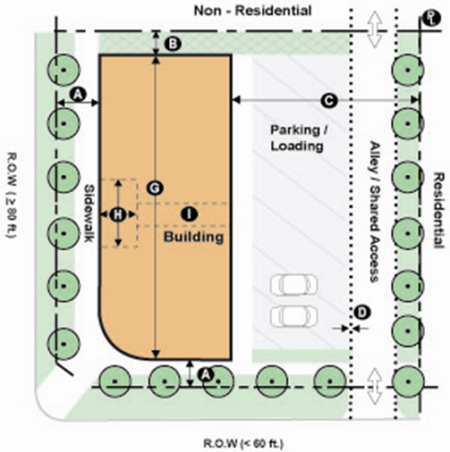
|
|
A.
|
Type 1 R-O-W Frontage
|
10’
|
15’
|
|
|
Buffered Sidewalk
|
15’
|
25’
|
|
Slip Street
|
42’
|
50’
|
|
Type 2 R-O-W Frontage
|
10’
|
20’
|
|
|
Buffered Sidewalk
|
18’
|
35’
|
|
Slip Street
|
42’
|
55’
|
|
Type 3 R-O-W Frontage
|
15’
|
25’
|
|
|
Buffered Sidewalk
|
20’
|
40’
|
|
Slip Street
|
47’
|
75’
|
|
Internal Street
Frontage
|
15’
|
25’
|
|
B.
|
Non-Residential
|
10’ (2)
|
N/A
|
|
C.
|
Residential (IRO
Project)
|
10’
|
N/A
|
|
Residential (Non-IRO
Project) (6)
|
30’
|
N/A
|
|
D.
|
Between Rear Parking
and Alley
|
5’ (3)
|
N/A
|
|
Building Frontage
Percentage (4)
|
|
|
|
G.
|
|
50%
|
100%
|
|
Individual Building
Length
|
|
|
|
G.
|
|
N/A
|
275’
|
|
Courtyard Percentage
of Footprint
|
|
|
|
H.
|
|
N/A
|
10%
|
|
Courtyard Dimensions
|
|
|
|
H.
|
|
15’
|
30’
|
|
Pedestrian Pass-Through
(4)(5)
|
|
|
|
I.
|
Separation (4)
|
100’
|
300’
|
|
Width
|
10’
|
20’
|
|
[Ord. 2010-005]
|
|
Notes:
|
|
1.
|
Required maximum build-to-line may be increased,
where necessary, to accommodate utility easements, landscape buffer, slip
street, safe sight distance, corner clips, or other similar need as may be
required by the County Engineer. [Ord. 2010-005] [Ord. 2018-002]
|
|
2.
|
May be reduced to zero feet where in compliance
with provisions for side setback reduction. [Ord. 2010-005]
|
|
3.
|
Shall be exempt for parcels eligible to use
parking drive aisles to comply with alley requirements. [Ord. 2010-005]
|
|
4.
|
Percentage shall be based upon length of
applicable property line. Where multiple buildings are proposed, the
applicable length shall be result of the overall length divided by the number
buildings. [Ord. 2010-005]
|
|
5.
|
Maximum pedestrian pass-through requirement does
not apply for buildings with a length of 300 feet or less. [Ord. 2010-005]
|
|
6.
|
Means adjacent residential parcels that are not
located within a development using IRO regulations. [Ord. 2010-005]
|
|
Table 3.B.15.F – Liner Building Configuration PDRs
|
|
Building Placement
|
|
|
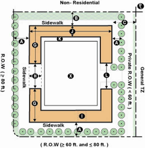
|
|
A.
|
Type 1 R-O-W Frontage
|
10’
|
15’
|
|
|
Buffered Sidewalk
|
15’
|
25’
|
|
Slip Street
|
42’
|
50’
|
|
Type 2 R-O-W Frontage
|
10’
|
20’
|
|
|
Buffered Sidewalk
|
18’
|
35’
|
|
Slip Street
|
42’
|
55’
|
|
Type 3 R-O-W Frontage
|
15’
|
25’
|
|
|
Buffered Sidewalk
|
20’
|
40’
|
|
Slip Street
|
47’
|
75’
|
|
Internal Street
Frontage
|
15’
|
25’
|
|
B.
|
Non-Residential
|
10’ (2)
|
N/A
|
|
C.
|
Residential (IRO
Project)
|
10’
|
N/A
|
|
Residential (Non-IRO
Project) (7)
|
30’
|
N/A
|
|
D.
|
Between Rear Parking
and Alley
|
5’ (3)
|
N/A
|
|
Building Frontage
Percentage (4)
|
|
|
|
G.
|
|
60%
|
100%
|
|
Individual Building
Length
|
|
|
|
G.
|
|
200’
|
400’
|
|
Courtyard Percentage
of Footprint
|
|
|
|
H.
|
|
N/A
|
10%
|
|
Courtyard Dimensions
|
|
|
|
H.
|
|
15’
|
30’
|
|
Pedestrian Pass-Through
(4)(5)
|
|
|
|
I.
|
Separation
|
100’
|
300’
|
|
Width
|
10’
|
20’
|
|
Liner and Interior
Standards
|
|
|
|
J. (6)
|
Depth
|
30’
|
100’
|
|
Length
|
75%
|
100%
|
|
K.
|
Separation
|
N/A
|
N/A
|
|
L.
|
Parking Access
|
N/A
|
10%
|
|
X.
|
Internal Use
|
N/A
|
N/A
|
|
[Ord. 2010-005]
|
|
Notes
|
|
1.
|
Required maximum build-to-line may be increased,
where necessary, to accommodate utility easements, landscape buffer, slip
street, safe sight distance, corner clips, or other similar need as may be
required by the County Engineer. [Ord. 2010-005] [Ord. 2018-002]
|
|
2.
|
May be reduced to zero feet where in compliance
with provisions for side setback reduction. [Ord. 2010-005]
|
|
3.
|
Shall be exempt for parcels eligible to use
parking drive aisles to comply with alley requirements. [Ord. 2010-005]
|
|
4.
|
Percentage shall be based upon length of
applicable property line. Where multiple buildings are proposed, the
applicable length shall be result of the overall length divided by the number
buildings. [Ord. 2010-005]
|
|
5.
|
Maximum pedestrian pass-through requirement does
not apply for buildings with a length of 300 feet or less. [Ord. 2010-005]
|
|
6.
|
Liner dimensions shall apply to all façades used
to conceal a large footprint tenant that front a perimeter street, slip
street, primary street, and usable open space. Additional standards may apply
to parking garage structures. [Ord. 2010-005]
|
|
7.
|
Means adjacent residential parcels that are not
located within a development using IRO regulations. [Ord. 2010-005]
|
|
|
|
|
|
|
|
|
|
Table 3.B.15.F – Courtyard Building Configuration PDRs
|
|
Building Placement
|
|
|
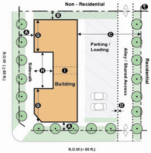
|
|
A.
|
Type 1 R-O-W Frontage
|
10’
|
15’
|
|
|
Buffered Sidewalk
|
15’
|
25’
|
|
Slip Street
|
42’
|
50’
|
|
Type 2 R-O-W Frontage
|
10’
|
20’
|
|
|
Buffered Sidewalk
|
18’
|
35’
|
|
Slip Street
|
42’
|
55’
|
|
Type 3 R-O-W Frontage
|
15’
|
25’
|
|
|
Buffered Sidewalk
|
20’
|
40’
|
|
Slip Street
|
47’
|
75’
|
|
Internal Street
Frontage
|
15’
|
25’
|
|
B.
|
Non-Residential
|
10’ (2)
|
N/A
|
|
C.
|
Residential (IRO
Project)
|
10’
|
N/A
|
|
Residential (Non-IRO
Project) (6)
|
30’
|
N/A
|
|
D.
|
Between Rear Parking
and Alley
|
5’ (3)
|
N/A
|
|
Building Frontage
Percentage (4)
|
|
|
|
G.
|
|
60%
|
100%
|
|
Individual Building
Length
|
|
|
|
G.
|
|
N/A
|
300’
|
|
Courtyard Percentage
of Footprint
|
|
|
|
H.
|
|
10%
|
25%
|
|
Courtyard Dimensions
|
|
|
|
H.
|
|
30’
|
N/A
|
|
Pedestrian Pass-Through
(4)(5)
|
|
|
|
I.
|
Separation
|
100’
|
300’
|
|
Width
|
10’
|
20’
|
|
[Ord. 2010-005]
|
|
Notes:
|
|
1.
|
Required maximum build-to-line may be increased, where
necessary, to accommodate utility easements, landscape buffer, slip street,
safe sight distance, corner clips, or other similar need as may be required
by the County Engineer. [Ord. 2010-005] [Ord. 2018-002]
|
|
2.
|
May be reduced to zero feet where in compliance with
provisions for side setback reduction. [Ord. 2010-005]
|
|
3.
|
Shall be exempt for parcels eligible to use parking drive aisles
to comply with alley requirements. [Ord. 2010-005]
|
|
4.
|
Percentage shall be based upon length of applicable
property line. Where multiple buildings are proposed, the applicable length
shall be result of the overall length divided by the number buildings.
[Ord.
2010-005]
|
|
5.
|
Maximum pedestrian pass-through requirement does not apply
for buildings with a length of 300 feet or less. [Ord. 2010-005]
|
|
6.
|
Means adjacent residential parcels that are not located
within a development using IRO regulations. [Ord. 2010-005]
|
|
|
|
|
|
|
|
|
|
Table 3.B.15.F – Townhouse Lot and Building
Configuration PDRs
|
|
Lot Placement
|
|
|

|
|
A.
|
Type 1 R-O-W Frontage
|
10’
|
15’
|
|
|
Buffered Sidewalk
|
15’
|
25’
|
|
Slip Street
|
42’
|
50’
|
|
Type 2 R-O-W Frontage
|
10’
|
20’
|
|
|
Buffered Sidewalk
|
18’
|
35’
|
|
Slip Street
|
42’
|
55’
|
|
Type 3 R-O-W Frontage
|
Prohibited
|
|
Internal Street
Frontage
|
15’
|
25’
|
|
B.
|
Non-Residential
|
10’
|
N/A
|
|
C.
|
Residential (IRO
Project)
|
10’
|
N/A
|
|
Residential (Non-IRO Project)
(4)
|
30’
|
N/A
|
|
Building Frontage
Percentage (2)
|
|
|
|
G.
|
|
50%
|
96%
|
|
Individual Building
Length
|
|
|
|
G.
|
|
32’
|
250’
|
|
Wing Standard (3)
|
|
|
|
M.
|
Wing Width
|
N/A
|
50%
|
|
Building Setbacks (3)
|
|
|
|
N.
|
Rear Setback to Alley
|
5’
|
N/A
|
|
O.
|
Front/End Setbacks
|
5’
|
10’
|
|
[Ord. 2010-005] [Ord. 2017-007]
|
|
Notes:
|
|
1.
|
Required maximum build-to-line may be increased, where
necessary, to accommodate utility easements, landscape buffer, slip street,
safe sight distance, corner clips, or other similar need as may be required
by the County Engineer. [Ord. 2010-005] [Ord. 2018-002]
|
|
2.
|
Percentage shall be based upon length of applicable
property line. Where multiple buildings are proposed, the applicable length
shall be result of the overall length divided by the number buildings.
[Ord.
2010-005]
|
|
3.
|
Townhouse, including wings, garages, or Accessory Quarters
shall comply with minimum common wall requirements unless set back from the
side PL a minimum of five feet; and shall comply with
Art. 3.D.2.B.3.b.1), Prohibited Openings
and Attachments
except for any first floor that is set back a minimum of ten feet from the
PL. [Ord. 2010-005] [Ord. 2017-007]
|
|
4.
|
Means adjacent residential parcels that are not located
within a development using IRO regulations. [Ord. 2010-005]
|
c. Building Type by Transect Zone
The implementation of
the transect zones includes identifying the placement of buildings by type so
as to allow for the proper location of higher intensity uses while ensuring
consistency with the context of less intensive neighboring uses, where
applicable. [Ord. 2010-005]
|
Table
3.B.15.F – Building Type by Transect Zone
|
|
Building Type
|
|
|
|
|
|
|
|
Block
|
✓
|
✓
|
|
|
|
Liner
|
✓
|
(1)
|
|
|
|
Courtyard
|
|
✓
|
✓
|
|
|
Civic
|
✓
|
✓
|
✓
|
|
|
Townhouse
|
|
✓
|
✓
|
|
|
[Ord. 2010-005]
|
|
Notes:
|
|
✓
|
Means applicable or permitted.
[Ord. 2010-005]
|
|
1.
|
Building type may be permitted where located a minimum of
200 feet from adjacent parcels with residential FLU designation or uses.
[Ord. 2010-005]
|
|
|
|
|
|
|
d. Special Building Standards
1) Pedestal
Building
The following standards
shall apply where any building exceeds either four stories or 48 feet in
height. [Ord. 2010-005]
a) A horizontal recess line of at least 15 feet
is required along at least 50 percent of building façades facing streets; and
[Ord.
2010-005]
b) Massing is regulated using a percentage of maximum
size of the floor footprint of the building footprint per each story above the
height limit threshold. All additional construction above this threshold shall
be limited to 65 percent of the first floor footprint, as follows:
[Ord.
2010-005]
(1) The main volume of the building shall be
oriented toward perimeter or primary streets, away from side or rear lot lines
to reduce impact on adjacent properties;
[Ord.
2010-005]
(2) Tower elements shall be located to
appropriately respond to the condition of the site. Desirable tower locations
emphasize street corners, main building entrances, gateways, or the visual axis
of another street or usable open space; and, [Ord. 2010-005]
(3) Massing articulation shall not wholly occur
within the center of the block and must be evident on the street façade(s)
using architectural variations such as changes in the number of stories,
articulations in the eave or roofline, or adjusting the location of the front
façade to accommodate civic open space.
[Ord.
2010-005]
2) Civic Building
An Applicant for a
civic building may apply any one or combination of block, liner, or courtyard
building type, or apply for a Type 1 Waiver in accordance with
Table 3.B.15.G, Type 1 Waivers
.
[Ord.
2010-005] [Ord. 2012-027]
e. Additional Building Standards
Additional building
standards are established to provide design standards to facilitate pedestrian
access and circulation. [Ord. 2010-005]
1) Primary
Entrances
The primary entrance
for all first floor tenants must directly face a street, or a courtyard, plaza,
square, or other form of usable open space fronting a street. Access for
tenants located on upper floors shall provide similar entrances, but may be
permitted to deviate from this requirement on sites less than one acre in size.
In either situation, street access may be in the form of common lobbies,
elevators, stairwells, or other form of consolidated access. There are no
limits on the allowable number of primary entrances. [Ord. 2010-005]
2) Secondary
Entrances
Each tenant may be
permitted to have additional entrances located at side or rear façades facing a
parking lot or other area, subject to the following limitations: [Ord. 2010-005]
a) Shall not exceed the number of primary
entrances. [Ord. 2010-005]
b) Limitations shall not apply to service access
or emergency exits. [Ord. 2010-005]
3) Windows on Façades
Facing Streets
Non-residential and Multifamily
building façades facing perimeter and primary streets or usable open space must
have transparent windows covering between 35 to 75 percent of the wall area of
each story as measured between finished floors, to allow transmission of
visible daylight. [Ord. 2010-005]
4) Outdoor Uses
Additional standards
are established for non-residential outdoor uses, excluding passive recreation
areas or other similar uses, to ensure compatibility with the streetscape,
usable open space areas, and any abutting residential uses or parcels with a residential
FLU designation. [Ord. 2010-005]
a) Residential Setbacks
Outdoor uses shall be
set back a minimum of 200 feet from any abutting residential use or parcel with
a residential future land use designation, unless approved through a Type 2
Waiver process. This shall include vehicular access and parking for vehicular
related uses such as gasoline sales, Car Washes, or drive-through facilities.
[Ord.
2010-005] [Ord. 2018-002]
b) Screening
Outdoor uses shall be
framed by either of the following, or a combination of both: [Ord. 2010-005]
(1) Buildings or similar structures on all four
sides; or [Ord. 2010-005]
(2) A five-foot-wide landscape strip that includes
a 30-inch-high hedge or concrete street wall, with multi-trunk or flowering
trees planted 30 feet on center. Breaks to allow for pedestrian access shall be
permitted. [Ord. 2010-005]
c) Drive-Through
and Gasoline Service Location
A minimum of 50 percent
of all drive-through lanes and gasoline service areas, inclusive of pump
islands, canopies, and queuing areas shall be located behind buildings that
comply with minimum frontage standards, and shall be consistent with
Figure 3.B.15.F, Typical Gasoline Service
Facilities
and
Figure 3.B.15.F, Typical Drive-Through
Configurations
.
[Ord.
2010-005]
|
Figure
3.B.15.F – Typical Gasoline Service Facilities
|
|
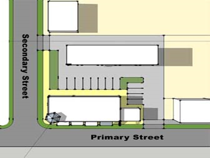
|
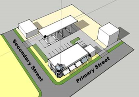
|
|
[Ord. 2010-005]
|
d) Drive-Through
Facility Exception
Exceptions shall be
permitted for drive-through facilities that are located inside a building or
side façade where vehicular traffic exits onto a Type 1 R-O-W, subject to
approval by the County Engineer, where designed similar to
Figure 3.B.15.F, Typical Drive-Through
Configurations
.
[Ord.
2010-005]
5) Building
Elevations, Height, and Use by Floor
The following Tables
establish regulations for building height and building encroachment in each TZ
to address compatibility and visual impact issues. [Ord. 2010-005]
|
Table
3.B.15.F – Pedestal, Liner, Block, Courtyard, and Civic Building Height and
Use
|
|
Building Height
|
|
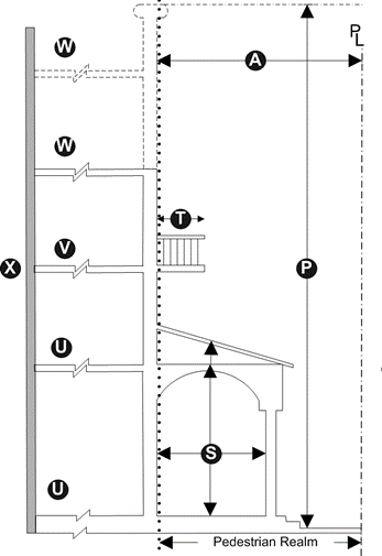
|
|
P.
|
Edge TZ or Townhouse
Building
|
35’ (3 stories)
|
|
General TZ
|
60’ (4 stories) (1)(2)
|
|
Core TZ
|
75’ (5 stories) (1)(2)
|
|
Encroachment
|
|
|
|
S.
|
Stoop (4)
|
-
|
6’
|
|
Gallery (3)(4)
|
10’
|
12’
|
|
Gallery Height
|
10’
|
15’
|
|
T.
|
Balcony
|
-
|
6’
|
|
Uses By Transect/Floor
|
|
|
|
|
|
|
|
|
|
|
|
|
|
U.
|
Edge
|
✓
|
|
|
✓
|
|
|
|
|
|
General
|
✓
|
✓
|
✓
|
✓
|
✓
|
✓
|
|
|
|
Core
|
✓
|
✓
|
✓
|
✓
|
✓
|
✓
|
|
✓
|
|
V
|
Edge
|
✓
|
|
|
✓
|
|
|
|
|
|
General
|
✓
|
|
✓
|
✓
|
✓
|
|
|
|
|
Core
|
✓
|
✓
|
✓
|
✓
|
✓
|
✓
|
|
✓
|
|
W
|
Edge
|
✓
|
|
|
✓
|
|
|
|
|
|
General
|
✓
|
|
✓
|
✓
|
✓
|
|
|
|
|
Core
|
✓
|
|
✓
|
✓
|
✓
|
|
|
✓
|
|
X
|
Liner building interior, same uses as
allowed in TZ.
|
|
Use Classification
Key (Refer to Art. 5.X.3, Use Standards)
|
|
R
|
Residential
|
C
|
Commercial, Other
|
O
|
Commercial, Office
|
W
|
Work/Live
|
|
CV
|
Public and Civic
|
RC
|
Recreation
|
U
|
Utilities and Excavation
|
I
|
Industrial
|
|
[Ord. 2010-005] [Ord. 2011-001]
|
|
Notes:
|
|
✓
|
Means applicable or permitted.
[Ord. 2010-005]
|
|
1.
|
Shall be exempt from
Art. 3.D.1.E, Building Height
where adjacent to a
R-O-W greater than 50 feet in width, or an IRO-compliant street (excluding
alleys). [Ord. 2010-005]
|
|
2.
|
One additional story and 15 feet in height permitted for green
building. [Ord. 2010-005]
|
|
3.
|
The required sidewalk zone may be accommodated within a
gallery. [Ord. 2010-005]
|
|
4.
|
Encroachment for stoop or gallery (including uses therein
such as outdoor dining, benches, or displays) shall not impede required
streetscape sidewalk area or be located within five feet of the streetscape
street tree planting area. [Ord. 2010-005]
|
|
5.
|
Allowances shall be permitted for single-floor units
located on the first floor to accommodate ADA requirements.
[Ord.
2010-005]
|
|
|
|
|
|
|
|
|
|
|
|
|
|
|
|
|
|
|
Table
3.B.15.F – Townhouse Building Height and Use
|
|
Building Height
|
|
|
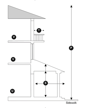
|
|
P.
|
Edge
|
35’ (3 stories)
|
|
General
|
|
Encroachment (1)
|
|
|
|
S.
|
Stoop
|
N/A
|
6’
|
|
Front Porch
|
N/A
|
8’
|
|
Front Porch Height
|
N/A
|
15’
|
|
T.
|
Balcony
|
-
|
6’
|
|
Uses By
Transect/Floor
|
|
Transect
|
|
|
|
|
|
U.
|
Edge
|
✓
|
✓
|
|
General
|
✓
|
✓
|
|
V.
|
Edge
|
✓
|
(2)
|
|
General
|
✓
|
✓
|
|
[Ord. 2010-005] [Ord.
2011-001]
|
|
Notes:
|
|
✓
|
Means applicable or permitted. [Ord. 2010-005]
|
|
1.
|
Encroachment for stoop or front porch shall not impede
required streetscape sidewalk area or be located within five feet of the
streetscape street tree planting area. [Ord. 2010-005]
|
|
2.
|
Shall only be permitted where uses on the second floor or
higher is limited to residential. [Ord. 2010-005]
|
|
3.
|
Allowances shall be permitted for single-floor units
located on the first floor to accommodate ADA requirements.
[Ord.
2010-005]
|
|
|
|
|
|
|
|
|
The standards of the
IRO allow only those uses that have been indicated on a DRO-approved FSP or FSBP
to be eligible to apply for Building Permits or a Business Tax Receipt (BTR). Where
permitted, uses may also be further restricted by TZ, building type and number,
or floor location. [Ord. 2010-005]
a. Permitted Uses
See
Art. 4, Use Regulations
. [Ord. 2010-005] [Ord. 2017-007]
b. Accessory Uses
Accessory uses shall be
permitted in accordance with
Art. 5.B, Accessory Uses and Structures
. Any proposed use that exceeds the
limitations of an accessory use shall only be permitted if allowed above and
where in compliance with the requirements of this Code. [Ord. 2010-005]
Streetscape standards
are established to improve both the physical and visual appearance of the
streetscape while creating a pedestrian-friendly environment along commercial
corridors, other perimeter street frontages, and for any new internal streets.
[Ord.
2010-005]
a. General Standards
The following standards
shall apply to all streetscapes.
[Ord.
2010-005]
1) Required buffer areas or street trees shall
be located between streets and pedestrian sidewalks and other hardscaped areas;
[Ord. 2010-005]
2) Required pedestrian sidewalks shall be free
and clear of all encumbrances;
[Ord.
2010-005]
3) All paving materials for the pedestrian
sidewalks shall be compliant with ADA accessibility standards, and shall be
constructed of concrete acceptable to the Engineering Department; [Ord. 2010-005]
4) Consistency in paving pattern and materials
for streetscapes are required for all individual projects, and are encouraged
for abutting IRO projects. The first application for an IRO of a commercial
corridor or a block shall establish the paving pattern. [Ord. 2010-005]
5) Where a sidewalk or a path crosses curb cuts
at ingress/egress points and internal drives, the pedestrian crossing shall be
paved with a material that provides a different texture or a
color
contrast with the vehicular surface, but preferably consistent with the paving
material of the path; [Ord. 2010-005]
6) Where a street tree planting area is
required, area may be landscaped with appropriate ground cover; however, Applicants
are encouraged to install required trees in tree grates with appropriate root
barrier or other similar structures to promote tree growth, and areas in between
may be hardscaped; [Ord. 2010-005]
7) Consistency in street tree species shall be
encouraged within a block, if applicable, and shall be reflective of the
character of the surrounding area. The first application for an IRO of a
commercial corridor or a block shall establish preferred species. [Ord. 2010-005]
8) Streetscape shall be provided along both
sides of primary and secondary streets;
[Ord.
2010-005]
9) Where applicable, sidewalks located within a
perimeter R-O-W may be incorporated into the streetscape requirements of this Section,
subject to a sidewalk easement agreement with the DEPW; and, [Ord. 2010-005]
10) Where an existing or proposed utility easement
is located adjacent to subject roadways, streetscape requirements shall be
applied from the inner edge of the utility easement, and shall be landscaped
with appropriate ground cover, with exception to the following: [Ord. 2010-005]
a) Applicants are encouraged to improve utility
easement areas with improved surfacing or landscaping to be consistent with
required streetscape areas; [Ord. 2010-005]
b) Utility easements may encroach into required
streetscape areas up to a maximum of five feet, subject to Engineering approval
and consent from easement holder; and, [Ord. 2010-005]
c) Street trees may be located in utility
easements subject to use of tree root barrier approved by County Landscape and
easement holder. [Ord. 2010-005]
b. Design Standards
The IRO establishes
three general forms of streetscape configurations, as follows: enhanced sidewalk,
buffered sidewalk, and slip street. While the enhanced sidewalk may be
applicable to both perimeter and internal streets, the remaining two are
generally limited to commercial corridors or other perimeter streets. The Applicant
may choose one of the streetscape configurations to use; however, the
streetscape design should be consistent with the surrounding character. [Ord. 2010-005]
1) Enhanced
Sidewalk
The enhanced sidewalk
streetscape option establishes a continuous sidewalk with regularly spaced
shade trees along the street.
[Ord.
2010-005]
a) The street tree planting area shall be a
minimum of five feet in width; [Ord. 2010-005]
b) The pedestrian sidewalk area shall be a
minimum of six feet in width, and shall be free and clear of any obstructions
or uses. Width may be reduced to five feet where abutting a Type 3 R-O-W or
secondary street. [Ord. 2010-005]
c) Street trees shall be installed in accordance
with
Art. 3.F.2.A.4.d, Street Trees
, except that exceptions to tree spacing may
be permitted where necessary to accommodate bisecting utility easements, or
other similar improvements; [Ord. 2010-005]
d) Street lights shall be required for all
perimeter and internal streets in accordance with
Art. 3.F.2.A.1.f.2)
, TDD Street Lighting; [Ord. 2010-005]
e) Any areas remaining between required street
tree and pedestrian sidewalk area and building frontages shall be improved with
additional pedestrian sidewalk area, or other decorative pavement treatment to
be used as outdoor dining areas, usable open space, or to encourage a
pedestrian interface display windows, where applicable; [Ord. 2010-005]
f) Decorative planter boxes or potted trees may
be located within two feet of building frontages, provided they do not screen
views to building windows or doors, or adversely impact pedestrian use areas;
[Ord.
2010-005]
g) No temporary or permanent physical structures
may be affixed to building frontages in the streetscape so as to preclude views
of windows or doorways; and, [Ord. 2010-005]
h) A minimum of 75 percent of buildings fronting
on a Type 2 or 3 R-O-W, primary, or slip street shall have arcaded sidewalks or
other architectural element that provides shade to pedestrians, such as
permanent canopies and awnings. [Ord. 2010-005]
|
Figure
3.B.15.F – Typical Enhanced Streetscape
|
|
|
|
[Ord. 2010-005]
|
2) Buffered
Sidewalk
The buffered sidewalk
streetscape option is similar to the enhanced sidewalk option, except that the
street tree planting area is replaced with a wider planting area to provide
additional buffering between streets and pedestrian areas. The following Table
shows dimensional standards for planting areas based perimeter street type. [Ord. 2010-005]
|
Table
3.B.15.F – Buffered Sidewalk Dimensional Standards
|
|
Width of R-O-W
|
|
|
|
|
|
Type 1 R-O-W
|
5’
|
10’
|
|
Type 2 R-O-W
|
8’
|
20’
|
|
Type 3 R-O-W
|
10’
|
25’
|
|
[Ord. 2010-005]
|
a) The planting area shall not be paved, except
that paved access shall be provided to crosswalks and transit stops;
[Ord.
2010-005]
b) One Canopy tree for each 25 feet of the
property’s frontage shall be provided. Trees may be installed in a formal,
uniform spacing or may be arranged within the planting area in informal
clusters so long as the required quantity is satisfied; [Od. 2010-005]
c) In addition to the required Canopy trees,
flowering trees, palms, shrub layers, grass, and ground covers shall be
required to provide design variations and colors. Quantity of plant materials
shall be established depending on the width of the planting area, and shall be
calculated in compliance with
Art. 7, Landscaping
;
[Ord. 2010-005]
d) Grass shall be permitted; however, ground cover
shall be encouraged as a substitute for grass for water conservation and
maintenance purposes; [Ord. 2010-005]
e) Berms shall only be permitted in order to create
a streetscape with an informal, naturalistic design; [Ord. 2010-005]
f) Meandering pedestrian walkways are
encouraged to be incorporated into larger sidewalk buffer planting areas; and,
[Ord.
2010-005]
g) All other requirements shall be in compliance
with the enhanced sidewalk defined above, with exception to street tree
planting requirements. [Ord. 2010-005]
|
Figure
3.B.15.F – Typical Buffered Sidewalk Streetscape
|
|
|
|
[Ord. 2010-005]
|
3) Slip Street
Slip street streetscape
shall be required for any proposed slip streets, and shall be designed as
follows: [Ord. 2010-005]
a) A landscape planting area shall be required
between a perimeter R-O-W and the slip street ranging from ten to 15 feet in
width. Additional width may be permitted to accommodate utility easements or
Engineering requirements, but shall not be increased otherwise. Area shall be
hardscaped or covered with appropriate ground cover. [Ord. 2010-005]
b) Street trees shall be planted in the
landscape area in accordance with
Art. 3.F.2.A.4.d, Street Trees
, but shall be generally consistent with the
tree species and spacing provided in the enhanced sidewalk area; and,
[Ord.
2010-005]
c) All other requirements shall be in compliance
with enhanced sidewalk, where applicable. [Ord. 2010-005]
|
Figure
3.B.15.F – Typical Slip Street Streetscape
|
|
|
|
[Ord. 2010-005]
|
A minimum of five percent
of the gross acreage of the project shall be dedicated or provided as usable
open space. Plazas or squares that provide a concentrated focal point for
pedestrians shall be the preferred method for providing usable open space, but
credit may be given for required pedestrian streetscapes or other similar
usable open space amenities. All usable open space areas shall meet the minimum
dimensions provided under
Table 3.B.15.F, Dimensions for Usable Open
Space
, unless exempted
otherwise herein. [Ord. 2010-005]
a. Required Plazas and Squares
Projects ten acres or
more shall provide at least one central plaza, square, or other similarly
dimensioned usable open space area.
b. Streetscape Credit
Projects that have net
land areas of less than two and one-half acres in size may count all
streetscape areas towards the usable open space requirement. All others may
count up to 50 percent of streetscape areas towards usable open space
requirements. [Ord. 2010-005]
c. Street Frontage
Minimum required usable
open space shall front on a perimeter or primary street on at least one side. [Ord. 2010-005]
d. Shade
A minimum of 15 percent
of each plaza, square, or other usable open space area shall be shaded by
landscape material or shade structures at time of construction. Where applied
to streetscape galleries, awnings or other building amenities may be counted
towards shade requirement. A minimum of 30 percent of the total square footage
shall be pervious. [Ord. 2010-005]
e. Pervious Areas and Landscaping
A minimum of 30 percent
of all usable open space areas, excluding streetscape where applicable, shall
be pervious, and covered with appropriate ground cover in accordance with
Art. 7, Landscaping
.
[Ord. 2010-005]
f. Pedestrian Amenities
Required usable open
space areas shall have a minimum of one linear foot of seating for each 200
square feet of overall area.
[Ord.
2010-005]
Parking and loading
shall comply with
Art. 6, Parking, Loading, and Circulation
, unless otherwise stated below:
[Ord.
2010-005]
a. Location and Access
Parking and service
areas shall be located at the side or rear of building(s) in accordance with
Table 3.B.15.F, Parking Location
, except for slip streets. The most intense
street shall be considered the frontage for corner lots. These standards
provide flexibility in dimensional and layout requirements to address site
restrictions, and provide for reductions in the number of required on-site
parking spaces for sites that are located in close proximity to public transit,
or have a potential for interconnectivity and shared parking areas between
contiguous developments. [Ord. 2010-005]
|
Table 3.B.15.F – Parking Location
|
|
Parking Location
|
|
|
Rear
|
100%
|
|
Side
|
50% (1)(2)
|
|
Front
|
(3)
|
|
[Ord. 2010-005]
|
|
Notes:
|
|
1.
|
On-street parking only, with additional located in parking
lots. [Ord. 2010-005]
|
|
2.
|
Exceptions may be permitted for parking courts located
internal to a development where all building placement standards have been
addressed. [Ord. 2010-005]
|
|
3.
|
On-street parking only, including slip streets where
applicable. [Ord. 2010-005]
|
|
|
|
1) On-Street
Parking
Parking in front of
buildings shall only be permitted where on-street parking is allowed. [Ord. 2010-005]
2) Parking Lots
It is the intent that
parking lots shall be screened from all streets. The perimeter of parking lots
shall be framed by either of the following, or a combination of both: [Ord. 2010-005]
a) Buildings; or [Ord. 2010-005]
b) A five-foot-wide landscape strip that
includes a minimum 30-inch-high hedge or concrete street wall, with Canopy
trees planted 30 feet on center. Breaks to allow for pedestrian access shall be
permitted. [Ord. 2010-005]
c) Alternatively, there shall be no required
separation between parking and parallel alleys for any project that does not
have streets or blocks, and alleys may be incorporated into parking lots as
standard drive aisles. [Ord. 2010-005]
|
Figure
3.B.15.F – Typical Parking Location and Access
|
|

|
|

|
|
|
|
|
|
[Ord. 2010-005]
|
3) Parking
Structures
Parking for any use in
excess of six spaces per 1,000 square feet of non-residential floor area shall be
located in a parking structure configured as a liner building, subject to the
following: [Ord. 2010-005]
a) When fronting perimeter and primary streets,
usable open space, or other similar areas, shall comply with liner building
PDRs; or [Ord. 2010-005]
b) When fronting secondary streets, alleys,
parking lots, or other similar areas, shall be screened by a façade that
incorporates landscaping or architectural features consistent with the primary frontage,
or any combination. [Ord. 2010-005]
4) Townhouse Parking
The requirements for Townhouse
parking may also be applied to Multifamily buildings that are designed to
appear and function as Townhouses. Individual parking spaces or garages shall
be permitted to the rear of Townhouses, with access from an alley or street. Garage
setbacks shall be in accordance with PDRs for Townhouse buildings. [Ord. 2010-005]
5) Service and Loading Areas
All service and loading
areas shall be located along the rear or side of buildings, and shall not be
visible from perimeter or primary streets, or any usable open space. The
service areas shall be located within the footprint of the building or
immediately adjacent to the building. Required loading space areas may be
waived, reduced in number, or dimension, in accordance with
Art. 6.E, Loading Standards
, or by IRO Waivers.
[Ord.
2010-005]
b. Parking Ratios
The required number of
parking spaces shall correspond to broad uses and not to a specific use, and
shall be responsive to the long-term transition of tenants within a non-residential
or mixed-use development. The Applicant may choose from the following parking
requirements: [Ord. 2010-005]
1) Non-Residential
a) Minimum: one space per 333 square feet of GFA
(3/1,000); [Ord. 2010-005]
b) Maximum: one space per 200 square feet of GFA
(5/1,000), unless parking is accommodated in a parking structure;
[Ord.
2010-005]
c) Where uses are not intended to allow for
transition to other uses, the general parking standards outlined in
Art. 6, Parking, Loading, and Circulation
may be applied, provided that use
limitations are identified on the DRO-approved Site Plan; [Ord. 2010-005]
d) Reduction in required parking through use of
a shared parking study, as defined in
Art. 6, Parking, Loading, and Circulation
; or, [Ord. 2010-005]
e) Where eligible, Applicant may receive credit
for any perimeter on-street parking spaces located along Type 1 streets,
subject to approval by the County Engineer. Use of this option may be limited
to where the developer pays for required improvements to existing Type 1
streets. [Ord. 2010-005]
2) Residential
Multifamily residential
parking ratios may be reduced in accordance with
Table 3.B.14.I, WCRAO Mixed-Use and
Residential Parking Deviations
. [Ord. 2010-005]
All IRO projects shall
comply with
Art. 7, Landscaping
, unless stated otherwise herein:
[Ord.
2010-005]
a. Perimeter Buffers
1) Streetscape
Exemptions
Required landscape
perimeter buffers pursuant to
Art. 7, Landscaping
shall not be required where an IRO streetscape is required. [Ord. 2010-005]
2) Compatibility
Buffers
A side interior
Compatibility Buffer shall not be required when a zero side setback is proposed
or exists. [Ord. 2010-005]
3) Alternative
Incompatibility Buffer Option
The following
Incompatibility Buffer option may be utilized where projects are in compliance
with minimum setbacks for non-residential outdoor use areas: [Ord. 2010-005]
a) Landscape buffer planting area shall be a
minimum of ten feet in width; [Ord. 2010-005]
b) No easement encroachment shall be permitted;
[Ord.
2010-005]
c) An eight-foot-tall solid concrete block or
panel wall shall be installed along the affected property line, with a setback
a minimum of two feet to allow for maintenance of the exterior side of the
wall. Setback may be increased as needed to accommodate required footers;
[Ord.
2010-005]
d) The required wall shall be constructed of materials
and with a design consistent with the principal building of the IRO, and shall
have the same architectural finish treatment and color on both sides of the
wall. [Ord. 2010-005]
e) Exterior landscape areas shall have ground cover
that is low maintenance and does not impede necessary access for maintenance;
[Ord.
2010-005]
f) Canopy trees shall be planted along the
internal side of the wall to be spaced a minimum of 20 feet on center;
[Ord.
2010-005]
g) A hedge shall be installed in accordance with
the standards for medium shrubs, as specified in
Table 7.D.3.A, Shrub Planting Requirements
. [Ord. 2010-005]
b. Foundation Planting
Foundation planting
requirements may be subject to the exemptions, exceptions, and deviations as
permitted for WCRAO projects, as indicated in
Art. 3.B.14.J.1.b, Foundation Planting Deviations
.
[Ord.
2010-005]
c. Alternative Parking Lot Design
Options
This Section allows
alternative parking lot designs through modifications to
Art. 7.C.4. Landscape Requirements for On-Site
Parking
to promote
innovative design or use of green building materials. The following may be used
individually or in combination, unless stated otherwise: [Ord. 2010-005] [Ord. 2014-025]
1) Option 1
Projects that are
one-half acre or less in size, with 20 or fewer parking spaces may consolidate
all required landscape island areas and planting materials into one or more
locations anywhere within the project;
[Ord.
2010-005] [Ord. 2014-025] [Ord.
2018-002]
2) Option 2
Projects that are two acres
or less in size may reduce required landscape island width to a minimum of five
feet in width of landscape area. This option may not be used in conjunction
with any option relocating these landscape areas;
[Ord. 2010-005] [Ord. 2014-025]
[Ord. 2018-002]
3) Option 3
Landscape shrub or
ground cover requirements for landscape islands and divider median islands may
be replaced with bio-swales and appropriate landscaping, provided that required
Canopy trees can be accommodated. Alterations to required curbing may be permitted
subject to demonstration that vegetated areas are protected from vehicles;
[Ord. 2010-005] [Ord. 2014-025] [Ord. 2018-002]
4) Option 4
Up to a maximum of 25
percent of required landscape islands and divider median landscape islands
shall not be required provided that covered parking that utilizes appropriate
solar reflectance index (SRI) materials are installed where islands are removed;
[Ord. 2010-005] [Ord. 2014-025] [Ord. 2018-002]
5) Option 5
Landscape shrub or
ground cover requirements for terminal, interior, and divider median landscape
areas shall not be required, subject to the following: [Ord. 2010-005] [Ord. 2014-025]
a) The number of required terminal, interior,
and divider median trees are doubled; and [Ord. 2010-005] [Ord. 2014-02
5
]
b) Green building standards for tree wells and
related root growth areas are utilized; [Ord. 2010-005]
6) Option 6
No landscape islands
are required if parking spaces are abutting landscape buffers, Street Walls, or
tree planting areas.
[Ord. 2010-005] [Ord.
2014-025] [Ord. 2018-002]
d. Rear or Side Entrances
Buildings with
additional entrances located on the side or rear façades shall either provide
an enhanced streetscape between any abutting parking lots that meets the
standards for a primary street; or shall provide foundation planting along a
minimum of 50 percent of the applicable façade, with a minimum depth of five feet,
to be planted in accordance with
Art. 7, Landscaping
,
with a sidewalk a minimum of five feet in width as needed to separate
pedestrians from abutting vehicle use areas along the building façade. [Ord. 2010-005]
The Applicant may apply
for Type 1 Waivers for development standards in accordance with
Art. 2.C.5.G, Type 1 Waiver
and
Table 3.B.15.G, Type 1 Waivers
. The following Table summarizes the IRO
development requirements eligible for the Type 1 Waiver process:
[Ord.
2010-005] [Ord. 2011-016] [Ord. 2012-027]
|
Table 3.B.15.G – Type 1 Waivers
|
|
Requirements
|
|
|
|
Internal Street Standards
|
|
Art. 3.B.15.F.3.b, Internal Street Types
|
Allow additional lanes, or minor increases in lane width.
|
·
Where required to accommodate traffic, or where required by
the DEPW or Palm Tran.
·
Minimum deviation required and remains generally consistent
with TDD street standards.
·
Consistent with livable street standards that prioritize
pedestrian safety.
|
|
Interconnectivity Standards
|
|
Art. 3.B.15.F.4, Interconnectivity
Standards
|
No interconnectivity requirement.
|
Document prohibition by Federal, State, Local, or other
laws that serve to establish limited access standards necessary to protect
facilities such as Water or Wastewater Treatment Plants, jails, or other
similar facilities. [Ord. 2017-007]
|
|
Art. 3.B.15.F.4.c, Gates
|
Allow use of gates within the development.
|
·
Special circumstances between adjacent uses.
·
Specific user requirements within the IRO project requires
the use of gates, provided such does not impact the continuity of required
blocks, streets, or alleys.
|
|
Building Standards
|
|
Civic Building Standards
|
No frontage requirement.
No build-to-line requirement.
|
·
Public and private civic buildings shall be designed to
reflect their public purpose and are intended to be landmarks within the
community.
·
Frontages shall be located abutting usable open space
areas, and additional pedestrian amenities shall be provided to emphasis the
civic nature of the use.
|
|
Usable Open Space
|
|
Art. 3.B.15.F.9, Usable Open Space
|
Allow for reduction.
|
Lot less than two and one-half acres in size having
insufficient frontage to accommodate usable open space in pedestrian
streetscape areas.
|
|
Loading Space
|
|
Art. 3.B.15.F.10.a.5), Service and Loading
Areas
; and
Art. 6.E, Loading Standards
|
Waive or reduce required loading spaces, dimensions for
width, length, maneuvering area, and location.
|
·
Limitations due to access, lot size, location of residential
uses, proximity to streets or alleys, or vehicular circulation.
·
Document that any loading alternatives will not adversely
impact pedestrian or vehicular circulation, including alleyways, drive aisles,
handicapped accessibility, or other similar functional considerations.
·
Document that any loading alternatives will not conflict
with DEPW or FDOT requirements.
|
|
[Ord. 2010-005] [Ord. 2012-027] [Ord.
2017-007]
|
The purpose and intent
of the Urban Redevelopment Area Overlay (URAO) is as follows:
[Ord.
2010-022]
1. Implement the concepts of the July 2007 Palm
Beach County Urban Redevelopment Area Planning Study and Corridor Master Plan,
prepared by the Treasure Coast Regional Planning Council, inclusive of the 2009
Planning Division addendum, and the 2016 amendments to the Plan (
Ordinance No. 2016-037
), URA Alternative Revisions. [Ord. 2010-022] [Ord. 2017-002]
2. Implement the Urban Redevelopment Area (URA)
Objectives and Policies of the Plan, with an emphasis on Priority Redevelopment
Area (PRA) Policies; [Ord. 2010-022]
3. Utilize Smart Growth and Form-Based Coding
principles to establish standards that create a predictable regulatory
framework and built form that improves the aesthetics of the streetscape and
establishes, enhances the pedestrian realm, and encourages redevelopment of the
PRAs; [Ord. 2010-022]
4. Encourage a compact, mixed-use, and walkable
development form, with an emphasis on safety, comfort, and ecological
responsibility; [Ord. 2010-022]
5. Create an interconnected pedestrian-friendly
street network that establishes parallel, alternate vehicular routes between
the PRAs and creates new blocks that are a walkable scale; [Ord. 2010-022]
6. Advocate walking, cycling, mass transit, or
other modes of transportation as viable alternatives to automobile use by encouraging
the development of commercial, civic, and recreational uses that provide for
the daily needs of residents within walking distance; [Ord. 2010-022]
7. Promote mixed-use development that balances
housing with employment, commercial, and civic uses; [Ord. 2010-022]
8. Provide a variety of housing types to support
residents of diverse ages, incomes, family sizes, ethnicities, and lifestyles; [Ord. 2010-022]
9. Promote sustainability by integrating the
social, economic, and ecological needs of the community with overall Regional, State,
and National policy advocating management of resources for future generations; [Ord. 2010-022]
10. Redevelop retail uses along the PRA corridors
along stipulated street frontages;
[Ord.
2010-022] [Ord. 2011-016]
11. Simplify and facilitate the permitting process;
and, [Ord. 2010-022] [Ord. 2011-016]
12. To encourage redevelopment and revitalization
of commercial corridors by establishing standards that recognize various
opportunities, challenges, and constraints. Certain standards may be altered
through a Waiver process.
[Ord.
2011-016]
Any Development Order
within the boundaries of the URAO shall be subject to the requirements of
Art. 3.B.16.F.5, Interconnectivity Standards
. [Ord. 2011-016]
Any application for a
Development Order or change in use for parcels with an Urban Center (UC) or
Urban Infill (UI) FLU designation shall comply with all URAO requirements,
unless permitted otherwise under
Art. 1.E, Prior Approvals
,
Art. 1.F, Non-Conformities
, or any other provisions herein.
[Ord.
2011-016]
The exact boundaries of
the URA are depicted on Map LU 3.1 of the Plan, but can be generally described
as being bound by Community Drive to the north, the Lake Worth Drainage
District L-14 Canal to the south, I-95 to the east, and extending as far west
as Jog Road at some points. The UC and UI parcels are located within the
Priority Redevelopment Area, generally located along the east and west sides of
Military Trail and Congress Avenue and bordered by Southern Boulevard to the
north and extend as far south as the Lake Worth Drainage District L-8 Canal. Additional
locations are along Lake Worth Road and Tenth Avenue North. The PRA boundaries
are depicted on Maps LU 9.1 and 9.2 of the Plan.
[Ord. 2010-022] [Ord.
2011-016]
Development Orders with
UC or UI FLU designation may not be used in conjunction with any other
overlays. [Ord. 2010-022] [Ord. 2011-016]
The zoning districts
permitted within the PRAs are as follows:
a.
Urban Center (UC) and Urban Infill (UI)
As of August 2010, all parcels that have a UC or UI FLU
designation, were rezoned to the corresponding UC and UI districts (Zoning Application
No. Z-2010-00667 and Zoning Application No. Z-2010-00668, respectively). Rezoning
applications shall only be required for parcels which initially opted out of
the PRA and are applying for a concurrent FLU amendment to the UC or UI FLU
designation.
[Ord. 2010-022] [Ord.
2011-016]
On August 22, 2016, the BCC adopted Plan amendments (
Ordinance
No. 2016-037
), which may allow flexibility for Property Owners to utilize
the FLU designations and zoning districts that were in place prior to the
adoption of rezoning to the UC or UI Zoning Districts. [Ord. 2017-002]
1) Mandatory
Pre-Application Meeting
A Pre-Application meeting with Zoning and Planning Staff is
required to review any requests for this option, prior to confirmation of
eligibility and final determination of the applicable FLU designation and zoning
district that may be utilized.
[Ord.
2017-002]
2) Decision
If the alternative zoning district is found to be consistent
with the alternative FLU designation, as specified in
Art. 3.A.3,
Zoning District Consistency with the Future Land Use Atlas (FLUA)
, then the
property may be developed in accordance with the standards for the alternative zoning
district. If inconsistent, the Applicant may be required to rezone the property
to a consistent zoning district.
[Ord.
2017-002]
Deviations from FLU and density/intensity requirements shall be
prohibited. [Ord. 2010-022] [Ord. 2011-016]
The maximum density and
intensity for a PRA Development Order shall only be limited by any applicable
site development requirements of this Code or the PRA TCEA (TE Policy 1.2-v of
the Plan). [Ord. 2010-022] [Ord. 2011-016]
The use of TDR, AHP, or
WHP density bonus incentives are not eligible within the PRAs.
[Ord.
2010-022] [Ord. 2011-016]
Residential projects
comprised of ten units or more shall comply with
Art. 5.G.1, Workforce Housing Program (WHP)
. [Ord. 2010-022] [Ord. 2011-016]
Only those projects
that are subject to the requirements of the PRA TCEA may be required to develop
as mixed use. [Ord. 2010-022]
All PRA applications
requiring DRO approval shall require a PAC pursuant to procedures in
Art. 2.A.5.A, Pre-Application Conference
(PAC)
, with exception to
amendments to prior approvals and non-conformities that do not comply with the
provisions of the URAO. [Ord. 2010-022]
Required plans shall
comply with
Art. 2.A.6.B, Plan Requirements
. [Ord. 2010-022] [Ord. 2011-016]
The list of uses
permitted within the URAO shall be in accordance
with
Art. 4, Use
Regulations
, and the following. [Ord. 2011-016] [Ord. 2017-007]
Those uses that were legally established prior to the adoption
of
Zoning
Resolution No. R-2010-1344
and
Zoning
Resolution No. R-2010-1345
(Zoning Application Z-2010-00667 and Zoning Application
No. Z-2010-00668, UC and UI districts, respectively) shall be permitted to
continue in accordance with
Art. 1.E, Prior Approvals
, or
Art. 1.F, Non-Conformities
. A change in use shall only be
permitted if the proposed use complies with all of the following: [Ord. 2011-016]
a. Listed in
the Use Matrices contained
in
Art. 4, Use
Regulations
; [Ord. 2011-016] [Ord. 2017-007]
b. Does not exceed the limitations of
Art. 1.F, Non-Conformities
; [Ord. 2011-016]
c. Is entirely located within existing
buildings; and, [Ord. 2011-016]
d. Parking is provided in accordance with the
minimum parking requirements of
Art. 6, Parking, Loading, and Circulation
, inclusive of the minimum parking
requirements of
Table 6.B.1.B, Minimum Parking and Loading
Requirements
. Previously
approved PDDs may apply any vested parking requirements in accordance with
Art. 1.E, Prior Approvals
, with exception to applications for Conditional Uses. [Ord. 2011-016]
Residential uses may be
allowed on any floor, with exception to the following:
[Ord. 2011-016] [Ord.
2017-007]
a. Where located in the same building as non-residential
uses, residential uses shall either be located above or internally separated
from any non-residential uses; and
[Ord.
2011-016]
b. Single Family, Cottage Home (Single Unit on a
Single Lot), Zero Lot Line housing types, or Community Residences within these
housing types, shall not front on Slip Street or Primary Street Frontages.
[Ord. 2011-016] [Ord. 2017-007] [Ord.
2021-022]
Additional standards
are established for non-residential outdoor uses, excluding passive recreation
areas, ATMs, or other similar uses, to ensure compatibility with the
streetscape, usable open space areas, and any abutting residential uses or
parcels with a residential FLU designation. [Ord. 2010-022] [Ord. 2011-016]
Outdoor uses shall be
set back a minimum of 200 feet from any abutting non-PRA residential use or
parcel with a residential future land use designation, unless approved through
a Type 2 Waiver. This shall include vehicular access and parking for vehicular
related uses such as gasoline sales, Car Washes, or drive-through facilities,
but shall not include drive-through facilities for Financial Institutions or
ATM lanes.
[Ord. 2010-022] [Ord.
2011-016] [Ord. 2018-002]
b. Screening
Outdoor uses, excluding
uses such as outdoor dining uses in compliance with residential setbacks, walk-up
Restaurant take-out windows, shall be screened from all streets by the use of a
Street Wall comprised of either or a combination of the following: [Ord. 2010-022] [Ord. 2011-016]
1) Buildings or similar structures; or [Ord. 2010-022]
2) A five-foot-wide landscape strip that
includes a minimum 30-inch-high hedge or concrete wall, and Canopy, multi-trunk,
or flowering trees planted 30 feet on center. Breaks to allow for pedestrian or
vehicular access shall be permitted.
[Ord.
2010-022] [Ord. 2011-016]
All drive-through lanes
and gasoline service areas, inclusive of pump islands, canopies, and queuing
areas shall be located behind buildings or the Street Wall screening
requirements above, and shall be consistent with
Figure 3.B.16.E, Typical Gasoline Service
Facilities
and
Figure 3.B.16.E, Typical Drive-Through
Configurations
. Exceptions
shall be permitted for drive-through facilities that are located inside a
building or side façade, subject to approval by the County Engineer, where designed
similar to
Figure 3.B.16.E, Typical Drive-Through
Configurations
. [Ord. 2010-022] [Ord. 2011-016]
Transect zones are
distinct categories that define and organize density and intensity ranging from
the most urban to the least urban. The URAO establishes the Urban Center (UC)
and Urban Infill (UI) FLU designations for the PRAs, and further refines these
designations using sub-areas as transect zones. Transect zones facilitate the
development of urban forms while providing for gradual transitions in building
scale and use intensity, rather than rigid distinctions. The default location
for the URAO Transect Zones shall be in accordance with the PRA GIS Regulating
Plan maintained by PZB. [Ord. 2010-022] [Ord. 2011-016]
The UC is designated at
prominent intersections and is the most intense PRA district, typically
comprised of larger interconnected commercial and buildings containing a wide
variety of uses, of at least two stories in height that create a continuous Street
Wall along designated street frontages. A well-balanced mix of residential,
commercial, civic, and recreational uses is encouraged, but may also be a
requirement of the PRA TCEA. The UC is broken down into three distinct sub-areas,
as follows:
[Ord. 2010-022] [Ord.
2011-016]
|
Figure
3.B.16.F – PRA Transect Zones and Sub-areas
|
|
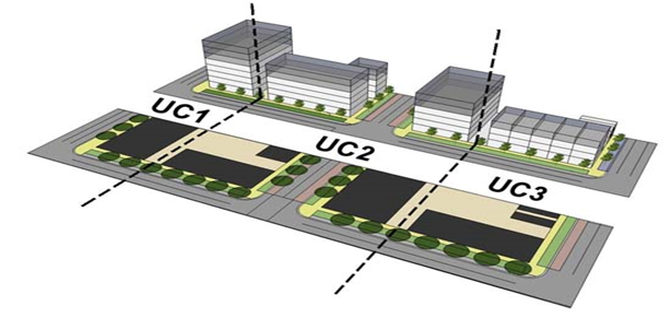
|
|
[Ord. 2010-022] [Ord. 2011-016]
|
1) UC 1 Sub-area
The most intense sub-area
accommodates the most intense types of uses and largest building scale
permitted in the PRAs.
[Ord. 2010-022]
[Ord. 2011-016]
2) UC 2 Sub-area
This sub-area allows
for the same intensity of uses, but begins a physical transition to the UC 3
Sub-area.
[Ord. 2010-022] [Ord.
2011-016]
3) UC 3 Sub-area
The least intense UC
Sub-area intended to provide for a transition between the more intense UC 1 and
2 Sub-areas, and abutting residential neighborhoods or adjacent UI Sub-areas. [Ord. 2010-022] [Ord. 2011-016]
b. Urban Infill (UI) Sub-area
Transects
The UI accommodates
mixed-use redevelopment along the corridors, while providing a transition to
the adjacent, existing residential neighborhoods. The UI is broken down into
two distinct sub-areas, as follows:
[Ord.
2010-022] [Ord. 2011-016]
|
Figure
3.B.16.F – PRA Transect Zones and Sub-areas
|
|
|
|
|
|
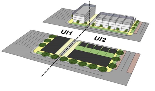
|
|
[Ord. 2010-022] [Ord. 2011-016]
|
1) UI 1 Sub-area
A moderately intense sub-area
accommodating commercial, mixed-use, and residential uses. [Ord. 2010-022]
2) UI 2 Sub-area
The least intense UI
Sub-area intended to provide for a gradual transition between the UI 1 Sub-area
and adjacent residential areas.
[Ord.
2010-022] [Ord. 2011-016]
c. TZ Sub-area Modifications
The DRO shall have the
authority to allow modifications to the location and boundaries of the default
UC or UI Sub-area Transects illustrated in the PRA GIS Regulating Plan, where
in compliance with the standards of
Table 3.B.16.F, PRA Sub-area Transect
Standards
. [Ord. 2010-022] [Ord. 2011-016]
Access shall be limited
to minimize curb cuts to streets to improve traffic flow and reduce
pedestrian-vehicular conflicts. Where available, access from rear alleys is
required. [Ord. 2010-022] [Ord. 2011-016]
a. External Access
One access point shall
be permitted for each 160 linear feet of street frontage. Access shall be in
the form of a street or alley, unless exempted otherwise herein. [Ord. 2010-022] [Ord. 2011-016]
b. Internal Access
No more than one access
point or alley shall be permitted for each 160 linear feet of street frontage
to allow for access to parking and loading, drive-through facilities, or other
similar uses. A maximum of two access points shall be permitted per block face.
[Ord. 2010-022] [Ord. 2011-016]
c. Existing Small Parcel Exception
Parcels that existed
prior to the adoption of the URAO with less than 160 feet of frontage shall be
permitted to establish one access point along a perimeter street. [Ord. 2010-022] [Ord. 2011-016]
Where applicable,
blocks shall be created by utilizing streets and alleys to provide continuous
pedestrian and vehicular circulation, interconnectivity, and accessibility in
PRA projects. Cul-de-sacs and other dead-end streets shall not be permitted
unless it can be demonstrated that physical constraints prohibit practical
alternatives. Any new blocks shall comply with the following:
[Ord. 2010-022]
[Ord. 2017-002]
a. Applicability
Blocks may be required
when subdividing land in order to meet the minimum frontage required for new
parcels, or when additional buildings internal to the site must comply with
Art. 3.B.16.F.6, Building Standards
.
[Ord.
2010-022] [Ord. 2017-002]
b. Minimum Dimensions
|
Table 3.B.16.F – Block Dimension Requirements
(1)
|
|
Transect Zone
|
|
|
|
|
|
|
|
|
UC
|
300-500’
|
600’
|
1,500-1,800’
|
2,500’
|
|
UI
|
1,200-1,500’
|
1,800’
|
|
[Ord. 2010-022] [Ord.
2011-016] [Ord. 2017-002]
|
|
Notes:
|
|
1.
|
Exceptions may be permitted only where PBC DEPW
requirements preclude required vehicular access points necessary to complete
the block structure.
|
|
|
|
|
|
|
c. Block Frontage
All blocks shall have
frontage on a perimeter or internal street. Streets shall be used to
interconnect blocks. When using alleys to meet block requirements, they shall
only be permitted along the side or rear of a block where streets are not
required. [Ord. 2010-022]
d. Subdivision
Any subdivision of land
shall comply with all lot dimensions applicable to the UC or UI district, with
exception to Townhouse or ZLL lots.
[Ord.
2010-022] [Ord. 2011-016]
e. PDD Subdivision Alternative
A PRA Development Order
may apply for an exemption from subdivision recordation requirements and
subdivide by fee title conveyance of individual lots in accordance with the
approval process and requirements of
Art. 11.A.6.B, Subdivision of Commercial and
Industrial Building Sites
. [Ord. 2010-022]
|
Figure
3.B.16.F – Typical Example of PRA Blocks, Streets, and Subdivision
|
|
|
|
|
|
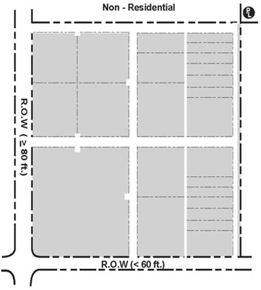
|
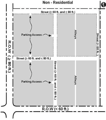
|
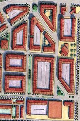
|
|
[Ord. 2010-022]
|
This Code addresses the
design of perimeter and internal streets and establishes related standards to
ensure that pedestrian amenities and walkways, buildings, and other
improvements are properly and safely situated.
[Ord. 2010-022] [Ord.
2011-016]
a. Frontage Classifications
Frontage
classifications define the details of the pedestrian realm located between the
public R-O-W or internal streets and the building façade. Three frontage types
are established, as follows: Slip Street, Primary, and Secondary. The default
location for the PRA Frontage Types shall be in accordance with Maps LU 9.1 and
LU 9.2, Urban Redevelopment Area Regulating Plans. [Ord. 2010-022] [Ord. 2011-016]
1) Slip Street Frontage
The Slip Street is an optional designation for areas that were
determined to have sufficient depth to accommodate landscaping along the
existing thoroughfare, a one-way vehicular lane, a parallel parking lane, and a
wide pedestrian zone.
[Ord. 2010-022]
[Ord. 2011-016]
a)
Applicability
(1) The parcel, or group of parcels, has 400 feet
of frontage; or [Ord. 2011-016]
(2) The parcel, or group of parcels, is located
between two side streets; or
[Ord.
2011-016]
(3) The parcel, or group of parcels, is located
adjacent to an existing Slip Street. Applicants may opt to utilize the Slip Street
in areas not designated for Slip Street, provided the parcel or group of
parcels has at least 400 feet of frontage where a Primary Frontage type is
identified.
[Ord. 2010-022] [Ord.
2011-016]
b) Standards
(1) Vehicular traffic shall be one way, in the
direction of the closest lanes on the abutting R-O-W; [Ord. 2010-022] [Ord. 2011-016]
(2) The street shall be a minimum of 12 feet wide,
or as required by the County Engineer;
[Ord.
2010-022] [Ord. 2011-016]
(3) Vehicle stacking and interaction with any
access points shall be as required by the County Engineer; and, [Ord. 2010-022] [Ord. 2011-016]
(4) On-street parking shall only be required on one
side of the street.
[Ord. 2010-022]
[Ord. 2011-016]
|
Figure
3.B.16.F – Typical Example of Slip Street Frontage
|
|
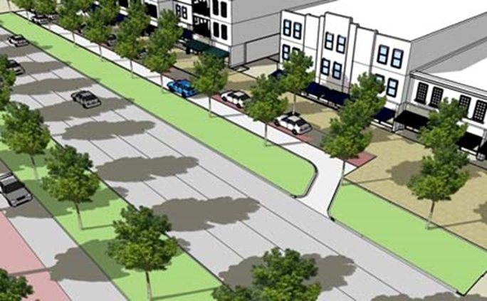
|
|
[Ord. 2010-022] [Ord. 2011-016]
|
2) Primary Street
Frontage
Primary Frontages are
located along adjacent thoroughfares or new internal streets, and accommodate a
wide pedestrian zone, lined by the main building façade and entrance(s). Shall
comply with streetscape standards.
[Ord.
2010-022] [Ord. 2011-016]
|
Figure
3.B.16.F – Typical Example of Primary Frontage
|
|
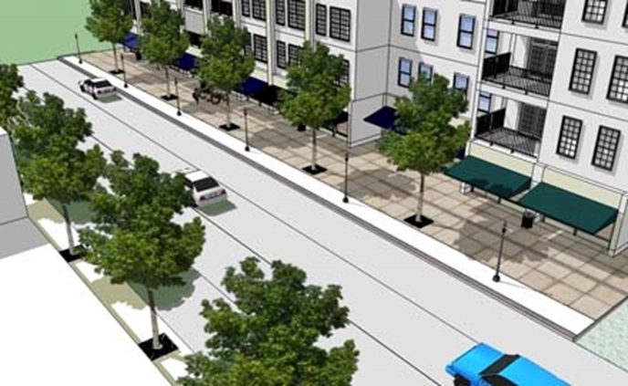
|
|
[Ord. 2010-022] [Ord. 2011-016]
|
3) Secondary Street
Frontages
Secondary Frontages are
located along existing side streets that intersect the main commercial
thoroughfare, or new internal side streets. Secondary Frontages provide a
planting strip for street trees and a pedestrian zone appropriate for less
intense uses and building sides. Shall comply with streetscape standards. [Ord. 2010-022] [Ord. 2011-016]
|
Figure 3.B.16.F – Typical Example of Secondary Street Frontage
|
|
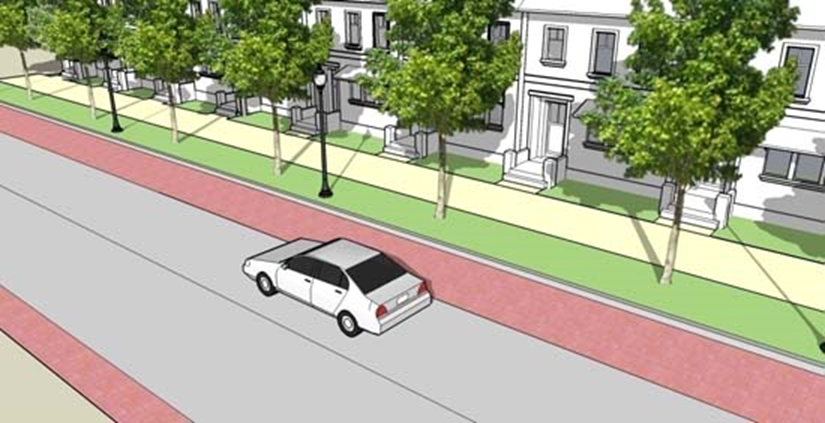
|
|
[Ord. 2010-022] [Ord. 2011-016]
|
The design for the
street and on-street parking shall comply with
Figure 3.F.2.A, TDD Commercial Street
, or the TMD design exception summarized in
Art. 3.F.4.C.2.a.1), Design Exception
as illustrated in
Figure 3.F.4.C, Typical Example of TMD Commercial
Street with Angled Parking
.
Internal streetscapes shall be designed as either Primary or Secondary
Frontages. Internal streets may include access ways designed to comply with
minimum street standards.
[Ord.
2010-022]
Alleys shall provide
primary access to parking lots, service areas, residential garages, or
driveways. A continuous network of alleys may serve as the primary means of
vehicular ingress/egress to individual parcels. Alleys shall provide rear
access to all buildings except for
block and liner buildings. Alleys
shall conform to the requirements of
Art. 3.F.2.A.1.e, Alleys
. [Ord. 2010-022] [Ord. 2011-016]
Interconnectivity to adjacent
residential parcels is encouraged, but not required. Interconnectivity shall be
required between similar uses. In the event the adjacent parcel is undeveloped,
a stub out shall be provided to accommodate future connections. In addition,
the following shall apply. [Ord. 2010-022] [Ord. 2011-016] [Ord. 2017-002]
a. Street Connections
Parcels required to or
proposing to establish a block structure, shall provide interconnectivity where
any new internal intersections abut adjacent parcels. [Ord. 2010-022]
b. Optional Parallel Alley
Applicants are
encouraged to develop parcels that have frontage on a commercial corridor with
an alley running parallel to the corridor. The alley may be generally located
along the rear property line, or at a point that allows interconnectivity to
shallower abutting lots. Where new blocks are not required or proposed, alleys
may be incorporated as drive aisles within parking lots. [Ord. 2010-022] [Ord. 2017-002]
The use of gates or
other similar barriers is prohibited. Exceptions are permitted for the
following: dumpsters, loading areas, and private garages or parking lots. [Ord. 2010-022]
d. Cross-Access Agreement
When interconnectivity
is required, an irrevocable cross-access easement shall be provided prior to Final
DRO plan approval. [Ord. 2010-022]
e. Small Parcel Exemptions
Legal Lots of Record of
less than one acre in size prior to the adoption of the URAO, may be exempt
from interconnectivity standards, by complying with any of the following
standards: [Ord. 2011-016]
1) Interconnectivity has been provided to
adjacent parcels establishing or allowing for a future cross-access point, or [Ord. 2011-016] [Ord. 2017-002]
2) Applicant can demonstrate that interconnectivity
requirements would adversely impact the development potential of the project. [Ord. 2011-016] [Ord. 2017-002]
The provisions of this Section
shall be applied in conjunction with any other applicable ULDC standards or
limitations for buildings or structures, unless stated otherwise herein.
[Ord.
2010-022]
1) General
a) To maximize the street frontage of buildings
and minimize the visibility of parking areas from the street, a building should
be articulated so that the longest side fronts the street. When located at an
intersection, the façade with the greatest length shall be considered the
front. This standard does not preclude two or more façades from being
designated as front façades. [Ord. 2010-022] [Ord. 2011-016]
b) Taller buildings should not cast a shadow
line on existing neighborhoods. To avoid this, building height should be
compatible with adjacent development, which may require reducing building
heights or stepping back upper stories in certain instances.
[Ord. 2010-022]
[Ord. 2011-016]
2) Corners
Where a parcel is
located at the intersection of two streets, at least one building shall be
placed at the corner meeting the build-to-lines for both streets. [Ord. 2010-022]
3) Building
Hierarchy
Building placement
shall follow an established order, with initial buildings required to meet
minimum placement and frontage requirements along the most intense perimeter
streets. Additional buildings may be located on interior streets, but shall be
ordered so as to create a consistent streetscape. [Ord. 2010-022] [Ord. 2011-016]
4) Civic Buildings
If civic buildings are
proposed they shall be located in visually prominent centralized locations,
easily recognizable and accessible to the public. [Ord. 2010-022]
5) Parking
Structures
Parking structures may
be allowed provided they are located in the interior of a block and are
completely screened by buildings with habitable uses on all stories for Slip
Street and Primary Frontages. Parking structures located on a Secondary
Frontage shall be completely screened by habitable uses on at least the first
story. Parking structures are allowed to face an alley without meeting the
requirement for habitable screening on the alley façade. [Ord. 2010-022] [Ord. 2011-016]
1) Perimeter Street
Building Frontage
Building frontage is
the percentage of the total width of a lot which is required to be occupied by
the primary façade of a building.
[Ord.
2010-022]
2) Perimeter
Frontage Exceptions
Buildings located on Secondary
Frontages, except for Townhouses, are not required to meet minimum building
frontage requirements. Frontage requirements may be reduced for lots with no
rear or side access to required parking as necessary to accommodate a drive
aisle for ingress/egress. [Ord. 2010-022]
3) Internal
Building Frontage
Internal buildings
shall only be permitted when located facing an internal street frontage, unless
exempted herein. [Ord. 2010-022]
4) Setback
Measurement
a) Perimeter
Streets
Setbacks shall be
measured from the edge of ultimate R-O-W, or from the property line, whichever
is applicable. [Ord. 2010-022]
b) Internal Streets
Setbacks shall be
measured from the proposed building frontage façade to the outside edge of
curb. [Ord. 2010-022]
c) Townhouse
Townhouse PDRs may also
be applied to Multifamily buildings that are constructed to Townhouse
standards. [Ord. 2010-022] [Ord. 2011-016]
d) Side Setback
Reduction
If permitted, a zero
side setback reduction shall comply with the following: [Ord. 2010-022]
(1) Windows, doors, or other openings shall not be
permitted. No portion of a building, including roof eaves, gutters, and soffits
may encroach onto adjacent parcels;
[Ord.
2010-022]
(2) Openings, attachments, or any item requiring
maintenance other than cleaning and painting, when visible, shall not be
permitted; and, [Ord. 2010-022]
(3) A maintenance easement a minimum of two feet
in width shall be provided to ensure access to exposed portions of the
building. [Ord. 2010-022]
|
Table 3.B.16.F – PRA Block
Building PDRs
|
|
Building Placement
|
|
|

|
|
A.
|
Slip Street Frontage
|
45’
|
50’
|
|
Primary Frontage
|
20’
|
25’
|
|
Secondary Frontage
(8)
|
10’
|
20’
|
|
B.
|
Non-Residential (9)
|
6’ (2)
|
N/A
|
|
C.
|
Residential (PRA) (4)
|
6’ (2)
|
N/A
|
|
Residential (Non-PRA)
(5)(9)
|
30’
|
N/A
|
|
D.
|
Between Parking and Alley
|
5’ (3)
|
N/A
|
|
Building Frontage
Percentage (6)
|
|
|
|
G.
|
Slip Street and
Primary
|
50%
|
100%
|
|
Individual Building
Length
|
|
|
|
G.
|
|
N/A
|
300’
|
|
Courtyard Percentage
of Footprint (Optional)
|
|
|
|
H.
|
|
N/A
|
25%
|
|
Courtyard Dimensions
(Optional)
|
|
|
|
H.
|
|
30’
|
N/A
|
|
Pedestrian Pass-Through
(6)(7)
|
|
|
|
I.
|
Separation
|
100’
|
300’
|
|
Width
|
10’
|
N/A
|
|
[Ord. 2010-022] [Ord. 2011-016] [Ord. 2012-027]
[Ord. 2017-002]
|
|
Notes:
|
|
1.
|
Required maximum build-to-line may be increased,
where necessary, to accommodate utility easements, landscape buffer, Slip Street,
safe sight distance, corner clips, or other similar need as may be required
by the County Engineer. [Ord. 2010-022] [Ord. 2018-002]
|
|
2.
|
May be reduced to zero feet where in compliance
with provisions for side setback reduction. [Ord. 2010-022]
|
|
3.
|
Shall be exempt for parcels eligible to use
parking drive aisles to comply with alley requirements. [Ord. 2010-022]
|
|
4.
|
Shall apply for any PRA Single Family or Multifamily
building 35 feet in height or less within 30 feet of property line.
[Ord.
2010-022] [Ord. 2011-016]
|
|
5.
|
Means adjacent residential parcels that are not
located within a development using PRA regulations.
[Ord. 2010-022] [Ord.
2011-016] [Ord. 2012-027]
|
|
6.
|
Shall be based upon length of applicable
property line. Where multiple buildings are proposed, the applicable length
shall be the result of the overall length divided by the number buildings.
[Ord.
2010-022] [Ord. 2011-016]
|
|
7.
|
Maximum pedestrian pass-through requirement does
not apply for buildings with a length of 300 feet or less.
[Ord. 2010-022]
[Ord. 2011-016]
|
|
8.
|
An existing SFD that has a greater setback than
the maximum permitted shall not be considered a non-conforming structure.
[Ord.
2012-027]
|
|
9.
|
Setbacks for Single Family residential units
shall be seven and one-half feet for side setbacks and 15 feet for rear
setbacks. Accessory structures to Single Family residential may be allowed in
accordance with the standards for residential districts in
Art. 5, Supplementary
Standards
. [Ord. 2012-027] [Ord. 2017-002]
|
|
Table 3.B.16.F – PRA Liner Building Configuration PDRs
|
|
Building Placement
|
|
|
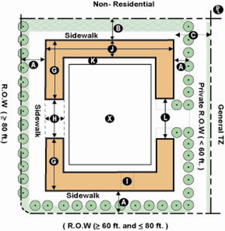
|
|
A.
|
Slip Street Frontage
|
45’
|
50’
|
|
Primary Frontage
|
20’
|
25’
|
|
Secondary Frontage
|
10’
|
20’
|
|
B.
|
Non-Residential
|
6’ (2)
|
N/A
|
|
C.
|
Residential (PRA)
|
6’
|
N/A
|
|
Residential (Non-PRA)
(4)
|
30’
|
N/A
|
|
D.
|
Between Rear Parking
and Alley
|
5’ (3)
|
N/A
|
|
Building Frontage
Percentage (5)
|
|
|
|
G.
|
Slip Street and
Primary
|
65%
|
100%
|
|
Individual Building
Length
|
|
|
|
G.
|
|
200’
|
400’
|
|
Courtyard Percentage
of Footprint
|
|
|
|
H.
|
|
N/A
|
10%
|
|
Courtyard Dimensions
(Optional)
|
|
|
|
H.
|
|
15’
|
30’
|
|
Pedestrian Pass-Through
(5)(6)
|
|
|
|
I.
|
Separation (4)
|
100’
|
300’
|
|
Width
|
10’
|
20’
|
|
Liner and Interior
Standards
|
|
|
|
J.
|
Depth (7)
|
30’
|
100’
|
|
Length (7)
|
75%
|
100%
|
|
K.
|
Separation
|
N/A
|
N/A
|
|
L.
|
Parking Access
|
N/A
|
10%
|
|
X.
|
Internal Use
|
N/A
|
N/A
|
|
[Ord. 2010-022] [Ord. 2011-016]
|
|
Notes:
|
|
1.
|
Required maximum build-to-line may be increased, where
necessary, to accommodate utility easements, landscape buffer, Slip Street,
safe sight distance, corner clips, or other similar need as may be required
by the County Engineer. [Ord. 2010-022] [Ord. 2018-002]
|
|
2.
|
May be reduced to zero feet where in compliance with
provisions for side setback reduction. [Ord. 2010-022]
|
|
3.
|
Shall be exempt for parcels eligible to use parking drive aisles
to comply with alley requirements. [Ord. 2010-022]
|
|
4.
|
Means adjacent residential parcels that are not located
within a development using PRA regulations.
[Ord. 2010-022] [Ord.
2011-016]
|
|
5
|
Percentage shall be based upon length of applicable
property line. Where multiple buildings are proposed, the applicable length
shall be result of the overall length divided by the number buildings.
[Ord.
2010-022] [Ord. 2011-016]
|
|
6.
|
Maximum pedestrian pass-through requirement does not apply
for buildings with a length of 300 feet or less.
[Ord. 2010-022] [Ord.
2011-016]
|
|
7.
|
Liner dimensions shall apply to all façades used to conceal
a large footprint tenant that front a perimeter street, Slip Street, Primary Street,
and usable open space. Additional standards may apply to parking garage
structures. [Ord. 2010-022] [Ord. 2011-016]
|
|
Table 3.B.16.F – PRA Townhouse Lot and Building Configuration PDRs
|
|
Lot Placement
|
|
|
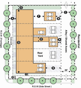
|
|
A. (1)
|
Slip Street Frontage
|
45’
|
50’
|
|
Primary Street
Frontage
|
15’
|
25’
|
|
Secondary Street
Frontage
|
10’
|
15’
|
|
B.
|
|
|
|
|
C.
|
Residential (PRA)
|
6’
|
N/A
|
|
Residential (Non-PRA)
(4)
|
10’
|
N/A
|
|
F.
|
No Minimum or Maximum
|
N/A
|
N/A
|
|
Building Frontage
Percentage (3)
|
|
|
|
G.
|
|
70%
|
N/A
|
|
Individual Building
Length
|
|
|
|
G.
|
|
32’
|
250’
|
|
Wing Standard (5)
|
|
|
|
M.
|
Wing Width
|
N/A
|
50%
|
|
Building Setbacks (4)
|
|
|
|
N.
|
Rear Setback to Alley
|
5’
|
N/A
|
|
O.
|
|
|
|
|
[Ord. 2010-022] [Ord. 2011-016] [Ord.
2017-007]
|
|
Notes:
|
|
1.
|
Dimension for building placement (A) regardless of whether
or not streetscape, alleys, or other similar uses are included on the lot or
as a separate tract. [Ord. 2010-022] [Ord. 2011-016]
|
|
2.
|
Required maximum build-to-line may be increased, where
necessary, to accommodate utility easements, landscape buffer, Slip Street,
safe sight distance, corner clips, or other similar need as may be required
by the County Engineer. [Ord. 2010-022] [Ord. 2011-016] [Ord. 2018-002]
|
|
3.
|
Percentage shall be based upon length of applicable
property line. Where multiple buildings are proposed, the applicable length
shall be the overall length divided by the number buildings.
[Ord.
2010-022] [Ord. 2011-016]
|
|
4.
|
Means adjacent residential parcels that are not located
within a development using PRA regulations.
[Ord. 2010-022] [Ord.
2011-016]
|
|
5.
|
Townhouse, including wings, garages, or Accessory Quarters shall
comply with minimum common wall requirements unless set back from the side PL
a minimum of five feet; and shall comply with
Art. 3.D.2.B.3.b.1), Prohibited Openings
and Attachments
except for any first floor that is set back a minimum of ten feet from the
PL. [Ord. 2010-022] [Ord. 2011-016] [Ord. 2017-007]
|
c. Building Height and Floors
1) Building Floors
a) Maximum Floors
The maximum number of
floors permitted in any building shall be determined by the parcel’s zoning
district and transect zone, as indicated in the following Table:
[Ord.
2011-016]
|
Table 3.B.16.F – Maximum Building Floors
|
|
Zoning/
Transect Zone
|
|
|
|
|
|
|
|
|
|
|
|
UC 1
|
P
|
P
|
P
|
P
|
P
|
(1)
|
(1)
|
(2)
|
|
UC 2
|
P
|
P
|
P
|
P
|
P
|
(1)
|
(1)
|
-
|
|
UC 3
|
P
|
P
|
P
|
P
|
P
|
-
|
-
|
-
|
|
UI 1
|
P
|
P
|
P
|
P
|
(1)
|
-
|
-
|
-
|
|
UI 2
|
P
|
P
|
P
|
P
|
(1)
|
-
|
-
|
-
|
|
[Ord. 2011-016] [Ord. 2017-002]
|
|
Notes:
|
|
P
|
Permitted.
|
|
-
|
Not permitted.
|
|
1.
|
LEED Silver or equivalent: Building floor only permitted
where in compliance with Green Building Incentive Program.
|
|
2.
|
LEED Gold or equivalent: Building floor only permitted
where in compliance with Green Building Incentive Program.
|
|
|
|
|
|
|
|
|
|
|
2) Exterior Height
a) All building frontages abutting Slip Street,
Primary, or Secondary Frontages shall be exempt from
Art. 3.D.1.E.2, Multifamily, Non-Residential
Districts, and PDDs
.
[Ord.
2010-022] [Ord. 2011-016]
b) Maximum building height shall be in
accordance with
Table 3.B.16.F, Maximum Building Floors
,
Table 3.B.16.F, Maximum Building Height
, and the following:
[Ord. 2010-022]
[Ord. 2011-016]
3) Green Building Incentive Program
The Green Building
Incentive Program is intended to stimulate private sector investment to
construct sustainable buildings by allowing for “bonus height” for projects
meeting industry criteria and standards for certification. Where applicable,
bonus height shall only be permitted subject to the following: [Ord. 2010-022] [Ord. 2011-016]
a) Applicability
Allowable increases in
building height are indicated in
Table 3.B.16.F, Maximum Building Floors
. [Ord. 2010-022]
b) Standard for
Certification
The standard for
certification shall be the U.S. Green Building Council Leadership in Energy and
Environmental Design (LEED) Green Building Rating System (LEED Silver or
Gold/Platinum levels), or appropriate Florida Green Building Coalition
designation standards, or other similar standard approved by the County.
[Ord.
2010-022]
c) Application
Procedures
All applications for
bonus height shall be submitted concurrently with an application for Public
Hearing or DRO approval, as applicable. The application form and requirements
shall be submitted on forms specified by the PBC Official responsible for
reviewing the application. [Ord. 2010-022]
d) Review Process
(1) Public Hearing
Certification
If applicable, projects
requiring BCC approval and including a request for bonus height shall provide a
LEED scorecard accompanied by a detailed analysis of each credit and why the
standard can or cannot be achieved.
[Ord.
2010-022]
(2) DRO Approval
Documentation indicating
the project has been registered with the Green Building Certification Institute
(GBCI) as a LEED project or other standard for Certification as noted above. If
applicable, bonus height requested at time of BCC approval may be reduced if
the GBCI registration is inconsistent with the original LEED scorecard and
proposed level of certification.
[Ord.
2010-022]
(3) Monitoring
During plan review and
construction, the Applicant’s LEED certified inspector or architect will
provide documentation and submit quarterly reports to Planning/Monitoring
demonstrating compliance with the LEED standards and scorecard and the approved
Site Plan. If during construction, the developer is unable to include required
green building components, or if the inspector/architect finds that the
developer failed to include these components, the County shall pursue
enforcement, actions which may include revocation of Building Permits, remand
back to DRO to remove the bonus height awarded, or release of surety to the
County. [Ord. 2010-022]
(4) Amendments
If during construction
of the building, the developer is unable to include all of the approved green
building components previously identified in the GBCI registration, the
developer may be permitted to replace components not provided with other green
building components where documented as approved by the GBCI for the project. Any
amendment to an exterior component shall require DRO approval. [Ord. 2010-022]
(5) Completion
UGCI certification
shall be obtained within two years of the date of issuance of Certificate of
Occupancy. [Ord. 2010-022]
e) Surety
Prior to DRO approval
of the Site Plan, the County (Planning Division) and the developer shall enter
into a Development Agreement requiring that the green building components
identified in the GBCI registration be constructed or installed in the building
and that any third-party inspection fees will be paid for by the developer. Furthermore,
the developer shall post a surety with the County. The amount of the surety
shall be based on the number of dwelling units contained within the “bonus
height” stories. Non-residential uses shall be based upon the equivalent of one
dwelling unit for each 1,000 square feet of non-residential use area (measured
by gross square footage). The number of dwelling units shall be multiplied by
the BCC’s established price for TDRs at the date of the application.
[Ord.
2010-022]
(1) Default
If the Applicant fails
to comply with the requirements above after CO, the County may, at its
discretion collect the surety and apply the funds to a TDR contract to purchase
an equivalent number of units to those proposed for the original bonus height
consideration. [Ord. 2010-022]
(2) Release of
Surety
If in compliance with
the review process requirements above, upon receipt of the GBCI certification
by the County, the Property Owner shall submit in writing to the Planning
Director a request that the posted surety shall be returned. [Ord. 2010-022]
d. Additional Architectural Design
Standards
Architecture shall be
in accordance with
Art. 5.C, Design Standards
, unless specified otherwise herein. [Ord. 2010-022] [Ord. 2011-016]
1) Primary Entrances
The primary entrance
for all first floor tenants must directly face a street, courtyard, plaza,
square, or other form of usable open space fronting a street. [Ord. 2010-022] [Ord. 2011-016]
2) Secondary
Entrances
Each tenant may be
permitted to have additional entrances located at side or rear façades facing a
parking lot or other area.
[Ord.
2010-022] [Ord. 2011-016]
3) Fenestration
Non-residential and Multifamily
building façades facing perimeter and Primary Streets or usable open space
shall provide transparent windows covering a minimum of 35 percent of the wall
area of each story as measured between finished floors, to allow transmission
of visible daylight. [Ord. 2010-022]
4) Storefronts
The storefront is a
first floor façade improvement required for all non-residential uses that face
a street or usable open space area:
[Ord.
2010-022] [Ord. 2011-016]
a) Storefronts shall extend across 70 percent of
the non-residential space; [Ord. 2010-022]
b) Storefronts shall have transparent glazing of
at least 70 percent of the linear width of the applicable façade area,
comprised of storefront windows and doors; [Ord. 2010-022] [Ord. 2011-016]
c) Storefront windows shall have a base one and
one-half feet to three feet high, with transparent glazed areas extending from
the base to at least eight feet in height as measured from sidewalk grade.
[Ord.
2010-022]
d) A minimum of 50 percent of all required
storefronts shall have an awning, gallery, or arcade shading the sidewalk.
[Ord.
2010-022]
5) Architectural
Appurtenances
Table 3.B.16.F, PRA Appurtenances by
Building Type
identifies
where appurtenances shall be required, and what additional appurtenances are
permitted. Where indicated by a checkmark, each building type shall be required
to provide a minimum of one appurtenance.
[Ord.
2010-022]
|
Table 3.B.16.F – PRA Appurtenances by Building Type
|
|
Building Type
|
|
|
|
|
|
|
|
|
|
|
|
Block
|
✓ P
|
✓ P
|
✓ P
|
P
|
P
|
|
|
|
|
Liner
|
✓ P
|
✓ P
|
✓ P
|
P
|
P
|
|
|
|
|
Townhouse
|
|
|
|
P
|
P
|
✓ P
|
✓ P
|
✓ P
|
|
[Ord. 2010-022] [Ord.
2011-016]
|
|
Notes:
|
|
✓
|
A minimum of one of the appurtenances checked shall be
required for each building type.
|
|
P
|
The appurtenance may be permitted.
|
|
1.
|
The clear height of appurtenances
that project or hang from a building shall be at a minimum eight feet above
the sidewalk elevation, unless specified otherwise.
|
|
2.
|
Appurtenance may project into
pedestrian circulation zone, subject to a minimum five-foot setback from
utility easements.
|
|
3.
|
Shall not encroach into the
pedestrian circulation zone, and may only encroach into the shy zone for upper
stories.
|
|
4.
|
Shall not encroach into the
pedestrian circulation zone.
|
|
|
|
|
|
|
|
|
|
|
Additional minimum
standards shall apply to the following types of appurtenances: [Ord. 2010-022]
a) Arcades and
Galleries
Arcades shall comply
with
Figure 3.B.14.G, WCRAO Arcade and Gallery
Standards
.
[Ord.
2010-022]
b) Balcony
A balcony above a
storefront shall be a minimum of three feet in depth. [Ord. 2010-022]
c) Porch or Stoop
(1) Required to be open, un-air conditioned. [Ord. 2010-022] [Ord. 2011-016]
(2) Minimum three feet deep by four feet wide. [Ord. 2010-022] [Ord. 2011-016]
(3) Minimum elevation 18 inches above the adjacent
sidewalk elevation
[Ord. 2010-022] [Ord.
2011-016]
Streetscape standards
are established to improve both the physical and visual appearance of the
streetscape while creating a pedestrian-friendly environment for the areas
located between building façades and abutting streets.
[Ord. 2010-022] [Ord.
2011-016]
a. General Standards
The following standards
shall apply to all streetscapes:
[Ord.
2010-022]
1) Required street trees shall be located in the
planting amenity zone; [Ord. 2010-022]
2) Required pedestrian sidewalks shall not be
encumbered; [Ord. 2010-022]
3) All paving materials for the pedestrian
sidewalks shall be compliant with ADA accessibility standards; [Ord. 2010-022] [Ord. 2017-002]
4) Where a sidewalk or a path crosses curb cuts
at ingress/egress points and internal drives, the pedestrian crossing shall be
paved with a material that provides a different texture or a color contrast
with the vehicular surface, but preferably consistent with the paving material
of the path;
[Ord. 2010-022] [Ord.
2011-016]
5) Where a street tree planting area is
required, improvements shall be in accordance with the requirements of the
planting/amenity zone;
[Ord. 2010-022]
[Ord. 2011-016]
6) Consistency in street tree species shall be
encouraged within a block, if applicable, and shall be reflective of the
character of the surrounding area;
[Ord.
2010-022] [Ord. 2011-016]
7) Where applicable, sidewalks located within a
perimeter R-O-W may be incorporated into the streetscape requirements of this Section,
subject to a sidewalk easement agreement with the DEPW; [Ord. 2010-022] [Ord. 2011-016]
8) All paving materials in planting/amenity and
pedestrian circulation zones shall be constructed entirely of pervious/porous
materials, allowing some stormwater to percolate into the underlying soil and
promote healthy street tree growth; and,
[Ord.
2010-022] [Ord. 2011-016]
9) If an existing or proposed utility easement
is located adjacent to subject roadways, streetscape requirements shall be
applied from the inner edge of the utility easement, and shall be landscaped
with appropriate ground cover, with exception to the following: [Ord. 2010-022] [Ord. 2011-016]
a) Utility easements may be improved hardscaped
or landscaped to be consistent with required streetscape areas;
[Ord.
2010-022]
b) Utility easements may encroach into required
streetscape areas up to a maximum of five feet, subject to Engineering approval
and consent from easement holder; and, [Ord. 2010-022]
c) Street trees may be located in utility
easements subject to use of tree root barrier approved by County Landscape and
easement holder. [Ord. 2010-022]
b. Streetscape Components
The area between a
front façade and the vehicular lanes of required, Primary, Secondary, and side
streets shall include two distinct zones: planting/amenity zone and pedestrian
circulation zone. [Ord. 2010-022]
1) Planting/Amenity Zone
The planting/amenity zone
shall be a minimum of five feet in width, and serves as the transition between
the vehicular and pedestrian areas. Bus stop locations, lighting, benches,
trash receptacles, art, street trees, ground covers, and pavers may be placed
in these areas. [Ord. 2010-022]
a) Street trees shall be installed in accordance
with
Art. 3.F.2.A.4.d, Street Trees
. Exceptions to tree spacing may be
permitted where necessary to accommodate bisecting utility easements, or other
similar improvements. [Ord. 2010-022]
b) Street lights shall be required for all
perimeter and internal streets in accordance with
Art. 3.F.2.A.1.f.2), Lighting
. [Ord. 2010-022]
c) Trees shall be planted in tree wells/grates
with an approved ground cover or other acceptable treatment over the top to protect
the roots, when planted along a street frontage. [Ord. 2010-022]
d)
A minimum of one bench shall be
provided along each streetscape, or one bench for every 150 linear feet of
street frontage, whichever is greater. Signage or advertising is prohibited on
benches. [Ord. 2010-022] [Ord. 2017-002]
e) A minimum of one trash receptacle shall be
provided at each bench location. [Ord. 2010-022]
f) Moveable chairs and sidewalk cafes are
strongly encouraged in the planting/amenity zone, but may not encroach into the
pedestrian circulation zone. [Ord. 2010-022]
2) Pedestrian Circulation Zone
The pedestrian
circulation zone is a continuous unobstructed space reserved for pedestrian
movement typically located adjacent to the planting/amenity zone. Minimum width
shall be eight feet for Slip Street and Primary Frontages, and five feet for Secondary
Frontages. [Ord. 2010-022]
a) The pedestrian circulation zone shall
function as a continuous unobstructed space along the street frontage, with the
exception of an arcaded sidewalk and gallery. [Ord. 2010-022]
3) Slip Street Planting/Amenity Zone
The following standards
shall apply for all Slip Street frontages:
[Ord.
2010-022]
a) A ten-foot-wide landscape planting area shall
be required between a perimeter R-O-W and the Slip Street;
b) Additional width may be permitted to
accommodate utility easements or Engineering requirements, but shall not be
increased otherwise;
c) Street trees shall be planted in the
landscape area in accordance with
Art. 3.F.2.A.4.d, Street Trees
, but shall be generally consistent with the
tree species and spacing provided in the enhanced sidewalk area; and,
d) Ground treatment shall comply with the standards
for the planting/amenity zone.
A minimum of five
percent of the gross acreage of all PRA projects shall be dedicated or provided
as usable open space. Plazas or squares that provide a concentrated focal point
for pedestrians shall be the preferred method for providing usable open space,
but credit may be given for required pedestrian streetscapes or other similar
usable open space amenities such as playgrounds and greens. All required usable
open space areas shall meet the minimum dimensions provided under
Table 3.B.16.F, PRA Dimensions for Usable
Open Space
, unless exempted
otherwise herein. [Ord. 2010-022]
1) Required usable open space areas shall be
provided prior to the issuance of CO for 50 percent any residential units
within the subject site, if applicable.
[Ord.
2010-022]
2) At least 95 percent of the residences within
the subject site must be within a one-quarter mile walk of usable open space. [Ord. 2010-022]
3) Usable open space areas shall feature
visible, open, and unimpeded pedestrian access from adjacent streets and
sidewalks, allowing passersby to see directly into the open space. [Ord. 2010-022]
A plaza or square shall
be defined by building façades or streets. It is primarily comprised of
hardscape/pavers, with trees and containerized plants serving as the primary
vegetative material. [Ord. 2010-022]
Greens are commonly
developed with grassy lawn areas unstructured recreation, intended for less
intensive foot traffic. It shall be defined by building façades or streets on two
or more sides. The minimum size shall be one-quarter acre and the maximum shall
be six acres. It may also be partially depressed below the street grade for the
purposes of accommodating temporary stormwater retention. [Ord. 2010-022] [Ord. 2011-016]
1) Minimum 80 percent unpaved surface area
(turf, ground cover, soil, or mulch).
[Ord.
2010-022]
2) The remaining balance may be any paved
surface up to a maximum 20 percent of the green. [Ord. 2010-022]
Projects that have net
land areas of less than two and one-half acres in size may count all
streetscape areas towards the usable open space requirement. All others may
count up to 50 percent of streetscape areas towards usable open space
requirements.
[Ord. 2010-022] [Ord.
2011-016]
If applicable, required
usable open space areas shall front on a Secondary or side street frontage and
be located in a prominent or central area internal to the development. Frontage
on a required or Primary Frontage shall not be permitted unless there are no Secondary
or side streets abutting or internal to the development. [Ord. 2010-022] [Ord. 2011-016]
A minimum of 15 percent
of each plaza, square, or other usable open space area shall be shaded by
landscape material or shade structures at time of construction. Where applied
to streetscape galleries, awnings or other building amenities may be counted
towards shade requirement.
[Ord.
2010-022] [Ord. 2011-016]
1) Required usable open space areas shall have a
minimum of one linear foot of seating for each 200 square feet of overall area.
Movable chairs are encouraged, and shall count as two and one-half linear feet
of seating area. [Ord. 2010-022]
2) One trash receptacle for each 5,000 square
feet of each physically separated civic open space. [Ord. 2010-022]
3) Art is encouraged to be placed within usable
open space areas.
[Ord. 2010-022] [Ord.
2011-016]
4) One drinkable water fountain for each 5,000 square
feet of each landscaped civic open space.
[Ord.
2010-022]
Parking and loading for
each tenant shall be located behind buildings or a Street Wall. Parking shall
only be permitted in front of buildings in the form of on-street parking. Parking
and loading shall comply with
Art. 6, Parking, Loading, and Circulation
, unless otherwise stated below:
[Ord.
2010-022] [Ord. 2011-016]
a. Location and Access
Parking may be provided
in surface lots, attached/detached garages or outbuildings, or a parking structure.
[Ord. 2010-022] [Ord. 2011-016]
1) On-Street Parking
Parking in front of
buildings shall only be permitted where on-street parking is allowed. [Ord. 2010-022]
2) Parking Lots
It is the intent that
parking lots shall be located behind buildings to screen from view from all
street frontages and usable open space areas, unless specified otherwise
herein. Exceptions shall be permitted for parking lots adjacent to a building
where a Street Wall is used, or lots on Secondary Streets. The perimeter of
parking lots shall be framed by a Street Wall using: [Ord. 2010-022] [Ord. 2011-016]
a) Buildings; or
b) A five-foot-wide landscape strip that
includes a minimum 30-inch-high hedge or concrete Street Wall, with Canopy,
multi-trunk, or flowering trees planted 30 feet on center. Breaks to allow for
pedestrian and vehicular access shall be permitted. [Ord. 2011-016]
c) Separation between parking and parallel
alleys shall not be required for any project that does not have streets or blocks,
and alleys may be incorporated into parking lots as standard drive aisles.
|
Figure
3.B.16.F – Typical Parking Location and Access
|
|
|

|
|
|
|
|
|
|
[Ord. 2010-022]
|
3) Requirement for Parking Garages
Parking for any use in
excess of five spaces per 1,000 square feet of non-residential floor area shall
be located in a parking structure/garage, with exception to a Development Order
for a project located on one parcel (inclusive of any outparcels) that requires
a minimum of or provides 100 or fewer parking spaces. [Ord. 2010-022] [Ord. 2011-016]
4) Townhouses
Parking for Townhouses
shall only be permitted to the rear and shall meet the requirements for Townhouse
parking. Garage setbacks shall be in accordance with PDRs for Townhouses. [Ord. 2010-022] [Ord. 2011-016]
5) Service and Loading Areas
All service and loading
areas shall be located along the rear or side of buildings, and shall not be
visible from usable open space areas, streets, or abutting residential
neighborhoods. The service areas shall be located within the footprint of the
building or immediately adjacent to the building. Required loading space areas
may be waived, reduced in number, or dimension, in accordance with
Art. 6.E, Loading Standards
, or by
Art. 3.B.16.G, Type 1 and 2 URAO Waivers
.
[Ord.
2010-022] [Ord. 2012-027]
a) Waste and recycling containers shall be
integrated within the building or entirely screened from view.
[Ord.
2010-022]
b) Loading docks, service areas, and trash
disposal facilities shall not face usable open space areas, a street frontage,
or an abutting residential neighborhood unless screened from view or integrated
within a building. [Ord. 2010-022]
c) Trash collection and other
services shall be accessed through the alley or other vehicular use areas
behind buildings. [Ord. 2010-022] [Ord. 2011-016]
b. Parking Ratios
The required number of
parking spaces shall correspond to broad uses and not to a specific use, and shall
be responsive to the long-term transition of tenants within a non-residential
or mixed-use development. The Applicant may choose from the following parking
requirements: [Ord. 2010-022]
1) Non-Residential
a) Minimum: one space per 333 square feet of GFA
(3/1,000) excluding assembly, and one space per five seats for assembly uses;
[Ord.
2010-022]
b) Where uses are not intended to allow for
transition to other uses, the general parking standards outlined in
Art. 6, Parking, Loading, and Circulation
, may be applied, provided that use
limitations are identified on the DRO-approved Site Plan; [Ord. 2010-022]
c) Reduction in required parking through use of
a shared parking study, as defined in
Art. 6, Parking, Loading, and Circulation
; or, [Ord. 2010-022]
d) If eligible, credit may be given for any
perimeter on-street parking spaces located along Secondary Streets, subject to
approval by the County Engineer (use of this option may be limited to where the
developer pays for required improvements), or for any new Slip Street or
internal street parking developed. [Ord. 2010-022]
2) Residential
Multifamily residential
parking ratios may be reduced in accordance with
Table 3.B.14.I, WCRAO Mixed-Use and
Residential Parking Deviations
. [Ord. 2010-022]
One parking area shall
be provided for every five units in Multifamily housing and for every 20
vehicle parking spaces serving non-residential uses. Bicycle parking spaces
shall be indicated on the Site Plan in visible, well-illuminated areas. For
each bicycle parking space required, a stationary object shall be provided to
which a user can secure the bicycle. The stationary object may either be a
freestanding bicycle rack or a DRO-approved alternative. [Ord. 2010-022]
Landscaping in the PRA
shall be in an urban form that compliments the intended intensity and density
of the PRA corridors, with an emphasis on the use of materials and design that
enhances pedestrian areas, allows for improved visual surveillance from
building windows, but also minimizes impacts to adjacent residential
developments. Drainage retention areas, preserves, and other similar low-intensity
open space areas shall be located to provide a transition between commercial uses
and existing adjacent residential neighborhoods, or parcels with a residential
FLU designation, when possible. Landscaping shall be in accordance with
Art. 7, Landscaping
,
unless stated otherwise herein: [Ord. 2010-022] [Ord. 2011-016]
a. Perimeter Buffers
1) Streetscape
Exemptions
Required landscape
perimeter buffers pursuant to
Art. 7, Landscaping
shall not be required where a PRA streetscape is required. [Ord. 2010-022]
2) Compatibility
Buffers
The PRAs shall be
exempt from Compatibility Buffer requirements. [Ord. 2010-022]
3) Alternative
Incompatibility Buffer
The following Incompatibility
Buffer option may be utilized subject to the following: [Ord. 2010-022]
a) Shall be a minimum of ten feet in width, and,
easement encroachment shall be prohibited, with exception to drainage
easements; [Ord. 2010-022]
b) A six-foot-tall solid concrete block or panel
wall shall be installed along the affected property line, with a setback a
minimum of two feet to allow for maintenance of the exterior side of the wall. Setback
may be increased as needed to accommodate required footers;
[Ord. 2010-022]
[Ord. 2011-016]
c) The required wall shall be constructed of
materials and with a design consistent with the principal building, and shall
have the same architectural finish treatment and color on both sides of the
wall; [Ord. 2010-022]
d) Exterior landscape areas shall have ground cover
that is low maintenance and does not impede necessary access for maintenance;
[Ord.
2010-022]
e) Canopy trees shall be planted along the
internal side of the wall to be spaced a minimum of 20 feet on center;
[Ord.
2010-022]
f) A hedge shall be installed in accordance
with the standards for medium shrubs, as specified in
Table 7.D.3.A, Shrub Planting Requirements
; and, [Ord. 2010-022]
g) A drainage easement may be permitted within
the buffer on the interior side of the wall to be used as a stormwater
management system, subject to approval by Land Development. [Ord. 2010-022]
b. Foundation Planting
The PRAs shall be
exempt from foundation planting requirements, unless stated otherwise herein. [Ord. 2010-022] [Ord. 2011-016]
c. Alternative Parking Lot Design
Options
This Section allows
alternative parking lot designs through modifications to
Art. 7.C.4, Landscape Requirements for
On-Site Parking
to promote
innovative design or use of green building materials. The following may be used
individually or in combination, unless stated otherwise: [Ord. 2010-022] [Ord. 2014-025]
1) Option 1
Projects that are
one-half acre or less in size, with 20 or fewer parking spaces may consolidate
all required interior landscape island areas and planting materials into one or
more locations anywhere within the project; [Ord. 2010-022] [Ord. 2014-025]
2) Option 2
Projects that are two
acres or less in size may reduce required terminal island landscape width to a
minimum of five feet in width of landscape area. This option may not be used in
conjunction with any option relocating these landscape areas;
[Ord. 2010-022] [Ord. 2014-025]
3) Option 3
Landscape shrub or
ground cover requirements for terminal, interior, and divider median islands
may be replaced with bio-swales and appropriate landscaping, provided that
required Canopy trees can be accommodated. Alterations to required curbing may
be permitted subject to demonstration that vegetated areas are protected from
vehicles;
[Ord. 2010-022] [Ord. 2014-025]
4) Option 4
Up to a maximum of 25
percent of required terminal, interior, and divider median landscape islands
shall not be required provided that covered parking that utilizes appropriate
solar reflectance index (SRI) materials are installed where islands are
removed;
[Ord. 2010-022] [Ord. 2014-025]
5) Option 5
Landscape shrub or ground
cover requirements for terminal, interior, and divider median landscape areas
shall not be required, subject to the following: [Ord. 2010-022] [Ord. 2014-025]
a) The number of required terminal, interior,
and divider median trees are doubled; and [Ord. 2010-022] [Ord. 2014-02
5
]
b) Green building standards for tree wells and
related root growth areas are utilized; [Ord. 2010-022]
6) Option 6
No interior islands are
required if parking spaces are abutting landscape buffers, Street Walls, or
tree planting areas.
[Ord. 2010-022]
[Ord. 2014-025]
d. Rear or Side Entrances
Buildings with
secondary entrances located on the side or rear façades shall either apply the
streetscape standards for a side street building frontage; or shall provide
foundation planting along a minimum of 50 percent of the applicable façade,
with a minimum depth of five feet, to be planted in accordance with
Art. 7, Landscaping
,
with a sidewalk a minimum of five feet in width as needed to separate
pedestrians from abutting vehicle use areas along the building façade. [Ord. 2010-022]
Signage shall be in
accordance with
Art. 8, Signage
, unless stated otherwise herein.
[Ord.
2010-022] [Ord. 2011-016]
Freestanding signs,
including outparcel identification signs, shall be prohibited, with exception
to Development Orders that include buildings located on internal streets that
do not have any frontage on a perimeter street, subject to the limits of
Table 8.G.2.A, Freestanding Sign Standards
, or the following, whichever is more
restrictive:
[Ord. 2010-022] [Ord.
2023-021]
1) Signs shall not
exceed 150 square feet of sign face area, 15 feet in height, or the maximum
dimensions permitted in
Art. 8, Signage
, whichever is
less; and [Ord. 2010-022] [Ord. 2016-020]
[Ord. 2023-021]
2) A maximum of one
freestanding sign per right-of-way frontage shall be permitted. [Ord. 2010-022] [Ord. 2023-021]
An Applicant may apply
for Waivers for development standards in accordance with
Art. 2.B.7.D, Type 2 Waiver
or
Art. 2.C.5.G, Type 1 Waiver
. Applications for Type 1 or Type 2 Waivers
shall be expressly limited to those Articles or Requirements listed in
Table 3.B.16.G, Type 1 and 2 URAO Waivers
. Type 2 Waiver requests shall be submitted
concurrently with any other DRO application request for Public Hearing
certification, where applicable. [Ord. 2010-022] [Ord. 2011-016]
Table 3.B.16.G – Type 1 and 2 URAO Waivers
(1)
|
|
Article/Table
Reference and Title
|
|
|
|
|
|
N/A
|
No Waiver.
|
No Waiver.
|
|
|
|
N/A
|
No Waiver.
|
No Waiver.
|
|
|
|
N/A
|
No Waiver.
|
No Waiver.
|
|
|
|
N/A
|
No Waiver.
|
No Waiver.
|
|
|
|
Art. 3.B.16.E.3.a,
Residential Setbacks
|
Ten percent reduction provided the use is screened.
|
Waiver permitted.
|
|
Art.
3.B.16.E.3.c, Drive-Through Uses and Gasoline Service Facilities
|
Exceptions to Street Wall requirements may be permitted for
vehicular and pedestrian access points.
|
Waiver permitted. Requires submittal of alternative design
that meets the intent of these provisions.
|
|
|
|
PRA Transect Zones
|
|
Art.
3.B.16.F.1.a, Urban Center (UC) Sub-area Transects
|
No Waiver.
|
Limited Waiver permitted only for reference to minimum
number of stories required in this TZ.
|
|
Table
3.B.16.F, PRA Sub-area Transect Standards
|
No Waiver.
|
Limited Waiver permitted:
·
Additional 25 percent deviation for minimum TZ minimum
setback abutting residential: Minimum UC 1 = 300 feet; UC 2 and UI 1 = 150 feet.
·
Subject to height of buildings, site layout, proposed uses,
Incompatibility Buffer, or other design alternative.
|
|
Block Design
Standards
|
|
Table. 3.B.16,F,
Block Dimension Requirements
|
Allow five
percent deviation due to unusual lot configuration.
|
Waiver permitted.
|
|
Frontage
Classifications and Street Standards
|
|
Art.
3.B.16.F.4.a.1), Slip Street Frontage
|
The minimum frontage requirement may be waived
where the Slip Street is used to provide cross access to one or more abutting
properties where the vehicular lane aligns with a Slip Street, parking lot aisle,
or access way on the abutting property. [Ord. 2017-002]
|
Waiver permitted.
|
|
Art. 3.B.16.F.4.b,
Internal Streets
|
Allow additional lanes or minor increases in lane width:
·
Where required by DEPW or Palm Tran;
·
Minimum modification necessary and remains consistent with
TDD street standards; and,
·
Consistent with standards for livable streets which
emphasis pedestrian safety.
|
Waiver permitted.
|
|
Art. 3.B.16.F.4.c,
Alleys
|
·
Drive aisles within parking lots may be used
to meet alley requirements; or [Ord. 2017-002]
·
Alleys shall not be required where Type 2
Waiver relief is approved for parking in front of buildings where drive aisles
for such parking provides cross access to adjacent properties.
[Ord.
2017-002]
|
Waiver permitted.
|
|
Interconnectivity
Standards
|
|
Art. 3.B.16.F.5,
Interconnectivity Standards
|
No interconnectivity required for the following:
·
Document prohibition by Federal, State, Local, or other
laws that serve to establish limited access standards necessary to protect
facilities such as Water or Wastewater Treatment Plants, jails, or other
similar uses. [Ord. 2017-007]
|
No Waiver.
|
|
Art. 3.B.16.F.5.c,
Gates
|
·
Special circumstances between adjacent uses.
·
Specific user requirements within the PRA project requires
the use of gates, provided such does not impact the continuity of required
blocks, streets, or alleys.
|
No Waiver.
|
|
Notes:
|
|
1.
|
Deviations from the limitations or permissions
granted for Waivers shall be prohibited. [Ord. 2011-016] [Ord. 2017-007]
|
|
|
|
|
|
Table
3.B.16.G – Type 1 and 2 URAO Waivers, Cont’d. (1)
|
|
Article/Table
Reference and Title
|
|
|
|
Building Standards
|
|
Art. 3.B.16.F.6.a,
Building Placement
|
No Waiver.
|
Waiver permitted.
|
|
Art.
3.B.16.F.6.b, Building Property Development Regulations
|
No Waiver.
|
Waiver permitted.
|
|
Table 3.B.16.F,
PRA Block Building PDRs
|
No Waiver.
|
Waiver permitted.
|
|
Table
3.B.16.F, PRA Liner Building Configuration PDRs
|
No Waiver.
|
Waiver permitted.
|
|
Table
3.B.16.F, PRA Townhouse Lot and Building Configuration PDRs
|
No Waiver.
|
Waiver permitted.
|
|
Table 3.B.16.F,
Maximum Building Floors
|
No Waiver.
|
Waiver permitted.
|
|
Table 3.B.16.F,
Maximum Building Height
|
No Waiver.
|
Waiver permitted.
|
|
Art.
3.B.16.F.6.c.3), Green Building Incentive Program
|
Allow deviations for different certifying
standards as may be approved by the County.
|
Waiver permitted.
|
|
Art.
3.B.16.F.6.d.1), Primary Entrances
|
No Waiver.
|
Waiver permitted.
|
|
Art.
3.B.16.F.6.d.3), Fenestration
|
Limited Waiver permitted to allow greater
than 20 percent and less than 35 percent.
|
Waiver permitted.
|
|
Art.
3.B.16.F.6.d.4), Storefronts
|
Limited Waiver permitted to allow greater
than 50 percent and less than 75 percent.
|
Limited Waiver permitted to allow greater
than 35 percent and less than 75 percent.
|
|
Table 3.B.16.F,
PRA Appurtenances by Building Type
|
No Waiver.
|
Limited Waiver permitted to allow similar
alternative.
|
|
Streetscape Standards
|
|
Art.
3.B.16.F.7.b.1), Planting/Amenity Zone
|
No Waiver.
|
Waiver permitted.
|
|
Art.
3.B.16.F.7.b.2), Pedestrian Circulation Zone
|
No Waiver.
|
Waiver permitted.
|
|
Art.
3.B.16.F.7.b.3), Slip Street Planting/Amenity Zone
|
No Waiver.
|
Waiver permitted.
|
|
Civic and Usable Open
Space Standards
|
|
Art.
3.B.16.F.8, Civic and Usable Open Space Standards
|
No Waiver.
|
Waiver permitted.
|
|
Table
3.B.16.F, PRA Dimensions for Usable Open Space
|
No Waiver.
|
Waiver permitted.
|
|
Art. 3.B.16.F.8.a,
General
|
No Waiver.
|
Waiver permitted.
|
|
Art. 3.B.16.F.8.b,
Plazas and Squares
|
No Waiver.
|
Waiver permitted.
|
|
Art. 3.B.16.F.8.c,
Greens
|
No Waiver.
|
Waiver permitted.
|
|
Art. 3.B.16.F.8.d,
Streetscape Credit
|
No Waiver.
|
Waiver permitted.
|
|
Art. 3.B.16.F.8.e,
Street Frontage
|
No Waiver.
|
Waiver permitted.
|
|
Art. 3.B.16.F.8.f,
Shade
|
No Waiver.
|
Waiver permitted.
|
|
Art. 3.B.16.F.8.g,
Pedestrian Amenities
|
No Waiver.
|
Waiver permitted.
|
|
Notes:
|
|
1.
|
Deviations from the limitations or permissions granted for
Waivers shall be prohibited. [Ord. 2011-016] [Ord. 2017-007]
|
|
|
|
|
|
Table 3.B.16.G – Type 1 and 2 URAO Waivers, Cont’d.
(1)
|
|
Article/Table
Reference and Title
|
|
|
|
Parking and Loading
Standards
|
|
Art. 3.B.16.F.9,
Parking and Loading Standards
|
A maximum of one row of parking may be permitted
in front of a building in the form of a parking lot for parcels that do not
qualify to use the Slip Street Frontage option, subject to the following:
[Ord.
2017-002]
·
Compliance with the requirements for the Slip
Street Planting Amenity Zone; and [Ord. 2017-002]
·
Either:
1)
Modification
to
Art.
3.B.16.F.4.a.1), Slip Street Frontage
and related build-to-line
requirements, is required to allow for vehicular cross access with existing
parking lots on adjacent parcels; or [Ord. 2017-002]
2)
The
parcel is exempt from interconnectivity requirements and allowing limited
parking in front of the building is consistent with existing parking
placement and building setbacks for one or more adjacent parcels.
[Ord.
2017-002]
|
Limited Waiver permitted for location of
parking only.
|
|
Art. 3.B.16.F.9.a.1), On-Street Parking
|
·
As needed to accommodate a concurrent request
for a Type 1 or 2 Waiver to
Art. 3.B.16.F.9,
Parking and Loading Standards
, to allow for parking in front of a
building.
·
Only where required to allow a Waiver approved
in the row above. [Ord. 2017-002]
|
Waiver permitted.
|
|
Art. 3.B.16.F.9.a.2), Parking Lots
|
As needed to accommodate a concurrent request
for a Type 1 or 2 Waiver to
Art. 3.B.16.F.9,
Parking and Loading Standards
, to allow for parking in front of a
building. [Ord. 2017-002]
|
Waiver permitted.
|
|
Art.
3.B.16.F.9.a.3), Requirement for Parking Garages
|
No Waiver.
|
Waiver permitted.
|
|
Art.
3.B.16.F.9.a.4), Townhouse
|
No Waiver.
|
Waiver permitted.
|
|
Art.
3.B.16.F.9.a.5), Service and Loading Areas
|
No Waiver.
|
Waiver permitted.
|
|
Art. 3.B.16.F.9.c,
Bicycle Parking
|
No Waiver.
|
Waiver permitted.
|
|
Signage Standards
|
|
Art.
3.B.16.F.11.a, Freestanding Signage Prohibitions
|
No Waiver.
|
Waiver permitted.
|
|
|
|
N/A
|
No Waiver.
|
No Waiver.
|
|
[Ord. 2011-016] [Ord. 2017-002]
|
|
Notes:
|
|
1.
|
Deviations from the limitations or permissions granted for
Waivers shall be prohibited. [Ord. 2011-016] [Ord. 2017-007]
|
|
|
|
|
These regulations are
intended to provide supplemental standards for development within an
Agricultural Enclave (AGE) to ensure compliance with related Goals, Objectives,
and Policies of the Plan, and
F.S. § 163.3162
. The AGE must include appropriate new
urbanism concepts to achieve clustering, mixed-use development, the creation of
rural village and city centers, and the transfer of development rights within
the boundaries of an AGE. This is accomplished by use of
Art. 3.F.5, Traditional Town Development
(TTD)
, and an AGE Future
Land Use Atlas (FLUA) amendment Conceptual Plan, which establishes the transects
within an AGE. [Ord. 2010-022] [Ord. 2014-031]
The provisions of the
AGEO shall apply to property with an AGE FLU designation. [Ord. 2014-031]
The boundaries of the
AGEO shall be consistent with an AGE FLUA amendment.
[Ord. 2010-022] [Ord.
2014-031]
Any application for a
Development Order for a Rezoning, Conditional Use approval, or Development
Order Amendment, within an AGEO shall be consistent with an AGE FLUA amendment
Conceptual Plan: [Ord. 2014-031] [Ord. 2018-002]
The Master Plan and
Regulating Plan, or Design Standards Alternative, shall include the following
information from the AGE FLUA Conceptual Plan. Previously approved Design
Standards Alternative shall be considered conforming unless changed to a
Regulating Plan. [Ord. 2014-031] [Ord. 2016-042]
a. The location and boundaries of the transect
zones; [Ord. 2014-031]
b. Allocation and range of density and
intensity; [Ord. 2014-031]
c. General location of all civic sites and a
summary chart for required or additional civic acreages; [Ord. 2014-031]
d. General location of existing or proposed Arterials,
thoroughfares, and Collector Streets, and access points for each pod; and, [Ord. 2014-031]
e. Any applicable Implementing Principles. [Ord. 2014-031]
An FSP or FSBP for a
TND, PUD, TMD, MUPD, or Conditional Use, shall include graphic and tabular
details as required above for Master Plans and Regulating Plans.
[Ord.
2014-031] [Ord. 2018-002]
a. Developable Transects
All uses within the
Developable Transects, shall be located within and in accordance with the
standards applicable to a TMD, TND, MUPD, or PUD Pod, as designated on the
Master Plan, unless stated otherwise herein or in the AGE FLUA Conceptual Plan.
[Ord. 2014-031]
b. Natural Transect Uses and
Standards
Any uses permitted within
the Natural Transect shall be developed in accordance with the FLUA Conceptual
Plan. [Ord. 2014-031]
An MUPD Pod developed
as a TTD Economic Development Center may include a College or University
subject to approval as a Conditional Use. Additional commercial uses that
support employees and students may be permitted in accordance with a FLUA
Conceptual Plan. [Ord. 2014-031] [Ord. 2018-002]
Existing agricultural
areas having an agricultural classification by the Property Appraiser at time
of rezoning to a TTD shall be permitted to continue or expand, in accordance
with the standards for the AR district, unless inconsistent with the FLUA
Conceptual Plan. [Ord. 2014-031]
All government and
civic uses owned and operated by a government entity may be permitted to
utilize the standards established for the Public Ownership district in
Table 3.D.1.A, Property Development
Regulations
, and
Table 4.B.4.A., Institutional, Public, and
Civic Use Matrix
, unless
inconsistent with the FLUA Conceptual Plan or a Master Plan. [Ord. 2014-031]
Exceptions from the
requirements of
Art. 3.F, Traditional Development Districts
(TDDs)
may be permitted or
required for an AGE TTD, in accordance with the following: [Ord. 2014-031]
Minimum civic area
required for PUDs or TDDs may be relocated outside of the boundaries of a
specific pod to central areas within the AGE where designated on the AGE Conceptual
Plan. [Ord. 2010-022] [Ord. 2014-031]
An AGE TND shall comply
with
Table 3.F.3.B, TND Land Use
, except that the maximum percentage
permitted for Single Family homes may be increased to 100 percent, and the
minimum Multifamily or Townhouse requirement may be reduced to zero, if
consistent with the AGE FLUA Conceptual Plan. [Ord. 2014-031]
Collector Streets
providing connectivity between TNDs, PUDs, and Arterials or other streets
outside of the AGE TTD, shall apply the Plan and Non-Plan Roadway Collector
Standards for the Rural Tier as indicated in
Table 3.F.2.A, TDD Street Design Standards
by Tier
(and related
Figures), subject to the following: [Ord. 2014-031]
a. Rural Collectors shall only be permitted
along the perimeter of TMD or TND Pods;
[Ord.
2014-031]
b. Maximum number of travel lanes may be
increased from two to four if required by PBC Engineering; [Ord. 2014-031]
c. Medians of up to 30 feet in width may be
permitted; [Ord. 2014-031]
d. An additional six-foot-wide bicycle lane may
be permitted; and, [Ord. 2014-031]
e. Overall R-O-W width may be increased to
accommodate the above. [Ord. 2014-031]
The maximum frontage
per single tenant permitted within a TMD Pod may be increased in accordance with
the exception permitted for the AGR Tier in
Art. 3.F.4.C.1.c.4), Maximum Frontage per
Single Tenant
.
[Ord.
2014-031]
A minimum 50-foot-wide
Type 3 Incompatibility Buffer shall not be required around the perimeter of an
AGE TTD if an alternative buffer is approved as part of a FLUA Conceptual Plan.
[Ord. 2014-031]
The minimum and maximum
land use mix for an AGE TTD shall comply with
Table 3.F.5.C, Traditional Town Development
Land Use Allocations
,
unless stated otherwise on the FLUA Conceptual Plan. [Ord. 2014-031]
To promote the growth and stability of bioscience
research/biotechnology uses in proximity to the Scripps Research Institute
(TSRI) campus at Abacoa/Briger, and deterring the conversion of those uses to commercial
or residential uses. This will be accomplished in coordination with the Town of
Jupiter, the City of Palm Beach Gardens, the City of Riviera Beach, the Town of
Lake Park, and the Town of Mangonia Park, with the objective to provide
opportunity for a minimum 8,000,000 square feet of bioscience/biotechnology use
cluster in Northern Palm Beach County. The BRPO does not limit the uses
currently allowed consistent with the property’s existing land use designation
and zoning designation including uses allowed pursuant to Planned Development
approvals and Development of Regional Impact approvals. [Ord. 2016-042]
Generally located and bifurcated north and south of Blue Heron Boulevard,
west of the C-17 Canal and Garden Road, and east of I-95; bordered in the north
by Consumer Street and in the south by Interstate Park Way; the larger portion
of the overlay lying in the area to the north of Blue Heron Boulevard, with a
smaller portion comprised of eight parcels to the south, as well as the area
included in the Florida Research Park (Palm Beach Park of Commerce) DRI
approval—shall be depicted on the Special Planning Areas Map in the
Comprehensive Plan Map Series. [Ord. 2016-042]
See
Art. 4.B.5.C.13, Research
and Development
, and FLUE Objective 1.9, Bioscience Research Protection
Overlay (BRPO). [Ord. 2016-042]
See
Art. 3.E.2.G.6,
Lion Country Safari Overlay
, for Purpose and Intent, Boundaries and
Applicability, and additional site development requirements.
[Ord. 2016-042]
[Ord. 2017-007]
See
Art.
3.E.2.H, WCR PUD
.