Search Entire Article - Hold CTRL + F
Article 3
Overlays and Zoning Districts
(Continued)
The AP district is to
conserve and protect areas for exclusive, Bona Fide Agriculture and farming-related
operations particularly where soil and water conditions favor continued
agricultural production. A wide range of agricultural activities and their
accessory uses shall be permitted in the AP district in order to maintain the
vitality of the agricultural industry in PBC.
a. Exempted Residential Uses
Legal Lots of Record
with an LR-1 FLU designation located in an area north of the unincorporated
community of Canal Point shall be considered conforming for the purpose of
renovating or developing a Single Family home, including related accessory uses
and structures. [Ord. 2007-013]
b. Agricultural Production Zoning
Consistency
Within the Glades Tier,
the Agricultural Production Zoning District is consistent with all FLU
designations, excluding conservation.
[Ord.
2016-016]
The AGR district is a
portion of PBC lying between Hypoluxo Road on the north, Clint Moore Road on
the south, the Ronald Reagan Turnpike on the east, and the Arthur R. Marshall
Loxahatchee National Wildlife Refuge on the west. The district encompasses
unique farmland, regional water management, and wetlands areas. It is
designated as an area to be preserved primarily for agricultural, environmental
and water resources, and open space-related activities west of SR 7,
agricultural and regional water management use if possible, residential development
is restricted to low densities and commercial development is limited to those
uses serving farm workers and other residents of the district. Gaming, pari-mutual
wagering, off-track betting, events, or activities held or broadcast for
similar purposes shall be prohibited.
a. Exempted Residential Uses
Residential
subdivisions and PUDs approved by the BCC prior to January 1, 1990 shall be
exempt from the provisions of the AGR district to the minimum extent required
to allow for continued development pursuant to their original Development Order
and the intent of the provisions of the AGR district.
1) Exempted
Developments
The exemption applies
to the following residential developments that may continue to exist, however,
they may not subdivide nor expand the boundaries of the property: Willis Glider
Port, Delray Lakes Estates, Tierra del Rey, Tierra del Rey South, Rio Poco,
Snow Ranch Estates (a.k.a. Horseshoe Acres), and Delray Training Center.
[Ord.
2007-001]
2) Permitted
Contiguous Development
An exception shall be
permitted in accordance with FLUE Policy 1.5-c, whereas Delray Lakes Estates,
Willis Glider Port, and Snow Ranch Estates (a.k.a. Horseshoe Acres) may expand,
subject to a Class A Conditional Use approval, to allow development of
contiguous residual parcels at a density that is consistent with the existing
development, where it would serve to establish uniform boundaries. Expansion
shall be subject to
Table 3.C.1.A, AGR Contiguous Development
PDRs
.
[Ord. 2006-004]
[Ord. 2007-001] [Ord. 2018-002]
|
Table 3.C.1.A – AGR Contiguous Developments PDRs
|
|
Name of Project
|
|
|
|
|
|
|
|
|
|
|
|
|
Delray Lakes Estates
|
1 ac.
|
65’ (1)
|
75’ (1)
|
40%
|
25’
|
7.5’
|
15’
|
15’
|
|
Willis Gliderport
|
1.5 ac.
|
200’
|
300’
|
40%
|
25’
|
7.5’
|
15’
|
15’
|
|
Horseshoe Acres
|
2 ac.
|
300’
|
300’
|
15%
|
100’
|
50’
|
80’
|
100’
|
|
Notes:
|
|
1.
|
All lots shall have an average width and depth that is
consistent with lots in the Delray Lakes Estates PUD. [Ord. 2007-001]
|
|
|
|
|
|
|
|
|
|
|
b. Previously Approved Uses
All uses that are
existing and were legally established or requested before the effective date of
Ordinance No. 2001-061
, but are not permitted by the provisions of
the AGR district, shall be considered exempted uses as set forth below: [Ord. 2016-042]
1) Exempted Uses –
4 Points Market
May be developed in
accordance with FLUE Policy 1.5-l, Pre-Existing Commercial Sites (1. 4 Points
Market). [Ord. 2017-002]
2) Right to Farm
All land in the AGR and
AP districts are located in areas where land is used for commercial agricultural
production. Owners, residents, and other users of this property or neighboring
property may be subjected to inconvenience and discomfort arising from
generally accepted agricultural management practices, including but not limited
to noise, odors, dust, the operation of machinery of any kind, including
aircraft, the storage and disposal of manure, and the application of
fertilizers, soil amendments, herbicides, and pesticides. Owners, occupants,
and users of properties in these areas are hereby put on official notice that:
(1) the State Right to Farm Act,
F.S. § 823.14
, may bar them from obtaining a legal judgment
against such as a public or private nuisance; and (2) farm operations that
conform to generally accepted agricultural and management practices in the AGR
and AP districts are exempt from the following miscellaneous standards
contained in
Art. 5.E, Performance Standards
of this Code for noise, vibration, smoke,
and emissions and particulate matters. [Ord. 2005-041]
The PC district is to
protect lands that provide habitats for endangered species of wildlife, fish,
or flora, that are important habitats for the production of fish and wildlife,
or that are sites of historical or archaeological significance.
The AR district is to
protect and enhance the rural lifestyle and quality of life of residents in
areas designated rural residential, to protect watersheds and water supplies,
wilderness and scenic areas, conservation and wildlife areas, and to permit a
variety of uses that require non-urban locations but do not operate to the
detriment of adjoining lands devoted to rural and residential purposes.
a. Previously Approved RSER and Non-Residential
Uses
The previously approved
site in the RSER Zoning District (Petition 1999-011 Everglades Farm Equipment
Co.) requested before the effective date of this Ordinance, may be developed as
a conforming use. [Ord. 2005-002] [Ord. 2011-016]
b. Special Agriculture Uses
Additional non-residential
uses may be allowed in the AR Zoning District with an SA FLU designation. [Ord. 2023-009]
The RE district is to
provide a transition between the agricultural and conservation areas and more
urban residential communities and to create a residential environment wherein
natural constraints applicable to development are recognized and protected in a
manner compatible with the needs of residents.
The RT district is to
provide a transition between a suburban Single Family atmosphere and estate
development, which promotes active recreational facilities within the privacy
of an individual lot.
The RS district is to
provide areas for moderate-density Single Family dwelling units.
The RM district is
intended primarily for the development of multiple family dwelling units.
The CLO district is to
encourage development of low-intensity offices and the integration of
complementary uses on a Local, Collector, or Arterial Street. The CLO district
may serve as a transition between residential areas and more intense commercial
development.
The CHO district is to
encourage development of business and professional office parks and
complementary uses.
The CN district is to
provide a limited commercial facility of a convenience nature, serving
residential neighborhoods within a one-half mile radius, located on a Local, Collector,
or Arterial Street.
The CC district is to
provide a commercial facility of a community nature that services residential
neighborhoods within a three to five-mile radius, located on a Collector or
higher classification street.
The CG district is to
encourage the development of intensive commercial uses providing a wide range
of goods and services, with access from a Collector or Arterial Street and
services a consumer market of at least a three-mile radius.
The CRE district is to
provide lands for major commercial recreation uses that are either publicly or
privately operated and require large amounts of land and have major effects on
adjacent uses.
The IR district is to
encourage infill and redevelopment in the U/S Tier, with all new development
subject to the requirements of the IRO. To further encourage the partial
conversion of larger existing commercial developments, previously developed uses,
buildings, and improvements may be retained where information is clearly shown
on prior approvals, provided that any future development in accordance with the
IRO. In granting approval of a rezoning to the IR district, the BCC may adopt Conditions
of Approval; or including carrying forward Conditions of Approval related to
prior approvals, under the premise that such conditions shall be phased out
upon conversion to an IRO development. [Ord. 2010-005]
PRA districts shall be
subject to the requirements of
Art. 3.B.16, Urban Redevelopment Area
Overlay (URAO)
.
[Ord.
2010-022]
The UC district is the
most intense PRA district, typically comprised of larger interconnected
commercial sub-areas with buildings containing either residential, non-residential,
or a well-balanced mix of residential, commercial, civic, and recreational
uses. [Ord. 2010-022] [Ord. 2017-002]
The UI district
accommodates either residential, non-residential, or mixed-use redevelopment
along the corridors, while providing a transition to the adjacent, existing
residential neighborhoods. [Ord. 2010-022] [Ord. 2017-002]
The IL district is to
provide sufficient land in appropriate locations for certain types of
businesses, light manufacturing, or processing uses likely to cause undesirable
effects upon residential or commercial uses.
The IG district is to
provide land in appropriate locations for those uses with one or more of the
following characteristics: industrial processes that involve significant
amounts of noise, heat, mechanical, and chemical processing; large amounts of
material transfer; outdoor activities; and, large structures. The IG district
provides for industrial uses located with convenient access to transportation
facilities.
The IPF district is to
provide land in appropriate locations for a variety of regional and community
uses that are either publicly or privately operated.
a. AGR Tier – Faith Farm Ministries
1) Approved Uses
Uses not permitted in the IPF district, but otherwise delineated
on the approved Final Site Plan for Faith Farm Ministries, Control # 94-073,
dated February 13, 2008, as amended, may continue to exist and are to be
accommodated as part of the continuation of the AG Reserve Tier. The
modification or expansion of any identified uses that exceed the limits of
Art. 2.C.5.C,
Administrative Modifications to Prior DOs
, may be allowed subject to BCC
approval as a Class A Conditional Use, provided such facilities and uses are
owned by and directly related to the existing Faith Farm Ministries program,
and provide training opportunities and financial support for Faith Farms
Ministries. [Ord. 2017-002]
2) Exception from
Development Thresholds
The 87.28-acre Faith Farm Ministries development shall be exempt
from
Table
4.A.9.B, Thresholds for Projects Requiring Board of County Commissioners
Approval
. [Ord. 2017-002]
3) Split
Zoning
Split zoning of a Legal Lot of Record wherein a portion of the
property is zoned IPF, in part, and AGR-PUD Preserve Area, in part, is
permitted in accordance with FLUE Policy 1.5-t and
Art.
3.E.2.F.3.c.1)b), Split Zoning
. No buffer shall be required between land
zoned IPF and AGR-PUD Preserve Area, provided both split zoned areas are owned
by Faith Farm Ministries or another single non-profit entity whose primary
mission is residential treatment and recovery program. [Ord. 2020-019]
The PO district is to
provide a coordinated land planning approach to the sale, rent, lease,
purchase, management, or alteration of publicly-owned or operated lands. Notwithstanding
those public uses permitted elsewhere in this Code, the PO district is
primarily intended for, although not limited to, public parks and recreation
areas, public buildings and facilities, and other capital improvements of a
significant nature.
The minimum lot
dimensions, maximum FAR, maximum building coverage, and minimum setbacks in
each Standard Zoning District are indicated in
Table 3.D.1.A, Property Development
Regulations
unless
otherwise stated within this Section. Front, side, side street, and rear
setbacks shall be applied in accordance with the lot orientation as defined by
lot frontage.
[Ord. 2005-041] [Ord. 2019-005]
[Ord. 2023-021]
|
Table 3.D.1.A – Property Development Regulations
|
|
Zoning District
|
|
|
|
|
|
|
|
|
|
|
|
|
|
|
|
PC
|
1 ac.
|
-
|
-
|
-
|
-
|
50’
|
50’
|
50’
|
50’
|
|
AP
|
10 ac.
|
300’
|
300’
|
-
|
10% (9)
|
100’
|
50’
|
80’
|
100’
|
|
AGR
|
5 ac.
|
300’
|
300’
|
-
|
15%
|
100’
|
50’
|
80’
|
100’
|
|
|
|
AR (RR-20)
|
20 ac.
|
300’
|
300’
|
0.15
|
15%
|
100’
|
50’
|
80’
|
100’
|
|
AR (RR-10)
|
10 ac.
|
|
AR (RR-5)
|
5 ac.
|
|
AR (RR-2.5)
|
2.5 ac.
|
200’
|
200’
|
-
|
20%
|
50’
|
25’
|
25’
|
40’
|
|
AR and RE
(U/S Tier) (1)
|
1 ac.
|
125’
|
200’
|
-
|
30%
|
50’
|
15’
|
25’
|
25’
|
|
RE (RSA)
|
2.5 ac.
|
200’
|
200’
|
-
|
20%
|
50’
|
25’
|
25’
|
40’
|
|
RT
|
14,000 sq. ft.
|
100’
|
125’
|
-
|
30%
|
25’
|
15’
|
25’
|
25’
|
|
RS
|
6,000 sq. ft.
|
65’
|
75’
|
-
|
40%
|
25’
|
7.5’ (10)
|
15’
|
15’
|
|
RM
|
-
|
65’
|
75’
|
-
|
40%
|
25’
|
15’
|
25’
|
15’ (8)
|
|
|
|
CN
|
0.5 ac.
|
100’
|
100’
|
-
|
25%
|
30’
|
30’
|
(6)
|
30’
|
|
CC
|
1 ac.
|
100’
|
200’
|
-
|
25%
|
30’
|
30’
|
(6)
|
30’
|
|
CG
|
1 ac.
|
100’
|
200’
|
-
|
25%
|
50’
|
15’
|
(6)
|
20’
|
|
CLO
|
1 ac.
|
100’
|
200’
|
-
|
25%
|
30’
|
15’
|
(6)
|
20’
|
|
CHO
|
1 ac.
|
100’
|
200’
|
-
|
25%
|
40’
|
15’
|
(6)
|
20’
|
|
CRE
|
3 ac.
|
200’
|
300’
|
-
|
40%
|
80’
|
50’
|
80’
|
50’
|
|
IR
|
N/A
|
50’
|
100’
|
-
|
40%
|
Art. 3.B.15,
Infill Redevelopment Overlay (IRO)
|
|
UI
|
N/A
|
50’
|
100’
|
-
|
N/A
|
Art. 3.B.16,
Urban Redevelopment Area Overlay (URAO)
|
|
UC
|
N/A
|
50’
|
100’
|
-
|
N/A
|
Art. 3.B.16,
Urban Redevelopment Area Overlay (URAO)
|
|
|
|
IL
|
1 ac.
|
100’
|
200’
|
-
|
45%
|
40’
|
15’
|
25’
|
20’
|
|
IG
|
2 ac.
|
200’
|
200’
|
-
|
45%
|
45’
|
20’
|
45’
|
20’
|
|
|
|
IPF
|
1 ac.
|
100’
|
200’
|
-
|
25%
|
50’
|
15’
|
25’
|
20’
|
|
PO
|
-
|
-
|
-
|
-
|
-
|
-
|
-
|
-
|
-
|
|
[Ord. 2005-002] [Ord.
2005-041] [Ord. 2010-005] [Ord. 2010-022] [Ord. 2012-027] [Ord. 2016-042]
[Ord. 2017-007] [Ord. 2019-005] [Ord. 2020-020] [Ord. 2023-009] [Ord. 2023-021]
|
|
Notes:
|
|
1.
|
Properties with AR zoning with a residential future land
use designation in the Urban/Suburban Tier are not required to rezone when:
[Ord.
2023-009] [Ord. 2023-021]
|
|
a.
|
subdividing for a residential use provided that the newly
subdivided density is a maximum of one unit per acre; or
[Ord. 2023-009]
[Ord. 2023-021]
|
|
b.
|
developing a non-residential use that is allowed in AR.
[Ord.
2023-009] [Ord. 2023-021]
|
|
2.
|
Existing residentially zoned lots that do not meet the
minimum width and depth pursuant to this Table or Notes 3 and 4 below, may
utilize the following PDRs for a Single Family dwelling unit only. For
non-conforming depth: Front setback is 30 percent of lot depth, and Rear
setback is 20 percent of lot depth. For non-conforming width: Side setback is
15 percent of lot width, and Side Street is 20 percent of lot width.
[Ord.
2010-005] [Ord. 2023-009] [Ord. 2023-021]
|
|
3.
|
A lot in the AR Zoning District that is a Legal Lot of
Record prior to the Plan’s August 31, 1989 adoption, and is one acre or
greater in any residential future land use designation, shall be considered a
conforming lot when developed with a residential or agricultural use in any
tier; or developed with an institutional use outside of the U/S Tier. The
PDRs shall be as follows: [Ord. 2023-009] [Ord. 2023-021]
|
|
a.
|
A lot with an RR-5, RR-10, or RR-20 FLU designation that
does not meet the minimum width or depth, but meets the minimum width or
depth of a lot with AR (RR-2.5) shall meet the setbacks for the AR (RR-2.5).
[Ord.
2023-021]
|
|
b.
|
A lot that does not meet the minimum lot width or depth of
a lot with AR (RR-2.5), shall use the non-conforming percentage setbacks,
pursuant to Note 2, for the applicable setback for which lot width or depth
is not met. [Ord. 2023-021]
|
|
4.
|
A lot in the AR Zoning District that is a Legal Lot of
Record prior to the Plan’s August 31, 1989 adoption, and is in the U/S Tier
shall be considered a conforming lot when developed with a residential or
agricultural use. The PDRs shall be as follows:
[Ord. 2023-009] [Ord.
2023-021]
|
|
a.
|
A lot less than one acre and greater than or equal to
14,000 square feet shall use the RT PDRs. [Ord. 2023-009] [Ord. 2023-021]
|
|
b.
|
A lot less than 14,000 square feet shall use the RS PDRs.
[Ord.
2023-009] [Ord. 2023-021]
|
|
c.
|
A lot that does not conform to the minimum lot width or
depth of the RT or RS Zoning Districts, shall use the non-conforming
percentage setbacks, pursuant to Note 2, for the applicable setback for which
lot width or depth is not met. [Ord. 2023-009] [Ord. 2023-021]
|
|
5.
|
The maximum FAR shall be in accordance with FLUE
Table 2.2-e.1, Maximum Floor Area Ratios
(FARs) For Non-Residential Future Land Use Categories and Non-Residential
Uses of the Plan
,
and other related provisions, unless otherwise noted. The 0.15 FAR for the AR
Zoning District is applicable where the primary use of a lot is residential.
[Ord.
2005-041] [Ord. 2023-021]
|
|
6.
|
Setback equal to width of R-O-W Buffer pursuant to
Art. 7, Landscaping
. [Ord. 2005-002] [Ord. 2005-041]
|
|
7.
|
Buildings over 35 feet in height shall increase setbacks in
accordance with
Art. 3.D.1.E.2, Multifamily,
Non-Residential Districts, and PDDs
. [Ord. 2005-002] [Ord. 2005-041] [Ord. 2023-021]
|
|
8.
|
Property previously developed with a RM or RH rear setback
of 12 feet shall be considered conforming and subject to
Art. 1.E, Prior Approvals
. [Ord. 2005-002] [Ord. 2005-041]
|
|
9.
|
Maximum Building Coverage in the AP district with an SA FLU
designation may be increased to 15 percent. [Ord. 2017-007]
|
|
10.
|
Side setback for a SFD shall be increased to ten feet when
adjacent to the ZLL side property line of a ZLL home, pursuant to
Art. 3.D.2.B.1.d, ZLL Adjacent to Other
Housing Types
.
The SF lot shall have an easement recorded pursuant to
Art. 3.D.2.B.3.e, Access, Maintenance, and
Roof Overhang Easement
. [Ord. 2020-020]
|
|
|
|
|
|
|
|
|
|
|
|
|
The property development
regulations for Single Family housing type in the RM district shall be in
accordance with the RS district PDRs in
Table 3.D.1.A, Property Development
Regulations
. [Ord. 2019-034]
Single Family dwelling
units in projects in the RT Zoning District which meet the criteria in Policy
2.2.1-e of the Plan or utilize the TDR Program may develop in accordance with
Table 5.G.1.B, RT Deviations for WHP
. [Ord. 2008-037]
Development in the PO
district shall be exempt from
Art. 3.D.1.A, PDRs
for Standard Zoning Districts. However, the
PO district shall be subject to the FAR requirements of the Plan.
[Ord.
2005-041]
On curving streets,
such as cul-de-sacs, the required frontage for lots between the points of
curvature may be reduced by 40 percent, provided the centerline radius of the
contiguous street is 125 feet or less.
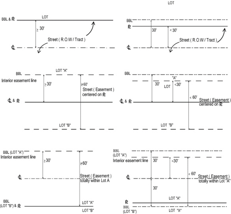
Pursuant to County
Engineering standards the front, side street, and rear setback (when the rear
property line abuts a street), shall be measured from the base building line.
|
Figure
3.D.1.D – Base Building Line
|
|
|
a. Major Street
The base building line
for any lot abutting a Major Street shall be 40 feet from the existing R-O-W.
b. Minor Street
The base building line
for any lot adjacent to a Minor Street shall be 30 feet from the centerline of
the existing street unless subject to the following:
1) Minor Street over
60 Feet Wide
The base building line
for any lot adjacent to a Minor Street over 60 feet in width shall be the
property line, or, if the street was created by a recorded easement, from the
easement line.
2) Platted
Subdivisions
The base building line
for any lot abutting a Minor Street within a subdivision platted and recorded
after February 5, 1973 shall be the property line abutting the Minor Street
shown on the plat.
c. Waiver
The County Engineer may
waive this requirement and establish the base building line at a lesser
distance. If the base building line is waived on a street created by a recorded
easement, the setback shall be measured from the easement line.
d. Permitted Encroachments
Pursuant to approval by
the County Engineer, temporary, removable, and non-habitable structures such as
signs and fences, may be located between a street and the base building line.
Approval shall be subject to a removal agreement with the DEPW. Setbacks shall
be measured from the existing street boundaries and the affected area shall be
landscaped in accordance with
Art. 7, Landscaping
.
[Ord. 2017-002]
e. Landscaping and Parking
In the event the County Engineer does not waive the base
building line requirement, required landscaping and parking shall be prohibited
in the area between a street and the base building line. [Ord. 2017-002]
The minimum separation
for Multifamily and Cottage Home structures in the RM district shall correspond
to the setback regulations in
Table 3.D.1.A, Property Development
Regulations
, and
Table 3.D.2.D, Cottage Home Property
Development Regulations
respectively. [Ord. 2019-034]
a.
Cottage Homes
The minimum separation for Cottage Homes may be reduced from 15
feet to ten feet subject to the approval by the Fire Department and the
Building Division.
[Ord. 2018-018] [Ord.
2019-034]
The minimum setback
from a corner clip shall be ten feet. The setback shall be measured
perpendicular from the midpoint of the interior line of the corner clip.
|
Figure
3.D.1.D – Corner Clip Setback
|
|
|
No setback reduction
shall be used in combination with any other setback reduction allowed by this
Code.
In residential zoning
districts located in the U/S Tier, or the Residential Pod of an AGR-PUD, the
rear and side setbacks along the length of a property line adjacent to
dedicated open space defined by a minimum of 50 feet in width may be reduced by
25 percent, unless otherwise stated by this Code. [Ord. 2008-037]
b. Alleys
In commercial and
industrial districts, the rear and side setbacks from an alley may be reduced
by 50 percent.
c. Railroad R-O-W
In industrial
districts, the setback from a railroad R-O-W may be reduced to the width of the
required landscape buffer.
The following
structures, projections, and improvements shall be allowed within required
setbacks:
a. Structures, Projections, and
Improvements Permitted in Setbacks
1) Arbors and
trellises less than ten feet in height, subject to a minimum three-foot
setback;
2) Balconies projecting a maximum of three feet
into the front setback of a SFD or ZLL home, not including setbacks allowed for
side loading garages pursuant to
Table 3.D.2.B, ZLL Property Development
Regulations
,
Table 3.D.2.B, Double ZLL Property
Development Regulations
, or
Art. 3.E.2.E.1.b, Side Loading Garage
; [Ord. 2005-041] [Ord. 2020-020]
3) Permanent/retractable awnings, canopies, or
Bahama shutters projecting a maximum of three feet into a setback, and having
no support other than provided by the wall or structure to which it is
attached; [Ord. 2005-041] [Ord. 2014-025]
4) Bay windows projecting a maximum of three
feet into a setback; [Ord. 2005-041]
5) Chimneys projecting a maximum of three feet
into a setback; [Ord. 2005-041]
6) Clothes poles or clotheslines in rear yard
setbacks; [Ord. 2005-041]
7) Driveways, subject to
Art. 6.B.3.A.2.a.3)a), Access Connections
; [Ord. 2005-002] [Ord. 2005-041]
8) Fire escapes projecting a maximum of three feet
into a setback, provided the riser is retractable and at least 50 percent open;
[Ord. 2005-041]
9) Flagpoles, subject to
Art. 8, Signage
;
[Ord.
2005-041]
10) Fountains; [Ord. 2005-041]
11) Heating, ventilation, and air-conditioning
units (including compressors and condensers); [Ord. 2005-041]
12) Mailboxes; [Ord. 2005-041]
13) Open terraces and patios, including walkways
and ground-level decks; [Ord. 2005-041]
14) Open, uncovered stoops; [Ord. 2005-041]
15) Recreational equipment and structures in the
rear setback of residential districts; [Ord. 2005-041]
16) Roof overhangs projecting into the required
setback a maximum of two and one-half feet; [Ord. 2005-041]
17) Sculptures and
other similar objects of art; [Ord. 2005-041]
18) Signs, subject to
Art. 8, Signage
;
[Ord.
2005-041]
19) On-site parking areas, unless otherwise
specifically prohibited; [Ord. 2005-041]
20)
Art. 5.B.1.A.2, Fences and Walls
(excluding corner clips for intersections);
[Ord. 2005-002] [Ord. 2005-041]
21) Landscaping planted in the ground or in
planters; [Ord. 2005-041]
22) Wells; [Ord. 2005-041]
23) Utility transmission lines and associated
structures; [Ord. 2005-041]
24) Basketball goals, provided there is a minimum
three-foot setback from the rear and side property lines and a minimum 15-foot
setback from the front and side street property lines; [Ord. 2005-041]
25) Light poles having only one structural ground
member; [Ord. 2005-041]
26) An accessory residential dock, shared by
abutting residential parcels only, subject to the submittal of an executed
construction and maintenance agreement, prepared in a manner and form
acceptable to the County Attorney and the Zoning Director; [Ord. 2005-041]
27) Bus
shelters and bus benches; [Ord. 2005-041] [Ord. 2014-025]
28) Fire hydrants
and other government service/utility structures required to be in certain locations
by applicable Codes and Ordinances; [Ord. 2005-041] [Ord. 2014-025]
29) Impact shutters projecting a maximum of 18
inches into the setback; and,
[Ord.
2014-025]
30) Decorative architectural treatment such as
lintels, stone veneer, or stucco banding, projecting a maximum of six inches
into a setback.
[Ord. 2014-025]
The maximum height for
buildings and structures in all districts shall be 35 feet, unless otherwise
stated.
[Ord. 2005-002]
Structures in Airport Zones are subject to the height restrictions in
Art. 16.B, Airport Protection Zoning
Regulations Governing Airport Hazards
.
[Ord. 2017-025]
In the RM, CLO, CHO,
CG, IL, IG, and PDD districts, buildings may exceed 35 feet in height as
follows: Buildings over 35 feet in height shall be set back in accordance with
Table 3.D.1.A, Property Development
Regulations
, with one
additional foot of setback to be provided in addition to the required setback
for each one foot in height, or fraction thereof, over 35 feet. In the PO district,
buildings over 35 feet in height shall provide one foot of setback, in addition
to required perimeter landscape buffers, for each additional one foot in height
or fraction thereof over 35 feet. This regulation shall have no effect on any
existing structure within the PO district that is conforming as of the
effective date of this Code. [Ord. 2005-002] [Ord. 2007-013]
In the AGR, AP, and AR
districts, structures accessory to a Bona Fide Agriculture use may exceed 35
feet in height as follows: one additional foot of setback shall be provided in
addition to the required setback for each one foot in height, or fraction
thereof, over 35 feet to a maximum of 100 feet.
The following
structures shall be exempt from the height restrictions in this Section, unless
otherwise stated:
a. Church spires, religious domes, and religious
ornamentation attached to a Place of Worship;
b. Belfries;
c. Monuments;
d. Tanks;
e. Water towers;
f. Fire towers;
g. Stage towers or scenery lofts;
h. Cooling towers;
i. Ornamental towers and spires;
j. Chimneys;
k. Structure built over the top of a stairwell
or elevator shaft providing access to the rooftop for maintenance purposes or
to house elevator mechanical equipment;
[Ord.
2014-001]
l. Smoke stacks;
m. Oil derricks;
n. Conveyors;
o. Flagpoles, subject to
Art. 8, Signage
,
except for
Art. 4.B.9, Commercial Communication Towers
;
p. Aircraft control towers;
q. Aircraft navigation aids;
r. Accessory radio towers, subject to
Art. 5.B.1.A.13, Accessory Radio Tower
;
s.
Art. 5.B.1.A.15, Amateur Radio and
Television Antennas
;
t.
Art. 4.B.9, Commercial Communication Towers
;
u. Required parapet screening of mechanical
equipment; and, [Ord. 2014-001]
v. Mechanical equipment, less than five feet in
height and any required screening, measured from the roof deck. [Ord. 2006-004]
The minimum lot
dimensions, maximum height, maximum FAR, maximum building coverage, and minimum
setbacks and separations for Townhouses in all districts where they are
permitted shall be as follows:
a. Common Area
Where any portion of
the original lot is not divided among and incorporated into the resulting Townhouse
lots, then that portion of the original lot shall be held by either of the
following or a combination of the following, in a form and manner acceptable to
the County Attorney: [Ord. 2005-002]
1) Each lot owner shall have an undivided
interest in the common area, which shall be appurtenant to that lot. The
individual interest in the common areas shall not be conveyed separately from
the ownership of said lot; or
2) A Property Owners’ Association (POA).
b. Individual Lot
The minimum area to be
conveyed to the lot owner shall be no less than 100 percent of the total ground
floor building area of the dwelling unit. A homeowner’s maintenance association
shall be formed among the unit owners to assure compliance with exterior area
maintenance regulations as may be adopted by the association.
No building or structure
shall exceed 35 feet in height.
No detached accessory
buildings or structures other than permitted fences or walls shall be permitted
on any lot less than 30 feet in width.
Townhouse lots may be
arranged in groups fronting on Residential Access Streets (if located within a
PDD) or fronting on parking tracts as allowed in
Art. 11.E.2, Access and Circulation Systems
. Minimum parking requirements shall be in
accordance with
Art. 6, Parking, Loading, and Circulation
.
In an effort to address
current building trends and needs of homeowners to modify existing units, the
following procedures have been established to facilitate replacement and
expansion of existing units, and to ensure the consistency of replacement units
with the character of the overall community. In the event a Townhouse unit is
replaced or expanded, the following shall apply: [Ord. 2008-037]
a. Process
1) Building Permit
Review
An application for
Building Permit shall be consistent with typical unit detail approved on the
DRO Site Plan or the original Building Permit. If no typical unit detail is
included then Staff will rely on the tabular data for setbacks/separations and
height. [Ord. 2008-037]
2) DRO Zoning
Review
An application for DRO
Zoning review shall be required to reflect proposed changes to a DRO-approved Site
Plan; typical unit shall include tabular data, setbacks/separations, and
height. [Ord. 2008-037]
b. Standards for Review
1) Setbacks/separations may be decreased a
maximum of 30 percent of the required minimum standard provided the development
was not approved utilizing flexible regulations or received prior Variance
relief. [Ord. 2008-037]
2) A 30 percent increase in the maximum
allowable height may be permitted.
[Ord.
2008-037]
3) Demonstrate compliance with all applicable
parking, landscaping, and drainage provisions. [Ord. 2008-037]
4) Comply with all applicable application
requirements. [Ord. 2008-037]
5) Submit a letter of support from the
applicable community HOA/POA.
[Ord.
2008-037]
6) Comply with any DRO-approved Architectural Elevations
or accepted revision consistent with Code.
[Ord.
2008-037]
Any purposed deviation
that exceeds the above standards will require Variance relief pursuant to
Art. 2.C.5.F, Type 1 Variance
. [Ord. 2008-037]
An attached Townhouse
building shall be developed as a whole, and no CO for a Townhouse unit shall be
issued until completion of one or more adjacent units and the entire attached
building exterior, parking, and landscaping.
A Townhouse unit shall
be attached to another Townhouse unit along a minimum of 50 percent of the
maximum depth of the unit. This minimum attached length between Townhouses is
limited to the portion of a building supporting an air-conditioned living area,
a garage, or a storage area and shall share a continuous foundation with the Townhouse
building.
|
Table 3.D.2.A – Townhouse Property Development Regulations
|
|
|
|
|
|
|
|
|
|
|
|
|
|
|
|
|
|
|
|
800 sq. ft.
|
16’
|
50’
|
35’
|
100% of buildable area
|
15’
– Unit
25’ – Front loading garage
15’ – Side loading garage or parking tract
|
20’
– Unit
30’ – Front loading garage
20’ – Side loading garage or parking tract
|
0’ – Interior unit
15’ – End unit
|
0’ – Interior unit
25’ – End unit
|
25’ – End unit
|
25’
|
|
Notes:
|
|
1.
|
Front and side street setbacks measured from street or
parking tract. Side and rear setbacks measured from plat, parcel, or pod
boundary; lake maintenance easement, canal easement, or canal R-O-W; or,
required landscape buffer. [Ord. 2005-002]
|
|
2.
|
Separations apply to the proximity of one Townhouse group
to another. Separation between two Townhouse buildings shall be by drawing a centerline
between the two adjacent buildings and measuring a minimum distance equal to
one-half of the required separation from the centerline to ensure an
equidistant separation between structures. For the purpose of this Section, a
Townhouse building shall mean two or more attached Townhouses.
|
|
3.
|
Recreation buildings and other structures which are not
accessory structures shall comply with the setback requirements in this
Section.
|
|
|
|
|
|
|
|
|
|
|
|
|
The minimum lot dimensions, maximum height, maximum building
coverage, and minimum setbacks for ZLL homes in all districts where they are
permitted, shall be as follows: [Ord. 2020-020]
|
Table 3.D.2.B – ZLL Property Development Regulations
|
|
|
|
|
|
|
|
|
|
|
|
|
|
|
|
4,500 sq. ft.
|
45’ – Interior
|
75’
|
35’
|
50%
|
10’ – Unit
25’ – Front loading garage
10’ – Side loading garage
|
0’
|
10’
|
N/A
|
10’
|
|
50’ – Corner
|
0’
|
N/A
|
10’
|
10’
|
|
55’ – Side Street home
|
N/A
|
10’
|
10’
|
10’
|
|
[Ord. 2005-041] [Ord.
2020-020]
|
a. ZLL Side Setback
1) A ZLL home
shall be located on a minimum of one, but not more than two, property lines,
except as stated in
Art.
3.D.2.B.1.b, Side Street Home
.
[Ord.
2005-002] [Ord. 2020-020]
2) A minimum of 20
feet of the length of the home under air or occupied by a totally enclosed area
under roof which is attached to and directly accessible from an air-conditioned
living area, such as a garage or storage area, shall be located on one lot line
and shall have a zero-foot setback from the lot line. [Ord. 2020-020]
a) The remaining
portion of the home along the ZLL side shall be set back a minimum of four feet
from the zero property line, unless otherwise stated herein
Art.
3.D.2.B.1.c, Double ZLL Home
, and
Art. 3.D.2.B.3,
Design Standards
. [Ord. 2020-020]
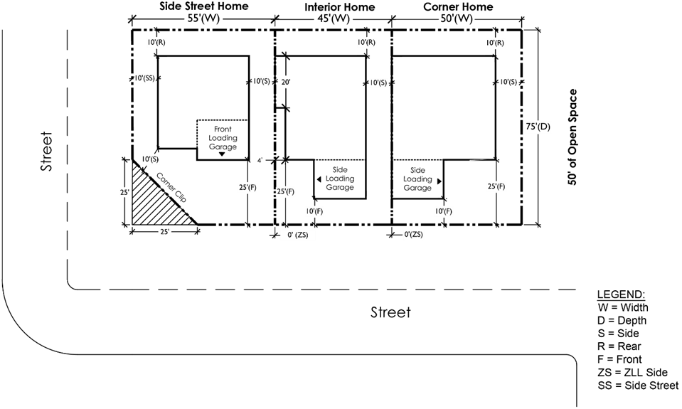
A Side Street home shall be located on a lot having one side of
the unit abutting a street, abutting a minimum of 50 feet of open space, or a
combination thereof. A Side Street home shall comply with the setbacks pursuant
to
Table
3.D.2.B, ZLL Property Development Regulations
. [Ord. 2005-041] [Ord. 2020-020]
|
Figure 3.D.2.B – Typical Example of ZLL
Home PDRs
|
|
|
|
[Ord.
2005-041] [Ord. 2020-020]
|
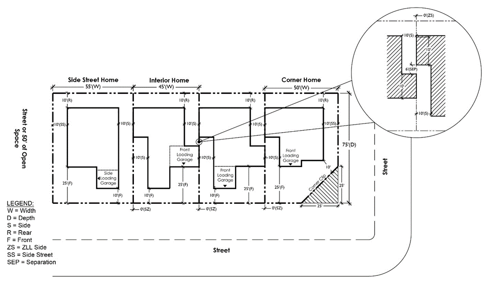
A Double ZLL home is constructed with portions of the home
located on two side property lines.
[Ord.
2020-020]
1) The
portion of the home abutting the ZLL side shall be under air or occupied by a
totally enclosed area, such as a garage or storage area; and [Ord. 2020-020]
2) A
Corner home shall have a minimum of 20 feet of the length of the home located
on one lot line and shall have a zero-foot setback from the lot line; or [Ord. 2020-020]
3) An
Interior Double ZLL home shall have a minimum of ten feet of length of the home
on each ZLL side property, for a minimum total of 20 feet. [Ord. 2020-020]
|
Table 3.D.2.B – Double ZLL Property
Development Regulations
|
|
|
|
|
|
|
|
|
|
|
|
|
|
|
4,500 sq. ft.
|
45’ – Interior
|
75’
|
35’
|
50%
|
10’ – Unit;
25’ – Front loading garage;
10’ – Side loading garage
|
0‘– For a min. 10’ on each ZLL side;
10’ – Portion of unit not built on the ZLL
side
|
N/A
|
10’
|
|
50’– Corner
|
0’ – For a min. 10’ on each ZLL side;
10’ – Portion of unit not built on the ZLL
side
|
10’
|
10’
|
|
55’ – Side Street home
|
N/A
|
10’
|
10’
|
|
[Ord.
2020-020]
|
|
Notes:
|
|
1.
|
A minimum ten-foot
setback shall be provided for the portion of the Double ZLL home that is not
built with a zero-foot setback. Reduction in setbacks, as described in
Art. 3.D.2.B.3.b.3),
Windows and Doors
,
shall be prohibited.
[Ord. 2020-020]
|
|
2.
|
A minimum six-foot
separation between the exterior walls and a minimum four-foot separation for
overhangs, shall be provided between Double ZLL units located on the same ZLL
side with the zero-foot setback unless waived by the Building Official based
on requirements of the current edition of the Florida Building Code.
[Ord. 2020-020]
|
|
|
|
|
|
|
|
|
|
|
|
Figure 3.D.2.B – Typical PDRs for Double
ZLL Homes
|
|
|
|
[Ord.
2020-020]
|
1) A
new ZLL lot shall not have a ZLL side abutting the side or rear property lines
of an existing SF lot with a SFD. A new ZLL lot abutting to a platted SF lot
that is vacant may be allowed pursuant to
Art.
3.D.2.B.1.d.2)
.
[Ord.
2020-020]
2)
A new subdivision may include both ZLL and SF lots. If a ZLL lot
abuts a SF lot, and the shared property line is the ZLL side, the SF lot shall
have a minimum ten-foot side or 15-foot rear setback. The SF lot shall have an
Access, Maintenance, and Roof Overhang Easement recorded pursuant to
Art. 3.D.2.B.3.e, Access, Maintenance, and Roof Overhang Easement
. [Ord. 2020-020]
3) A
new subdivision may include ZLL and MF or Cottage Homes (Multiple Units on a
Single Lot). If a ZLL lot abuts the MF or Cottage Homes (Multiple Units on a
Single Lot), and the shared property line is the ZLL side, the side setback for
MF and Cottage Homes (Multiple Units on a Single Lot) shall be a minimum of 15
feet. The MF or Cottage Homes (Multiple Units on a Single Lot) lot shall have
an Access, Maintenance, and Roof Overhang Easement recorded pursuant to
Art.
3.D.2.B.3.
e, Access, Maintenance, and
Roof Overhang Easement
.
[Ord.
2020-020]
4) ZLL
lot shall not abut a Cottage Home (Single Unit on a Single Lot) or a Townhouse
lot. [Ord. 2020-020]
In an effort to address
current building trends and needs of homeowners to modify existing units, the
following procedures have been established to facilitate replacement and
expansion of existing units, and to ensure the consistency of replacement units
with the character of the overall community. In the event an existing home is
being replaced, modified, or expanded, the following shall apply:
[Ord.
2008-037] [Ord. 2020-020]
a. General
The application of a provision in this Section, which was not
allowed prior to the effective date of this Code, shall require: [Ord. 2020-020]
1) consent from
the HOA;
2) submittal of an
application, pursuant to
Art. 2, Application
Processes and Procedures
, to amend the prior DO; [Ord. 2020-020]
3) the amendment
to apply to an entire pod; and,
4) the pod to be
brought into conformance with the remainder of this Code, to the extent
possible.
b. Process
1) Building Permit
Review
An application for
Building Permit shall be consistent with either a typical unit detail that is
shown on the Final Plan approved by the DRO or the original Building Permit. If
no typical unit detail is included on the Final Plan, then Staff shall rely on
the Site Data Table for setbacks/separations and height required at the time of
issuance of the original DO.
[Ord.
2008-037] [Ord. 2020-020]
2) Administrative
Modifications
An application for Full
DRO shall be required to reflect proposed changes on the subdivision or regulation
plan typical unit detail including: tabular data, setbacks/separations, and
height. [Ord. 2008-037] [Ord. 2020-020]
a) Setbacks/separations
may be decreased a maximum of 30 percent of the required standard at time of
issuance of the DO, provided the development was not approved utilizing
flexible regulations or received prior Variance relief and the setbacks are not
less than the requirements pursuant to
Table 3.D.2.B,
ZLL Property Development Regulations
or
Table
3.D.2.B, Double ZLL Property Development Regulations
.
[Ord. 2008-037]
[Ord. 2020-020]
b) A 30 percent
increase in the maximum allowable height approved in the original DO may be
permitted, provided it does not exceed the height limitations described in
Table 3.D.2.B,
ZLL Property Development Regulations
or
Table
3.D.2.B, Double ZLL Property Development Regulations
, and complies with the
requirements of
Art.
3.D.2.B.3.a, Height and Story Limitation
. [Ord. 2008-037] [Ord. 2020-020]
c) The Applicant
shall demonstrate compliance with all applicable parking, landscaping, and
drainage provisions; [Ord. 2008-037] [Ord. 2020-020]
d) The Applicant
must comply with all applicable application requirements;
[Ord. 2008-037]
[Ord. 2020-020]
e) The Applicant
must submit a letter of support from the applicable community HOA/POA; and,
[Ord.
2008-037] [Ord. 2020-020]
f) Any proposed
deviation that exceeds the above standards will require Variance relief
pursuant to
Art. 2.C.5.F, Type 1 Variance
.
[Ord.
2008-037] [Ord. 2020-020]
Buildings or structures shall not exceed 35 feet in height. Lots
with a ZLL side that abuts the rear property line of an adjacent lot or is
separated from the rear property line of an abutting lot by less than ten feet
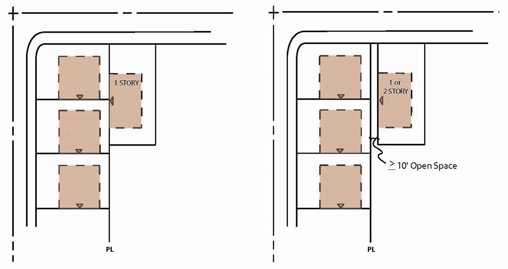
of open space shall be limited to a home one story (one floor) in height. If
the lots are separated with open space ten feet or greater, the homes may have
two stores (two floors).
[Ord. 2009-040]
[Ord. 2020-020]
|
Figure 3.D.2.B – ZLL Story Limitations
Based on Separation
|
|
|
|
[Ord.
2009-040] [Ord. 2020-020]
|
b. ZLL Side Façade
Certain openings and attachments shall not be allowed to
penetrate or be attached to any portion of the home on the ZLL side, except as
otherwise listed below. [Ord. 2020-020]
1)
Prohibited Openings and Attachments
a) Prohibited
openings and attachments include, but are not limited to, the following:
[Ord.
2005-002] [Ord. 2020-020]
(1) A/C condensate
drain; [Ord. 2005-002]
(2) A/C emergency
overflow drain; [Ord. 2005-002]
(3) Exhaust ducts,
such as, but not limited to, kitchens, bathrooms, clothes dryers, etc.;
[Ord.
2005-002]
(4) Garage vents;
[Ord.
2005-002]
(5) Temperature or
pressure relief line; [Ord. 2005-002]
(6) Doors, except
as otherwise stated below;
[Ord. 2005-002]
[Ord. 2020-020]
(7) Windows, except
as otherwise stated below; [Ord. 2005-002] [Ord. 2020-020]
(8) Electric
meters; [Ord. 2005-002]
(9) Hose bibs;
[Ord.
2005-002]
(10) Satellite
dishes; and, [Ord. 2005-002]
(11) Electrical
outlets. [Ord. 2020-020]
b) Exceptions may
be considered only for those existing projects where an opening or attachment
was permitted on the ZLL wall for the models or more than 30 percent of the
total ZLL units of that project. [Ord. 2005-002] [Ord. 2020-020]
2) Permitted
Openings
Clean out fittings and soffit vents shall be allowed to
penetrate and/or be attached to the portion of the home on the ZLL side.
[Ord.
2005-002] [Ord. 2020-020]
3) Windows and Doors
Window and door materials may be used along the portion of the
home on the ZLL side pursuant to the following: [Ord. 2020-020]
a) Translucent
Windows or Translucent/Solid Doors
Material which allows a maximum 60 percent of exterior light
transmission according to the manufacturer’s specifications shall be used. A
notarized affidavit shall be submitted with the Building Permit which verifies
the degree of light transmission and the translucency of the material to be
used. [Ord. 2020-020]
b) First Floor
(1) ZLL Façade
Constructed Less Than Five Feet from the ZLL Side Property Line
(a) Windows shall
be constructed with translucent material.
[Ord.
2020-020]
(b) Doors shall be
constructed with translucent or solid material and may not be located on any
portion of a wall with a zero setback.
[Ord.
2020-020]
(c) A privacy
wall/fence shall be installed pursuant to Art. 3.D.2.B.3.d.1)a).
[Ord. 2020-020]
(d) Exceptions
i. Windows and doors located on the front or
rear façade of the unit may be transparent. [Ord. 2020-020]
ii.
Windows and doors located
on a façade that is perpendicular to the ZLL side may be transparent. [Ord. 2020-020]
iii. A ZLL side façade that is recessed off of the
ZLL side less than five feet, may have transparent windows and doors
constructed on the ZLL side façade that are parallel or angled towards the ZLL
side. The height of the privacy wall or fence shall be increased and installed
pursuant to
Art.
3.D.2.B.3.d.1)c)(1)
. [Ord. 2020-020]
(2) ZLL Façade Constructed
Greater Than or Equal to Five Feet from the ZLL Side Property Line
(a) A ZLL side
façade that is recessed off of the ZLL side five feet or greater, may have
transparent or translucent windows and doors constructed on the ZLL side façade
that are perpendicular, parallel, or angled towards the ZLL side. [Ord. 2020-020]
(b) A privacy wall
or fence is only required
extending a
minimum distance of ten feet beyond the rear of the home toward the rear
property line
pursuant to Art. 3.D.2.B.3.d.1)a).
[Ord. 2020-020]
(3) Double ZLL Home
(a) For the
portion of the ZLL home that is constructed at the ZLL side, all windows shall
be constructed with translucent material, and doors shall be prohibited.
Windows and doors located on a façade that is perpendicular to the ZLL side may
be transparent. [Ord. 2020-020]
(b) For the
portion of the ZLL home that is constructed ten feet from the ZLL side, windows
and doors may be transparent or translucent material. [Ord. 2020-020]
(c) A privacy wall
pursuant to
Art.
3.D.2.B.3.d.1)a)
is not required.
[Ord.
2020-020]
c) Second Floor
(1) ZLL Façade
Constructed Less Than Five Feet from the ZLL Side Property Line
(a) Windows located on a façade that is parallel
or angled toward the ZLL side shall be constructed with translucent material.
[Ord.
2020-020]
(b) Windows located on a façade that is
perpendicular to the ZLL side may be transparent. [Ord. 2020-020]
(2) ZLL Façade
Constructed Greater Than or Equal to Five Feet from the ZLL Side Property Line
(a) A
ZLL side façade that is recessed off of the ZLL side five feet or greater, may
have transparent or translucent windows constructed on the ZLL side façade that
are perpendicular, parallel, or angled towards the ZLL side. [Ord. 2020-020]
(3) Double ZLL Home
(a) For the portion of the ZLL home that is
constructed at the ZLL side, all windows shall be constructed with translucent
material; and [Ord. 2020-020]
(b) For the
portion of the ZLL home that is constructed ten feet from the ZLL side, windows
and doors may be transparent or translucent material. [Ord. 2020-020]
d) Exception
Transparent windows may be permitted on the ZLL side (first or
second story) if the ZLL side façade abuts a dedicated open space or landscape
buffer a minimum of 50 feet in width. [Ord. 2020-020]
e) Surface Area
Use shall be limited to a maximum of 50 percent of the surface
area of the wall along the portion of the home on the ZLL side.
f) Limitation
Use shall be limited to new construction only, unless consent
from the HOA is submitted with the Building Permit.
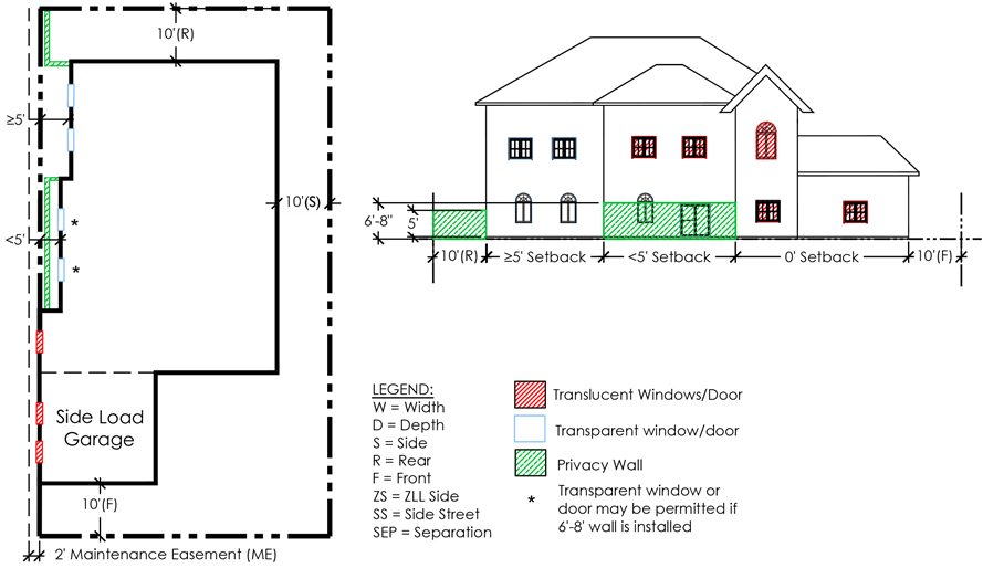
|
Figure 3.D.2.B – ZLL Home Windows and Doors
|
|
|
|
[Ord. 2020-020]
|
c. Covered Porches, Courtyards, and Balconies
1) Covered Porch
(Front of the ZLL Home)
A covered porch may be constructed along the ZLL side, at the
front of the home. If windows and doors are constructed into the façade of the
home adjacent to the porch, the following shall apply: [Ord. 2020-020]
a) Windows or
doors, parallel or angled toward and less than five feet from the ZLL side
shall be constructed with translucent material.
[Ord. 2020-020]
b) Windows or
doors, parallel or angled toward and greater or equal to five feet or perpendicular
to the ZLL side may be constructed with transparent material.
[Ord. 2020-020]
c) No privacy wall
is required adjacent to the covered porch.
[Ord.
2020-020]
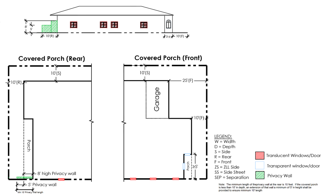
2) Covered Porch
(Rear of the ZLL Home)
A covered porch, with a solid roof, may be constructed along the
ZLL side, at the rear of the home. A wall shall be constructed the entire
length of the porch along the ZLL side. The height of the wall shall be a
minimum of eight feet. The privacy walls or fences shall be installed in
accordance with ZLL wall
Art.
3.D.2.B.3.d, Privacy Walls or Fences
.
[Ord. 2020-020]
|
Figure 3.D.2.B – ZLL Covered Porch
|
|
|
|
[Ord. 2020-020]
|
3) Courtyard
A courtyard may be constructed along the ZLL side. A gate shall
be installed on the ZLL for emergency exit purposes provided the gate meets the
following dimensions:
[Ord. 2020-020]
a) Width: minimum
of 36 inches; [Ord. 2020-020]
b) Height: minimum
of five feet; [Ord. 2020-020]
(1) Exception
If the ZLL façade, within the courtyard, has windows and doors
installed pursuant to
Art.
3.D.2.B.3.b.3)b)(1)(d)ii
, the privacy wall and gate shall be increased in
height, six feet eight inches, pursuant to
Art.
3.D.2.B.3.d, Privacy Walls or Fences
.
c) The gate shall
be opaque; and, [Ord. 2020-020]
d) Operable only
from the inside with the gate opening inward toward the unit.
[Ord. 2020-020]
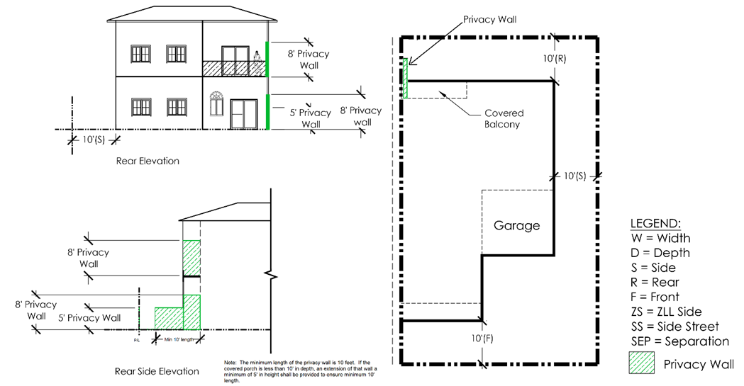
4) Balconies (Front
or Rear of the Home)
In addition to the requirements of
Art. 3.D.1.D.5,
Setback Exceptions
, balconies located less than five feet from the ZLL
side, shall construct a wall the entire length of the porch along the ZLL side
subject to the following:
[Ord. 2020-020]
a) No roof: The
height of the wall shall be a minimum six feet eight inches.
[Ord. 2020-020]
b) Roof: The
height of the wall shall be a minimum of eight feet from the floor of the
balcony. [Ord. 2020-020]
|
Figure 3.D.2.B – ZLL Balcony, Rear
|
|
|
|
|
|
[Ord. 2020-020]
|
|
Figure 3.D.2.B – ZLL Balcony, Front
|
|
|
|
[Ord. 2020-020]
|
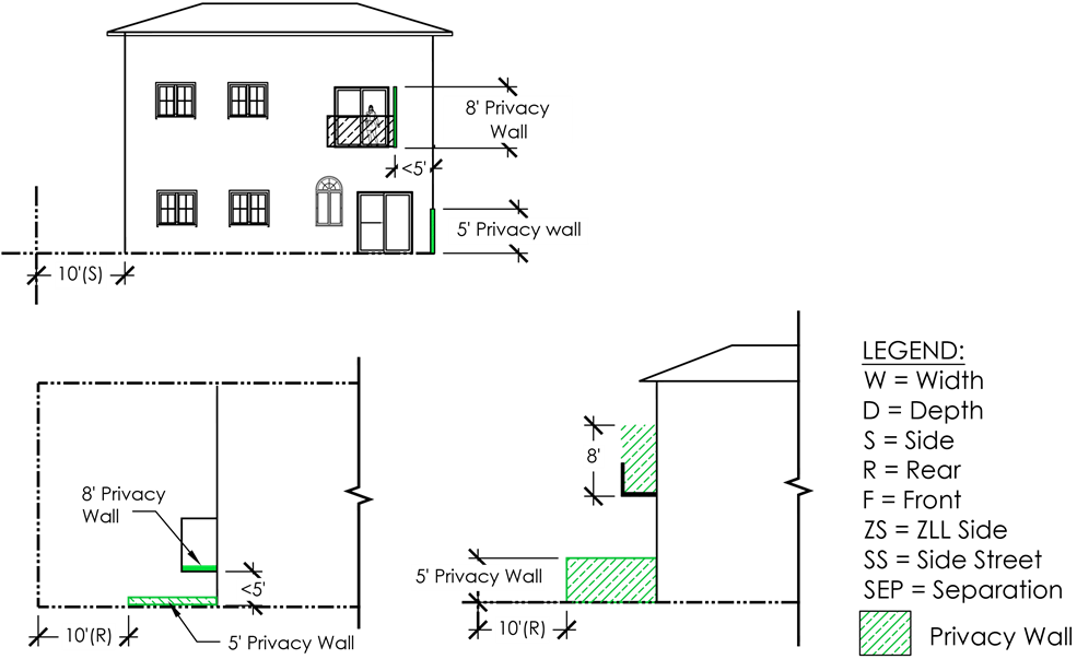
1) Wall or Fence
a)
A minimum five-foot-high opaque wall or fence shall be provided
along the ZLL side of a ZLL home, beginning at the end of the home with a zero
setback and extending a minimum distance of ten feet beyond the rear of the
home toward the rear property line. [Ord. 2005-041] [Ord. 2020-020]
b) A minimum
five-foot-high opaque wall or fence, including a gate, shall be constructed the
entire length of an opening for a courtyard. [Ord. 2020-020]
c) Exception
(1)
A wall or fence shall not be required if the ZLL side is adjacent
to dedicated open space a minimum of 50 feet in width. [Ord. 2020-020]
(2) ZLL Façade
Constructed Less Than Five Feet from the ZLL Side Property Line with
Transparent Windows or Doors
(a) A minimum six-foot
eight-inch-high opaque wall or fence and any courtyard gate shall be provided
along the ZLL side of a ZLL home when transparent windows and doors are
constructed parallel or angled toward the ZLL side, pursuant to
Art.
3.D.2.B.3.b.3)b)(1)(d)ii
.
[Ord.
2020-020]
(b) The length of
the wall shall begin at the end of the home with a zero setback and extend a
minimum two feet beyond the window or door with transparent material. The
remaining length of the wall or fence shall be constructed a minimum five feet
high, pursuant
Art.
3.D.2.B.3.d.1)a)
. The two-foot extension provision above shall not apply to
courtyards fully enclosed by a minimum six-foot eight-inch-high opaque wall or
fence and any courtyard gate.
[Ord.
2020-020]
(3) ZLL Façade
Constructed Greater Than or Equal to Five Feet from the ZLL Side Property Line
A privacy wall or fence is only required at the point
extending a minimum distance of ten feet
beyond the rear of the home toward the rear property line,
pursuant to Art. 3.D.2.B.3.d.1)a).
[Ord. 2020-020]
(4) Covered Porch
(Rear) and Balconies (Front or Rear)
Privacy walls shall extend the
length of the covered porch or balcony when less than five feet from the
property line. The height of the wall shall be a minimum eight feet. [Ord. 2020-020]
2) Rear Lot Line
A minimum five-foot-high
opaque wall or fence shall be provided along the rear lot line between lots
with abutting rear lot lines and between lots with abutting side and rear
property lines.
3) Design
Requirements
If a wall is
constructed, the required wall, including any extension, shall be constructed
of the same material used to construct the adjoining ZLL wall of the home (e.g.,
brick home with a brick privacy wall) or any structurally sound, opaque, and
permanent material with an exterior finish that matches the style, color, and
surface texture of the exterior of the adjoining ZLL wall (e.g., CBS home with
stucco finished wood frame wall painted to match the home).
4) Roof Enclosures
When a screened
enclosure is attached to the ZLL wall, the length and height of the wall shall
comply with
Art. 5.B.1.A.11, Screen Enclosures
. [Ord. 2020-020]
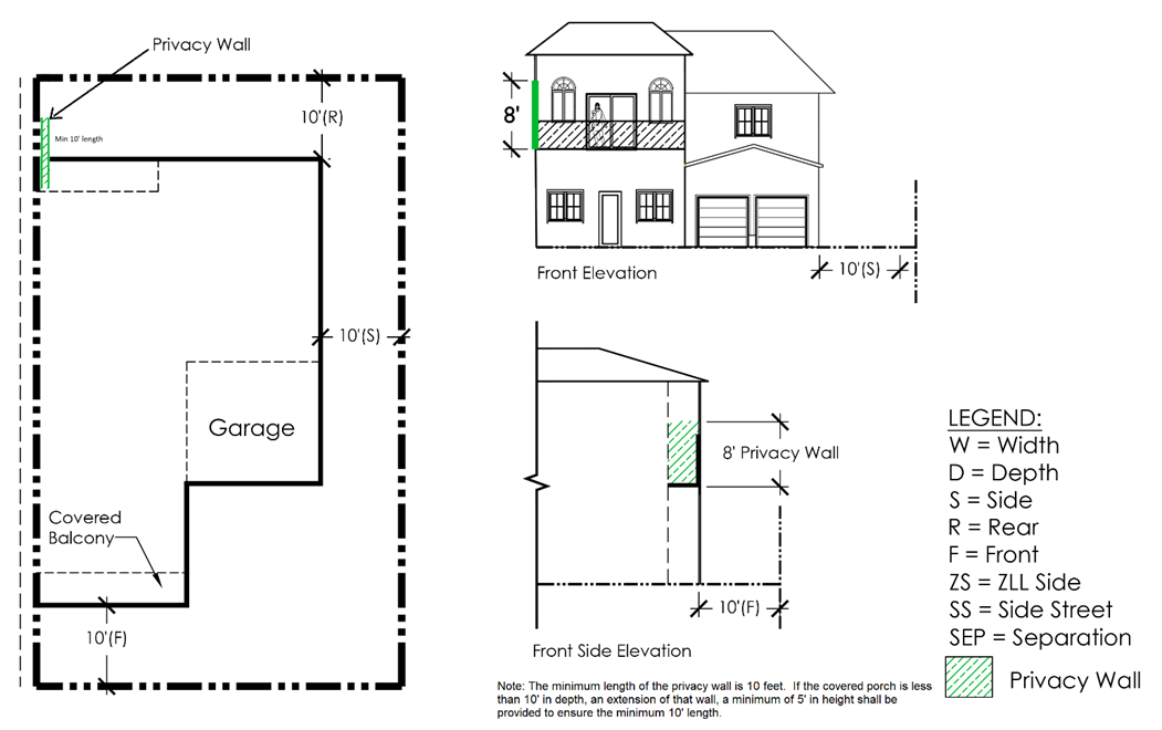
The Subdivision Plan,
plat, and subsequent surveys submitted with an application for a Building Permit,
shall indicate an Access, Maintenance, and Roof Overhang Easement along the ZLL
for each ZLL lot for the purpose of allowing access for emergency purposes of
exiting the home and for the maintenance of the portion of the home with a zero
setback and to accommodate any overhang of the roof eave and gutter. Should a
fence or wall traverse or be located within the easement, written permission
from the POA will be required prior to the issuance of a permit by PBC. A gate
for access and maintenance purposes will be required. Access for the owner of
the lot abutting the easement and the easement beneficiaries shall be provided
after advanced notification and during reasonable hours except for emergency
purposes as provided for above. No construction, landscaping, mechanical
equipment, fence, or wall shall prevent perpetual access to said easement by
the owner of the lot abutting the easement or the easement beneficiaries.
[Ord. 2013-001] [Ord. 2015-031] [Ord.
2020-020]
1) Easement Width
This easement shall
have a minimum width of two feet.
2) Roof Overhang
Roof eaves, gutters,
and soffits may encroach the easement up to a maximum of 24 inches. Gutters
shall be installed along the entire length of the ZLL side to prevent water
runoff onto the adjacent property.
3) Drainage
This easement shall not
overlap a drainage easement.
4) Plat
A dedication shall be
included on the plat for each ZLL subdivision for an Access, Maintenance, and
Roof Overhang Easement. The easement language will incorporate the purpose and
intent as described in
Art. 3.D.2.B.3.e, Access, Maintenance, and
Roof Overhang Easement
, in
a format approved by the County Engineer, and referenced in the Land
Development Forms Manual. [Ord. 2020-020]
5) Easement
Encroachments
Projections or
improvements may be permitted to encroach into the ZLL Access, Maintenance, and
Roof Overhang Easement, as follows:
[Ord.
2014-025] [Ord. 2020-020]
a) Mounting hardware for impact shutters,
accordion shutters, or roll-down shutters, projecting a maximum of six inches
into the ZLL easement; and [Ord. 2014-02
5
]
b) Decorative
architectural treatment such as lintels, stone veneer, or stucco banding
extending a maximum distance of three feet measured from the front façade,
projecting a maximum of two inches into a ZLL easement. [Ord. 2014-025]
To recognize Florida
State laws pertaining to the placement of Residential Manufactured Buildings (a.k.a.
Modular Homes) in Mobile Home Park communities, to provide additional
flexibility to allow for the redevelopment of fee simple Mobile Home Park lots
with either Modular Homes or traditional Single Family dwelling units.
[Ord.
2012-027]
The provisions of this
Section shall only apply to: [Ord. 2012-027]
a. Existing Mobile Home Parks identified in PZB
PPM #MD-RI-003, Mobile Home Parks in Unincorporated
Palm Beach County
; and [Ord. 2012-027]
b. Provisions allowing for alternative PDRs and
related requirements for Residential Manufactured Buildings or Single Family dwellings
shall only be permitted for existing fee simple Mobile Home Subdivisions. [Ord. 2012-027]
An existing Mobile Home
may be replaced with a Modular Home subject to the following:
[Ord.
2012-027]
a. Requirements of PZB
PPM #MD-RI-003
; and
[Ord.
2012-027]
b. Where applicable, subject to prior written
approval of the Mobile Home Park owner in accordance with
F.S. § 553.382, Placement of Certain Housing
.
[Ord.
2012-027]
A Modular Home or a Single
Family dwelling shall be permitted to be placed on a fee simple lot within an
existing Mobile Home Subdivision, subject to the following: [Ord. 2012-027]
a. PDRs
The following PDRs
shall apply to Modular Homes or SFDs. Setbacks for accessory structures shall
be in accordance with
Art. 5.B.1.A, Accessory Uses and Structures
.
[Ord.
2012-027]
1) Minimum lot width: 45 feet. [Ord. 2012-027]
2) Maximum lot coverage: 50 percent. [Ord. 2012-027]
3) Front and side street setback: 20 feet. [Ord. 2012-027]
4) Side setback: seven and one-half feet. [Ord. 2012-027]
5) Rear setback: 15 feet. [Ord. 2012-027]
b. Garages
Garages and carports
may be permitted only on the rear portion of the lot. An attached garage may be
permitted to encroach the front half of the lot, if set back a minimum of 20
feet from the front façade. Attached carports shall not extend past the front
façade. [Ord. 2012-027]
c. Main Entrances and Porches
When located on lots
less than 50 feet in width, main entrances shall be required to front a street,
and include a porch a minimum of six feet deep, 12 feet wide, and 18 inches
above grade. [Ord. 2012-027]
d. Changes to Lot Finished Grade
Any modifications to a
lot that raises the grade for the proposed foundation shall not alter the
existing grade within the required side setbacks unless demonstrated that such
will not alter any historical drainage patterns for adjacent lots. Where
foundation elevation is required, this may require the use of a retaining wall
to ensure that existing grade and drainage patterns are not adversely impacted.
[Ord. 2012-027]
Cottage Homes are detached housing types that may be developed
with one unit or multiple units on a single lot. [Ord. 2019-034]
Cottage Homes shall comply with the following PDRs:
[Ord.
2018-018] [Ord. 2019-034]
|
Table 3.D.2.D – Cottage Home
Property Development Regulations
(1)
|
|
|
|
|
|
|
|
|
|
|
|
|
|
|
|
|
1,000 to
2,500 sq. ft. (max.)
|
20 to
30’ (max.);
30’ – Side Street home (max.)
|
50’
|
35’ (max.)
|
40% (max.)
|
20’
|
5’
|
10’
|
5’
|
|
|
|
(3)
|
65’
|
75’
|
35’ (max.)
|
N/A
|
25’ (4)
|
15’ (4)(6)
|
25’ (4)
|
15’ (4)
|
|
[Ord. 2018-018] [Ord.
2019-034] [Ord. 2020-020]
|
|
Notes:
|
|
1.
|
Minimum property development regulations except
where it stated as maximum.
|
|
2.
|
Apply to a Cottage Home that is located on a
single lot. This may apply to either a subdivided lot of a pod in a PDD or in
a Standard Zoning District. [Ord. 2019-034]
|
|
3.
|
The minimum lot size of the zoning district
which multiple Cottage Homes are located shall apply. [Ord. 2019-034]
|
|
4.
|
Setbacks shall be measured from the lot. The
front setback shall be measured from the property line or base building line,
whichever is applicable, where the lot frontage is located. [Ord. 2019-034]
|
|
5.
|
A Cottage Home (Single Unit on a Single Lot) shall
not abut a ZLL home. [Ord. 2020-020]
|
|
6.
|
A new subdivision may include ZLL and Cottage
Homes (Multiple Units on a Single Lot). If a ZLL lot abuts the Cottage Homes
(Multiple Units on a Single Lot), and the shared property line is the ZLL
side, the side setback for the Cottage Homes (Multiple Units on a Single Lot)
shall be a minimum of 15 feet. The Cottage Homes (Multiple Units on a Single
Lot) lot shall have an Access, Maintenance, and Roof Overhang Easement
recorded pursuant to
Art.
3.D.2.B.3.e, Access, Maintenance, and Roof Overhang Easement
.
[Ord.
2020-020]
|
|
|
|
|
|
|
|
|
|
|
Additional PDRs shall
apply in certain districts as follows:
a. Enclosed Uses
All uses shall be
operated entirely within enclosed buildings, with the following exceptions:
[Ord.
2005-002]
1) Air Curtain Incinerator, temporary;
[Ord.
2005-002]
2) Commercial
Communication Tower; [Ord. 2005-002] [Ord. 2017-007]
3) Electric Power
Plant; [Ord. 2005-002] [Ord. 2017-007]
4) Passive Park; [Ord. 2005-002] [Ord. 2017-007]
5) Recycling
Drop-Off Bin;
[Ord. 2005-002] [Ord.
2013-001]
6) Minor Utility;
and, [Ord. 2005-002] [Ord. 2017-007]
7) Water or
Wastewater Treatment Plant. [Ord. 2005-002] [Ord. 2017-007]
a. Enclosed Uses
All uses shall be
operated entirely within enclosed buildings, with the following exceptions:
1) Air Curtain Incinerator,
temporary;
2) Commercial
Communication Tower; [Ord. 2017-007]
3) Electric Power
Plant; [Ord. 2017-007]
4) Passive Park; [Ord. 2017-007]
5) Recreation facility,
accessory;
6) Recycling
Drop-Off Bin; [Ord. 2013-001]
7) Solid Waste
Transfer Station; [Ord. 2017-007]
8) Minor Utility;
and, [Ord. 2017-007]
9) Water or
Wastewater Treatment Plant.
[Ord.
2017-007]
Use of the IPF district with a UT FLU designation, shall only be
permitted for privately-operated utility uses and related collocated or
accessory uses. [Ord. 2017-007]
a. Accessory Uses
Heavy Equipment Repair and Maintenance and Light Repair and
Maintenance may be allowed as an accessory use to a privately-operated utility
use, subject to the approval process for the applicable utility use. [Ord. 2017-007]
b. Collocated Uses
Data and Information Processing or Warehouse uses may be allowed
as a collocated use, subject to the approval process for the applicable utility
use. Additional uses to allow for emergency management staging or operations
may be permitted subject to Class A Conditional Use approval.
[Ord.
2017-007]
The purpose of PDDs is
to provide opportunities for development patterns which exceed the expectations
of the Standard Zoning Districts, and allow for the creative use of land. The
types of development addressed in this Chapter include those encouraged by the
Managed Growth Tier System (MGTS) in the Plan. The intent of this Chapter is to
encourage ingenuity, and imagination on the part of, architects, landscape
architects, engineers, planners, developers, and builders to create development
that promotes sustainable living, addresses traffic impacts, encourages
alternative modes of transportation, creates logical street and transportation
networks, preserves the natural environment, enhances the built environment,
provides housing choices, provides services to the community, encourages
economic growth, encourages infill development and redevelopment, and minimizes
impacts on surrounding areas through the use of flexible and innovative land
development techniques. [Ord. 2009-040]
In addition to the
other Articles in this Code, the requirements of this Chapter shall apply to
all PDDs, modifications to previously approved PDDs, and modifications to
previously approved Special Exceptions for Planned Developments, unless
otherwise stated.
a. Previous Approvals
Previously Approved
Planned Developments with a Development Order that does not conform to
provisions in this Code shall be considered conforming in accordance with
Art. 1.E, Prior Approvals
, where in compliance with the requirements of
Art. 3.A.3, Zoning District Consistency with
the Future Land Use Atlas (FLUA)
.
[Ord. 2009-040] [Ord. 2010-022]
[Ord. 2011-016]
1) Development
Order Amendment
Shall be in compliance with
Art. 3.A.3, Zoning District Consistency with
the Future Land Use Atlas (FLUA)
. [Ord. 2009-040] [Ord. 2011-016]
2) Additional Requested
Uses
Previously approved “Additional
Conditional Uses” shall remain conforming uses, and may be modified or
expanded, subject to a DOA approval.
[Ord.
2005-002]
[Ord. 2009-040] [Ord.
2018-002]
b. Government Facilities
A parcel of land in any
FLU category that supports Government Facilities shall be exempt from the PDD
threshold provisions.
[Ord. 2007-013]
[Ord. 2009-040]
If a conflict exists
between this Chapter and other Articles in this Code, the provisions of this
Chapter shall apply to the extent of the conflict.
All pods shown on a Master Plan shall receive approval of a
Final Site Plan or a Final Subdivision Plan pursuant to
Art. 2.C, Administrative
Processes
. [Ord. 2020-020]
Uses allowed, PDRs,
density, and intensity shall be determined by the land use designation on the
affected area. In the U/S Tier, density may be transferred from one portion of
the project to another based on the gross acreage of the project. An underlying
designation is not a split FLU designation. [Ord. 2009-040] [Ord. 2019-005]
a. PDDs that have
a non-residential FLU designation and an underlying residential FLU designation
may utilize density and/or intensity for either or both FLU designations. [Ord. 2019-005]
b. PDDs that have
two non-residential FLU designations may utilize either or both FLU
designations. If the Development Order utilizes both FLU designations, a
Preliminary Master Plan shall be approved by the BCC depicting the locations of
each FLU designation as a pod. Each pod will be limited to the allowable uses,
for the applicable FLU designation, pursuant to
Art. 4.B, Use
Classification
and the property development regulations pursuant to
Table 3.E.3.D,
MUPD Property Development Regulations
. The FAR shall be in accordance with FLUE
Table 2.2-e.1 for each pod and the applicable FLU designation. Double counting
of intensity is prohibited.
[Ord. 2019-005]
[Ord. 2021-023]
The allowable density shall be pursuant to FLUE Table 2.2.1-g.1
and other related Policies. [Ord. 2019-005]
Uses allowed in a PDD
shall be pursuant to
Art. 4, Use Regulations
. Previously Approved Planned Developments shall be governed by the FLU
designation in the Plan or pod designation on the most recent approved Master Plan
for the purpose of determining the uses allowed and applicability of this Code.
Previously approved additional Conditional Uses shall be considered conforming
uses, and any expansion, relocation, or increase in intensity shall be subject
to BCC approval. [Ord. 2005-041] [Ord. 2017-007] [Ord. 2018-002]
Uses permitted in a PDD
shall be according to the pod designation on the Master Plan approved by the
DRO, or the land use designation of the PDD, whichever is applicable. Uses may
be further limited by the Development Order, Concurrency Reservation, or other
applicable requirement. [Ord. 2009-040]
a. Conditional Use
Conditional Uses shall be shown on the Master Plan or Site Plan
approved by the BCC and shall remain in the location shown. All prior approvals
for a Requested Use shall correspond to a Conditional Use. [Ord. 2017-007]
Planned developments
shall comply with the following objectives:
a. Contain sufficient depth, width, and frontage
on a public street, or appropriate access thereto, as shown on the PBC
Thoroughfare Identification Map to adequately accommodate the proposed use(s)
and design;
b. Provide a continuous, non-vehicular and
pedestrian circulation systems which connect uses, public entrances to
buildings, recreation areas, amenities, usable open space, and other land
improvements within and adjacent to the PDD; [Ord. 2019-005]
c. Provide pathways and convenient parking areas
designed to encourage pedestrian circulation between uses;
d. Preserve existing native vegetation and other
natural/historic features to the greatest possible extent;
e. Screen objectionable features (e.g.,
mechanical equipment, loading/delivery areas, storage areas, dumpsters,
compactors) from public view and control objectionable sound;
f. Locate and design buildings, structures,
uses, pathways, access, landscaping, water management tracts, drainage systems,
signs, and other primary elements to minimize the potential for any adverse
impact on adjacent properties;
g. Minimize parking through shared parking and
mix of uses;
h. Creation of a strong pedestrian system
through the design and placement of buildings connected to a common public
space or usable open spaces; and,
[Ord.
2019-005]
i. For PDDs with non-residential uses, a
minimum of one pedestrian amenity for each 100,000 square feet of non-residential
GFA, or fraction thereof, shall be incorporated into the overall development to
create a pedestrian-friendly atmosphere. Suggested amenities include, but are
not limited to:
[Ord. 2009-040] [Ord.
2019-005]
1) public art; [Ord. 2009-040]
2) clock tower; [Ord. 2009-040]
3) water feature/fountain; [Ord. 2009-040]
4) outdoor patio, courtyard, or plaza; and, [Ord. 2009-040]
5) tables with umbrellas for open-air eating in
common areas and not associated with tenant use (i.e., restaurant) or outdoor
furniture. [Ord. 2009-040]
Planned developments
shall comply with the following standards:
a. Access and Circulation
1) Minimum Frontage
PDDs shall have a
minimum of 200 linear feet of frontage along an Arterial or Collector Street
unless stated otherwise herein;
[Ord.
2010-022] [Ord. 2012-027]
a) Type 2 Waiver – Infill Development
The BCC may grant a
Type 2 Waiver to reduce the frontage requirement in the U/S Tier upon
demonstration by the Applicant that the requirements cannot be satisfied by any
other means and by complying with the following standards:
[Ord.
2005-002] [Ord. 2010-022] [Ord. 2012-
027]
(1) the reduction is the minimum necessary to
provide safe and adequate access to the project; [Ord. 2005-002]
(2) the reduction will not result in any undue
hardship or adverse impact on adjacent Property Owners; [Ord. 2005-002]
(3) the reduction will not adversely affect the
development of adjacent land in accordance with the Plan and this Code;
[Ord.
2005-002]
(4) the reduction is supported by the County
Engineer and PZB; [Ord. 2005-002]
b) PUD Minimum
The BCC shall not
reduce the frontage requirements below the following thresholds:
[Ord.
2005-002]
(1) 1,500 trips or less: 50 feet of frontage.
[Ord.
2005-002]
(2) More than 1,500 trips: 80 feet of frontage.
[Ord.
2005-002]
Further reductions from the frontage requirements shall only be
allowed by the ZC as a Type 2 Variance in accordance with
Art. 2.B.7.E, Type 2 Variance
. [Ord. 2005-002]
2) PDDs shall have legal access on an Arterial
or Collector Street;
3) Vehicular access and circulation shall be
designed to minimize hazards to pedestrians, non-motorized forms of
transportation, and other vehicles. Merge lanes, turn lanes, and traffic
medians shall be required where existing or anticipated heavy traffic flows
indicate the need for such controls;
4) Traffic improvements shall be provided to
accommodate the projected traffic impact;
5) Cul-de-Sacs
The objective of this provision is to recognize a balance
between dead-end streets and interconnectivity within the development. In order
to determine the total number of Local Streets that can terminate in
cul-de-sacs, the Applicant shall submit a Street Layout Plan, pursuant to the
Technical Manual. The layout plan shall indicate the number of streets
terminating in cul-de-sacs, as defined in
Art. 1, General Provisions
of this Code, and how the total
number of streets is calculated. During the DRO certification process, the Addressing
Section shall confirm the total number of streets for the development, which
would be consistent with how streets are named. Streets that terminate in a
T-intersection providing access to less than four lots, or a cul-de-sac that
abuts a minimum 20-foot-wide open space that provides pedestrian cross access
between two pods shall not be used in the calculation of total number of cul-de-sacs
or dead-end streets. [Ord. 2008-037]
a) 40 percent of
the Local Streets in a PDD may terminate in a cul-de-sac or a dead end by
right. [Ord. 2007-001] [Ord. 2008-037]
b) An
additional 25 percent of the Local Streets in a PDD may terminate in a cul-de-sac
pursuant to a Type 2 Waiver application approved by the BCC. The BCC shall
consider the following additional standards when deciding whether or not to
approve the Waiver. [Ord. 2007-001] [Ord. 2008-037] [Ord. 2012-027]
(1) cul-de-sacs terminate in an open space that
provides amenities accessible to the residents of the development; and [Ord. 2008-037]
(2) cul-de-sacs connect to a pedestrian system
including but not limited to sidewalks, and designated path or trail systems. [Ord. 2008-037]
6) Non-residential PDDs shall provide cross
access to adjacent properties where possible, subject to approval by the County
Engineer;
7) Streets shall not be designed nor constructed
in a manner which adversely impacts drainage in or adjacent to the project; and,
8) Public streets in the project shall connect
to public streets directly adjacent to the project. If no adjacent public
streets exist, and the County Engineer determines that a future public street
is possible, a connection to the property line shall be provided in a location
determined by the County Engineer. This standard may be waived by the BCC.
b. Street Lighting
Street lights shall be
a maximum of 25 feet in height and shall be installed along all streets 50 feet
in width or greater. The light fixture shall be designed to direct light away
from residences and onto the sidewalk and street and shall comply with
Art. 5.E, Performance Standards
.
c. Median Landscaping
Refer to the most
recent Engineering and Public Works Operations – Streetscape Standards
available from the PBC Engineering Department. [Ord. 2011-001]
d. Street Trees
Street trees shall meet
the Canopy tree requirements of
Art. 7, Landscaping
and planting standards pursuant to Engineering and Public Works Operations –
Streetscape Standards, and as follows:
[Ord.
2011-001]
1) Street trees shall be spaced an average of 50
feet on center. Palms meeting the requirements of
Art. 7, Landscaping
and Engineering and Public Works Operations – Streetscape Standards, may be
planted as street trees if spaced an average of 40 feet on center. [Ord. 2011-001]
2) Street trees shall be located along both
sides of all streets 50 feet in width or greater and shall be planted between
the edge of pavement and sidewalk. Appropriate root barrier techniques shall be
installed where applicable.
[Ord.
2011-001]
3) Street trees shall be installed in accordance
with the phasing of the Planned Development pursuant to
Art. 7.F.2.B.1, Developments with Phasing
. For residential PDDs, planting of street
trees shall be completed prior to the issuance of the final Certificate of Occupancy
within that phase or pursuant to Conditions of Approval. [Ord. 2011-001]
4) This requirement may be waived or modified by
the County Engineer if the location of the proposed street trees conflict with
requirements of
Art. 11, Subdivision, Platting, and Required
Improvements
. [Ord. 2011-001]
e. Bike Lanes
Bike lanes shall be
provided in all streets 80 feet in width or greater, unless an alternative is
approved by the County Engineer in accordance with
Art. 11, Subdivision, Platting, and Required
Improvements
.
f. Mass Transit
All non-residential
PDDs over five acres and 50,000 square feet, and all PUDs over 50 units, shall
comply with the following, unless waived by the DRO:
1) The location of a Bus Stop Boarding and
Alighting Area shall be shown on the Master Plan and/or Final Site Plan prior
to approval by the DRO, unless written conflicts that one is not required. The
purpose of this easement is for the future construction of Mass Transit Infrastructure
in a manner acceptable to Palm Tran;
2) Prior to the issuance of the first Building Permit,
the Property Owner shall convey to PBC an easement for a Bus Stop Boarding and
Alighting Area, in a location and manner approved by Palm Tran. As an alternative,
prior to Technical Compliance of the first plat, the Property Owner shall
record an easement for a Bus Stop Boarding and Alighting Area in a manner and
form approved by Palm Tran. The Property Owner shall construct continuous paved
pedestrian and bicycle access compliant with the Americans with Disabilities
Act (ADA) to and through the Bus Stop Boarding and Alighting Area; and,
3) All PDDs with more than 100 units shall
comply with the following requirement:
Prior to the issuance
of the Building Permit for the 100th unit, the petitioner shall construct a
Palm Tran-approved Mass Transit shelter with appropriate access lighting, trash
receptacle, and bicycle storage. The location of the shelter shall be within an
approved Bus Stop Boarding and Alighting Area easement. Any and all costs
associated with the construction and perpetual maintenance shall be funded by
the petitioner.
g. Utilities
All utility services
located in a utility easement, such as telephone, cable, gas, and electric,
shall be installed underground or combination/alternative acceptable to the
DRO.
1) Exceptions
a) Primary facilities and high voltage wires.
b) Lift stations, transformers, and other above-ground
structures necessary for the function of utility services. Such above-ground
structures shall be screened from view from adjacent R-O-W by landscaping,
fences, walls, or combination.
1) Residential Uses
Parking for residential
uses shall comply with
Art. 6, Parking, Loading, and Circulation
. The DRO may require a covenant to be
recorded limiting the affected area to a specific use or uses.
2) Non-Residential Uses
Non-residential uses
located within a PDD may apply the parking standards indicated in
Table 6.B.1.B, Minimum Parking and Loading
Requirements
, based on the
use or the minimum/maximum parking standards below or a combination of both. The
Site Plan shall clearly indicate which parking standards are being utilized for
the entire site.
[Ord. 2009-040] [Ord.
2019-005]
a) Minimum/Maximum
Parking Standards
(1) Minimum: one space per 250 square feet of GFA (4/1,000)
(2) Maximum: one space per 166.66 square feet of
GFA (6/1,000)
b) Exceptions –
MLU/EDC
Parking for large-scale
and regional facilities in excess of 500,000 gross square feet may be reduced
to one space per 333.33 square feet of GFA (3/1,000).
3) Design
Parking areas open to
the public shall be interconnected and provide safe efficient flow of traffic. Parking
areas directly adjacent to other parking areas in the same project shall have
cross access.
4) Cross Access
Cross access shall be
provided to adjacent internal uses/properties, if required by the DRO.
5) Location – Non-Residential PDDs
A minimum of ten
percent of the required parking shall be located at the rear or side of each
building it is intended to serve.
6) Distance
All parking spaces shall
be located within 600 linear feet of a public entrance of the building which it
is intended to serve.
a)
Remote Parking Areas
Paved pedestrian
pathways shall be provided to all parking areas in excess of 400 feet from a
public entrance. Pathways shall be unobstructed grade separated and/or
protected by curbs, except when traversing a vehicular uses area, and clearly
marked.
i. Way Finding Signs
Off-site directional
signs, consistent with the on-site directional sign standards in
Art. 8, Signage
, may
be allowed along internal streets in the R-O-W, subject to approval by the
County Engineer.
j. Emergency Generators
A permanent emergency
generator shall be required to meet the standards of
Art. 5.B.1.A.19, Permanent Generators
.
[Ord. 2006-004] [Ord. 2010-022] [Ord.
2021-022]
For a Rezoning to a
PDD, the Applicant shall comply with the requirements in,
Art. 2.B.7.B, Conditional Uses and Official
Zoning Map Amendments (Rezoning) to a PDD or TDD
,
Art. 2.A.6.A, Zoning Application
Requirements
, and
Art. 2.A.6.B, Plan Requirements
for certification and Final Approval by the DRO.
[Ord. 2009-040]
[Ord. 2017-025]
See
Art. 2.A.6.B, Plan Requirements
for preparation of plan(s) and plan labeling requirements.
[Ord.
2009-040]
a. Effect of BCC Approval
Approval of a
Preliminary Master Plan, Site Plan, or Subdivision Plan, as applicable, by the
BCC shall be binding upon the landowners subject to the Development Order,
their successors, and assignees, and shall constitute the development
regulations for the land. Development of the land shall be limited to the uses,
density, intensity, access, configuration, and all other elements and
conditions set forth on the plan(s) and in the Development Order.
Administrative modifications to a Master or Site Plan may only be allowed in
accordance with
Art. 2.C.5.C, Administrative Modifications
to Prior DOs
and
Art. 2.A.6.B, Plan Requirements
. In granting an approval, the BCC relies on the oral and written
representations of the petitioner both on the record and as part of the
application process. Deviations from or violation of these representations
shall cause the approval to be reviewed by the BCC as a DOA. [Ord. 2009-040]
b. Pods
All land within the
boundaries of a Master Plan shall be designated as one of the pod types
indicated for the applicable PDD, or the FLU designation, whichever is
applicable
[Ord. 2009-040] [Ord.
2017-007]
1) Exceptions
Perimeter landscape buffers,
water management tracts not located in pods, canals, Primary Streets, open
space, and similar areas allowed by the DRO.
c. Tabular Data
Each pod shall clearly
indicate the acreage and proposed density/intensity. Tabular data for the
entire project shall be provided in a form acceptable to the DRO.
d. Density
The number of units
shown on a Site Plan or Subdivision Plan shall correspond to the Master Plan.
e. Intensity
The intensity (e.g.,
square feet, beds, seats, number of children/occupants/rooms, etc.) shown on a
Site Plan or Subdivision Plan shall correspond to the Master Plan.
Modifications to a
planned development with a valid Development Order shall comply with
Art. 2.A.6.B, Plan Requirements
and
Art. 2.C.5.C, Administrative Modifications
to Prior DOs
.
[Ord.
2009-040]
The DRO shall have the
authority to approve modifications to a Master Plan, Subdivision Plan, Site
Plan, or Regulating Plan approved by the BCC or ZC, subject to the following
limitations. In case of a conflict with
Art. 2.A.6.B, Plan Requirements
and,
Art. 2.C.5.C, Administrative Modifications
to Prior DOs
the following
standards shall apply. Modifications which do not comply with these procedures
and requirements of this Section shall require approval by the BCC.
[Ord.
2009-040] [Ord. 2018-018] [Ord. 2019-005]
a. Consistency
Modifications shall be
consistent with the representations regarding the original approval, the Conditions
of Approval, and the Development Order. Modifications which change the original
goals or intent of the project, such as reduce internal trip capture, reduce
non-vehicular circulation or cross access, reduce the amount of affordable
housing without a corresponding decrease in density, or reduce the amount of
land allocated to the preservation of agriculture, farmland, or wetlands, shall
require approval by the BCC.
b. Pods
The re-designation of a
pod from one
pod
type to
another shall require approval by the BCC. The reconfiguration of pods may be
approved by the DRO only if determined to be an improvement to the project and
no adverse impact on adjacent properties.
[Ord.
2019-005]
c. Housing Classification
The housing
classification(s) approved by the BCC for each Residential Pod may be changed
through the ZAR process pursuant to
Table 2.C.5.C, Administrative Modifications
to Prior DOs
or Full DRO,
whichever is applicable, and subject to the limitations listed below:
[Ord.
2018-002] [Ord. 2019-005]
|
Table 3.E.1.E – Housing Classification
(2)(3)
|
|
|
|
|
Attached
|
Attached (1)
|
|
Attached
|
Detached
|
|
Detached
|
Detached
|
|
[Ord. 2018-002] [Ord.
2019-005]
|
|
Notes:
|
|
1.
|
Provided there is no height increase from the
originally approved housing type.
|
|
2.
|
Housing classification Attached are Multifamily
or Townhouse housing types. [Ord. 2019-005]
|
|
3.
|
Housing classification Detached are Cottage Home,
Zero Lot Line, or Single Family housing types. [Ord. 2019-005]
|
|
|
|
d. Density Transfer
The Applicant may
request a density transfer or a density decrease pursuant to the Criteria
listed in
Table 2.C.5.C, Administrative Modifications
to Prior DOs
. A density
transfer may be processed in conjunction with a change in housing
classification. [Ord. 2019-005]
e. Recreation
The amount of
recreation and usable open space shown on a plan approved by the BCC shall not
be reduced. Alternative locations may be approved by the DRO only if determined
to be an improvement to the project and no adverse impact on adjacent
properties.
f. Traffic
There shall be no
substantial increase in traffic impact above that approved by the BCC, as
determined by the County Engineer.
g. Access
Access shall not be
added to roads external to the project, internal roads indicated on the
Thoroughfare Identification Map, or to roads external to a pod, except for: [Ord. 2018-018]
1) access to roads
external to a Residential Pod, but internal to the project, may be added in
accordance with
Art. 11, Subdivision, Platting, and Required
Improvements
; [Ord. 2015-006]
2)
a Civic Pod supporting a Fire Rescue
station, Government-Owned Tower, or other Government Facilities having no
substantial increase in traffic impact above that approved by the BCC as
determined by the County Engineer. Prior to DRO approving modifications, Zoning
Staff shall notify the District Commissioner; and, [Ord. 2018-018]
3) the addition of
emergency access ways as required by PBC Fire Rescue. The DRO shall ensure the
District Commissioner is notified of this request in advance of Final DRO
approval. The access point shall be secured by a gate that has the necessary
mechanism to ensure it is closed and secured after each Fire Rescue emergency
call. [Ord. 2018-018]
h. Non-Vehicular Circulation
Pathways, sidewalks,
and bike lanes may be relocated, however, the resulting design shall maintain a
continuous non-vehicular circulation system within the project. [Ord. 2019-005]
Modifications which
exceed the thresholds in
Art. 2.C.5.C, Administrative Modifications
to Prior DOs
, shall require
a DOA in accordance with
Art. 2.B.7.C, Development Order Amendment
(DOA)
.
Any modifications to
reduce the acreage or reconfigure the boundaries of the golf course previously
approved on the Master Plan shall meet the following criteria:
[Ord.
2006-004]
a. Courtesy Notice
1) Initial
Submittal
At the time of submitting the Zoning application to amend the
Master Plan, the Applicant shall provide documentation that the Property Owners
of the PUD, as outlined in the latest PBC Property Appraisal list, were notified
by first class mail, and shall post notice as may be allowed at appropriate
common areas within the PUD. The notice mailed and posted shall describe the Applicant's
request to reconfigure the boundaries of the golf course. The submitted Zoning
application shall include the Property Owner list, a copy of the notice, and
verification that the notice was provided as required by this Section.
[Ord. 2006-004] [Ord. 2010-022] [Ord.
2023-020]
2) Additional
Documentation
The Applicant shall submit documentation of all additional
efforts to coordinate with the HOA/POA and Property Owners within the PUD of
the proposed golf course reconfiguration following the initial submittal of the
application, including but not limited to meeting dates and minutes/notes.
[Ord.
2006-004] [Ord. 2023-020]
b. Reduction of Open Space or
Recreation
The Applicant shall
provide justification and documentation that the golf course land areas to be
reduced in acreage or the reconfiguration of boundaries will not result in a
reduction in required open space for the development. If a previously approved
development was subject to zoning regulations for open space or recreation that
have since been amended, the Applicant shall outline how the affected area for
the proposed development complies with current ULDC requirements, while
demonstrating that the unaffected area is consistent with the requirements in
place at the time of the original or amended approval. [Ord. 2006-004]
c. Visual Impact Analysis Standards
The requirements of
this Subsection shall be required for any application to reconfigure an
existing golf course: [Ord. 2006-004]
1) Visual Analysis
To assess the
compatibility and impact of a proposed reconfiguration of the golf course on
adjacent properties, the Applicant shall submit a Visual Impact Analysis.
[Ord.
2006-004]
2) Methodology
The Visual Impact
Analysis shall be prepared and sealed by an Architect, Engineer, Landscape Architect,
or Surveyor registered in the State of Florida. Digital imaging technology may
be utilized to prepare the analysis, in a manner acceptable to the Zoning
Director. In addition, non-digital methods may be required by the Zoning
Director in order to implement the intent and purpose of this Section. The
non-digital method shall, at a minimum, provide or include the information
listed below. [Ord. 2006-004]
a) The location of
the proposed structures/buildings illustrated upon an aerial photograph at a
scale of not more than one inch equals 300 feet (1” = 300’). All adjacent
structures/buildings located within a 1,000-foot radius of all property lines
of the proposed site shall be indicated.
[Ord.
2006-004]
b) A line of sight
analysis, which shall include the following information: [Ord. 2006-004]
(1) Identification
of all significant existing natural and man-made features within 1,000 feet of
the boundary of the affected area and identification of features that may
provide screening and buffering for adjacent properties; [Ord. 2006-004]
(2) Identification
of at least three specific points within a 1,000-foot radius of the proposed
site, subject to approval by the Zoning Director, for conducting the Visual
Impact Analysis; [Ord. 2006-004]
(3) Copies of all
calculations and description of the methodology used in selecting the points of
view and collection of data submitted in the analysis; [Ord. 2006-004]
(4) Graphic
illustration of the visual impact of the proposed structure(s)/building(s) on
surrounding development, at a scale that does not exceed five degrees of
horizontal distance, presented from the specific identified points; and, [Ord. 2006-004]
(5) Identification
of all screening and buffering materials within a designated planting area
under the permanent control of the Applicant (only screening and buffering
materials located within the boundaries of the proposed site shall be
considered for the Visual Impact Analysis). [Ord. 2006-004]
(6) Any other
graphic illustrations, such as perspectives, cross sections, or elevations,
shall be at a scale consistent with the Master/Site Plan. The Zoning Director
may request a scale that is necessary to clearly depict the detail of what the
visual analysis is trying to convey to the BCC. [Ord. 2006-004]
The most recent
approved Master Plan, Site Plan, or subdivision by the DRO shall be the
controlling plan for the PDD. All land development shall be consistent with the
controlling plan. The controlling plan shall supercede any previously approved Master
Plan, Site Plan, or subdivision. [Ord. 2005-002]
The number of units and
total gross square feet shown on the most recent Master Plan, Site Plan, or
subdivision approved by the DRO shall constitute the maximum number of units or
square footage which can be constructed in the PDD and shall supersede the
density or intensity approved by the BCC and the density or intensity shown on
any previously approved Master Plan, Site Plan, or subdivision. In case of a
conflict between plans, an approved Master Plan shall control to the extent of
the conflict.
A Real Estate Sales and
Management Office is allowed as a Temporary Use in a PDD or TDD pursuant to
Art. 4.B.11.C.5, Real Estate Sales and
Management Office, PDD or TDD
,
and
Art. 4.B.11.C.6, Real Estate Sales Model, PDD
or TDD
. A permanent Real
Estate Sales Office is permitted in a Commercial Pod only, except where allowed
otherwise within a Recreational Vehicle Park Development (RVPD).
[Ord.
2014-025] [Ord. 2019-005]
See
Art. 4.B.11.C.6, Real Estate Sales Model, PDD
or TDD
. [Ord. 2019-005]
Building Permits for
gatehouses, entry features, and utilities may be issued prior to recording a Final
Plat, but not before approval of a Final Site or Subdivision Plan by the DRO.
The following accessory uses and structures
in permanent or temporary structures shall comply with the following standards:
[Ord. 2019-005]
a. Gatehouses
Gatehouses for security
of the project may be permitted, subject to approval by the DRO.
b. Utilities
Public or private
utilities, accessory buildings/structures, and related infrastructure shall be
permitted, subject to compliance with all applicable rules and regulations
governing such facilities.
c. Temporary Structures
Temporary structures,
such as construction trailers, shall be permitted in accordance with
Art. 5.B.1.C, Temporary Structures
. [Ord. 2019-005]
d. Permits
Building Permits for
temporary and accessory structures may be issued in accordance with
Art. 4.B.11.C.6.b, Approval Process
.
The Unified Control
shall be demonstrated by the provision of a Unity of Control or a Property
Owners’ Association pursuant to
Art. 5.F.1.F, Content Requirement for
Documents
. [Ord. 2021-006]
PDDs shall be subject
to the phasing, time limitations, and review requirements of
Art. 2.E, Monitoring of Development Orders
(DOs) and Conditions of Approval
, any Conditions of Approval, and shall proceed in a reasonably
continuous and timely manner. If a PDD other than a PUD has multiple phases,
each of the first two phases shall contain a minimum of 20 percent of the land
area unless otherwise approved in the Development Order approved by the BCC.
[Ord.
2005-002] [Ord. 2012-003]
All land in a PDD shall
be platted in accordance with
Art. 11, Subdivision, Platting, and Required
Improvements
.
[Ord. 2005-002]
[Ord. 2011-001] [Ord. 2012-003]
a. Exemptions
The following shall be
exempt from platting requirements:
[Ord.
2012-003]
1) Right-of-way dedicated to a government agency
when approved by the County Engineer; or
[Ord.
2012-003]
2) A DOA to a prior approval which includes a rezoning
to a current PDD, where the proposed amendments do not involve any subdivision
or other modifications which would require platting or a replat. [Ord. 2012-003]
b. Timing
All land within the
PDD, including private civic tracts, golf courses, and open space areas
(including but not limited to recreation and water retention) shall be platted
prior to Technical Compliance for the last residential, commercial, or
industrial tract. [Ord. 2012-027]
c. Dedications
Required landscape buffers within or around Residential Pods,
for the development of Single Family, Zero Lot Line, Townhouse, or Cottage Home
(Single Unit on a Single Lot) housing types, within a Planned Development,
shall be platted and dedicated as separate tracts of land. [Ord. 2018-002] [Ord. 2020-001]
The purpose of a PUD
district is to offer a residential development alternative, which provides a
living environment consisting of a range of living opportunities, recreation
and civic uses, and a limited amount of commercial uses. Residential PUDs shall
correspond to a range of land uses in the Plan.
The intent of a PUD is
to promote imaginative design approaches to the residential living
environments. These approaches include but are not limited to:
a. the preservation of the natural environment;
b. the integration and connection of land uses
with perimeter landscape areas which provide vegetation preservation,
buffering, and circulation areas;
c. the creation of a continuous non-vehicular
circulation system;
d. the establishment of private civic and/or
public civic and recreation area to serve the PUD;
e. provide for a limited amount of commercial uses
to serve the residents of the PUD;
f. provide for efficient use of land and public
resources by co-locating harmonious uses to share civic uses and public
facilities and services for the residents of PBC;
g. the reduction of land consumption by roads
and other impervious surface areas; and,
h. the provision for flexible PDRs to promote
innovative and quality site design.
The requirements of
this Section shall apply to all PUDs, modifications to previously approved
PUDs, and modifications to previous approvals specified in
Art. 3.A.3.B.2, Special Exceptions or
Conditional Use Approvals for Previously Approved Planned Developments
. [Ord. 2009-040] [Ord. 2011-016]
If a conflict exists
between this Section and other Sections in this Code, the provisions of this
Section shall apply to the extent of the conflict.
A rezoning to the PUD
Zoning District or a Development Order Amendment (DOA) to a previously approved
PUD shall only be granted to a project consistent with the Goals, Objectives,
and Policies (GOPs) of the Plan, and exceeds the minimum requirements of this
Code and the design objectives and performance standards in this Article which
include, but are not limited to, sustainability, trip reduction, cross access,
buffering, aesthetics, creative design, vegetation preservation, recreational
opportunities, mix of uses, mix of unit types, safety, and affordable housing. A
DOA to a previously approved PUD shall be reviewed pursuant to
Art. 1.E.1.B, Prior Approvals
. [Ord. 2006-055] [Ord. 2022-002]
A PUD shall comply with
the following objectives:
a. Designed as a predominantly residential
district;
b. Provide a continuous non-vehicular
circulation system for pedestrians and non-motorized vehicles;
c. Provide perimeter landscape areas to buffer
incompatible land uses, or where residential uses are adjacent to other
incompatible design elements such as roadways, usable open space areas, where a
more intense housing type is proposed, or where residential setbacks are less
than adjacent residential development outside the perimeter of the PUD;
[Ord.
2006-055]
d. May offer limited commercial uses for the
population of the PUD;
e. Establish neighborhood character and
identity;
f. Preserve the natural environment to the
greatest extent possible; and,
g. Provide incentives for civic uses to reduce
public capital improvements and expenditures by encouraging joint acquisition,
development, and operation of publicly-owned and operated facilities to serve
the residents of the PUD and PBC.
A PUD shall comply with
the following standards; a through d are required and a minimum of two
standards listed in e through i are required: [Ord. 2006-055] [Ord. 2022-002]
a. Proximity to Other Uses
All Residential Pods
with five or more units per acre shall be located within 1,320 feet of a
neighborhood park, Recreation Pod, Private Civic Pod, Commercial Pod, or public
recreational facility. [Ord. 2006-055] [Ord. 2022-002]
1) Measurement of
Distance
For the purpose of this
Section, distance shall be measured by drawing a straight line between the
property lines of a Residential Pod to the property line of a neighborhood
park, Recreation Pod, Private Civic Pod, Commercial Pod, or public recreational
facility. [Ord. 2022-002]
b. Focal Points
A focal point shall be
provided at the terminus of 15 percent of the streets in the project. The focal
point may be in the form of a plaza, fountain, landscaping, or similar amenity
deemed acceptable to the DRO. The focal point shall not be located on a private
residential lot. [Ord. 2006-055]
c. Neighborhood Park
Neighborhood parks
shall have a direct connection to the pedestrian system and include a tot lot,
gazebo, fitness station, rest station, or similar recreation amenity.
Neighborhood parks shall not be used towards the Parks and Recreation
Department’s minimum recreation requirements and shall not be located within
areas designated for drainage, stormwater management, or other utility
purposes. [Ord. 2006-055]
d. Decorative Street Lighting
Decorative street
lights shall be provided along the development entrances. [Ord. 2008-037]
e. Decorative Paving
Decorative pavers shall
be provided at the development entrances and incorporated into recreational
areas. [Ord. 2006-055]
f. Fountains
A minimum of one fountain
shall be located in the main or largest lake or water body. [Ord. 2006-055]
g. Benches or Play Structures
Benches or play
structures shall be provided in usable open space areas and along pedestrian pathways.
[Ord. 2006-055]
h. Interspersed Housing
WHP units shall be
interspersed with market rate units within a pod.
[Ord. 2006-055] [Ord.
2022-002]
i. Pedestrian Circulation System
An interconnected
pedestrian sidewalk, path, or trail system shall be provided linking pods to
recreation amenities within the development. [Ord. 2008-037]
Projects that meet or
exceed the acreage threshold indicated in
Table 3.E.2.C, PUD Minimum Thresholds
(Acerage)
may be submitted
and reviewed as a PUD. [Ord. 2006-004]
Table 3.E.2.C, PUD Land Use Mix
, indicates the minimum and maximum
percentage of each land use allowed in a PUD.
|
Table
3.E.2.C – PUD Land Use Mix
|
|
|
|
|
|
|
|
|
|
|
Min.
|
60%
|
2% (1)
|
-
|
0.006 ac. per du
|
40%
|
80/20 AGR – 80%
|
-
|
|
60//40 AGR – 60%
|
|
Max.
|
-
|
65%
|
1%
|
-
|
-
|
-
|
80/20 AGR – 25% (4)
|
|
60/40 AGR – 40%
|
|
[Ord. 2006-004] [Ord.
2008-037] [Ord. 2011-001] [Ord. 2016-042]
|
|
Notes:
|
|
1.
|
Minimum Civic Pod requirement may be waived, subject to the
following: [Ord. 2011-001]
·
Public civic may not be required where two percent of the
gross acreage of a PDD is less than one and one-half acres in size, subject
to FDO approval; and [Ord. 2011-001]
·
If located in a CCRT area, shall be labeled as private
civic unless waived by the BCC. [Ord. 2011-001]
|
|
2.
|
Minimum recreation area required for a CLF may be reduced
in accordance with
Art. 5.D, Parks and Recreation – Rules and
Recreation Standards
,
Table 5.D.2.B, Property Development
Regulations
.
[Ord. 2016-042] [Ord. 2020-001]
|
|
3.
|
Calculation of open space may include Recreation Pods,
Civic Pods, and open space areas within residential. [Ord. 2006-004]
|
|
4.
|
See 80/20 option exception.
|
|
|
|
|
|
|
|
|
|
The calculation for the
mix of land uses shall be based on the gross acreage of the PUD. Neighborhood
parks, water management tracts, and local roads, which are internal to a Residential
Pod rather than a separate pod or tract may be credited toward the minimum
residential land area requirement in
Table 3.E.2.C, PUD Land Use Mix
.
a. AGR Exceptions
In the AGR FLU designations,
the required land use mix shall be based on the gross acreage of the
development portion of the PUD only. [Ord. 2006-004]
The acreage for open
space tracts, water management tracts, and R-O-W, shall be provided on the Master
Plan.
The minimum lot
dimensions, density, maximum FAR, maximum building coverage, and minimum
setbacks in each pod are indicated in
Table 3.E.2.D, PUD Property Development
Regulations
, unless
otherwise stated. [Ord. 2019-005]
For residential
development, except MF and Type 3 CLF, building setbacks shall be measured from
the inside edge of the perimeter landscape buffers. For MF, Type 3 CLF, and non-residential
development, building setbacks shall be measured from the property line,
provided the structures do not encroach the landscape buffer. Rear or side
setbacks may be reduced pursuant to
Art. 3.D.1.D,4, Setback Reductions
. [Ord. 2020-001]
|
Table 3.E.2.D – PUD Property Development Regulations
|
|
Pod
|
|
|
|
|
|
|
|
|
|
|
|
|
|
|
|
|
SF (4)
|
Apply the RS Zoning District regulations in
Table 3.D.1.A, Property Development
Regulations
.
|
|
Cottage Home
|
Refer to
Table 3.D.2.D,
Cottage Home Property Development Regulations
.
|
|
ZLL (4)
|
Refer to
Art. 3.D.2.B, Zero Lot Line (ZLL)
.
|
|
TH
|
Refer to
Art. 3.D.2.A, Townhouse
.
|
|
MF
|
Apply the RM Zoning District
regulations in
Table 3.D.1.A,
Property Development Regulations
.
|
|
|
|
Private
|
0.5 ac.
|
100’
|
100’
|
-
|
-
|
30%
|
25’
|
20’
|
25’
|
20’
|
|
Public
|
1.5
ac.
|
100’
|
200’
|
-
|
|
|
|
Commercial
|
Apply the CC Zoning District regulations in
Table 3.D.1.A, Property Development
Regulations
.
|
|
|
|
Recreation Pod (5)
|
(3)
|
(3)
|
(3)
|
-
|
-
|
30%
|
25’
|
15’
|
25’
|
15’
|
|
Neighborhood Park
|
0.1 ac.
|
45’
|
75’
|
-
|
-
|
15%
|
15’
|
15’
|
15’
|
15’
|
|
|
|
Preservation
|
Apply the AGR Zoning District regulations in
Table 3.D.1.A, Property Development Regulations
.
|
|
[Ord. 2005-002] [Ord.
2007-001] [Ord. 2008-037] [Ord. 2016-042] [Ord. 2018-018] [Ord. 2019-005]
[Ord. 2019-034] [Ord. 2020-001] [Ord. 2021-006] [Ord. 2021-023]
|
|
Notes:
|
|
1.
|
Preservation includes the Preservation Areas in a PUD
allowed in the AGR FLU designations.
|
|
2
|
The maximum FAR shall be in accordance with FLUE
Table 2.2-e.1 of the Plan, and other related
provisions, unless otherwise noted. [Ord. 2007-001] [Ord. 2021-023]
|
|
3.
|
Recreation Pods required for Multifamily units, CLFs, or Cottage
Homes in an MF Pod or lot may be exempt from the following: [Ord. 2020-001]
|
|
a.
|
Minimum lot frontage may be reduced or eliminated where the
pod does not front on a street, and is located within the MF or CLF
structures, surrounded by the MF, CLF, or Cottage Homes, or located on a
shared driveway. A sidewalk shall be provided from the Recreation Tract to
the internal pedestrian network; and [Ord. 2016-042] [Ord. 2020-001]
|
|
b.
|
Minimum PDRs may be reduced proportionate to or in
accordance with
Art. 5.D, Parks and Recreation – Rules and
Recreation Standards
,
Table 5.D.2.B, Property Development
Regulations
.
[Ord. 2016-042] [Ord. 2020-001]
|
|
4.
|
SF and ZLL residential units may be allowed to increase
building coverage by ten percent subject to the following: [Ord. 2020-001]
|
|
a.
|
Maximum one story; and [Ord. 2020-001]
|
|
b.
|
Increase in building coverage cannot be in conjunction with
other reductions, Waivers, or Variances for building coverage.
[Ord.
2020-001]
|
|
5.
|
Setbacks for Outdoor Recreation Amenities shall be in
accordance with
Art. 5.B.1.A.10.b, Setbacks
. [Ord. 2021-006]
|
|
|
|
|
|
|
|
|
|
|
|
|
|
A Residential Pod shall
be designated on the Master Plan as follows:
a. Range of Housing
A PUD in excess of 100
acres and 300 dwelling units shall provide a minimum of two residential use
types. A minimum of ten percent of the residential dwellings in a PUD in excess
of this threshold shall be of a second use type.
A side loading garage
is permitted in a SF Pod, subject to a minimum front setback of 15 feet.
A Commercial Pod is
intended to provide personal services, retail opportunities, and professional
or business offices for use primarily by the residents of the PUD, except as
described in
Art. 4.B.2.C.17, Hotel or Motel
. A Commercial Pod shall be designated on
the Master Plan as follows: [Ord. 2021-039]
a. Location
A Commercial Pod shall
comply with the following location and design criteria:
1) Frontage
A Commercial Pod shall
not have frontage on a public Arterial or Collector Street traversing or
bordering the PUD. Access shall be limited to an Arterial or Collector Street internal
to the PUD only.
a) Exception
A private Arterial or Collector
Street traversing the PUD is exempt from this requirement.
2) Setback
a) A Commercial Pod shall be set back a minimum
of 1,000 feet from the perimeter of the PUD.
b) A Commercial Pod shall be set back a minimum
of 1,000 feet from a public Arterial or Collector Street traversing the PUD.
1) Any single use exceeding 10,000 square feet
of GFA shall obtain approval as a Conditional Use. [Ord. 2018-002]
2) A Type 3 Incompatibility Buffer, including a
six-foot-high opaque concrete wall, shall be required adjacent to a Residential
Pod.
3) In addition to the landscape requirements in
Art. 7.C, Landscape Buffer and Interior
Landscaping Requirements
,
R-O-W Buffers shall include a two to three-foot-high continuous or undulating
berm.
4) Freestanding point of purchase signs shall be
monument style only and shall be limited to a maximum of ten feet in height
with a maximum sign face area of 80 square feet per side. A maximum of one
freestanding point of purchase sign shall be allowed per frontage.
5) Outdoor lighting shall not exceed 30 feet in
height, and shall be shielded, oriented, and directed away from residential uses.
6) Dumpsters, compactors, and loading areas
shall be set back a minimum of 50 feet from the property line and oriented away
from residential uses.
7) Outdoor storage of any merchandise,
equipment, refuse, or similar material shall be prohibited.
8) A continuous non-vehicular circulation system
shall provide access to commercial uses from adjacent Residential Pods.
c. Architecture
Proposed buildings
shall be subject to
Art. 5.C, Design Standards
.
d. Property Development Regulations
(PDRs)
The PDRs for a Commercial
Pod are in
Table 3.E.2.D, PUD Property Development
Regulations
.
1) Multiple Uses
A Commercial Pod
meeting the requirements for an MUPD with a CL FLU designation may be developed
in accordance with the PDRs in
Table 3.E.3.D, MUPD Property Development
Regulations
.
2) Market Place
A Commercial Pod
meeting the requirements for TMD or a TMD with a CL FLU designation may be
developed in accordance with the PDRs in
Table 3.D.1.A, Property Development Regulations
.
[Ord.
2021-023]
e. Accessory Commercial Areas
Ten percent of the
floor area in a Recreation or Civic Pod may be utilized for commercial uses Permitted
by Right in the CC Zoning District.
f. Non-Conforming Commercial Pods
In addition to the
criteria in
Art. 3.E.2.E.2.b, Design
, above, the following standards shall apply
to a Commercial Pod in a PUD approved prior to June 16, 1992, but which has not
received Site Plan approval by the DRO:
1) A single use shall not exceed 15,000 square
feet of GFA; and
2) Auto repair and gasoline sales shall be
prohibited.
Recreation areas shall
be designated on the Master Plan as Recreation Pods and shall comply with
Art. 5.D, Parks and Recreation – Rules and
Recreation Standards
, in
addition to the requirements of this Section.
[Ord. 2011-001] [Ord.
2013-001] [Ord. 2016-042] [Ord. 2020-001]
A Civic Pod is intended
to promote a coordinated land planning approach for providing and encouraging
publicly and privately-owned civic, institutional, educational, and additional recreational
uses for the community.
a. Applicability
1) Public Civic
Where two percent of a
PUD is less than one and one-half acres, Public Civic Pods may not be required
subject to FDO approval. [Ord. 2011-001]
2) Private Civic
If a Public Civic Pod
is not required in a CCRT area, a Private Civic Pod shall be provided unless
waived by the BCC. For any other PUD, Private Civic Pods shall be optional. [Ord. 2011-001]
b. AGR-PUD Calculation
A PUD in AGR FLU areas
shall use two percent of the developable portion of the PUD. [Ord. 2011-001]
c. Public and Private Civic
All Civic Pods so
designated shall be identified as public or private. PBC may require all or a
portion of a Civic Pod to be dedicated to PBC for public purposes. [Ord. 2011-001]
1) Public Civic
a) Public
Civic Pods shall be
located adjacent to publicly-owned, or anticipated to be owned, lands. The
location of, and access to, a Public Civic Pod shall be acceptable to FDO prior
to certification of the Master Plan by the DRO. [Ord. 2019-005]
(1) Where a Public
Civic Pod is located adjacent to publicly-owned, or anticipated
to be owned, lands
outside the boundary of the PUD, the required landscape buffer along
the common boundary may be
reduced or eliminated on both properties
subject to the following:
[Ord. 2019-005]
(a) A minimum five-foot
setback shall be required for all permanent structures, measured from the common interior boundary; and
(b)
The
remaining setbacks
for the Public Civic Pod shall be applied pursuant to
Table 3.E.2.D, PUD
Property Development Regulations
.
[Ord. 2005-002] [Ord. 2008-037]
[Ord. 2019-005]
b) Conveyance
Conveyance of a Civic
Pod to PBC shall be in a form and manner acceptable to FDO as outlined in the
FDO Property Acquisition Policy and Procedures, and by the County Attorney.
Documentation, such as a deed, survey, environmental assessment, and evidence
of a clear title shall be required to be provided by the Applicant prior to
acceptance by PBC. Site shall also be conveyed with:
[Ord.
2005-002]
(1) concurrency;
(2) drainage accommodated within and allowed to
discharge into the stormwater management system of the PUD;
(3) filled and stabilized;
(4) sufficient sized water, sewer, and other
associated utilities stubbed to the site; and,
(5) direct access to a utility easement for phone,
electric, and cable.
c) Uses
Public civic parcels
shall consist of civic uses and other typical uses provided by governmental
agencies, which are required to provide services to meet concurrency
requirements such as, but not limited to, regional parks, water treatment
facilities, and fire stations, and services required to mitigate other impacts
of the development to Service Providers such as, but not limited to, public
schools, libraries, or other civic uses.
[Ord. 2005-002]
d) Frontage
A Public Civic Pod
shall have frontage on a Collector or Arterial Street unless waived by FDO.
[Ord.
2005-002] [Ord. 2011-001]
e) Alternative
Civic Pod Designation
A Public Civic Pod may
have an alternative pod designation in addition to the Public Civic Pod
designation on the Master Plan approved by the BCC. The alternative pod
designation may only be utilized following preliminary approval by FDO and
final approval by the BCC of a cash-out, off-site dedication agreement, or
other proposal that satisfies a public civic obligation. A Public Civic Pod may
be excluded from the Master Plan approved by the BCC or DRO provided that prior
approval of a cash-out, off-site dedication agreement or other proposal that
satisfies a public civic obligation has been rendered acceptable by FDO and
granted by the BCC. [Ord. 2011-001]
2) Private Civic
Private civic parcels
shall be labeled as “Private” on the Master Plan and may be underscored for a
particular use as defined in this Section or as outlined in the Use Matrices
contained in
Art. 4, Use Regulations
. Such pods may be located anywhere within
the PUD but should remain as one singular parcel. [Ord. 2005-002]
a) Use Limitations
Private civic sites
shall consist of civic uses which: provide services to PUD residents or fulfill
recreational or educational needs for the residents of PBC; are customarily
privately-owned and operated; such as but not limited to, private schools or
libraries, day care centers, churches, temples, and Property Owners’ Association
meeting areas. Private civic uses may include parking if such use benefits the
intended private civic site function. Private civic sites may not be used as
PUD overflow parking areas or to fulfill any other non-civic site-related
requirements.
[Ord. 2005-002]
d. PDRs
The PDRs for a Civic
Pod shall be in accordance with
Table 3.E.2.D, PUD Property Development
Regulations
. Public Civic Pods
may be exempt from
Table 3.E.2.D, PUD Property Development
Regulations
, by the DRO if
the PDRs hinder the proper functioning of the intended civic use. [Ord. 2011-001]
The following regulations
have been created to fulfill Goals, Objectives, and Policies in the AGR FLU
designations.
a. Purpose and Intent
In addition to
provision in
Art. 3.E.2.A.1, Purpose and Intent
, a PUD is permitted in the AGR FLU
designations in order to accommodate low-density residential development in
conjunction with the preservation of agriculture, wetlands, or other
significant open space areas. It is the intent of a PUD in this land use
designation to provide for the residential development of land in a manner
compatible with agriculture, wetlands, or other significant open space, which
does not detract from the protection and perpetuation of such uses in the area.
b. Applicability
AGR-PUDs with AGR FLU
designation, unless noted otherwise.
[Ord.
2017-002]
a. Options
The following two
options are allowed with the AGR FLU designation: 80/20 and 60/40. [Ord. 2017-002]
1) Minimum Land
Area
The minimum gross land
area (GLA) for the 80/20 option is 40 acres and 250 acres for the 60/40 option.
2) Areas
Each PUD shall consist
of two areas, the Preservation Area and the Development Area. Both areas shall
be rezoned to the AGR-PUD district.
[Ord.
2017-002]
b. Density
The maximum density for
both options shall be based on the total GLA of the PUD calculated at one
dwelling unit per acre. The residential density in the Development Area is not
restricted, except as necessary to meet applicable development standards and to
assure compatibility with adjacent land uses. [Ord. 2017-002]
c. Land Use Mix
The land area allocated
for the Preservation Area and the Development Area shall be based on the ratio
specified for each development option as described below.
1) 80/20 Option
A minimum of 80 percent
of the GLA of the PUD shall be designated as Preservation Area on the Master Plan.
The remaining land area (20 percent) may be designated on the Master Plan as
residential, civic, commercial, recreation, or open space in accordance with
Table 3.E.2.C, PUD Land Use Mix
.
a) Exception
Up to an additional
five percent of the GLA of the PUD may be allocated to the Development Area where
the allocation can be accounted for as R-O-W for streets or water retention
areas. In no event shall the Development Area, including R-O-W and water
retention areas, exceed 25 percent of the GLA.
2) 60/40 Option
A minimum of 60 percent
of the gross land area of the PUD shall be designated as a Preservation Area on
the Master Plan. The remaining land area (40 percent) may be designated on the
Master Plan as residential, civic, commercial, recreation, or open space in
accordance with
Table 3.E.2.C, PUD Land Use Mix
.
3) Both Options
Credit shall not be
given that would reduce the size of the Preservation Area for encroachment of
R-O-W, water retention, open space, landscape buffers, or natural habitats
preserved in the Development Area. Native vegetation required to be set aside
in a Development Area by
Art. 14.C, Vegetation Preservation and Protection
, shall not be credited toward satisfying
the minimum Preservation Area requirement.
A Preserve Area is
intended to support Bona Fide Agriculture uses, wetlands, or other significant
open space. Adjacent residential development in the PUD should be designed to
be compatible with a Preserve Area and shall not detract from its operation or
function. [Ord. 2015-047]
a. Location and Access
A Preserve Area may be
situated anywhere in the AGR Tier on a Legal Lot of Record with an AGR FLU
designation, provided it is accessible by a street. [Ord. 2015-047] [Ord. 2017-002]
1) Exception
Lands owned by the Lake Worth Drainage District identified by
FLUE Policies 1.5.1-i and 1.5.1-n and in
Art.
3.E.2.F.3.c.1)a)(1)(c)
, below, are not required to be Legal Lots of Record.
[Ord. 2021-033]
Uses allowed in a
Preserve Area are indicated in the Use Matrices contained in
Art. 4, Use Regulations
, and where specified by the Preserve Management Plan as approved by
ERM.
[Ord. 2006-004] [Ord. 2012-027] [Ord. 2015-047] [Ord. 2017-002] [Ord.
2017-007]
c. Configuration
1) Property
Development Regulations
A Preserve Area and any
remaining portion of a lot used to create a Preserve Area shall meet the
minimum PDRs for the AGR Zoning Dstrict
, inclusive of
Table 3.D.1.A,
Property Development Regulations
,
with
exception to the following:
[Ord.
2006-004] [Ord. 2017-002] [Ord. 2021-033]
a) General
Exceptions
(1) The minimum
width of an AGR-PUD Preserve Area may be reduced as follows: [Ord. 2017-002]
(a) 100 feet for a
Rural Parkway, as defined in the Plan; or
[Ord.
2006-004] [Ord. 2015-047] [Ord. 2017-002]
(b) for an
equestrian use that meanders through a 60/40 Development Area; or [
Ord. 2006-004] [Ord. 2015-047] [Ord. 2017-007]
(c)
for lands owned by the Lake Worth Drainage District identified
by FLUE Policies 1.5.1-i and 1.5.1-n.
[Ord.
2021-033]
(2) A Legal Lot of
Record or land owned by the Lake Worth Drainage District identified by FLUE
Policies 1.5.1-i and 1.5.1-n that does not meet the minimum acreage or
dimensions of the AGR Zoning District may be used as a Preserve Area if in
compliance with all other requirements of this Section; or [Ord. 2006-004] [Ord. 2017-002] [Ord. 2021-033]
b) Split Zoning
(1) In cases of
split zoning, where a Legal Lot of Record is partially zoned AGR and AGR-PUD
Preserve Area where permitted in accordance with FLUE Policy 1.5-j, the
following shall apply: [Ord. 2017-002]
(a) Subdivision
shall be prohibited unless each newly subdivided parcel meets the minimum PDRs
for the AGR district; [Ord. 2017-002]
(b) The Preserve
Area shall be configured in one reasonably compact contiguous location within
the subject parcel; [Ord. 2017-002]
(c) That portion
of the lot not designated as a Preserve Area, shall be configured as one
reasonably compact and contiguous area;
[Ord.
2017-002]
(d) Access to
either zoning district may be through the designated Preserve Area on the
subject parcel, or vice versa; [Ord. 2017-002]
(e) Where
applicable, setbacks shall be measured from the perimeter of the subject
parcel, unless stated otherwise herein; and, [Ord. 2017-002]
(f) A Farm Residence
and all accessory structures accessory to the Farm Residence, excluding fences
or walls, shall be set back a minimum of five feet from an AGR-PUD Preserve
Area located on the same lot.
[Ord.
2017-002]
(2) In cases of
split zoning, where a Legal Lot of Record is partially zoned IPF and AGR-PUD
Preserve Area where permitted in accordance with FLUE Policy 1.5-t, the
following shall apply: [Ord. 2020-019]
(a) Subdivision
shall be prohibited unless each newly subdivided parcel meets the minimum PDRs
for the IPF or AGR district;
[Ord.
2020-019]
(b) The Preserve
Area shall be configured in one reasonably compact contiguous location within
the subject parcel; [Ord. 2020-019]
(c) That portion
of the lot not designated as a Preserve Area, shall be configured as one
reasonably compact and contiguous area;
[Ord.
2020-019]
(d) Access to
either zoning district may be through the designated Preserve Area on the
subject parcel, or vice versa; [Ord. 2020-019]
(e) Where
applicable, setbacks shall be measured from the perimeter of the subject
parcel, unless otherwise stated herein; and, [Ord. 2020-019]
(f) All
structures and accessory structures within the IPF portion of the lot,
excluding fences or walls, shall be set back a minimum of five feet from an
AGR-PUD Preserve Area located on the same lot. [Ord. 2020-019]
2) General
Preserve Areas shall be
arranged so as to maximize the purpose, function, and perpetuation of the
preserve use. This shall be accomplished, in part, through the following: [Ord. 2015-047]
a) Agriculture
Agricultural areas
shall have boundaries that allow for efficient agricultural operation, and
shall not be encroached upon by a Development Area.
[Ord. 2006-004]
b)
Wetlands
The boundary of
preserved wetlands shall be determined by the ecological function of the viable
area, as determined by the BCC upon recommendations from ERM and/or the SFWMD.
Wetland areas shall be preserved in the following order of priority: adjacent
to off-site wetlands; open space; fallow land; or, agricultural land. Primary
consideration shall be given to preserved wetland areas adjacent to off-site
wetlands.
The Preserve Area in
the 80/20 option shall be located contiguous to the Development Area. [Ord. 2015-047]
e. Plans
Plans submitted to the
DRO shall depict the Preservation Area as specified below.
1) Contiguous Area
When the Preservation
Area is contiguous to the Development Area, the Preservation Area shall be
shown and designated on the Master Plan and all applicable Subdivision Plans at
the same scale and in the same detail as the Development Area.
2) Non-Contiguous
Area
When the Preservation
Area is not contiguous to the Development Area, the Preservation Area shall be
referenced by a location sketch and notes on the Master Plan.
Prior to recording the
first plat for a Development Area, the Preservation Area shall be established
in perpetuity in a form acceptable to the County Attorney. The Preservation
Area shall be established by fee simple dedication to and acceptance by the
BCC, or by recordation of an agricultural conservation easement. [Ord. 2008-037]
The Development Area
shall contain the development-related pods, residential, commercial, civic, and
recreational as described in
Table 3.E.2.D, PUD Property Development
Regulations
, allowed in a
Development Area are based on the pod designation indicated in
the Use Matrices contained in
Art. 4, Use Regulations
. [Ord. 2017-007]
a. Location
The Development Area
for the 60/40 option shall not be located west of SR 7 (U.S. Highway 441).
1) Frontage
All Development Areas
shall have frontage on either SR 7, SR 806 (Atlantic Avenue), SR 804 (Boynton
Beach Boulevard), Clint Moore Road, Lyons Road extending north of Boynton Beach
Boulevard or Lyons Road extending south of Atlantic Avenue, and Acme Dairy Road
extending south of Boynton Beach Boulevard to the L-28 Canal. [Ord. 2012-027]
2) Adjacency
Development Areas shall
be located, to the greatest extent practical, adjacent to existing, planned, or
projected Development Areas.
3) Connectivity
Development Areas
adjacent to potential or existing TMD locations shall have at least one paved
pedestrian and vehicular connection.
b. Configuration
1) General
The Development Area
shall be a single, compact, contiguous area, which possesses the
characteristics listed below. An equestrian community may deviate from these
characteristics only to the extent that contiguous pasture land may meander
throughout the Development Area:
a) at least two sides of the Development Area
shall share a common border with the perimeter of the PUD;
b) the Development Area shall be designed as a
single unified whole within a tightly compact area with continuous common
boundaries with other pods in the PUD;
c) isolated Development Areas and Preservation
Areas shall not be created within a contiguous PUD; and,
d) lakes, water retention areas, golf courses,
and other similar amenities shall be located within the Development Area to
provide a buffer from adjacent Preservation Areas or off-site agricultural uses.
c. Contiguity
A Development Area
shall be situated in only one location and shall be contiguous within itself.
a. Water and Sewer Service
All Development Areas
shall utilize central water and wastewater service provided by WUD. The use of
package treatment facilities shall not be permitted.
The following
additional regulations apply to the PUDs in the RR FLU designation.
a. Purpose and Intent
A PUD is permitted in
the RR FLU designations to accommodate low-density residential development in
conjunction with the protection and maintenance of rural, equestrian,
agricultural communities, or to address preservation of specific uses within
the Lion Country Safari (LCS). It is the intent of a PUD in these land use
designations to provide for the residential development of land in a manner
compatible with agriculture, wetlands, or other significant open space and
which does not detract from the protection and perpetuation of such uses in the
area. The areas in which this development alternative is offered are
characterized by agriculture, small farming operations, equestrian activities, and
open spaces where residents are attracted to low-density lifestyles. [Ord. 2011-016]
b. Conflicts
If a conflict exists
between this Section and other Sections of this Code, the provisions of this
Section shall apply to the extent of the conflict.
c. Option 1 – Rural Cluster
1) Land Area
A minimum of 100 acres.
2) Open Space
A minimum of 60 percent
of the land area shall be designated on the Master Plan as contiguous and
compact open space, unless otherwise determined by the existing resources and site
analysis. Open space satisfying this requirement shall have a minimum width of
150 feet and be designated as common area on the Master Plan or dedication in
perpetuity as a preserve, in accordance with
Art. 3.E.2.F.3.f, Perpetual Preservation
.
a) Exception
(1) Existing environmental, geological, and
historic resources identified in the site analysis required by
Art. 3.E.2.G.4,
Existing Resources and Site Analysis
, and having a minimum area of five acres are not required to be
contiguous.
(2) A PUD within the LCS may comply with minimum open
space requirements through use of an Overall Master Plan which identifies
Preserve Areas within the Lion Country Safari MUPD or RVPD, subject to the
following: [Ord. 2011-016]
(a) Open space is limited to preservation,
conservation, passive recreation, wetlands, Bona Fide Agriculture, regional
water management projects, and equestrian trails; or [Ord. 2011-016]
(b) The Safari Park MUPD (excluding hotel site)
and RVPD shall be permitted to count towards the 60 percent open space
requirement provided that prior to issuance of the final Development Order, a
deed restriction/conservation easement, subject to approval by the PZB
Executive Director in consultation with the County Attorney, is recorded that
limits the use of the site to those listed above, in the event commercial
recreation uses were to cease. This shall not preclude any renovation or
expansion of park facilities where permitted by this Code. [Ord. 2011-016]
b) Common Area
If designated as common
area, maintenance of the open space shall be the perpetual responsibility of
the HOA.
c) Separate Tract
All areas designated as
open space on the Master Plan shall be platted and maintained as a separate
tract of land. No area designated as open space on the Master Plan shall be
platted with, nor made part of, a lot or land in the Development Area,
excluding alternative LCS Open Space Preserve Areas. [Ord. 2011-016]
d) Plat
All open space shall be
platted simultaneously with the first plat in the Development Area, excluding
any previously platted areas identified on an LCS Overall Master Plan.
[Ord.
2011-016]
3) Development Area
A maximum of 40 percent
of the land area shall be designated on the Master Plan as the Development Area.
All Residential, Civic, and Recreation Pods shall be limited to the Development
Area. All improvements, including streets, water management tracts for on-site
and street drainage (including R-O-W), excavation, and accessory structures
shall be limited to the Development Area.
a) Exception
Mitigation projects,
excavation with jurisdictional wetlands, and excavation by public agencies, as
defined as exempt in
Art. 4.B.10, Excavation
Uses
, and regional water
management facilities certified by the SFWMD, shall be permitted in open space
areas. [Ord. 2017-007]
4) Design
The Development Area
shall be designed to emphasize the open space areas identified in the site
analysis in accordance with
Art. 3.E.2.G.4, Existing Resources and Site
Analysis
. The Development Areas
shall be designed so as to not interfere with the continued or future function
of any designated open spaces, preserves, or areas, identified as
environmentally, geologically, or historically significant in the site analysis
required by
Art. 3.E.2.G.4, Existing Resources and Site
Analysis
. Pods should be
located and designed to ensure compatibility with open space and Preserve Areas.
All streets shall terminate in a vista or focal point, such as a trail head,
passive park, water view, open space, or an alternative acceptable to the BCC.
e. Option 2 – Variable Lot Size
1) Minimum Land
Area
A minimum of 100 acres.
2) Open Space
No minimum percentage
of open space shall be required in a PUD with an RR land use designation
utilizing the variable lot size option (Option #2).
3) Development
Areas
The Development Area shall
be required to have an equestrian lifestyle. Development shall be designed so
as to not interfere with the continued or future function of any area
identified as environmentally, geologically, or historically significant in the
site analysis required in
Art. 3.E.2.G.4, Existing Resources and Site
Analysis
. Residential Pods
should be located and designed to ensure compatibility with non-residential pods
and open space areas. All streets shall terminate in a vista or focal point,
such as a trail head, passive park, water view, agricultural structure, or an
alternative acceptable to the BCC.
a) Exception
All drainage
improvements, such as water management tracts, street drainage, and excavation
for water management purposes, shall be developed as common areas and platted
as separate tracts of land. Type 1 Excavation, for the purposes of building a Single
Family residence, shall not be permitted on individual lots.
4) Design
A PUD with an RR land
use designation utilizing the variable lot size option (Option #2) may
subdivide parcels into a range of lot sizes as accepted by the BCC. The minimum
lot size shall not be less than indicated in
Table 3.E.2.G, RR-PUD Property Development
Regulations
. The gross
density of the PUD shall not exceed the density assigned to the project by the
Plan.
a. Residential Pod
Housing type and
classification shall be limited to Single Family detached only, typical
residential accessory uses/structures, and accessory agricultural or equestrian
uses/structures.
1) Lion Country
Safari Exception
Townhouses may be
permitted within an LCS RR-PUD up to a maximum of 20 percent of all residential
units, to the extent necessary to accommodate any density transferred from Open
Space Preserve Areas, provided that the units are located within the center of
the Development Area. [Ord. 2011-016]
b. Commercial Pod
A Commercial Pod is
prohibited, with exception of allowances for a 3,500-square foot neighborhood
store within the LCS. [Ord. 2011-016]
c. Civic Pod
Civic and institutional
uses shall be limited to government services only. No private civic uses shall
be permitted.
d. Recreation Pod
Active recreation uses,
such as golf courses and common outdoor recreation areas shall be limited to
the Development Area only. Equestrian uses shall be allowed in accordance with
the AGR/P Pod provisions in
the
Use Matrices contained in
Art. 4, Use Regulations
. [Ord. 2017-007]
The PDRs for
residential lots are in
Table 3.E.2.G, RR-PUD Property Development
Regulations
. Accessory residential
uses/structures may use the setbacks in accordance with
Art. 5.B.1.A.1.d.1), Residential Districts
. [Ord. 2023-009]
|
Table 3.E.2.G – RR-PUD Property Development Regulations
|
|
Pod
|
|
|
|
|
|
|
|
|
|
|
|
|
|
|
|
|
Residential Option 1 (1)
|
1.25 ac.
|
100’
|
125’
|
-
|
-
|
0.20
|
20%
|
50’
|
20’
|
25’
|
25’
|
|
Residential Option 2
|
2.5 ac.
|
200’
|
200’
|
-
|
-
|
0.20
|
20%
|
50’
|
40’
|
50’
|
50’
|
|
Public Civic
|
1%
|
Apply PUD Public Civic Pod PDRs.
|
|
Recreation
|
Apply PUD Recreation Pod PDRs.
|
|
[Ord. 2011-016]
|
|
Notes:
|
|
1.
|
The following PDRs shall be permitted within the
Development Area of an LCS RR-PUD, to the extent necessary to accommodate
density relocated from the Safari Park Open Space Preserve Areas within the
MUPD or RVPD:
[Ord. 2011-016]
|
|
a.
|
Where Townhouses are permitted, the PDRs of
Art. 3.D.2.A, Townhouse
;
[Ord.
2011-016]
|
|
b.
|
SFD lots located within the center of the Development Area
may apply the PDRs for the RS Zoning District, in accordance with
Table 3.D.1.A., Property Development
Regulations
;
and,
[Ord. 2011-016]
|
|
c.
|
SFD lots located along the perimeter of the LCS adjacent to
residential uses may apply the PDRs for the RT Zoning District (LR-1) in
accordance with
Table 3.D.1.A, Property Development
Regulations
.
[Ord. 2011-016]
|
|
|
|
|
|
|
|
|
|
|
|
|
|
|
a. Design Standards
The rural design
standards in
Art. 5.C, Design Standards
, shall apply to all development not located
on a Single Family lot (e.g., entry features, Recreation, Public Civic Pods, or
when permitted within the LCS, a Commercial Pod). [Ord. 2011-016]
The application shall
include an analysis and maps of existing environmental, geological, and
historic conditions on the proposed site. At a minimum, the analysis shall
contain the following information and be subject to review and approval by the
DRO prior to certification of the project.
a. Natural Resources and
Environmentally Sensitive Areas
Location and
identification of environmentally sensitive lands, habitats of endangered
species, significant areas of native vegetation, wetlands, canals, ditches, and
natural drainage.
b. Historic Resources
Location and
identification of all historically and archaeologically significant features,
sites, and structures.
c. Preservation
Significant
environmental, geological, and historic conditions identified in the site
analysis shall be incorporated and preserved in open space areas on the Master Plan
or as required by ERM and/or the SFWMD.
d. Open Space Management Plan
The Applicant shall
submit an Open Space Management Plan for review and approval by the DRO, which
ensures that all areas designated as open space on the Master Plan are
maintained in perpetuity. The Open Space Management Plan shall include a bond,
or the funding mechanism, in an amount necessary to ensure maintenance of the
Preserve Area on a permanent basis. Bona Fide Agriculture land shall remain in
agricultural production or returned to a natural state acceptable to ERM. Fallow
land shall remain free of prohibited species and maintained to prevent the
creation of a nuisance on adjacent properties. Wetlands shall remain viable and
subject to the permitting and maintenance requirements of the SFWMD.
1) Lion Country
Safari Exemption
The required bond or
other funding mechanism shall not be required for any open space areas located
within the LCS MUPD or RVPD that have been counted towards an LCS PUD, until
such time as the Safari Park ceases operations. [Ord. 2011-016]
e. Plat
All open space shall be
platted simultaneously with the first plat in the Development Area.
A landscape buffer
shall only be required around the Development Area, adjacent to the perimeter
of the project. The buffer shall be a minimum of 150 feet in width and consist
of 100 percent native vegetation. Landscape buffers providing continuity
between open space areas to be preserved may be counted toward meeting the
minimum open space requirement.
a. Landscape Requirements
Portions of the buffer
which are not adjacent to a street shall comply with the compatibility
landscape requirements in
Art. 7, Landscaping
.
All landscape material shall be planted in groups and/or a naturalistic pattern.
b. Trails
A continuous equestrian
trail, fitness trail, bike path, walking path, or similar trail system shall be
incorporated into the internal street R-O-W sections, around lakes, and/or
within the buffers in the Development Area. Trials and paths in open space
areas shall only be paved with pervious materials.
In addition to the standards for an RR-PUD, an application for an
RR-PUD within the LCSO that includes the transfer of density from the Lion
Country Safari MUPD or RVPD, shall be limited to Option 1, Rural Cluster, and
the following: [Ord. 2011-016] [Ord. 2016-042]
a) Purpose and
Intent
The purpose of the LCSO
is to acknowledge the importance of the Lion Country Safari Park as a unique
tourist attraction and recognize that the viability of the park is important
for the County’s tourism industry, pursuant to FLUE Objective 1.10, Lion
Country Safari Overlay. The overlay establishes a mechanism to encourage the
preservation of the Safari Park (MUPD), RV Park (RVPD), and related commercial
recreation activities, while allowing for residential development at an overall
density that is compatible with the surrounding area. This is accomplished by
allowing the density of the Safari and RV Parks (excluding hotel approval) to
be transferred to the Development Area of an RR-PUD within the boundaries of
the overlay.
[Ord. 2011-016] [Ord.
2016-042]
b) Applicability
The LCSO is
approximately one square mile in size, generally located north of Southern
Boulevard and west of Seminole Pratt Whitney Road in Section 23, Township 43,
Range 40, as depicted on Map LU 3.1, Special Planning Areas, in the Map Series
of the Plan. The provisions of the LCSO are optional, and shall only apply to
projects that propose to relocate density from the Safari Park to a PUD within
the boundaries of the overlay.
[Ord.
2011-016] [Ord. 2016-042]
c) Application
Requirements
Any application that
proposes to relocate density from the Safari or RV Parks to an RR-PUD within
the overlay shall comply with the following: [Ord. 2011-016]
1) Pre-Application
Conference
Each application shall
require a PAC in accordance with
Art. 2.A.5.A, Pre-Application Conference
(PAC)
. [Ord. 2011-016]
2) Master Plan
A Preliminary or Final
Master Plan shall be required to depict the overall boundaries of the LCSO,
include any Zoning approvals, identify Open Space Preserve Areas from which
density will be relocated to the Development Area of an RR-PUD, location of
access and interconnectivity, and related tabular data.
[Ord. 2011-016]
[Ord. 2016-042]
d) RR-PUD
Development Area
In addition to the
Development Area requirements for a Rural Cluster PUD, the following shall
apply: [Ord. 2011-016]
1) Clustered residential units which provide a
variety of lot sizes to allow for a range of housing choices;
[Ord.
2011-016]
2) Smaller sized lots shall be located towards
the center of the Development Area and should transition to larger lot sizes
located at the edge, adjacent to the existing residential neighborhoods.
[Ord.
2011-016]
e) Other
Requirements
1) Existing native vegetation and other natural
features located within the LCSO, including a minimum of 37 acres of upland
native vegetation, shall be preserved. At the time a PUD is requested, higher
quality upland native vegetation shall be preserved in accordance with
Art. 14.C.7.B.3, Establishing Native Upland
Preserves
. This requirement
shall not preclude the relocation of existing native upland preserves to other
areas with higher quality upland native vegetation.
[Ord. 2011-016] [Ord.
2016-042]
2) Interconnectivity shall be provided between
uses within the LCSO. This shall not preclude the use of security gates within
the RR-PUD. [Ord. 2011-016] [Ord. 2016-042]
3) A neighborhood-serving commercial store of up
to 3,500 square feet shall be permitted within the RVPD to serve campers, or
should the RVPD be abandoned, the neighborhood store may be incorporated into an
RR-PUD. [Ord. 2011-016]
4) Golf courses are prohibited within the LCSO.
[Ord.
2011-016] [Ord. 2016-042]
f) Additional
Notification Requirements
Pursuant to the
adoption of an LCSO Overall Master Plan, any subsequent applications for a
Development Order Amendment within the boundaries of any designated Open Space
Preserve Areas or associated RR-PUD shall provide for the following notification
to all affected landowners and Property Owners’ Associations, as follows: [Ord. 2011-016] [Ord. 2016-042]
1) The Notice shall describe the Applicant's
request for a DOA; [Ord. 2011-016]
2) The list of landowners and Property Owners’
Association(s) shall be pursuant to the latest PBC Property Appraisal list;
[Ord.
2011-016]
3) The Notice shall be sent to the landowners
and Property Owners’ Association(s) by certified mail within ten days of filing
its applications; and, [Ord. 2011-016]
4) The Applicant shall provide to the Zoning
Division a copy of the Notice and written confirmation the Notice requirements
have been satisfied. [Ord. 2011-016]
To enable the appropriate transition between rural, suburban,
and other uses including existing and future conservation areas, specifically
the J.W. Corbett Wildlife Management Area and Everglades restoration programs
and projects. It achieves compatibility with the existing residential
development pattern in the surrounding area while furthering remediation of the
historic land use imbalance in that area through additional non-residential uses,
and residential support for other non-residential projects. This is
accomplished through use of the Planned Unit Development (PUD) Zoning District,
a WCR Site Specific FLUA amendment Conceptual Plan, hereinafter referred to as “FLUA
Conceptual Plan,” and the following additional standards. [Ord. 2017-011]
The provisions of the WCRO shall apply properties within a
Planning Conceptual Plan for a WCR FLU designation. [Ord. 2017-011]
Any application for a Development Order shall be consistent with
the FLUA Conceptual Plan. [Ord. 2017-011]
a. Rezoning
All land areas included within the FLUA Conceptual Plan shall be
rezoned to a single PUD. [Ord. 2017-011]
b. FLUA Conceptual Plan
Interpretation
Any interpretation of the FLUA Conceptual Plan shall be made by
the Planning Director, or by the Zoning Director in consultation with the
Planning Director. [Ord. 2017-011]
c. Commercial Pod(s) – BCC
Preliminary Site Plan Approval
The BCC shall approve a Preliminary Site Plan for each Commercial
Pod within a WCR PUD, with Commercial Pods developed in accordance with the
standards for a Traditional Marketplace Development (TMD).
[Ord. 2017-011]
a. Contiguity
For the purposes of contiguity, any land area included within
the FLUA Conceptual Plan, shall be considered contiguous in accordance with FLUE
Policy 1.12-d.
[Ord. 2017-011]
b. Minimum Acreage
As indicated on the FLUA Conceptual Plan.
[Ord.
2017-011]
c. PUD Land Use Mix
The following deviations shall be permitted from
Table 3.E.2.C,
PUD Land Use Mix
, where specified otherwise on the FLUA Conceptual Plan.
[Ord. 2017-011]
1) Minimum
Residential
The minimum required residential may be reduced.
[Ord. 2017-011]
2) Maximum
Commercial
The maximum required commercial may be increased.
[Ord. 2017-011]
3) Open Space
Minimum or maximum required open space area shall be in
accordance with the FLUA Conceptual Plan.
[Ord.
2017-011]
d. TMD Requirements for Commercial
Pods
Commercial Pods shall be located in accordance with the FLUA
Conceptual Plan, developed in accordance with the standards for a TMD as
specified in
Art.
3.F, Traditional Development Districts (TDDs)
, and exempt from the PUD Commercial
Pod requirements for use regulations, location, design, and PDRs.
[Ord.
2017-011]
e. Standards for Open Space
If designated on the FLUA Conceptual Plan, additional required
open space set-aside areas not located within the Development Area of the WCR
PUD shall be further limited to preservation, conservation, passive recreation,
perimeter landscape buffers, Rural Parkways, pedestrian/equestrian pathways and
greenways, wetlands, agricultural uses in accordance with
Art. 3.E.2.H.4.f,
Agricultural Uses
below, regional water management, and fallow land uses. [Ord. 2017-011]
Agricultural uses shall be permitted within a WCR PUD Development
Area as an interim use, or where otherwise designated on the FLUA Conceptual
Plan, provided that existing or new agricultural uses have or are eligible to
be agriculturally classified by the Property Appraiser. Unless stated otherwise
on the FLUA Conceptual Plan, agricultural uses shall be permitted in accordance
with the standards for the AR or AP Zoning Districts, whichever is applicable
based on the prior zoning for the subject area.
[Ord.
2017-011]
g. Landscape Buffer Exceptions
The following exceptions to landscape buffer requirements may be
allowed:
[Ord. 2017-011]
1) Rural Parkways
Landscape buffers shall not be required adjacent to Rural
Parkways approved as part of the FLUA Conceptual Plan. The Planning Division
shall establish Conditions of Approval on the rezoning for all planting and
pathway requirements. [Ord. 2017-011]
2) Contiguous Open
Space
Landscape buffers shall not be required around the boundary of
the required large contiguous open space land area (33.33 percent of the
overall site) approved on the FLUA Conceptual Plan.
[Ord.
2017-011]
3) Optional
Agriculture Use Compatibility Buffer
Landscape buffers required between residential and agricultural uses
located within a WCR PUD, shall only be required to be a minimum five-foot-wide
Compatibility Buffer, provided the residential lots and agricultural use(s) are
separated by a minimum of 50 feet of dedicated open space.
[Ord. 2017-011]
4) Section Line
Easements within the WCRO
Within the WCRO, WCR PUDs may be encumbered by ingress, egress,
maintenance, drainage, and irrigation easements. Collectively, when specified
in the Development Order for a WCR PUD rezoning, these easements are
hereinafter referred to as “Section Line Easements.” The following may apply to
Section Line Easements, except where encumbered by any other easements,
including those dedicated to Palm Beach County, the Indian Trail Improvement
District, a POA, or other similar:
[Ord.
2017-011]
a) When road right-of-way
dedication to Palm Beach County is required, Palm Beach County will accept
these rights-of-way encumbered with only ingress, egress, irrigation, maintenance,
and drainage easements,
provided the
dedicator/grantor, on behalf of itself and its successors and assigns, agrees
to rectify to the reasonable satisfaction of the County Engineer any impacts
resulting from later construction of improvements within such right-of-way
which are made by easement beneficiaries done without the consent of the County
that materially and adversely impact the use or functionality of then-existing
or future County improvements within the right-of-way
. Other types of
easements shall be released prior to dedication of rights-of-way to Palm Beach
County. The limit of the right-of-way conveyance shall establish the WCR PUD base
building line;
[Ord. 2017-011]
b) Overlap or
encroachment of landscape buffer easements or tracts shall be prohibited in the
Section Line Easements; [Ord. 2017-011]
c) A minimum five-foot-wide
Compatibility Buffer may be allowed in lieu of a R-O-W Buffer, where adjacent
to a Section Line Easement for ingress or egress, subject to the following: [Ord. 2017-011]
(1) The Section
Line Easement is not used for ingress or egress purposes, and there are no
proposed streets. [Ord. 2017-011]
(2) There is a
minimum 50-foot-wide dedicated open space between the Development Area and
adjacent uses.
[Ord. 2017-011]
(3) Adjacent uses
within the Development Area of the WCR PUD are designated for agriculture,
water management, residential, or conservation uses, or external parcels
support residential, agricultural, or conservation uses, or have a residential
or conservation FLU designation.
[Ord.
2017-011]
d) Required
landscape buffer material may be relocated into the Section Line Easements;
e) Improvements
such as, but not limited to landscaping, undulating berms, pedestrian pathways,
equestrian trails, signage, drainage, utilities, and irrigation may be allowed
within Section Line Easements; and, [Ord. 2017-011]
f) The WCR PUD
property line shall establish the base building line. [Ord. 2017-011]
a. Minimum Square Footage
As designated on the FLUA Conceptual Plan.
[Ord.
2017-011]
b. Permitted Locations
As designated on the FLUA Conceptual Plan.
[Ord. 2017-011]
Concurrent with the
first recorded plat a POA shall be formed to manage the common areas and govern
the operations of the HOA. The Preservation Area of an RR-PUD is not required
to be governed by a POA.
All properties included
in the legal description of a PUD shall be subject to a Declaration of
Covenants and Restrictions acceptable to the County Attorney's Office which
shall, among other things, provide for formation of a single “master” HOA,
automatic voting membership in the master association by any party holding
title to any portion of the subject property, and assessment of all members of
the master association for the cost of maintaining all common areas. The
property shall not be subjected to the Declaration of Restrictions in phases. Approval
of the Declaration must be obtained from the County Attorney's Office prior to
the recordation of the first plat for any portion of the planned development. This
Declaration shall be amended if additional units or land area are added to the
PUD.
The petitioner shall
include in the homeowner’s documents, as well as written sales brochures and
sales contracts, a disclosure statement identifying and notifying of the
existence of agricultural, equestrian, or cellular communication towers in the
vicinity of the development.
A PUD shall be subject
to the time limitation and review requirements of
Art. 2.E, Monitoring of Development Orders
(DOs) and Conditions of Approval
and
Art. 3.E.1.J,
Phasing and Platting
, and
shall proceed in a reasonably continuous and timely manner complying with these
phasing requirements and the requirements listed below.
All land within the
PUD, including golf courses, shall be platted. All golf courses and open space
areas (including but not limited to recreation and water retention) shall be
platted prior to Technical Compliance for the last residential, commercial, or
civic site plat.
The purpose of an MUPD
is to provide for the efficient use of land by the integration of multiple
uses, or large single uses, within a unified development. The intent of an MUPD
is to provide opportunities for enlightened and imaginative approaches to
community planning and site design by: [Ord. 2014-025]
a. allowing flexibility from standard PDRs;
b. applying PDRs to the entire project rather
than individual lots, such as: access, parking, lot dimensions, lot frontage,
and landscaping;
c. encouraging the creation of a unified image
between buildings and signage through architecture and linkages between land
uses;
d. allowing the
use of vertical or horizontal integration with residential and non-residential
uses; [Ord. 2021-023]
e. promoting the
design of a Site Plan which provides for the integration of residential and non-residential
uses; and, [Ord. 2021-023]
f. promoting the
design of safe and efficient circulation systems for pedestrians, bicycles, and
automobiles. [Ord. 2021-023]
The requirements of
this Section shall apply to all MUPDs, modifications to previously approved
MUPDs, and modifications to previous approvals specified in
Art. 3.E, Planned Development Districts
(PDDs)
unless otherwise
stated. [Ord. 2009-040] [Ord. 2011-016]
If a conflict exists
between this Section and other Sections of this Code, the provisions of this
Section shall apply to the extent of the conflict.
An MUPD shall comply
with the following objectives:
a. Allow for both residential and non-residential
uses within a project that is designed to incorporate vertical or horizontal
integration of residential uses, to foster compatibility within and adjacent to
the project;
[Ord. 2019-005] [Ord.
2021-023]
b. Provide innovative building location and
orientation;
c. Protect adjacent residential uses from
potential adverse impacts;
d. Provide a continuous, non-vehicular and
pedestrian circulation system which connect uses, public entrances to
buildings, recreation areas, amenities, usable open space, and other land
improvements within and adjacent to the MUPD; [Ord. 2021-023]
e. Allow for landscape design that enhances the
appearance of the project; and,
[Ord.
2014-025]
f. An MUPD with an EDC FLU designation shall be
primarily utilized by office and research parks, which may also include
manufacturing and processing, research and development, wholesale distribution,
and storage of products.
[Ord. 2014-025]
An MUPD shall comply
with the following standards:
a. Non-Vehicular Circulation
An MUPD shall be
designed to provide for a pedestrian and bicycle-oriented circulation system throughout
the development. [Ord. 2021-006]
1) Sidewalks
Internal sidewalks
shall connect to sidewalks located along adjacent streets. Where sidewalks
cross vehicular use areas, they shall be constructed of pavers, brick,
decorative concrete, or similar pavement treatment. [Ord. 2021-023]
A Type 3
Incompatibility Buffer shall be provided along the property lines of an MUPD,
where mixed-use and non-residential uses are adjacent to a residential use type
or undeveloped land with a residential FLU designation. The Applicant may
request for an alternative buffer subject to a Type 2 Waiver process, unless
exempted below.
[Ord. 2018-002] [Ord.
2019-005] [Ord. 2021-023]
1) Mixed Use
No buffer shall be required between residential and non-residential
uses within a mixed-use development. Internal vegetation shall be planted to
promote integration of uses within the development. [Ord. 2021-023]
2) Vertical
Integration
A Type 2 Incompatibility Buffer shall be permitted along the
perimeter between a structure with vertical integration of residential and
non-residential uses and adjacent properties with residential structures
greater than 35 feet in height.
[Ord. 2021-023]
c. Cross Access
Parking lots and
vehicular circulation areas shall be designed to facilitate cross access
directly to adjacent parcels. Cross access shall be provided between an MUPD
and adjacent land with a non-residential FLU designation, if required by the
DRO. The cross access shall be in a location and manner acceptable to the DRO.
d. Parking
On-site parking areas
shall comply with
Art. 6, Parking, Loading, and Circulation
,
Art. 7, Landscaping
,
and the following:
1) Parking Areas
a) Ground cover or small shrubs 18 to 24 inches
in height at installation, and maintained to achieve a maximum of 30 inches in
height shall be planted in all landscape islands and divider medians.
[Ord.
2018-002]
b) Where pedestrian access ways cross landscape
islands or are provided within divider medians, they shall consist of brick,
decorative concrete, or similar paving treatment. [Ord. 2018-002]
c) 20 percent of
the required parking shall be located at the side or rear of non-residential
uses, unless all spaces are provided within a parking structure per
Art. 6.B.2.E, Parking
Structures
. [Ord. 2021-023]
d) All required
on-site parking shall be located within 400 feet of a public entrance to any
non-residential or individual access points of a residential building within
the development. [Ord. 2021-023]
2) Loading Area
Screening
Internally oriented
loading areas, or loading areas between a building and an adjacent residential
use, shall provide an opaque wall of a height necessary to screen vehicles from
view. Foundation planting shall be provided on the exterior side of the wall. [Ord. 2021-023]
e. Residential
An MUPD with residential uses shall comply with the following
additional performance standards:
[Ord.
2019-005]
1) Proximity of
Uses
All dwelling units shall be located within 1,320 linear feet of
a recreation use or usable open space.
[Ord.
2019-005]
2) Pedestrian Circulation
Internal sidewalks shall connect residential to both the non-residential
use(s), and the usable open space(s). Elements of human scale shall be
incorporated along these systems including but not limited to light fixtures,
seating, gathering spaces, water features, statuary, and landscaping. [Ord. 2019-005]
3) Compatibility
The MUPD shall be designed to create an integration of non-residential
and residential land uses within the project. The uses within the MUPD shall be
designed to transition to less intensive residential housing located on
abutting property to the MUPD. These transitional areas may vary in width based
on the adjacent housing type or residential land use designations. The elements
of transition between the use types may include but is not limited to changes
in housing types, variations in buildings heights, increases in building
setbacks and separations, orientation of buildings, and placement of open spaces.
[Ord. 2019-005] [Ord. 2021-023]
a) Architectural
Within an MUPD, buildings that face a residential use(s), within
or adjacent to the development, shall comply with
Art. 5.C.1.B.2, Mixed
Use
. [Ord. 2021-023]
4) Usable Open
Space
In addition to the requirements of
Art. 5.D, Parks and
Recreation – Rules and Recreation Standards
for the residential use, a
minimum of five percent of the total Development Area shall be usable, open
space. This open space is encouraged to be located between, or in the common
area of, the non-residential and residential uses as a central gathering area
in order to integrate the two uses. Trees shall be installed within this area
at one tree for each 1,000 square feet of usable open space. [Ord. 2019-005] [Ord. 2021-023]
The BCC may require
that a portion of the gross acreage of the development be dedicated to PBC for
public purposes, when insufficient facilities are available to allow for the
provision of government services required for the proposed development. The
dedication of such property shall be in accordance with
Art. 3.E.2.E.4.c.1), Public Civic
. The PDRs for the PO district shall apply
to the civic parcel. [Ord. 2006-004]
All permitted
commercial, public and civic, agricultural, utility, or industrial uses shall
comply with the following: [Ord. 2014-025]
a. Shall be clustered within the overall project
so as to minimize any adverse impacts, including heavy truck traffic, on office
and research portions of the project; and
[Ord.
2014-025]
b. Outdoor storage or activity areas shall be
buffered and screened from view of office or research areas, or operate
completely in enclosed buildings.
[Ord.
2014-025]
Projects that meet or
exceed the requirements of
Table 3.E.3.D, MUPD Property Development
Regulations
, in addition to
all other minimum MUPD requirements, may be submitted and reviewed as an MUPD.
[Ord.
2006-004] [Ord. 2007-013] [Ord. 2015-031] [Ord. 2019-005]
The minimum lot dimensions, maximum FAR, maximum building coverage, and
minimum setbacks in the MUPD district are indicated in
Table
3.E.3.D, MUPD Property Development Regulations
, unless
otherwise stated.
|
Table 3.E.3.D – MUPD Property Development Regulations
|
|
FLU Designations
|
|
|
|
|
|
|
|
|
|
|
|
|
|
CL
|
3 ac.
|
200’
|
200’
|
-
|
25%
|
25’
|
C – 15’
R – 30’
|
25’
|
C – 20’
R – 30’
|
|
CH
|
5 ac.
|
300’
|
300’
|
-
|
40% (3)
|
30’
|
C – 15’
R – 30’
|
30’
|
C – 20’
R – 30’
|
|
CL-O
|
3 ac.
|
200’
|
250’
|
-
|
25%
|
25’
|
C – 15’
R – 30’
|
25’
|
C – 20’
R – 30’
|
|
CH-O
|
5 ac.
|
200’
|
200’
|
-
|
40% (3)
|
30’
|
C – 15’
R – 30’
|
30’
|
C – 20’
R – 30’
|
|
CMR
|
3 ac.
|
200’
|
200’
|
-
|
45%
|
30’
|
C – 15’
R – 40’
|
30’
|
C – 20’
R – 40’
|
|
IND
|
5 ac.
|
300’
|
300’
|
-
|
45%
|
30’
|
C – 15’
R – 40’
|
30’
|
C – 20’
R – 40’
|
|
EDC
|
5 ac.
|
300’
|
300’
|
-
|
45%
|
30’
|
C – 15’
R – 40’
|
30’
|
C – 20’
R – 40’
|
|
CR
|
5 ac.
|
300’
|
300’
|
-
|
30%
|
30’
|
C – 15’
R – 40’
|
30’
|
C – 20’
R – 40’
|
|
INST
|
5 ac.
|
300’
|
300’
|
-
|
30%
|
30’
|
C – 15’
R – 30’
|
30’
|
C – 20’
R – 30’
|
|
Residential Uses and
Recreation
|
|
ZLL
|
Refer to
Art. 3.D.2.B,
Zero Lot Line (ZLL)
.
|
|
TH
|
Refer to
Art. 3.D.2.A,
Townhouse
.
|
|
MF
|
Apply the RM Zoning District regulations in
Table 3.D.1.A,
Property Development Regulations
.
|
|
Recreation Pod
|
Apply PUD Recreation Pod regulations.
|
|
Neighborhood Park
|
Apply PUD neighborhood park regulations.
|
|
[Ord. 2007-001] [Ord.
2014-025] [Ord. 2015-031] [Ord. 2019-005] [Ord. 2021-023] [Ord. 2023-011]
|
|
Notes:
|
|
C
|
Indicates the building setback if the lot abuts a parcel
with a non-residential zoning district or FLU designation, that does not
support a residential use. [Ord. 2015-031]
|
|
R
|
Indicates the setback from an adjacent parcel with
residential zoning. [Ord. 2015-031]
|
|
1.
|
Setbacks are measured in linear feet from the boundary of
the MUPD.
|
|
2.
|
The maximum FAR shall be in accordance with FLUE
Table 2.2-e.1 of the Plan, and other related
provisions, unless otherwise noted, and shall include all residential and
non-residential buildings. [Ord. 2019-005] [Ord. 2021-023]
|
|
3.
|
The maximum building coverage for CH and CH-O FLU
designations may be increased to 60 percent for developments with both
residential and non-residential uses. [Ord. 2021-023]
|
|
4.
|
An MUPD with split or multiple FLU designations shall apply
the minimum acreage of the more restrictive FLU designation. [Ord. 2021-023]
|
|
|
|
|
|
|
|
|
|
|
|
The front and side street setbacks in
Table 3.E.3.D, MUPD Property Development
Regulations
, may be reduced to zero in a mixed-use development which
provides vertically integrated live/work or residential uses in the structure.
At least 50 percent of the square feet in the structure shall be provided on
the second or higher floors as live/work or Multifamily dwelling units. The
required landscape buffer may be relocated subject to approval of an ALP in
accordance with
Art. 7.B.4, Type 1 Waiver for Landscaping
.
[Ord. 2021-023]
Vertically and horizontally integrated residential uses shall comply
with
Table 3.E.3.D, MUPD Property Development
Regulations
, for the
applicable non-residential designation,
Art. 4, Use Regulations
and
Art. 3.B, Overlays
,
or as otherwise allowed within this Code
. [Ord. 2021-023]
a. Hours of Operation
Hours of operation described in Art. 5.E.5, Hours of Operation,
shall only apply to non-residential uses that meet the proximity to residential
requirements to an abutting property. The hours of operation proximity to residential
requirements do not apply to the residential within the same MUPD. [Ord. 2019-005]
b. Open Storage
No open storage or placement of any material, refuse equipment,
or debris shall be permitted in the rear of any structure. [Ord. 2019-005]
c. Outdoor Speakers
No outdoor loudspeaker systems shall be permitted. [Ord. 2019-005]
The following standards
shall apply to MUPDs in the AGR Tier. [Ord. 2017-002]
If a conflict exists
between provisions for an AGR-MUPD and other Articles of this Code, the AGR-MUPD
provisions shall prevail except where superseded by State or Federal laws.
[Ord.
2017-002]
New applications for an
MUPD in the AGR Tier greater than 16 acres in size as of January 1, 2016, as
determined by FLUE Policy 1.5.1-q of the Plan, shall consist of two areas, the
Preservation Area and the Development Area. Both areas shall be rezoned to the
MUPD district and comply with the following: [Ord. 2017-002]
a) Preserve
Area
1) Minimum Land Area
A minimum of 60 percent
of the gross acreage, less roadways identified on the Thoroughfare Identification
Map, shall be designated as an AGR Preserve Area. [Ord. 2017-002]
2) Standards and Requirements
a) Use Regulations
Permitted uses shall be
the same as those permitted in the Preserve Area of an AGR-TMD.
[Ord.
2017-002]
b) Requirements
The Preserve Area shall
comply with the requirements of
Art. 3.E.2.F.3, Preserve Area
, with exception to the following:
[Ord.
2017-002]
(1) References to residential development or PUD
shall be considered synonymous with residential or non-residential development
or MUPD, respectively; [Ord. 2017-002]
(2)
Art. 3.E.2.F.3.b, Uses
; and,
[Ord.
2017-002]
(3)
Art. 3.E.2.F.3.d, 80/20 Contiguity
Requirement
. [Ord. 2017-002]
b. Development
Area
The remaining land area,
not to exceed 40 percent of the gross acreage less right-of-way as shown on the
Thoroughfare Identification Map, may be developed as an MUPD, subject to the
following: [Ord. 2017-002]
1) Agricultural Reserve Design Elements
The Development Area
shall comply with FLUE Policy 1.5.1-r, Ag Reserve Design Elements. [Ord. 2017-002]
2) Residential Mixed Use
Residential uses shall
be permitted in accordance with the standards for residential uses in an
AGR-TMD. [Ord. 2017-002] [Ord. 2021-023]
The purpose of the PIPD
district is to create an industrial development alternative, which provides
employment opportunities for industries, manufacturing, research and
development, and encourages internal trip capture by offering support uses. The
intent of a PIPD is to promote creative design approaches to community planning
and site design for planned industrial developments. Support uses, such as
hotels, offices, commercial, institutional, residential, and recreation are
intended to serve the PIPD workforce and residential populations, with
exception to regional-serving recreation uses permitted within the Regional Recreation
Pod. [Ord. 2004-040] [Ord. 2014-025] [Ord. 2017-032]
The requirements of
this Section shall apply to all PIPDs, modifications to previously approved
PIPDs, and modifications to previous approvals specified in
Art. 3.A.3.B.2, Special Exceptions or
Conditional Use Approvals for Previously Approved Planned Developments
, unless otherwise stated.
[Ord.
2009-040] [Ord. 2011-016]
If a conflict exists
between this Section and other Sections in this Code, the provisions of this
Section shall apply to the extent of the conflict.
[Ord. 2010-022] [Ord.
2016-042]
A PIPD shall comply
with the following objectives: [Ord. 2014-025]
a. Provide a balanced mix of land uses to
provide for the needs of the residential population (if proposed) and the
projected workforce;
b. Be designed as a predominantly industrial development,
with exception to: [Ord. 2016-042]
1) the EDC FLU designation, which shall be
primarily utilized by office and research parks, but may also include
manufacturing and processing, research and development, wholesale distribution,
and storage of products. [Ord. 2014-025]
c. Preserve natural features, scenic areas, and
native vegetation to the extent possible;
d. Encourage the co-location of industrial
processes, products, and services;
e. Provide for support uses intended to serve
the PIPD workforce and residential populations, or on-site essential services
for industries, employees, and clients;
[Ord.
2017-032]
f. Protect nearby existing and future
non-industrial land uses and activities;
g. Arrange buildings and land use intensities to
minimize and mitigate negative impacts;
h. Be located near convenient access to
transportation facilities such as interstate highways, major trucking routes,
shipping, and/or railroad lines; and,
i. Encourage the expansion to PBC’s economic base
through new industrial investment or regional-serving recreation uses. [Ord. 2017-032]
A PIPD shall comply
with the following standards:
a. Perimeter Buffers
Industrial Pods
adjacent to the boundary of a PIPD shall provide a minimum 25-foot-wide Type 3
Incompatibility Buffer along the perimeter.
b. Residential – Proximity to Other
Uses
All pods with
residential units in a PIPD shall be located within 1,320 feet of commercial
and personal service uses. A pedestrian accessible route shall be provided. For
the purpose of this Section, distance shall be measured by drawing a straight
line between the property line of a Residential Pod to the property line of the
pod where the commercial/personal services are located.
[Ord. 2004-040]
[Ord. 2008-003]
c. Internal Trip Capture
A PIPD with Commercial
or Residential Pod shall demonstrate the ability to achieve a ten percent
internal trip capture concurrent with the build-out of the PIPD.
A PIPD shall comply
with
Art. 3.A.3, Zoning District Consistency with
the Future Land Use Atlas (FLUA)
, and with the following thresholds: [Ord. 2006-004]
a. Lot Size
The minimum gross land
area required for a PIPD shall be as follows:
[Ord. 2006-004] [Ord.
2014-025]
1) IND FLU designation: 40 contiguous acres; or
[Ord. 2014-025]
2) EDC FLU designation: 20 acres, except for
parcels approved with a lower acreage as part of a FLUA amendment.
[Ord. 2014-025]
b. Land Use Mix
Land uses shall be
grouped into pods which limit and define the types of uses within a specific
area of a PIPD.
Table 3.E.4.C, PIPD Land Use Mix
, indicates the range of each pod within a
PIPD.
[Ord. 2014-025]
|
Table 3.E.4.C – PIPD Land Use
Mix
|
|
Pods
|
|
|
|
Industrial
|
60%
|
100%
|
|
Light Industrial
|
20%
|
100%
|
|
General Industrial (1)
|
-
|
50%
|
|
Commercial
|
-
|
20%
(Max. – 15 ac.) (2)
|
|
Residential
|
-
|
20%
|
|
Recreation
|
-
|
20%
|
|
Neighborhood Recreation
|
0.006 ac. (3)
|
20%
|
|
Regional Recreation
|
-
|
5%
|
|
[Ord. 2014-025] [Ord.
2017-032]
|
|
Notes:
|
|
1.
|
A General Industrial Pod shall only be permitted
with an IND FLU designation. General Industrial Pods shall be prohibited with
an EDC FLU designation. [Ord. 2014-025]
|
|
2.
|
The maximum commercial acreage shall not apply
to an Economic Development Center (EDC).
|
|
3.
|
Minimum Recreation Pod requirement only applies
to Residential Pods. Other residential uses such as live/work located in
other than a Residential Pod shall still comply with
Art. 5.D, Parks
and Recreation – Rules and Recreational Standards
.
[Ord. 2014-025]
[Ord. 2017-032]
|
|
|
|
|
c. Land Use Calculation
The calculation for the
mix of land uses shall be based on the gross acreage of the PIPD, excluding
Preserve Areas. Neighborhood parks, water management tracts, and local roads
which are internal to a pod rather than a separate pod or tract shall be
credited toward the maximum land area requirement in
Table 3.E.4.C, PIPD Land Use Mix
.
The minimum lot
dimensions, maximum FAR, maximum building coverage, and minimum setbacks in
each pod are indicated in
Table 3.E.4.D, PIPD Property Development
Regulations
:
[Ord.
2004-040]
|
Table 3.E.4.D – PIPD Property Development Regulations
|
|
Pods
|
|
|
|
|
|
|
|
|
|
|
|
|
|
Light Industrial
|
1 ac.
|
100’
|
200’
|
(1)
|
45%
|
25’
|
C – 15’
R – 40’
|
25’
|
C – 15’
R – 40’
|
|
General Industrial
|
2 ac.
|
200’
|
200’
|
(1)
|
45%
|
25
|
C – 20’
R – 40’
|
25’
|
C – 20’
R – 40’
|
|
Commercial
|
Apply MUPD or TMD regulations.
|
|
Residential
|
Apply PUD regulations.
|
|
Neighborhood Recreation
|
Apply PUD Recreation Pod and neighborhood park
regulations.
|
|
Regional Recreation
|
1 ac.
|
100’
|
200’
|
(1)
|
30%
|
25’
|
C – 20’
R – 40’
|
25’
|
C – 20’
R – 40’
|
|
Civic
|
Apply PUD civic regulations.
|
|
[Ord. 2004-040] [Ord.
2014-001] [Ord. 2017-032] [Ord. 2021-023]
|
|
Notes:
|
|
C
|
Indicates the required building setback for land uses
abutting a non-residential zoning district, a Civic, Mixed-Use Commercial, or
Industrial Pod, or a recreation area.
|
|
R
|
Indicates the required building setback for land uses
abutting a residential zoning district or a Residential Pod.
|
|
1.
|
The maximum FAR shall be in accordance with FLUE
Table 2.2-e.1 of the Plan, and other related
provisions, unless otherwise noted. [Ord. 2007-001] [Ord. 2021-023]
|
|
2.
|
Land uses, which abut open
space 40 feet in width or greater, may substitute a 20-foot side or rear
setback if a 40-foot setback is required. [Ord. 2004-040] [Ord. 2017-032]
|
|
|
|
|
|
|
|
|
|
|
|
An Industrial Pod is
intended to provide areas for light and general industrial uses, and accessory
uses. [Ord. 2004-040]
a. EDC Future Land Use Designation
1) Industrial Pods
General Industrial Pods
are prohibited. [Ord. 2014-025]
2) Use Limitations
All commercial, public
and civic, agricultural, utility, or industrial uses permitted within a Light Industrial
Pod shall comply with the following:
[Ord.
2014-025]
a) Shall be clustered within the overall project
so as to minimize any adverse impacts, including heavy truck traffic, on office
and research portions of the project; and [Ord. 2014-02
5
]
b) Outdoor storage or activity areas shall be
buffered and screened from view of office and research areas, or operate
completely in enclosed buildings. [Ord. 2014-02
5
]
A Commercial Pod is
intended to provide commercial service, retail, and professional office uses to
serve the needs of the population and workforce within a PIPD. Commercial uses
within a PIPD shall comply with the following additional use regulations:
a. Additional Requirements
Commercial uses within
a PIPD shall comply with the following additional use regulations:
[Ord.
2004-040] [Ord. 2008-003] [Ord. 2017-007]
1) Outdoor Storage
Outdoor storage of any
merchandise, equipment, or refuse or similar material shall be prohibited.
2) Outdoor Speakers
No outdoor loudspeaker
systems shall be permitted.
b. Mixed Use
Mixed-use development
is intended to provide residential and commercial land uses integrated
vertically into one building or horizontally into groups of buildings. A PIPD
with a BCC approval for a Commercial Pod may apply to the DRO to re-designate
the pod as a Mixed-Use Pod on the Master Plan. A mixed-use development in a
PIPD shall comply with the following:
1) Thresholds
A mixed-use development
shall have a minimum land area equal to or larger than five acres or a minimum
GFA of 50,000 square feet.
2) Development
Regulations
A Mixed-Use Pod shall
comply with the requirements for an MUPD or TMD. [Ord. 2021-023]
A Residential Pod is
intended to provide areas for residential housing, including units to aid in
accommodating the workforce of a PIPD. [Ord. 2004-040]
a. Use Regulations
Uses shall be permitted
in accordance with the provisions for a PUD Residential Pod. [Or
d. 2004-040] [Ord. 2008-003]
[Ord. 2010-022] [Ord. 2016-042] [Ord. 2017-007]
b. Transitional Land Uses
Housing or recreational
land uses shall be located between the PIPD and adjacent residential uses
outside of the PIPD, as determined by PZB to provide a transitional area
between on-site non-residential uses and adjacent residential uses.
a. Neighborhood Recreation Pod
A PIPD with a Residential Pod shall provide recreation uses
based on the number of units provided. Site improvements shall be provided in
accordance with
Art. 5.D, Parks
and Recreation –
Rules and Recreation Standards
.
1. Use Regulations
Uses shall be permitted in accordance with the provisions for a
PUD Recreation Pod. [Ord. 2004-040] [Ord. 2008-003] [Ord. 2017-007]
2. Location
A Recreation Pod shall not have vehicular access from an Arterial
or Collector that is not part of the interior circulation system of the PIPD.
No recreation facility shall maintain direct physical access to any Arterial or
Collector bordering or traversing the PIPD.
3. Recreation Area
In Residential Pods, recreation areas shall be provided in
accordance with
Art. 5.D, Parks and Recreation – Rules
and Regulations Standards
, for use by the residents of the pod and their
guests. [Ord. 2017-007]
4. Neighborhood
Park
Neighborhood parks shall be provided in Residential Pods
developed in accordance with
Table 3.E.2.D, PUD Property
Development Regulations
.
b. Regional Recreation Pod
A Regional Recreation Pod is intended to accommodate regional-serving
recreation uses that further the intended economic activity center and value-added
activities envisioned for and allowed within a PIPD. [Ord. 2017-032]
1. Use Regulations
Uses shall be limited to
Outdoor Entertainment
in accordance with the Supplementary Standards of
Art. 4.B.3.C.4, Entertainment,
Outdoor
. [Ord. 2017-032]
2. Location
A Regional Recreation Pod shall have frontage on an Arterial or
Collector. [Ord. 2017-032]
A Civic Pod is intended
to provide areas for the provision of civic needs for residents and the
workforce of a PIPD. [Ord. 2004-040]
a. Use Regulations
Uses shall be permitted
in accordance with the provisions for a PUD Civic Pod. [Ord. 2008-003] [Ord. 2017-007]
The purpose of the MHPD
district is to offer a Mobile Home residential development alternative which
allows a limited amount of commercial uses and corresponds to a range of residential
FLU designations in the Plan. The intent of the MHPD is to promote the
efficient design of Mobile Home communities, provide imaginative design
approaches to community planning and, accommodate the housing needs of those
residents who prefer Mobile Home living and those who desire an economic
alternative to conventional dwellings.
The requirements of
this Section shall apply to all MHPDs, modifications to previously approved
MHPDs, and modifications to previous approvals specified in
Art. 3.A.3.B.2, Special Exceptions or
Conditional Use Approvals for Previously Approved Planned Developments
, unless otherwise stated.
[Ord.
2009-040] [Ord. 2011-016]
If a conflict exists
between this Section and other Sections in this Code, the provisions in this
Section shall apply to the extent of the conflict.
An MHPD shall comply
with the following objectives:
a. Provide sufficient separation between units
to ensure privacy;
b. Provide creative and safe circulation
systems;
c. Provide sufficient parking and storage areas;
d. Provide accessible recreation and civic
opportunities; and,
e. Offer limited commercial opportunities.
An MHPD shall comply
with the following additional standards.
a. Separation
The minimum separation
between units shall be ten feet.
b. Traffic Calming
Streets shall be
designed to include traffic calming measures, such as chicanes, landscaped
medians, speed humps, roundabouts, etc., if required by the County Engineer.
c. Parking
A minimum of one
visitor space shall be provided for every five Mobile Homes.
d. Storage
The Site Plan shall
contain an area for outdoor storage of boats, trailers, RVs, etc., if required
by the DRO.
e. Proximity to Other Uses
Each residential lot
shall be located within 600 feet of a neighborhood park or Civic, Commercial,
or Recreation Pod.
An MHPD shall comply
with
Art. 3.A.3, Zoning District Consistency with
the Future Land Use Atlas (FLUA)
, and the following:
[Ord. 2006-004]
The minimum gross land
area required for an MHPD is ten contiguous acres. [Ord. 2006-004]
The density in an MHPD
shall be in accordance with the Plan. [Ord. 2006-004]
A mix of land uses
shall be provided in an MHPD by designating pods on the Master Plan as residential,
civic, commercial, or recreation. The mix of uses shall be calculated based on
the gross acreage of the MHPD and
Table 3.E.5.C, MHPD Land Use Mix
.
a. Neighborhood parks internal to a Residential
Pod may be credited toward the minimum residential land area requirement.
The minimum lot
dimensions, density, maximum FAR, maximum building coverage, and minimum setbacks
in each pod are indicated in
Table 3.E.5.D, MHPD Property Development
Regulations
, unless
otherwise stated. [Ord. 2019-005]
|
Table 3.E.5.D – MHPD Property Development Regulations
|
|
Pods
|
|
|
|
|
|
|
|
|
|
|
|
|
|
|
Mobile Home
|
4,200 sq. ft.
|
40’
|
70’
|
55’
|
-
|
50%
|
20’
|
20’
|
5’
|
10’
|
|
Recreational
|
-
|
65’
|
75’
|
-
|
0.35
|
30%
|
25’
|
25’
|
C – 20’
R – 40’
|
C – 20’
R – 40’
|
|
Private Civic
|
0.5 ac.
|
100’
|
100’
|
-
|
0.35
|
30%
|
25’
|
25’
|
C – 20’
R – 40’
|
C – 20’
R – 40’
|
|
Public Civic
|
1 ac.
|
200’
|
|
Commercial
|
1 ac.
|
100’
|
200’
|
25’
|
0.25
|
20%
|
25’
|
25’
|
C – 20’
R – 40’
|
C – 20’
R – 40’
|
|
[Ord. 2005-002] [Ord. 2007-013] [Ord.
2020-001]
|
|
Notes:
|
|
C
|
Indicates the required building setback for land uses
abutting a non-residential zoning district, a Civic, Mixed-Use Commercial, or
Industrial Pod. [Ord. 2005-002]
|
|
R
|
Indicates the required setback for land uses abutting a
residential zoning district or a Residential Pod.
|
|
1.
|
Pods that abut a lake, canal, or preserve area that is
greater than or equal to 40 feet in width along the boundary of the land use,
may reduce the required 40-foot setback by 50 percent. Setbacks shall be
measured from the inside edge of perimeter landscape buffer and internal road
R-O-Ws for recreation, civic, and commercial uses. Setbacks shall be measured
from individual lot lines, rental lines, and from condominium lines.
[Ord.
2005-002] [Ord. 2020-001]
|
|
|
|
|
|
|
|
|
|
|
|
|
The MHPD allows a
limited amount of flexibility in establishing the proper amounts of pods. Land
uses shall be grouped into pods which define the types of uses within a
specific area of an MHPD (see
Art. 3.E.5.C.3, Land Use Mix
). Percentages of pods may vary as outlined
in
Table 3.E.5.C, MHPD Land Use Mix
, and the requirements listed below.
a. An MHPD shall comply with the required site
improvements for a Single Family subdivision in
Art. 11, Subdivision, Platting, and Required
Improvements
.
b. The County Engineer shall approve a site
improvement implementation schedule and all construction plans prior to
construction.
c. The construction plans shall coincide with
the approved Site Plans/Subdivision Plans.
d. The following improvements shall be provided,
as required by
Art. 11, Subdivision, Platting, and Required
Improvements
: bridges,
grading, drainage, fire hydrants, monuments, potable water system, sanitary
sewer system, streets, street markers, street lighting, and traffic controls.
The site design and
layout for each Residential Pod shall be indicated on a Site Plan and/or
Subdivision Plan approved by the DRO. The site design shall include the fee
simple, rental, lease, or condominium lot configuration and circulation
systems. The layout shall indicate compliance with
Table 3.E.5.D, MHPD Property Development
Regulations
, and the
setbacks for accessory structures such as storage buildings, covered parking
areas, screen enclosures, and pools. [Ord. 2006-004]
The Civic Pod is
intended to promote a coordinated land planning approach for providing and encouraging
publicly and privately-owned land uses to serve the community.
a. Threshold
An MHPD with a gross
land area equal to or larger than 50 acres shall designate a minimum of two percent
of the gross area of the MHPD as civic.
b. Public/Private Dedication
A Civic Pod in an MHPD
shall comply with the standards for a Civic Pod in a PUD.
A limited amount of
neighborhood-oriented commercial development may be provided in an MHPD for the
convenience of the residents.
a. Location
A Commercial Pod in an
MHPD shall comply with the standards for a Commercial Pod in a PUD.
b. Architecture
A Commercial Pod shall
be subject to
Art. 5.C, Design Standards
.
c. Building Permits
Building Permits for
commercial structures shall not be issued until tie-down permits have been
finalized for a minimum of 20 percent of the total number of units.
a. Parking
Parking is not required
for neighborhood parks or Recreation Pods less than one acre.
A permanent hurricane
evacuation and emergency shelter shall be provided prior to the issuance of tie-down
permits for 20 percent of the total number of units. The shelter shall be
designed to accommodate the population of the MHPD based on a minimum of 40
square feet per person.
Temporary structures,
such as construction trailers and security quarters, may be allowed, subject to
Art. 5.B, Accessory Uses and Structures
. A Mobile Home may be used as a rental
office.
Any rezoning, or other
application for a DO, for property having an existing Mobile Home Park shall
comply with the requirements of
F.S. § 723.083, Governmental Action
Affecting Removal of Mobile Home Owners
. [Ord. 2011-001] [Ord. 2017-025]
The purpose of the RVPD
district is to promote the design of recreation-oriented development for land
which has a Commercial, Industrial, Commercial Recreation, or Rural Residential
FLU designation. The intent of an RVPD is to provide tourist-oriented uses in a
park-like environment for temporary residents.
The requirements of
this Section shall apply to all RVPDs, modifications to previously approved
RVPDs, and previous approvals specified in
Art. 3.A.3.B.2, Special Exceptions or
Conditional Use Approvals for Previously Approved Planned Developments
, unless a rezoning is required pursuant to
Art. 3.A.3, Zoning District Consistency with
the Future Land Use Atlas (FLUA)
. [Ord. 2011-016]
If a conflict exists
between this Section and other Sections in this Code, the provisions in this
Section shall apply to the extent of the conflict.
The minimum gross land
area required for an RVPD is ten contiguous acres. [Ord. 2006-004]
The number of RV and campsites allowed shall be as specified in
Table 4.B.3.C, Campground Intensity
. [Ord. 2017-007]
A mix of land uses shall
be provided by designating pods on the Master Plan as recreation or commercial.
The mix of uses shall be calculated based on the gross acreage of the RVPD and
Table 3.E.6.B, RVPD Land Use Mix
.
A minimum of ten
percent of the land area in a Recreation Pod shall be devoted exclusively to
recreation uses.
No commercial use,
building, or structure shall front or have direct legal access on any Arterial
or Collector Street bordering or traversing the RVPD. Commercial uses shall be
intended for the use of temporary residents in the RVPD only, with exception to
a permanent Real Estate Sales Office for the sale of RV sites located within
the RVPD. [Ord. 2014-025]
RV sites, campsites, and Camping Cabins shall comply with
standards in
Art. 4.B.3.C.2.f, Duration of Stay
.
[Ord. 2017-007]
The PDRs for an RVPD
are indicated in
Table 3.E.6.E, RVPD Property Development
Regulations
.
|
Table 3.E.6.E – RVPD Property Development Regulations
|
|
Pod
|
|
|
|
|
|
|
|
|
|
|
|
|
|
Recreation – RV Space
|
1,000 sq. ft.
|
20’
|
40’
|
-
|
25’
|
25’
|
|
Recreation – All
Other
|
-
|
100’
|
100’
|
0.35
|
35’
|
50’
|
|
Commercial
|
1 ac. max.
|
100’
|
100’
|
0.25
|
35’
|
100’
|
|
Notes:
|
|
1.
|
Setbacks shall be measured from
the inside edge of the landscape buffers. [Ord. 2020-001]
|
|
2.
|
All other recreation buildings include the clubhouse and
accessory structures.
|
|
3.
|
Lot dimensions are the minimum, except where noted.
|
|
|
|
|
|
|
|
|
|
|
|
Perimeter landscape
areas shall comply with the following:
The R-O-W Buffer shall
include a minimum six-foot-high opaque landscape barrier in the form of a berm,
wall, fence, hedge, or combination.
A Type 3 Incompatibility
Buffer shall be provided around the perimeter of an RVPD. This requirement may
be modified by an ALP, pursuant to
Art. 7.B.4, Type 1 Waiver for Landscaping
.
a. Permanent structures or additions attached to
an RV, such as screen rooms, carports, or utility sheds, shall be prohibited
except as provided for under
Art. 3.E.6.G.1.b
below.
[Ord.
2014-001]
b.
Detached accessory structures
used for storage, utilities, or entertainment are permitted on individual RV
sites subject to the following:
[Ord.
2014-001]
1) Maximum of 200 square feet in size; [Ord. 2014-001]
2) Minimum ten-foot separation between
buildings; [Ord. 2014-001]
3) Sleeping accommodations are prohibited; [Ord. 2014-001]
4) Full kitchens or cooking facilities shall be
prohibited. Sinks, refrigerators, and cabinets/counters shall be allowed; and, [Ord. 2014-001]
5) HVAC and bathroom facilities may be
permitted. [Ord. 2014-001]
6) Minimum RV site size shall be 3,000 square
feet; [Ord. 2014-001]
7) Accessory structures shall be exempt from the
requirements of
Art. 5.C.1.H.1.g.4), Porches and Entryways
; and,
[Ord.
2014-001]
8) Accessory structures shall be exempt from the
foundation planting requirements of
Art. 7.C.3.B, Foundation Plantings
, provided that a minimum of 40 percent of the perimeter façade shall
have a foundation planting a minimum of two feet in width. [Ord. 2014-001]
Parking or storage of
vehicles in areas not designed or designated for parking or storage is
prohibited.
Temporary structures,
such as construction trailers, RV site Real Estate Sales Office, and security
quarters, may be allowed, subject to
Art. 5.B.1.C, Temporary Structures
. A Mobile Home may be used as a Caretaker Quarters, security quarters, Watchman
Trailer, or temporary structure. [Ord. 2014-025] [Ord. 2019-005]
The Site Plan shall
contain an area for outdoor storage of boats, trailers, RVs, etc. if required
by the DRO.
A permanent Real Estate
Sales Office for RV sites may be collocated with an accessory management office
in a Recreation Pod. [Ord. 2014-025]
The purpose and intent
of TDDs is to implement the Traditional Town Development (TTD), the Traditional
Marketplace Development (TMD), and the Traditional Neighborhood Development
(TND) provisions of the Plan and to:
1. Encourage mixed-use, compact development that
is pedestrian in scale and sensitive to environmental characteristics of the
land, and facilitates the efficient use of services within PBC;
2. Have residences, shopping, employment, and
recreational uses located within close proximity with each other and
efficiently organized to provide for the daily needs of the residents;
3. Provide for a range of housing types within
pedestrian-oriented, human-scale neighborhoods;
4.
Provide efficient circulation
systems for pedestrians, non-motorized vehicles, and motorists that serve to
functionally and physically integrate the various land use activities; and,
5. Allow for a cohesive neighborhood identity
and focus.
The requirements of
this Chapter shall apply to all TDDs, whether new or amended, within
unincorporated PBC, in accordance with
Art. 1, General Provisions
and
Art. 1.E, Prior Approvals
. To the extent this Section conflicts with
other Sections of this Code, the provisions of this Section shall apply.
See
Art. 1.H, Definitions and Acronyms
.
All development within
TDDs are subject to the review and approval procedures that apply to planned
developments; see
Art. 3.E, Planned
Development Districts (PDDs)
.
The BCC may approve a
Preliminary Master Plan for a TTD, including TMD, MUPD, TND, and PUD Pods, and Conditional
Uses, without concurrent submittal of Preliminary Site Plans or Subdivision
Plans. The BCC shall approve a Preliminary Site Plan for a TMD, MUPD, and any Requested
Uses prior to Final Site Plan approval. Preliminary Site Plan or Subdivision
Plan approval shall not be required for a TND or PUD Pod, unless the Applicant
is requesting Waivers or other standards requiring BCC approval.
[Ord.
2014-031] [Ord. 2018-002]
TDDs include the
following:
TNDs are primarily
residential areas with neighborhood-scale commercial, civic, and open space
uses.
TMDs are mixed-use
commercial, residential, and office areas that function as town activity
centers serving residents in the vicinity. The Lifestyle Commercial Center (LCC)
is a type of TMD in the Urban/Suburban Tier limited only to
sites
required by Condition of Approval by
Ordinance
No. 2008-048
and
Ordinance
No. 2009-028
. [Ord. 2017-025]
TTDs are intended for
the coordinated development of larger sites that include a combination of Traditional
Development Districts. Standards focus on connections between these districts.
Any application for a Rezoning
to a TDD shall be in accordance with
Art. 3.A.3, Zoning District Consistency with
the Future Land Use Atlas (FLUA)
. [Ord. 2005-002] [Ord. 2011-016]
a. TMD Exception
A TMD with more than
one underlying non-residential FLU designation may utilize either land use, or
combination, to satisfy the minimum required land use mix for a TMD.
[Ord.
2005-002]
The allowable density shall
be in accordance with FLUE Table 2.2.1-g.1 and other related Policies of the
Plan and related Policies. [Ord. 2019-005]
Uses permitted in a TDD shall be according to the land use zone
designation on the Master Plan approved by the DRO, or the land use designation
of the TDD, whichever is applicable,
and
Art. 4, Use
Regulations
. Uses may be further limited by the Development Order,
Concurrency Reservation, or other applicable requirement.
[Ord. 2005-002]
[Ord. 2017-007]
The location, or alternative locations for each Conditional Use
must be approved by the BCC, and the Conditional Use must be located in only
one of the locations approved by the BCC. All prior approvals for a Requested
Use shall correspond to a Conditional Use.
[Ord. 2005-002] [Ord. 2005-041]
[Ord. 2017-007]
TDDs shall comply with
the following design guidelines:
a. A mix of residential uses shall be required
in a TND, to provide a variety of housing opportunities. [Ord. 2005-002] [Ord. 2021-022]
|
Figure
3.F.1.G – TDD Mixed Housing Types
|
|
|

|
|
|
Residential neighborhoods include a mixture of housing
types from Multifamily buildings integrated with commercial and office uses,
to Single Family detached houses.
|
b. Centrally located community focal points for
the formal and informal interaction of neighborhood residents, such as a
neighborhood square, community meeting hall, or neighborhood commercial center.
These uses are within walking distance (within 1,320 feet) of all neighborhood
residents. [Ord. 2005-002]
c. A variety of open spaces and recreation areas
to allow for both passive and active recreation. Small neighborhood parks and
playgrounds should be located throughout the neighborhood, so all residents are
closely located (within 1,320 feet) to a neighborhood park. Large outdoor
recreation areas should be located at the periphery of neighborhoods rather
than in central locations. [Ord. 2005-002]
|
Figure
3.F.1.G – TDD Focal Points
|
|
|

|
d. An interconnected network of streets, bike
lanes, and sidewalks throughout the neighborhood, providing multiple routes for
vehicle, bicycle, and pedestrian travel, diffusing traffic, and shortening
walking distances. Streets are designed for slower speeds to encourage
pedestrian safety. Alleys shall provide vehicular access to garages and open
spaces in the rear of buildings. [Ord. 2005-002]
|
Figure
3.F.1.G – TDD Interconnected Street Grid
|
|
|
|
e. A safe and attractive pedestrian environment
enhanced by the design of buildings which provide windows and entrances to
reduce the amount of blank walls. Sidewalks include pedestrian amenities such
as shade trees and street furniture.
a. Public spaces, such as plazas and squares,
integrated within commercial development providing places for people to gather
or rest. Walkways provide pedestrian connections throughout the development.
Lighting and landscaping accent public spaces and provide for security and
shading.
b. Parking is provided on street, behind
buildings, and in shared parking lots. Parking lots in front of buildings
create barriers between pedestrians and storefronts and shall be discouraged.
[Ord.
2005-002]
c. Buildings are human-scaled in design with a
range of architectural features, which create an attractive and varied
streetscape. Building frontages shall be set near the sidewalk and building
sizes are generally consistent, providing a sense of enclosure for the street,
except where separations are permitted. Architectural detailing and applied
decoration enliven façades and add texture. Building entrances and windows
shall be located along street frontages to break up blank walls and enhance the
pedestrian environment. [Ord. 2005-002]
TDDs shall be subject
to the phasing, time limitations, and review requirements of
Art. 2.E, Monitoring of Development Orders
(DOs) and Conditions of Approval
. [Ord. 2005-002]
All land in a TDD shall
be platted in accordance with
Art. 11, Subdivision, Platting, and Required
Improvements
. All land
within the TDD, including private civic tracts and open space areas (including
but not limited to recreation and water retention) shall be platted prior to
Technical Compliance for the last residential or commercial tract.
[Ord.
2005-002]
Phasing of TDD
developments in the U/S Tier shall be limited to a maximum of four phases of up
to three years each. The first phase of the project shall include a minimum of
25 percent of the total project, unless otherwise approved by the BCC.
[Ord.
2005-041]
The following standards
shall apply to all TDDs:
The circulation system
within a traditional development shall allow for different modes of travel
within the TDD and between adjacent uses, based upon a hierarchy of
transportation methods. The street and sidewalk network shall be designed
around a series of blocks which provide visual and functional links within and
between residential, commercial, office, civic, and open space areas, and shall
be connected to existing and proposed external development.
a. TDD Definition for Street
For the purposes of
this Section, the term “streets” shall include private access ways.
[Ord.
2005-002]
To ensure compact,
contiguous development and to facilitate connectivity and pedestrian
accessibility, the layout of streets and alleys shall conform to the following
standards.
|
Table 3.F.2.A
– Block Dimension Requirements
|
|
|
|
|
No Pedestrian Pass-Through
|
660’
|
|
With Pedestrian Pass-Through
|
750’ (1)
|
|
|
|
|
|
|
|
|
Traditional
Marketplace Development (TMD)
|
500’
|
1,200-1,500’
|
2,500’
|
|
Traditional
Neighborhood Development (TND)
|
1,500-1,800’
|
|
[Ord. 2014-031]
|
|
Notes:
|
|
1.
|
The maximum block face within a TND district or pod may be
increased to up to 1,000 feet subject to the following:
·
Pedestrian pass-through
shall be a minimum of 50 feet in width, and comply with the TND requirements
for neighborhood parks;
·
Pedestrian pass-through
shall interconnect with other pedestrian pass-through or streets to provide
enhanced interconnectivity between the outer edges of each TND and a required
Neighborhood Center; and,
|
|
2.
|
Parcels located along the perimeter of a TDD may be exempt
from the block perimeter requirements where a TMD or TND district or pod
abuts open space, roads external to the development or pod, or where DEPW
requirements preclude vehicular access points necessary to complete the block
structure.
|
|
|
|
|
|
|
Figure 3.F.2.A – TDD Block Structure
|
|
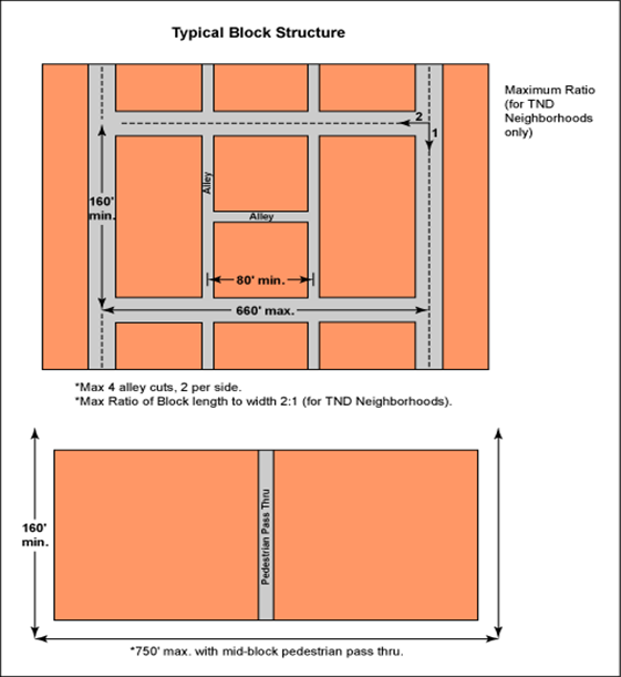
|
|
[Ord. 2005-002]
|
1) Maximum Number
of Alley Curb Cuts
Four per block and two
per side.
2) Minimum Spacing between
Alley Curb Cuts
80 feet.
c. Streets
1) Street Design
Public streets shall
conform to the standards in
Table 3.F.2.A, TDD Street Design Standards
by Tier
.
|
Table 3.F.2.A – TDD Street Design Standards by Tier
(1)
|
|
Type of Street
|
|
|
|
|
|
|
|
|
|
|
|
|
|
|
Commercial Street
|
42-72’ (4)
|
2
|
11’
|
2’
|
8’
(both sides)
|
No
|
27’
|
15’ (4)
|
No
|
|
|
|
Collector: Without
On-Street Parking
|
64’
|
2
|
11’
|
2’
|
No
|
5’
(both sides)
|
24’
|
6’
|
10’
|
|
Collector: With
On-Street Parking
|
74’
|
2
|
11’
|
2’
|
8’
(both sides)
|
5’
(both sides)
|
27’
|
6’
|
10’
|
|
Local Residential Street
|
62-66’
|
2
|
10’
|
2’
|
8’
|
No
|
25’
|
5’
(multi-purpose pathway)
|
10’
|
|
|
|
Plan Roadway
Collector
|
104’
|
2
|
11’
|
4’ shoulder.
No curb and gutter.
|
No
|
No
|
27’
|
8’
(multi-purpose pathway)
|
10’
|
|
Non-Plan Roadway
Collector
|
100’
|
2
|
11’
|
2’ shoulder.
No curb and gutter.
|
No
|
No
|
27’
|
8’
(multi-purpose pathway)
|
10’
|
|
[Ord. 2005-002] [Ord.
2008-003] [Ord. 2014-031]
|
|
Notes:
|
|
1.
|
Unless otherwise stated herein, exceptions to dimensions
shall only be permitted to accommodate turn lanes at the perimeter of a TMD,
TND, or TTD for turn lanes required by the PBC Engineering Department, or for
roundabouts or other traffic calming measures typically associated with a
TDD. This exception shall not be permitted for divider medians.
[Ord.
2008-003]
|
|
2.
|
Parking lane dimensions include the curb and gutter
dimensions. [Ord. 2008-003]
|
|
3.
|
Easements may be collocated with
alleys. [Ord. 2008-003]
|
|
4.
|
Includes a minimum ten-foot-wide pedestrian sidewalk that
may be reduced for arcades, and a minimum five-foot-wide strip for street
trees and street lights. This dimension may be increased by up to ten feet in
width (for a total of 20 feet) to accommodate outdoor dining areas, or larger
street tree and street light areas. [Ord. 2008-003]
|
|
|
|
|
|
|
|
|
|
|
|
|
Figure
3.F.2.A – TDD U/S (Local Residential Street)
|
|
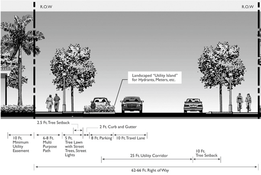
|
|
Figure
3.F.2.A – TDD U/S (Collector: With On-Street Parking)
|
|
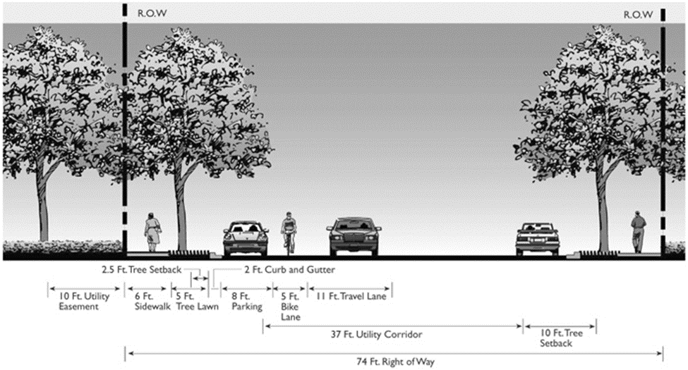
|
|
Figure
3.F.2.A – TDD U/S (Collector: Without On-Street Parking)
|
|
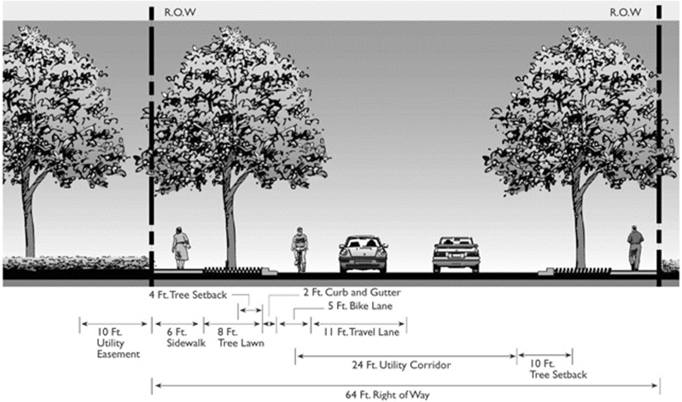
|
|
Figure 3.F.2.A
– TDD Exurban/Rural/AGR (Non-Plan Roadway – Collector)
|
|
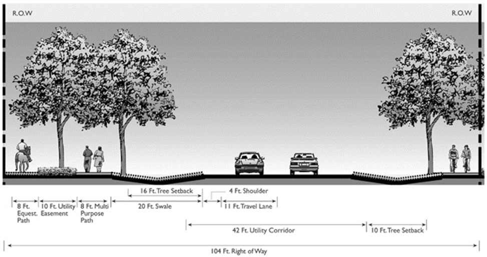
|
|
Figure
3.F.2.A – TDD Exurban/Rural/AGR (Plan Roadway – Collector)
|
|
|
2) Connectivity
All streets and alleys
shall connect to other streets and alleys to form a continuous vehicular and pedestrian
network within the district. Streets shall connect to streets in adjacent
development or vacant parcels, except for AGR-TMDs. The use of gates or other
preventative barriers shall not be permitted on Collector Streets.
[Ord.
2005-041]
a) Dead-End Streets
No more than 20 percent
of all streets may be dead-end streets, such as cul-de-sacs and T-turnarounds.
The maximum length for dead-end streets shall be 660 feet and up to 750 feet, with
a mid-block pedestrian pass-through. The maximum length for dead-end streets
shall be:
[Ord. 2005-002]
(1) Single Family
Residential
660 feet. Up to 750
feet with a mid-block pedestrian pass-through.
(2) All Others
500 feet.
|
Figure
3.F.2.A – TDD Dead-End Streets
|
|
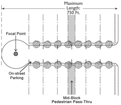
|
d. Sidewalks and Pathways
Sidewalks and/or pedestrian
pathways shall connect to one another to form a continuous pedestrian network
within the TDD and between all adjacent uses to a TDD. Unless otherwise
indicated, sidewalks shall be provided along both sides of the street and shall
conform to the standards in
Table 3.F.2.A, Sidewalk/Pathway Design
Standards
.
1) Master
Pedestrian Circulation Plan
A Master Pedestrian
Circulation Plan, prepared in accordance with the requirements of
Art. 11.E.2, Access and Circulation Systems
shall be submitted with the Regulating
Plan.
2) Accessibility
Sidewalks at street
intersections and pedestrian crossings shall be grade accessible, with the use
of curb cuts and/or ramps.
Figure
3.F.2.A – TDD Sidewalk/Pathway Design Standards
|
|
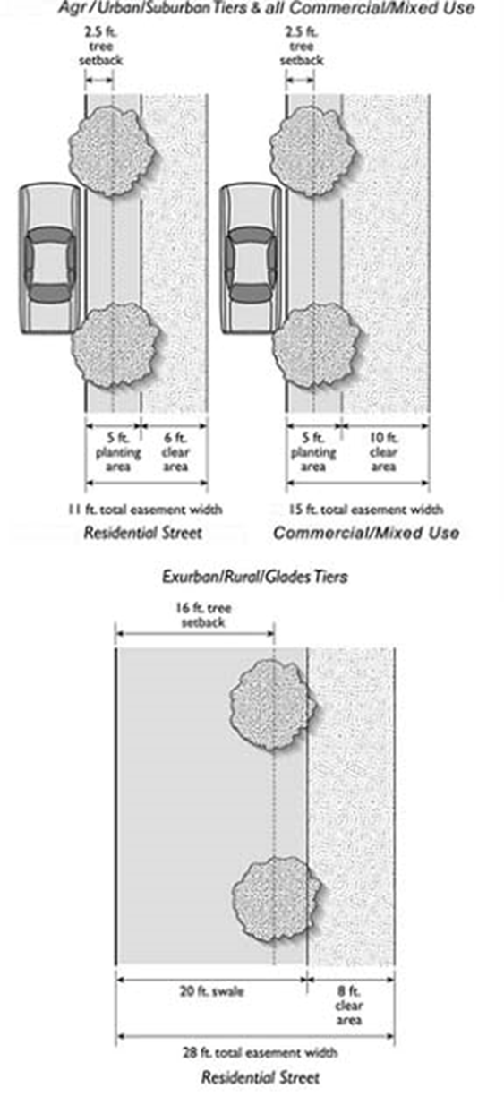
|
A minimum of one alley
shall be required in all blocks, except blocks of Single Family and ZLL
residential uses and AGR-TMDs. Alleys shall conform to the standards in
Art. 11, Subdivision, Platting, and Required
Improvements
, and the
following: [Ord. 2005-041]
1) Alleys shall conform to the design standards
in
Table 3.F.2.A, TDD Alley Design Standards
. Alleys providing access to residential
buildings shall be built to residential alley standards. Alleys providing
access to commercial or office buildings shall be built to commercial alley
standards. Where an alley provides access to a block with both residential and commercial
uses, the alley shall be built to the commercial alley standards.
|
Figure
3.F.2.A – TDD Alley Design Standards
|
|
|
f. Utilities and Lighting
1) Utilities
Public utilities and
lighting shall be installed in accordance with the standards of
Art. 11.E.7, Utilities
.
2) Lighting
a) Street Lighting
Street lighting shall
be provided along all streets and alleys, subject to
Art. 5.E.4.E, Outdoor Lighting
, and the standards in
Table 3.F.2.A, TDD Street Lighting Standards
. A minimum of one light fixture shall be
located at every crosswalk.
(1) Exurban/Rural
Tiers
(a) Lights are optional for Residential Streets.
(b) All lights
must be fully shielded utilizing full-cutoff luminaires per the Illuminating
Engineer Society of North America (IESNA) definition for full cutoff which
allows for zero percent of lumens above 90 degrees from nadir. [Ord. 2014-031]
(2) AGEO
All lights must be
fully shielded in accordance with the standards for the Exurban and Rural
Tiers. [Ord. 2014-031]
|
Figure
3.F.2.A – TDD Street Lighting Standards
|
|
|
b) Parking Lot
Lighting
All parking lot
lighting shall be fully shielded. All lighting fixtures shall be a maximum of
35 feet in height.
a. Number of Spaces
Parking shall be
provided as follows. On-street spaces may be used to meet these parking
requirements.
1) Residential
Parking shall be
provided in accordance with
Art. 6, Parking, Loading, and Circulation
.
2) Non-Residential
a) Minimum Number
of Parking Spaces
One parking space per
400 square feet of GFA (2.5/1,000).
[Ord. 2005-002]
b) Maximum Number
of Parking Spaces
(1) Exurban and
Rural Tiers
One space per 250
square feet of GFA (4/1,000). [Ord. 2005-002]
(2) AGR Tier
One space per 200
square feet of GFA (5/1,000). [Ord. 2005-002]
b. Reduction in Requirement
The number of required
spaces may be reduced by either of the following methods:
1) The shared parking requirements of
Art. 6, Parking, Loading, and Circulation
; or
2) A parking demand study prepared by a traffic
engineer licensed by the State of Florida demonstrating that the parking demand
for the project will be less than the requirements of this Section.
c. Location of Parking
On-site parking is
prohibited in required front or side street setbacks. No parking space shall be
located farther than 750 feet from a building entrance. Parking shall be
equitably distributed throughout the project. [Ord. 2005-002]
d. Parking Structures
1) U/S and AGR
Tiers
Structured parking is
required for any spaces in excess of one space per 250 gross square feet of non-residential
floor area.
a) Type 2 Waiver
The requirement for
structured parking in the AGR Tier may be waived by the BCC upon approval of a
Type 2 Waiver. [Ord. 2005-002] [Ord. 2012-027]
2) Exurban and
Rural Tiers
Structured parking is
prohibited. [Ord. 2005-002]
e. Bicycle Parking
One parking area shall
be provided for every five units in Multifamily housing and for every 20 vehicle
parking spaces serving non-residential uses. Bicycle parking spaces shall be
indicated on the Site Plan in visible, well-illuminated areas. For each bicycle
parking space required, a stationary object shall be provided to which a user
can secure the bicycle. The stationary object may either be a freestanding
bicycle rack or a DRO-approved alternative. [Ord. 2005-002]
a. U/S and AGR Tiers
20 percent of the gross
Development Area. [Ord. 2005-002] [Ord. 2005-041]
b. Exurban and Rural Tiers
30 percent of the
project site. [Ord. 2005-002] [Ord. 2005-041]
In addition to the
requirements in
Art. 7, Landscaping
, the following standards apply:
[Ord.
2005-002]
a. Buffer around Districts
1) No buffers are required where one TDD abuts
another TDD. [Ord. 2005-002]
2) AGR-TMD
Perimeter Buffer
a) Incompatibility
Buffer
A Type 3
Incompatibility Buffer shall be required between the Development Area and all
abutting properties zoned AGR that support agricultural uses, or are vacant
(unless deed restricted to non-agricultural or residential uses). The minimum
buffer width shall be 25 feet.
[Ord. 2005-002]
b) R-O-W Buffer
(1) The R-O-W Buffer width reduction permitted
under
Art. 7.C.2.A, R-O-W Buffer
, shall only be permitted for any property
line which abuts a 100-foot-wide Rural Parkway. In the AGR Tier, a R-O-W Buffer
abutting open space a minimum of 100 feet in width and designated as a Rural Parkway
may be deleted subject to DRO approval of a Regulating Plan that demonstrates
that the landscaping in the Rural Parkway exceeds required R-O-W planting and
buffering requirements. Required landscaping must be located within or adjacent
to the Rural Parkway. [Ord. 2005-041]
(2) A minimum four-foot-high hedge, fence, or wall
visual screen shall be required in a R-O-W Buffer adjacent to any surface
parking area having more than two rows of parking. [Ord. 2005-041]
b. Internal Compatibility and
Incompatibility Buffers
Buffers are not
required within TDDs, except that a solid six-foot-high wall or five-foot-wide
landscape planting area providing a visual screen at least six feet in height
is required along an interior property line where a non-residential use abuts a
residential use. The height of the wall or landscape screen shall not exceed
three feet within required front setback areas. The internal buffer requirement
for Multifamily and Townhouse units may be waived when the units are
constructed on a Main Street; are attached to a commercial structure; are
separated from a commercial structure by streets or an alley, pedestrian
walkway, or plaza; or, when adjacent to open space, plazas, or private
recreational uses associated with units requiring a buffer.
[Ord. 2005-002] [Ord.
2005-041]
c. On-Site Parking Areas
1) Trees
One Canopy tree shall
be planted for every eight parking spaces. In a Neighborhood Center, one Canopy
tree shall be planted for every six parking spaces. Trees shall not be spaced
more than 80 feet apart.
2) Terminal Islands
Terminal landscape
islands, subject to the requirements of
Art. 7.C.4, Landscape Requirements for
On-Site Parking
. Terminal
and interior landscape islands shall be provided on both sides of all vehicular
access points.
|
Figure
3.F.2.A – TDD On-Site Parking Landscaping Standards
|
|
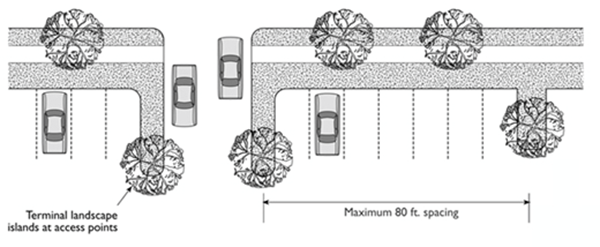
|
Street trees shall be
provided along sidewalks, subject to the following standards:
1) Number
A minimum of one Canopy
tree shall be required for every 40 lineal feet of street frontage. Palm trees may
be substituted for a Canopy tree on a four-to-three basis along a frontage with
a covered walkway. [Ord. 2014-031]
2) Minimum Height
14 feet.
3) Minimum Diameter
Two and one-half
inches, measured four and one-half feet above grade.
4) Spacing
Trees shall be spaced
between a maximum of 40 feet on center.
[Ord.
2014-031]
|
Figure
3.F.2.A – TDD Street Tree Standards
|
|
|
Fences and walls shall
be subject to the standards of
Art. 5.B.1.A.2, Fences and Walls
. Fences shall be made of wood, wrought iron, reinforced concrete with
stucco, brick, vinyl-covered chain link, plastic composite, or a combination of
these materials. Fences in the Exurban, Rural, and AGR Tiers shall be made of
wood or other materials consistent with the rural design standards that
demonstrate a vernacular or rural character.
All signs shall be
located on site in a manner that ensures consistency within the development;
with Site, Architectural, and Landscape Plans; site layout; ultimate maturity
of vegetation; and, Final Architectural Elevation. When preparing a Sign Plan
the Applicant shall consider and give attention to the placement of the sign to
provide clear visibility for the tenants. In addition to the regulations in
Art. 8, Signage
, the
following shall apply: [Ord. 2009-040]
a. Building-Mounted Signs
Building-mounted signs,
including wall signs, awning and canopy signs, and projecting signs shall be
permitted, subject to the following additional requirements: [Ord. 2009-040]
1) Size
Three-fourths square foot of signage for every linear foot of
tenant frontage shall be permitted, up to a maximum of 64 square feet. [Ord. 2009-040]
2) Sign Placement
a) Signs shall be
located between the first and second story of the building. If the second story
is non-residential, the signage shall comply with the minimum vertical
separation requirements in
Table 8.G.1.A, Wall Sign Standards
.
[Ord. 2009-040]
b) All significant
decorative elements on the building shall be considered when locating wall
signs to ensure they are in harmony with each other. In addition, the
architecture features, elements, or building lines shall not be modified to
accommodate the location of the signs. [Ord. 2009-040]
3) Projection
Sign projection shall
not exceed a maximum of 30 inches from any building face. [Ord. 2009-040]
b. Freestanding Signs
Unless otherwise
provided herein, all freestanding signs shall be prohibited.
1) AGR-TMD
Exceptions
Freestanding signs shall
be permitted in an AGR-TMD pursuant to the following requirements: [Ord. 2009-040]
a)
Maximum Size and Height
Signs shall not exceed
150 square feet of sign face area, and shall be limited to 15 feet in height.
[Ord.
2009-040]
b)
Maximum Number Allowed
One freestanding sign
shall be permitted per right-of-way frontage. [Ord. 2009-040]
2) A-Frame Signs
Temporary freestanding
A-frame signs shall be allowed in front of arcades and covered walkways for
commercial or mixed-use buildings, provided they do not conflict with
pedestrian walkways. [Ord. 2009-040]
c. Entrance Wall Signs
Entrance wall signs are
permitted for the purpose of identification, subject to the standards in
Art. 8, Signage
. Sign
copy and graphics shall identify only the name of the development and the
address.
A permanent emergency
generator shall be required for all TDD clubhouses 20,000 square feet or
greater, and shall meet the standards of
Art. 5.B.1.A.19, Permanent Generators
. [Ord. 2006-004] [Ord. 2011-016]
The purpose of the TND district
is to:
1. Establish a specific neighborhood identity
and focus with a pedestrian-oriented design consistent with the tier in which
the development is located;
2. Provide a range of residential, commercial,
civic, and open space land uses in close proximity to one another within the
neighborhood;
3. Encourage a variety of non-vehicular modes of
transportation, such as walking, bicycling, Segways, equestrian, golf carts where
permitted by the F.S., and water-oriented uses such as kayaks, canoes, or stand-up
paddle boards, to reduce the need for local automobile trips; [Ord. 2014-031]
4. Offer a range of housing opportunities;
5. Preserve natural features and scenic areas;
and,
6. Provide a safe and efficient circulation
system for pedestrians, non-motorized vehicles, and automobiles, and emphasize
connectivity within and to adjacent uses.
A TND shall comply with
Art. 3.A.3, Zoning District Consistency with
the Future Land Use Atlas (FLUA)
, and the following:
[Ord. 2006-004]
The minimum gross land
area required for a TND is 40 contiguous acres. Within the U/S Tier, the
minimum size may be reduced to 25 acres for infill projects that are adjacent
to existing residential, civic, or commercial development on at least two sides.
[Ord. 2006-004]
TNDs shall provide
residential, recreational, civic, and neighborhood commercial land uses, as
provided in
Table 3.F.3.B, TND Land Use
. A TND developed as part of a TTD is
subject to the minimum land use allocations provided in
Table 3.F.5.C, Traditional Town Development
Land Use Allocations
.
[Ord.
2006-004]
|
Table 3.F.3.B – TND Land Use
|
|
Land Use Mixes
|
|
|
|
|
|
Residential
|
-
|
-
|
|
Single Family
|
25
|
70
|
|
Zero Lot Line (ZLL)
|
-
|
50
|
|
Multifamily/Townhouse
|
20
|
50
|
|
Neighborhood Centers
|
2
|
10
|
|
Civic (1)
|
2
|
25
|
|
Open Space/Recreation
|
5
|
-
|
|
[Ord. 2006-004] [Ord.
2010-022]
|
|
Notes:
|
|
1.
|
Civic uses may be collocated
with the Neighborhood Centers.
|
|
|
|
|
Any TND or single
project of TNDs with more than 320 acres shall be developed as a TTD.
[Ord.
2006-004] [Ord. 2010-022] [Ord. 2014-031]
The following standards
apply to all TND development:
The basic component of
a TND is the neighborhood, organized in blocks around a Neighborhood Center.
Each neighborhood within a TND shall not exceed 80 acres. No TND shall include
more than four neighborhoods unless the TND is included within a TTD. Refer to
Art. 3.F.5, Traditional Town Development
(TTD)
.
All uses in a TND shall
be connected by sidewalks or pedestrian paths, bicycle paths or bicycle lanes,
and vehicular streets. A minimum of 80 percent of all streets shall connect at
both ends to other streets at an intersection. All paths or trails, including
bicycle paths or lanes, shall interconnect to form a continuous network
throughout the TND and to paths or trails linking adjacent neighborhoods.
Vehicular gates are prohibited on all streets, except alleys serving residential
uses. Vehicular gates are not allowed on alleys serving commercial uses.
[Ord.
2006-004]
A Neighborhood Center
is intended to accommodate neighborhood-oriented non-residential uses and
services. It may include professional offices, community facilities, and civic
uses to serve the population of the TND and adjacent neighborhoods. Multifamily
is encouraged when located above non-residential uses.
[Ord. 2012-027] [Ord.
2017-025]
a. General Standards
1) Location
Each Neighborhood
Center shall be centrally located in its neighborhood and shall be adjacent to
a minimum of one side of a neighborhood square. A non-central location is
permitted on an infill site, provided it is within 1,320 linear feet of 100
percent of the units in the TND and also can serve the local shopping needs of
an adjacent neighborhood.
2) Maximum and
Minimum Site Area
Each individual
Neighborhood Center shall be a minimum one-half acre and a maximum of two and
one-half acres in size.
3) Parking
Parking shall be
provided in accordance with
Art. 3.F.2.A.2, Parking and Access
.
4) Maximum Floor
Area Ratio (FAR)
1.0, FAR for residential
uses counted as density shall not be calculated as square footage subject to
the maximum FAR. [Ord. 2012-027]
5) Maximum Building
Coverage
50 percent.
6) Maximum Total
Floor Area
40,000 square feet of
GFA, excluding Multifamily units.
[Ord.
2012-027] [Ord. 2017-025]
b. Building Standards
1) Maximum Floor
Area per Tenant
8,000 square feet.
a) Exception
Up to 30,000 square
feet is allowed for a food store. If a TND is developed as part of a TTD, the
maximum allowed for a food store in a Neighborhood Center shall be 20,000
square feet.
2) Setbacks
Minimum and maximum
building setbacks shall conform to the standards in
Table 3.F.3.D, TND Non-Residential Setback
Regulations
.
3) Multifamily
Multifamily units shall
only be permitted subject to the following: [Ord. 2012-027] [Ord. 2017-025]
a) Permitted residential uses are located above non-residential
uses; and [Ord. 2012-027]
b) The FAR of residential uses shall not exceed
30 percent of the combined FAR of non-residential and residential uses. The
calculation of residential FAR in determining compliance herein does not alter
that residential uses are calculated as density, unless otherwise stated within
the ULDC. [Ord. 2012-027]
c. Maximum Building Height
45 feet – U/S Tier, 25
feet – Rural/Exurban Tiers.
d. Building Orientation
Buildings shall front a
street. All principal buildings shall have their entrance facing the street or
an intersection.
e. Build-to-Lines
A minimum of 50 percent
of a commercial building shall have a zero setback. The remaining 50 percent
may be set back a maximum of ten feet.
f. Covered Walkways
A minimum of 50 percent
of all first floor building frontages shall be constructed as storefronts and
be adjacent to a covered sidewalk, with features such as awnings, colonnades,
or arcades. Colonnades and arcades shall be a minimum of ten feet in width,
including any support column intrusions. All covered walkways shall have a
minimum interior height clearance of 12 feet from ground to ceiling.
|
Figure 3.F.3.D
– TND Neighborhood Center Standards
|
|
|
The civic designation
is intended to accommodate publicly and privately-owned institutional land uses
intended to serve the neighborhood.
a. Location
Civic parcels used for
community buildings shall be located adjacent to a neighborhood square or park,
or on a lot terminating in a street vista.
b. Public Land Dedication
Based on the
proportional impacts of development on the demand for public services and
facilities, a portion of a TND may be required to be conveyed or voluntarily
committed in simple fee title to PBC for civic purposes. These conveyances
shall be in a form approved by the County Attorney or in the form of a Development
Agreement.
Areas designated for
open space/recreation include neighborhood parks, neighborhood squares, and
active or passive recreation uses.
a. Each neighborhood within a TND shall include
a centrally located neighborhood square or “commons.” The square and abutting
neighborhood commercial and civic uses should serve as a focal point for the
surrounding residential neighborhoods.
1) Size
The square shall have a
minimum lot size of 20,000 to 140,000 square feet, see
Figure 3.F.3.D, TND Neighborhood Park and
Square
.
2) Street Access
A minimum of 75 percent
of a square perimeter shall abut a street.
3) Minimum Pervious
Area
The minimum required
area of a neighborhood park that must be pervious surface is:
a) U/S Tier
25 percent.
b) Exurban and
Rural Tiers
50 percent.
b. Neighborhood Parks
1) Minimum Area
A minimum of 25 percent
of the open space/recreation area required by
Table 3.F.3.B, TND Land Use
, must be common open space or parks
accessible to the public. Each neighborhood park shall have a minimum area of
20,000 square feet.
2) Location
Neighborhood parks
shall be located within each neighborhood of a TND and shall be distributed so
that 100 percent of all dwelling units are located within 1,320 linear feet
from a park or other recreation area.
3) Minimum Pervious
Area
The minimum required
area of a neighborhood park that must be pervious surface is:
a) U/S Tier
50 percent.
b) Exurban and
Rural Tiers
66 percent.
4) Pedestrian
Access
A minimum of 50 percent
of a neighborhood park perimeter shall abut a street.
5) Active
Recreation Areas
Common active
recreation uses, such as playing fields and swimming pools, shall be buffered
by a perimeter landscape area that complies with the Compatibility Buffers in
Art. 7, Landscaping
.
The neighborhood square shall be exempt from this requirement.
a) Active
Recreation Areas in Residential Buildings
Penthouse and rooftop
active and passive recreation shall not be counted towards the minimum open space/recreation
area requirement.
6) Required
Amenities
Neighborhood squares
shall include street furniture for outdoor seating and other amenities such as
gazebos, fountains, statuary, flagpoles, kiosks, and benches. At least one lineal
foot of seating area shall be provided for each 100 square feet of park area.
Seating area may include wooden benches, seating walls, and retaining walls
where the seating area is between 16 inches and 30 inches above grade. [Ord. 2014-031]
|
Figure 3.F.3.D
– TND Neighborhood Park and Square
|
|
|
a. Lot Size and Setbacks
Minimum and maximum lot
sizes and building setbacks shall conform to the standards in
Table 3.F.3.D, TND Residential Lot Size and
Setback Regulations
, with
exception to Multifamily units located in a Neighborhood Center. [Ord. 2012-027]
b. Maximum Building Height
35 feet.
1) U/S Tier
One foot of additional
height may be allowed for Multifamily residential buildings for each additional
foot of front and side setback, or upper story setback, provided beyond the
minimum required setback, up to a total building height of 45 feet.
c. Building Orientation
Residential buildings
shall front a street, neighborhood square, or neighborhood park and be directly
accessible from a street.
d. Accessory Buildings
Accessory buildings
shall not exceed 25 feet in height and may be used as a garage or Accessory Quarters.
[Ord. 2017-007]
1) Calculation of
Density
Accessory Quarters are
not considered “dwelling units” for the purposes of calculating the maximum
allowable density in a TND.
[Ord.
2017-007]
2) Maximum Number
Up to one Accessory Quarters
unit per principal dwelling unit is permitted. [Ord. 2017-007]
3) Required Parking
One additional parking
space per Accessory Quarters is required.
[Ord.
2017-007]
e. Garages
Garages are permitted
in the rear half of the lot only. Garages accessible from an alley shall be set
back a minimum of five feet from the rear property lot line.
1) Exception for Single
Family or ZLL
Garages may be attached
to a Single Family house or ZLL if recessed a minimum of 20 feet from the front
façade of the house. Attached garages shall occupy a maximum of 30 percent of
the total frontage of the house, as determined by the total length between the
two main exterior walls nearest to the interior property lines, including the
garage but excluding any attached structures, such as a porch, deck, or patio. Attached
garages may be increased to a maximum of 40 percent of the total frontage of
the house, when a
porte-cochère
is connected to the dwelling and located in front of the garage, and the
driveway is limited to a maximum of 16 feet in width. [Ord. 2014-031]
|
Figure 3.F.3.D
– ZLL Garages
|
|
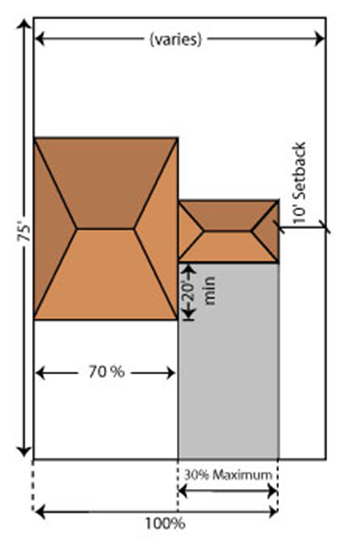
|
f. Main Entrances
All residential
structures shall have their main entrance fronting a street or an intersection.
Corner entries at street intersections are preferred for Multifamily
structures.
g. Porches
All Single Family and
ZLL dwellings shall have a front porch, raised a minimum of 18 inches from the
finished grade, or from the sidewalk located in the front yard within the
R-O-W. [Ord. 2014-031]
1) Size
Porches shall have a
minimum depth of six feet and a minimum width of 12 feet.
2) Enclosure
Porches shall comply
with the definition of TND, Porch in
Art. 1.H, Definitions and Acronyms
.
3) Setback
Encroachment
A porch, and attached porte-cochère
where applicable, may encroach a maximum of
25 percent into a front or side street setback, provided there is no utility
easement overlap. [Ord. 2014-031]
h. Balconies and Patios
A minimum of 20 percent
of the total number of dwelling units on each floor in a Multifamily structure
shall have individual balconies and/or patios.
1) Setback
Encroachment
A Single Family or ZLL
patio may encroach a maximum of 25 percent into a front or side street setback,
provided there is no utility easement overlap. A balcony may encroach a maximum
of six feet into a front or side street setback, provided there is no utility
easement overlap. [Ord. 2014-031]
|
Table 3.F.3.D – TND Residential Lot Size
and Setback Regulations
|
|
Regulation
|
|
|
|
|
|
Min. Lot Size
|
5,000
sq. ft.
|
3,000
sq. ft.
|
1,000
sq. ft.
|
-
|
|
Max. Lot Size
|
40,000
sq. ft.
|
15,000
sq. ft.
|
8,000
sq. ft.
|
-
|
|
Min. Lot Width
|
50’
|
40’
|
16’
|
50’
|
|
Min. Lot Depth
|
75’
|
75’
|
75’
|
75’
|
|
Front Setback
|
10’
min.
|
10’
min.
|
5’
min.
|
No
min.
|
|
20’
max.
|
20’
max.
|
10’ max.
|
30’
max.
|
|
Side Setback
|
5’
min.
|
0’
on ZLL side and
10’
on other
|
No
min.
15’
separation
|
5’
min.
15’
separation
|
|
10’
adjacent to Single Family or ZLL houses
|
20’
adjacent to Single Family or ZLL houses
|
|
Side Street Setback
|
10’ min.
|
10’ min.
|
10’ min.
|
10’ min.
|
|
Rear Setback
|
10’
|
10’ min.
|
15’ min.
|
15’ min.
|
|
5’ min. for accessory structure
|
5’ min. for accessory structure or alley
|
5’ min. for accessory structure or alley
|
-
|
|
5’ min. for a garage accessible from an
alley
|
5’ min. for a garage accessible from an alley
|
5’ min. for a garage accessible from an
alley
|
|
[Ord.
2012-027] [Ord. 2014-031]
|
|
Notes:
|
|
1.
|
Multifamily units located in a
Neighborhood Center shall be subject to the lot sizes of that use zone.
|
|
|
|
|
|
|
The purpose of the TMD
district is to:
[Ord. 2005-041]
1. Provide a concentrated area for shopping,
entertainment, business, services, and cultural opportunities by allowing a mix
of commercial and institutional uses and establishing physical development and
design standards that create pedestrian-oriented development; [Ord. 2005-002]
2. Provide housing opportunities through
integrated residential uses; [Ord. 2005-002] [Ord. 2014-031]
3. Promote a mix of uses in a manner that
creates a stronger pedestrian orientation through design, placement, and
organization of buildings, plazas, common public space, and dispersed parking;
and, [Ord. 2005-002]
4. Ensure traditional marketplaces are
compatible with the overall design objectives of the Plan and the MGTS.
[Ord.
2005-041]
In addition to the
above, the purpose of the AGR-TMD is to:
[Ord. 2005-041]
1. Promote the preservation of agriculture by
providing for compact commercial areas and preserved agricultural land;
[Ord.
2005-002]
2. Provide for commercial uses serving AGR
residents at accessible locations on major Arterials; [Ord. 2005-002]
3. Encourage design that is compatible with the
surrounding agricultural or rural area;
[Ord. 2005-002]
4. Implement the conceptual designs that were
submitted to the BCC on April 6, 2005; and, [Ord. 2005-041]
5. Implement the requirements of FLUE Policies
1.5-m, 1.5.1-m, 1.5.1-n, and 2.4-c of the Plan, as amended, and FLUE Policy
1.5.1-r, Ag Reserve Design Elements, adopted in 2016.
[Ord. 2005-041] [Ord.
2017-002]
The following standards
apply to TMDs located in all tiers
:
[Ord.
2005-002]
The following standards
apply to all TMDs; however, additional standards or provisions shall apply to
the AGR Tier, per
Art. 3.F.4.D, Standards Applicable to AGR
Tier
, and Urban/Suburban
Tier, per
Art. 3.F.4.E, Urban/Suburban Tier –
Lifestyle Commercial Center (LCC)
. [Ord. 2005-002] [Ord. 2005-041] [Ord. 2017-025]
a. Thresholds
A TMD shall comply with
Art. 3.A.3, Zoning District Consistency with
the Future Land Use Atlas (FLUA)
, and the following: [Ord. 2006-004]
1) Minimum Site
Area
The minimum gross land
area required for a TMD is ten contiguous acres.
[Ord. 2005-002] [Ord.
2006-004]
2) Minimum Total
Floor Area
The following MGTS thresholds
shall apply to all non-residential development within a TMD, unless stated
otherwise herein: [Ord. 2010-022]
a) U/S Tier
In the U/S Tier,
200,000 square feet is required, with a minimum of 125,000 square feet in the
first phase. [Ord. 2010-022]
b) Exurban/Rural
Tiers
In the Exurban and
Rural Tiers, 125,000 square feet is required. Additional development may be
phased but shall not exceed a total of 200,000 square feet for the Exurban and
Rural Tiers. [Ord. 2010-022]
(1) Agricultural
Enclave (AGE) Exception
The minimum square
footage for TMDs within an AGE shall be in accordance with an AGE Site Specific
FLUA Conceptual Plan. [Ord. 2010-022]
c) AGR Tier
See
Art. 3.F.4.D, Standards Applicable to AGR
Tier
, for AGR standards.
[Ord.
2010-022]
d) Civic and
Institutional Exception
Civic and institutional
uses are not subject to these floor area limitations.
[Ord. 2005-002] [Ord.
2006-004] [Ord. 2010-022]
3) Minimum FAR
0.4 in the U/S Tier.
[Ord.
2005-002] [Ord. 2006-004]
b. Permitted Locations
1) Within the CL designations in Exurban, Rural,
and AGR Tiers. [Ord. 2005-002]
2) Within the CL/CH designations in the U/S
Tier. [Ord. 2005-002]
3) Within an area designated as a TMD Pod within
a TTD. [Ord. 2010-022] [Ord. 2014-031]
4) A TMD must have at least 200 feet of frontage
along an Arterial or Collector Street. [Ord. 2005-002]
c. Maximum Floor Area per Single
Tenant
1) U/S Tier
Variance from these requirements shall be prohibited. No single
tenant may occupy more than 50,000 square feet, except as follows: [Ord. 2017-025]
a) CL FLU
A maximum of 65,000 square feet may be permitted subject to
Class A Conditional Use approval. [Ord. 2017-025]
b) CH FLU
A maximum of 100,000 square feet may be permitted subject to
Class A Conditional Use approval. [Ord. 2005-002] [Ord. 2017-025]
2) Exurban/Rural
and AGR Tiers
No single tenant may
occupy more than 25,000 square feet unless approved as a Conditional Use. Single
tenants occupying 65,000 square feet or more are prohibited.
[Ord. 2005-002]
[Ord. 2017-025]
3) Maximum Ground
Floor Area per Establishment
No single tenant may
occupy more than 40 percent of the total ground floor area of a TMD.
[Ord.
2005-002]
4) Maximum Frontage per Single Tenant
No single tenant may
occupy more than 200 feet of frontage. An increase of up to 240 feet of
frontage per single tenant is permitted in the AGR Tier, provided that any
increase over 200 feet incorporates the appearance of a separate storefront on
the subject façade, to include the following: a distinct architectural style a
minimum of 40 feet in length, a similar percentage of transparency, and an
additional building entrance, or appearance of an entrance. [Ord. 2005-002]
[Ord. 2005-041] [Ord. 2019-005]
|
Figure
3.F.4.C – TMD Maximum Frontage Per Establishment
|
|
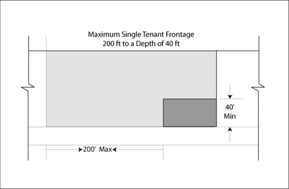
|
|
[Ord. 2005-002]
|
All streets and alleys
in a TMD dedicated to the public or meeting the definition of a private street
shall conform to the standards of
Art. 11, Subdivision, Platting, and Required
Improvements
. All Neighborhood
Centers and the central plaza of a TMD shall be directly connected by a
non-gated street network. [Ord. 2005-002]
a. Main Street
At least two two-way
streets forming an intersection shall be designated as Main Streets. A minimum
of one Main Street shall cross through the entire length or width of a TMD,
unless waived by the BCC. Main Streets shall be designed to be consistent with
Figure 3.F.2.A, TDD Commercial Street
. [Ord. 2005-002]
1) Design Exception
Main Streets designed
as an access way or non-residential parking lot may increase the overall width
to provide for angled parking, not to exceed a 70-degree angle, as indicated in
Figure 3.F.4.C, Typical Example of TMD
Commercial Street with Angled Parking
. The required width of travel lanes shall be as approved by the County
Engineer based upon such
factors as anticipated Average Daily Traffic
and overlap of back-out maneuvers. Parking stall dimensions shall be in
accordance with
Table
6.B.3.A, Minimum Parking Dimensions for Non-Residential Uses and Residential
Uses with Shared Parking Lots
. [Ord. 2005-002] [Ord. 2007-013]
b. Sidewalks
Sidewalks are required
on both sides of all streets and shall be designed to be consistent with
Figure 3.F.2.A, TDD Commercial Street
, except for: alleys; drive aisles between
rows of parking or providing access to a surface parking lot; service streets;
the side of a street abutting a Preserve Area of an AGR-TMD; and, where one side
of a street abuts a surface parking lot or open space. All sidewalks shall
conform to the requirements of
Art. 3.F.2.A.1, Streets, Sidewalks, and
Alleys
. [Ord. 2005-002]
[Ord. 2005-041]
c. Alley Access
Alley access is not
allowed from a Main Street. [Ord. 2005-002]
d. Prohibition of Vehicular Gates
Vehicular gates are not
allowed in a TMD. [Ord. 2005-002]
a. Maximum Building Height
1) U/S Tier
a) 45 feet and two stories unless waived through
a Type 2 Waiver. A third story is allowed if the top floor is dedicated to residential
uses.
[Ord. 2005-002] [Ord. 2017-025]
b) The height limit shall not apply to those
exceptions listed in
Art. 3.D.1.E.4, Height Exceptions
. [Ord. 2005-002]
2) Exurban, Rural,
and Agricultural Reserve Tiers
35 feet and two
stories. [Ord. 2005-002]
a) AGR Tier
Exception
(1) A third story is allowed if limited to residential
uses where a garage is provided on the ground floor for each residential unit.
[Ord.
2005-002]
(2) The height
limit shall be 45 feet for those exceptions listed in
Art. 3.D.1.E.4, Height Exceptions
.
[Ord. 2005-002]
|
Figure 3.F.4.C
– TMD Building Form U/S Tier
Three-Story
Maximum
|
|
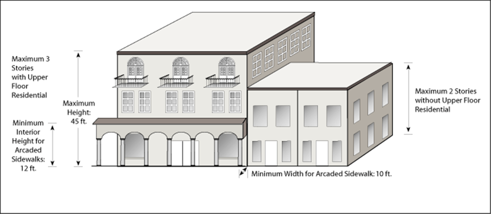
|
|
[Ord. 2005-002]
|
All buildings shall be
designated on the Site Plan as either Primary or Secondary Frontage and shall
conform to the following requirements: [Ord. 2005-002] [Ord. 2005-041]
|
Figure 3.F.4.C
– Primary and Secondary Frontage for TMD
|
|
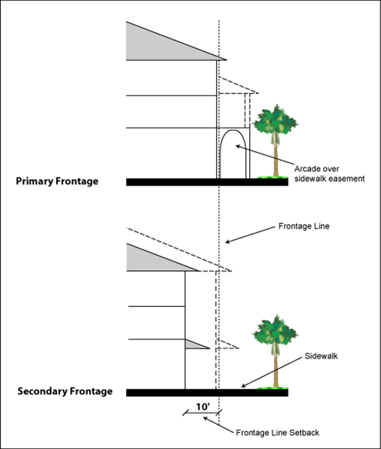
|
|
[Ord. 2005-002]
|
a. Standards for Primary Frontage
1) A minimum of 60 percent of the length of a
Main Street shall be designated as a Primary Frontage. [Ord. 2005-002]
|
Figure 3.F.4.C
– TMD Frontage Designation and Standards
|
|
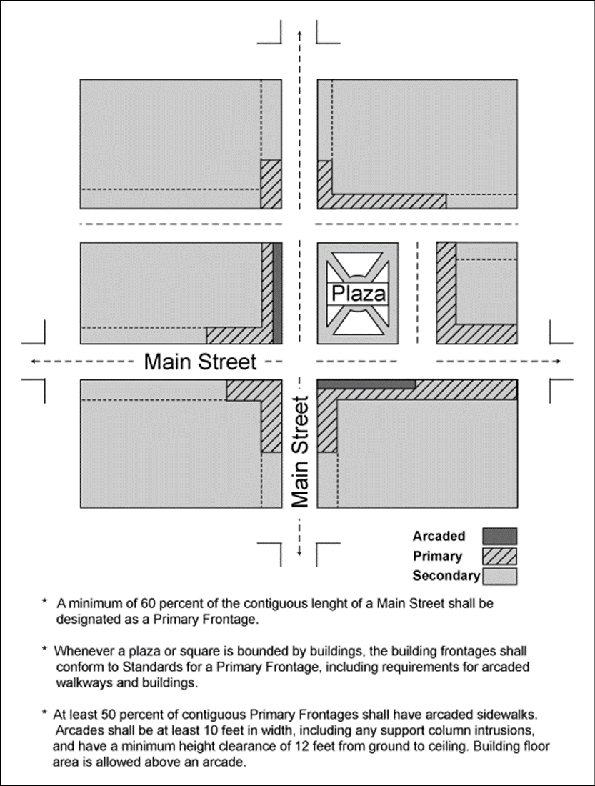
|
|
[Ord. 2005-002]
|
2) Continuity and
Separations
Primary Frontage shall
be continuous, except as follows: [Ord. 2005-002]
a) A central plaza or square may be located at
the end of a block.
[Ord. 2005-002]
b) One separation between buildings is allowed
for each 120 linear feet of frontage, provided it is located a minimum of 120
feet from the end of a block.
[Ord. 2005-002]
(1) The width of this separation shall not exceed:
[Ord. 2005-002]
(a) 20 feet for pedestrian access to internal
parking areas, on-site loading, refuse collection, or recessed building
entrances. [Ord. 2005-002]
(b) 30 feet for outdoor dining areas or pedestrian
shade and rest areas. [Ord. 2005-002]
(c) 60 feet for a mid-block plaza, other than the
central plaza. [Ord. 2005-002]
3) Build-to-Lines
All buildings and
structures along a Primary Frontage shall abut the required sidewalk.
[Ord.
2005-002]
a) Exception
A maximum of ten
percent of Primary Frontage structures may be set back a maximum of 20 feet
from the build-to-line to provide for outdoor dining areas and/or usable open
space, subject to the following:
[Ord. 2005-002]
(1) No more than one area described above shall be
permitted at any intersection or at any intersection created by permitted
separations; and [Ord. 2005-002]
(2) The area shall not exceed 40 feet in length,
nor be within 40 feet of any other setback area or building separation, except
as permitted above. [Ord. 2005-002]
4) Arcaded Sidewalk
At least 50 percent of
the Primary Frontages shall have arcaded sidewalks. Arcades shall be a minimum
of ten feet in width, including any support column intrusions, and have a
minimum height clearance of 12 feet from ground to ceiling. Building floor area
is allowed above an arcade. The arcade shall provide for a pedestrian walkway a
minimum of eight feet in width with no encumbrances such as support columns,
but may be reduced to six feet in width to provide for outdoor dining areas, as
illustrated in
Figure 3.B.14.G, WCRAO Arcade and Gallery
Standards
.
[Ord. 2005-002]
[Ord. 2008-003]
b. Standards for Secondary Frontage
1) Secondary
Frontage
A maximum of 40 percent
of the length of a Main Street may be designated as Secondary Frontage.
[Ord.
2005-002]
2) Separations
Secondary Frontage may
include physical separations between buildings, as follows:
a) One separation between buildings for each 80
linear feet of frontage, provided it is located a minimum of 80 feet from the
end of a block or from the edge of a plaza.
[Ord. 2005-002]
b) The width of this physical separation shall
not exceed:
(1) 20 feet for pedestrian access to internal
parking areas or recessed building entrances; [Ord. 2005-002]
(2) 30 feet for an alley or vehicular access to
internal parking, outdoor dining areas, or pedestrian shade and rest areas; or,
[Ord. 2005-002]
(3) 60 feet for a mid-block plaza. [Ord. 2005-002]
3) Build-to-Lines
All building structures
along a Secondary Frontage shall be located within ten feet of the required
sidewalk. [Ord. 2005-002]
a) Exception
A maximum of ten
percent of Secondary Frontage structures may be set back a maximum of 20 feet
from the build-to-line to provide for outdoor dining areas and/or usable open
space, subject to the following:
[Ord. 2005-002]
(1) No more than one area described above shall be
permitted at any intersection or at any intersection created by permitted
separations; and [Ord. 2005-002]
(2) The area shall not exceed 40 feet in length,
nor be within 40 feet of any other setback area or building separation, except
as permitted above. [Ord. 2005-002]
c. Standards for Buildings Abutting
Perimeter Frontages
Exterior façades of
buildings that abut Arterial or Collector Streets shall be designed to provide
views of building entrances or display windows.
[Ord. 2005-002] [Ord.
2010-022]
d. Optional Standards for
Residential PDRs
Residential buildings
may use the TND Residential Lot Size and Setback Regulations, or the following:
[Ord. 2005-041]
1) Multifamily Alley Frontage Design Alternative
Multifamily dwellings
may be permitted to have frontage from a street built to alley standards,
subject to the following: [Ord. 2005-041]
a) Build-to-Lines
and Setbacks
Setbacks or build-to-lines
must be measured from the inside alley edge, or sidewalk if provided.
[Ord.
2005-041]
(1) Front setbacks
must be a minimum of five feet, and a maximum of ten feet. Garages fronting the
alley shall be set back at least 20 feet. [Ord. 2005-041]
(2) Side street
setbacks must be a minimum of five feet, and a maximum of ten feet. An
exception may be made for one side of a block which fronts on open space or a
recreation use. [Ord. 2005-041]
(3) The rear of each unit shall have access to and
be within 20 feet of a street, open space, or plaza a minimum of 40 feet in
width, with sidewalks that connect to the project’s pedestrian circulation
system. [Ord. 2005-041]
b) Continuity and
Separations
One separation between
buildings is allowed for each 80 feet of frontage, provided it is located a
minimum of 80 feet from the end of a block. The width of this separation shall
not exceed 25 feet for pedestrian access, or 40 feet for a mid-block plaza. One
mid-block plaza may be permitted to have a separation of up to 120 feet in the
AGR Tier only.
[Ord. 2005-041]
In addition to the
sidewalk requirements of
Art. 3.F.2.A.1, Streets, Sidewalks, and
Alleys
, all internal
sidewalks shall provide a minimum clear width of six feet. [Ord. 2005-002]
Notwithstanding the
requirements of
Art. 7.C.3.B, Foundation Plantings
, foundation plantings shall not be required
for primary and secondary building frontages, buildings along an alley or
access way to a parking area, where the alley or access way is located in between
non-residential buildings, or where buildings front on a plaza or square.
[Ord.
2005-002] [Ord. 2005-041]
On-street parking is
required on both sides of all two-way streets and on at least one side of
one-way streets, except within 25 feet of a street intersection or alley, or
ten feet of a fire hydrant, or along Arterials, Plan Collector Streets, alleys,
or a vehicular access way to internal parking. [Ord. 2005-002] [Ord. 2005-041]
Plazas are required to
provide a focal point for pedestrians, and must meet the minimum standards of
Table 3.F.4.C, Minimum Dimensions for
Required Plazas
, and the
following: [Ord. 2005-002] [Ord. 2005-041]
a. Minimum Total Area
20,000 square feet or
five percent of the gross Development Area within a TMD, whichever is greater,
shall be used for public plazas or squares. [Ord. 2005-002]
b. Required Location
The central plaza shall
front on a Main Street; other plazas shall be bounded by a street on at least
one side. [Ord. 2005-002] [Ord. 2005-041]
c. Required Landscaping and
Pedestrian Amenities
1) A minimum of 15 percent of each plaza shall
be shaded by landscaping or shade structures, at time of installation. Landscaping
shall provide a minimum of 50 percent of required shade.
[Ord. 2005-002]
[Ord. 2005-041]
2) A minimum of 40 percent of the overall plaza
areas shall be pervious. [Ord. 2005-002] [Ord. 2005-041]
3) Each plaza must provide a minimum of one
linear foot of seating for each 200 square feet of overall area.
[Ord.
2005-002] [Ord. 2005-041]
d. Corner and Mid-Block Plaza
Abutting Buildings
Wherever
a plaza is bounded by buildings, the building frontages must conform to the
standards for a Primary Frontage, including requirements for arcaded walkways
and buildings. See
Art. 3.F.4.C.4, Frontages and Residential
PDRs
.
[Ord. 2005-002]
[Ord. 2005-041]
|
Figure 3.F.4.C
– TMD Plazas and Squares
|
|
|
|
[Ord. 2005-002]
|
a. Transparency
All commercial first
story façades shall consist of transparent glass that provides views into a commercial
use or window display. Calculation of transparency shall be pursuant to
Art. 1.C.4.K, Building Transparency
. [Ord. 2005-002] [Ord. 2010-022]
|
Figure 3.F.4.C
– TMD Building Design Standards
|
|
|
|
[Ord. 2005-002]
|
1) Percentage
a) Primary Frontage – 60 percent.
[Ord.
2010-022]
b) Secondary Frontage – 50 percent.
[Ord.
2010-022]
c) Perimeter Frontage – 25 percent.
[Ord.
2005-002] [Ord. 2010-022]
2) Exemption
Indoor movie or any
type of theater shall be exempt from the Secondary and Perimeter Frontage
transparency requirements. The minimum transparency requirement may be reduced
by up to 75 percent for medical offices and other similar uses that require
privacy as determined by the Zoning Director, subject to the following: [Ord. 2010-022] [Ord. 2014-031]
a) Documentation that there is no interior
layout options to maximize use of lobby, reception, or other similar areas to
attain required transparency; and [Ord. 2014-031]
b) Use of architectural embellishment that
provides the appearance of glazing commensurate with the reduction in required
transparency. [Ord. 2010-022] [Ord. 2014-031]
b. Balconies
Balconies may project
beyond build-to-lines, subject to the following standards: [Ord. 2005-002]
1) Maximum
Projection
Three feet.
[Ord.
2005-002]
2) Maximum Size
24 square feet.
[Ord.
2005-002]
a. Phasing
TMDs shall be subject to the phasing and time limitations in
Art. 3.F.1.H, Phasing and Platting
, as well as
Art. 2.E, Monitoring of Development Orders
(DOs) and Conditions of Approval
. [Ord. 2005-002]
b. First Phase
The following elements
shall be constructed before the issuance of the first CO: [Ord. 2005-002]
1) All plazas and squares located on required Main
Streets, including required landscaping. [Ord. 2005-002]
2) 50 percent of required Primary Frontage
buildings located on required Main Streets. [Ord. 2005-002]
3) All Main Streets, including all sidewalks,
landscaping, and lighting required to service the above. [Ord. 2005-002]
25 acres, including
Preserve Area. [Ord. 2005-002]
40 percent of gross acreage.
[Ord. 2005-002]
175,000 square feet of
commercial/civic uses (inclusive of work/live space). Of these, 125,000 square
feet shall be retail and office space. [Ord. 2005-002]
375,000 square feet.
[Ord.
2005-002]
1.0. [Ord. 2005-002]
One dwelling unit per
acre. Residential density shall be transferred from the Preserve Area to the Development
Area at a ratio of one to one. [Ord. 2005-002]
A TMD shall only be
located within 1,320 feet of the intersections of Lyons Road and Boynton Beach
Boulevard and Lyons Road and Atlantic Avenue, on a site with a CL FLU
designation. A maximum of one TMD is allowed at each of these intersections.
[Ord.
2005-002]
A TMD shall conform to FLUE
Objective 1.5
of the Plan,
Art. 1.E, Prior Approvals
, and the following additional requirements: [Ord. 2005-002]
a. Minimum Preserve Area
A minimum of 60 percent
of the gross acreage, less roadways identified on the Thoroughfare Identification
Map, shall be designated as Preserve Area. Rural Parkway easements may be
counted toward the preserve requirement. [Ord. 2005-002]
b. Location
The Preserve Area shall
be contiguous with the TMD, or non-contiguous provided it has a common border
with other land that is at least 150 acres and: [Ord. 2005-002]
1) In a conservation district; [Ord. 2005-002]
2) Designated as an AGR preserve; or,
[Ord.
2005-002]
3) Has had development rights removed and is
permanently restricted to usable open space or agricultural uses through a
conservation easement or other legal instrument approved by the County
Attorney’s Office. [Ord. 2005-002]
c. Preserve Areas
An AGR Preserve Area shall comply with the requirements of
Art. 3.E.2.F.3,
Preserve Area
and
Art. 4, Use Regulations
; all other development regulations
that are applicable to the AGR Tier and proposed use(s); and, Policies under
Objective 1.5 of the FLUE of the Plan. Nothing herein shall be misconstrued as
requiring a Preserve Area to conform to
Art. 3.F.4.C,
Development Standards for all TMDs
.
[Ord. 2005-002] [Ord. 2006-004]
[Ord. 2007-013] [Ord. 2017-007]
An AGR-TMD shall comply
with
Art. 3.F.2.A.1.b, Block Structure
, except for the provision below, unless
waived through a Type 2 Waiver by the BCC upon the BCC determining that the
block structure proposed is functionally equivalent for the purpose of
Art. 3.F.1.A.4
, and
Art. 3.F.4.A Purpose
. The Type 2 Waiver may be granted only upon
the Applicant’s agreement to be bound by the block configuration of the Site Plan
approved by the BCC. [Ord. 2005-002] [Ord. 2005-041] [Ord. 2012-027]
b. AGR-TMD Freestanding Structures
A maximum of ten percent
of the overall allowable square footage of an AGR-TMD may be permitted to be
developed as freestanding structures, provided that a minimum of one façade is
developed according to the standards for Primary or Secondary Frontage. Buildings
developed under this provision shall not be required to have circulation on all
four sides, nor be subject to continuity and separation requirements.
[Ord.
2005-002]
Streets for TMDs may
also include access aisles in a parking lot for commercial blocks, only when
located along the side or rear of a block; non-residential alleys; and, alleys
in residential blocks, subject to the standards or
Art. 3.F.4.C.4.d.1), Multifamily Alley
Frontage Design Alternative
.
[Ord. 2005-041]
Shall comply with FLUE Policy 1.5.1-r, Ag Reserve Design
Elements. [Ord. 2017-002]
1. Applicable to
existing sites assigned a commercial FLU designation and Condition of Approval
requiring the use of the LCC within the boundaries of two Site Specific FLUA
amendments: [Ord. 2017-025]
a. LGA 2008-009, Lake
Worth Commercial Amendment,
Ordinance No. 2008-048
. [Ord. 2017-025]
b. LGA 2009-006,
Lake Worth/Turnpike SW Commercial,
Ordinance No. 2009-028
. [Ord. 2017-025]
2. Unless stated
otherwise, TMD provisions shall apply to all Site Specific FLUA amendments
noted above. [Ord. 2017-025]
The purpose of the TTD
district is to:
1. Provide a framework for the coordinated
development of compact, walkable neighborhoods with a well-developed
traditional marketplace center and a mixture of office, open space and
recreation, and civic uses serving local residents;
2. Ensure an interconnected street and
pedestrian circulation network that serves the needs of pedestrians, vehicles,
and other non-motorized forms of transportation and that functionally and
physically integrates the various land use activities;
3. Provide for larger-scale community
development that retains a strong neighborhood identity through a compatible
scale of development, an identifiable center and edge, and well-defined public
spaces for recreation and civic activities;
4. Accommodate optional development districts to
provide additional employment opportunities and housing choices interconnected
with traditional neighborhoods and within close proximity to the commercial,
civic, and recreation and open space amenities of the traditional town; and,
5. Make traditional towns compatible with the
overall design objectives of the Plan and its MGTS.
The requirements of
this Section,
Art. 3.F.1,
General Provisions for TDDs
,
and
Art. 3.F.2,
General Standards
, shall
apply to all TTDs. In addition, the components of a TTD shall be subject to the
following requirements:
The requirements of
Art. 3.F.3, Traditional Neighborhood Development
(TND)
shall apply to Residential
Pods in a TTD.
The requirements of
Art. 3.F.4, Traditional Marketplace
Development (TMD)
shall
apply to Commercial Pods in a TTD.
A residential Planned
Unit Development (PUD) may be included within a TTD, subject to the
requirements of
Art. 3.E.2, Planned Unit Development (PUD)
district.
An MUPD may be included
within a TTD with a minimum of 320 acres, subject to the requirements for a
Multiple Use Planned Development (MUPD) with an EDC FLU designation
[Ord.
2014-025]
The minimum gross land
area required for a TTD is 200 contiguous acres. [Ord. 2006-004]
TTDs shall consist of a
balanced mix of land uses subject to the minimum land use allocations in
Table 3.F.5.C, Traditional Town Development
Land Use Allocations
.
|
Table 3.F.5.C – Traditional Town Development Land Use Allocations
|
|
|
|
|
|
|
|
Traditional Neighborhood (TND)
|
60
|
90
|
|
Traditional Marketplace (TMD)
|
10
|
25
|
|
Civic/Institutional (1)
|
-
|
20
|
|
Recreation and Open Space
|
-
|
25
|
|
Residential PUD
|
-
|
10
|
|
MUPD (2)
|
-
|
5
|
|
Notes:
|
|
1.
|
Regional-serving civic and institutional uses may be
located outside a TND but may not be used to fulfill the civic/institutional
requirements of a TND as established by
Table 3.F.3.B, TND Land Use
.
|
|
2.
|
Requires a TTD with a minimum of
320 acres.
|
|
|
|
|
An interconnected
network of streets, and sidewalks or pathways shall be provided that connects
all pods within the TTD and to any adjacent thoroughfare roads.
A minimum 50-foot-wide
Type 3 Incompatibility Buffer shall be provided around the perimeter of a TTD.
|
To Accompany Sketch of Turnpike Aquifer
Protection Overlay District
|
|
Those tracts of land lying in Sections 27 and 28, Township 45 South,
Range 42 East, PBC, Florida, being more particularly described as follows:
The Southeast quarter of Section 28 and the Southwest quarter of Section
27.
|
|
|
|
[Ord.
2005-002]
|
|
To Accompany Sketch of Turnpike Aquifer
Protection Overlay District
|
|
Those tracts lying in Sections 27, 33, and 34, Township 43 South,
Range 42 East, PBC, Florida, being more particularly described as follows:
The part of the West half of Section 27 laying east of Florida’s Turnpike;
The part of the Southeast quarter of Section 28 laying east of
Florida’s Turnpike; [Ord. 2005-002]
The North half of Section 34 less the Northeast quarter of the Northeast
quarter section;
The East half of the Southeast quarter of Section 34; and,
The part of the East half of the Northeast quarter of Section 33
laying east of Florida’s Turnpike.
|
|
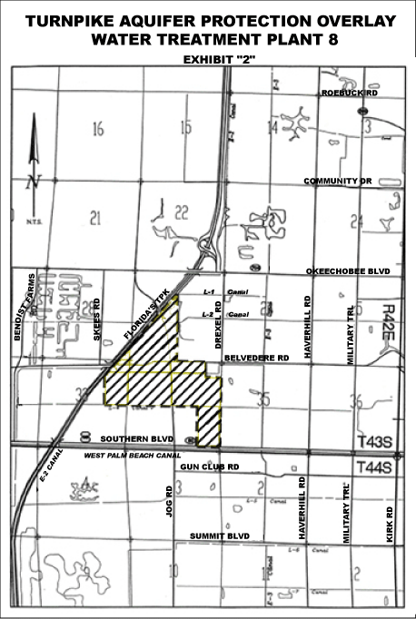
|
|
MARKETPLACE,
NEIGHBORHOODS, AND STREET NETWORK
|
|
|
|
EXAMPLE OF
RESIDENTIAL DEVELOPMENTS
|
|
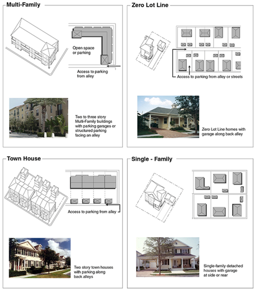
|
Amendment History:
[Ord. 2003-067;
January 1, 2004] [Ord. 2004-040; October 21, 2004] [Ord. 2004-051; November 24,
2004] [Ord. 2005-002; February 2, 2005] [Ord. 2005-041; September 1, 2005]
[Ord. 2006-004; March 1, 2006] [Ord. 2006-013; June 27, 2006] [Ord. 2006-036;
August 29, 2006] [Ord. 2006-055; December 1, 2006] [Ord. 2007-001; January 31,
2007] [Ord. 2008-003; January 30, 2008] [Ord. 2008-037; September 4, 2008]
[Ord. 2009-040; October 28, 2009] [Ord. 2010-005; February 2, 2010] [Ord.
2010-009; April 2, 2010] [Ord. 2010-022, September 1, 2010] [Ord. 2011-001;
February 4, 2011] [Ord. 2011-016; September 6, 2011] [Ord. 2012-003; February
1, 2012] [Ord. 2012-007; March 29, 2012] [Ord. 2012-027; August 31, 2012] [Ord.
2013-001; January 31, 2013] [Ord. 2013-021; August 30, 2013] [Ord. 2014-001;
February 3, 2014] [Ord. 2014-025; September 3, 2014] [Ord. 2015-006; February
3, 2015] [Ord. 2014-031; July 7, 2015] [Ord. 2015-031; September 3, 2015] [Ord.
2015-047; December 4, 2015] [Ord. 2016-016; February 2, 2016] [Ord. 2016-020;
March 24, 2016] [Ord. 2016-042; September 27, 2016] [Ord. 2017-002; January 31,
2017] [Ord. 2017-007; March 2, 2017] [Ord. 2017-011; March 28, 2017] [Ord.
2017-025; August 28, 2017] [Ord. 2017-032; October 31, 2017] [Ord. 2018-002;
February 1, 2018] [Ord. 2018-018
;
August 29, 2018
]
[Ord. 2019-005; January 29, 2019] [Ord.
2019-034; August 27, 2019] [Ord. 2020-001; January 28, 2020] [Ord. 2020-019; September
3, 2020] [Ord. 2020-020; September 3, 2020] [Ord. 2021-006; March 2, 2021] [Ord.
2021-022; September 3, 2021] [Ord. 2021-023; September 3, 2021] [Ord. 2021-033;
December 20, 2021] [Ord. 2021-039; December 22, 2021] [Ord. 2022-002; February
4, 2022] [Ord. 2022-018; July 29, 2022] [Ord. 2023-009; February 28, 2023]
[Ord. 2023-011; March, 23, 2023] [Ord. 2023-012; March, 23, 2023] [Ord. 2023-020;
May 30, 2023] [Ord. 2023-021; May 30, 2023]